Where are the Carpathians located? Where are the Carpathians? Country, features and interesting facts
The Carpathians are a mountain system in the east of Central Europe, on the territory of Ukraine, Hungary, the Czech Republic, Poland, Slovakia, Romania, Serbia and Austria. It extends from the environs of Bratislava to the Iron Gates for 1500 km, forming a convex arc, and closes the Middle Danube Plain.
The Carpathians are one of the main watersheds of Europe between the Baltic and Black Seas. They are divided into two sub-provinces - the Outer Carpathians (Western and Eastern) and the Inner Carpathians (Western and Eastern). Orographically, the Western Carpathians, the Eastern Carpathians (part of which are the so-called Ukrainian Carpathians), the Southern Carpathians, the Western Romanian Mountains and the Transylvanian Plateau are distinguished.
The prevailing heights of the Carpathians are 800-1200 m, the highest height is 2655 m (mountain Gerlakhovsky Shtit in the Tatras), in Ukraine - Mount Hoverla (2061 m). The greatest width is 430 km. The area of this mountain system is 24,000 km². Up to 20% of all forests in Ukraine are located in the Carpathians. The Carpathian Mountains are relatively young, formed in the Alpine era of mountain building and are over 25,000,000 years old.
The name "Carpathians" has the same root as the Armenian Քար (Qar) - stone, Պատ (Pat) - wall. The ancient Polish word "karpa" means significant bumps, pitfalls, significant trunks or roots. From the possible Dacian meaning - "mountains", the name of the tribe - "carps" - "those who live in the mountains", who inhabited the Carpathians during the Roman Empire, may come from. The Celtic-Illyrian word "Karn" - meant "stone" or "heap of stones". The striking similarity of the name of the mountains can be traced to the name of the island of Karpathos between Cyprus and Rhodes.
Another name - Sarmatian mountains - happens in the works of ancient and medieval geographers. In Ptolemy, from the name of the Celtic tribe of the Bastarns who lived here, the mountains of the Carpathians were called - lat. Alpes Bastarnidae.
 Formation of the Carpathian Mountains
Even before the formation of the Carpathian geosyncline, on the site of the modern mountain structure of the Carpathians and their foothills in the Paleozoic era, there was a strand of mountains connecting the Sventokshitsky and Sudeten Mountains with Dobruja. This ancient strand is called Prakarpatamy. Due to the movement of the earth's crust, the Prakarpaty were destroyed, and at the beginning of the Mesozoic era, an almost flat territory arose in their place, close to the platform.
A significant accumulation of sedimentary strata within the Carpathian geosyncline is closely related to the activity of the Tethys marine basins, which for a long time separated two ancient continents - Gondwana in the south, and Laurasia - in the north.
Only at the end of the Mesozoic era did the ocean recede, and mountains, plains and sea depressions began to appear in its place. It is believed that the Mediterranean basin and the deep waters of the Black and Caspian Seas are its remnants. The remaining territories during the Mesozoic and Cenozoic eras were covered by the formation of a mountain range, which includes the Apennines, the Pyrenees, the Alps, the Carpathians, the Balkans, the Crimea, the Caucasus, the Pamirs, etc. This grandiose mountain range, elongated in a latitudinal direction, makes up the Alpine folded belt . Within its limits, the Carpathians occupy one of the central positions.
The process of formation of the mountain structure of the Carpathians took place gradually. Intense deflection of the earth's crust within the Carpathian geosyncline was accompanied by active accumulation of sedimentary strata within it. Their formation took place due to the destruction of mountain structures in the southwestern part of the Russian platform, the Kielce-Sandomierz ridge, the Sudetes, Prakarpat, Dobruja, and the Marmarosh massif.
During the Cenozoic era, the modern territory of the Carpathians was under the reservoirs of the Paleogene Sea. Based on the distribution and structure of sedimentary rocks, it is possible to establish the geographical features of the basin, its contours and the morphology of the seabed. In limestone strata, a large number of remains of marine organisms occur - corals, sea lilies, various shells, and the like. They were deposited at the bottom of warm, open and shallow pools. These were the conditions at the beginning of the formation of the Paleogene Sea. In sandstones, next to the fossil marine fauna, plant remains occur, which testify to the proximity of land and the coastal nature of sand deposits.
Starting at the end of the Mesozoic era, the ascending movements of the Alpine orogeny developed during the Cenozoic era. At the end of the Paleogene period, the axial parts of the future mountain systems of the Alps, Carpathians, and the Caucasus began to form.
At that time, individual islands began to emerge from the sea, and then entire islands. The largest of them were the modern Chivchinsky mountains and the Rakhovsky crystalline massif. To the north and northwest of this massif, among the expanses of water, the outlines of the Carpathian Mountains stood out more and more clearly. They were constantly eroded, but mountain-building processes were active. Therefore, at the end of the Paleogene period, two mountain ranges had already clearly formed on the site of the geosyncline, which correspond to the current Outer Carpathians.
At that time there was a sea on both sides of the Outer Carpathians. Here the mountain range passed within the modern Beskydy, Gorgan and Bukovina Carpathians. To the northeast of the Outer Carpathians, on the territory of the Carpathian region, the sea basin raged further. Thick sedimentary strata were deposited at its bottom due to the erosion of the southwestern flank of the Russian platform and the elevated mountain range of the Outer Carpathians.
The Inner Carpathians were represented by Pienin and Maramor cliffs. The Transcarpathian inner trough with the Virgolat-Guty volcanic ridge passed to the south-west of them. Even further south, in the area of the Beregovsky low mountains, the Pripanonsky deep split lay, separating the Carpathians from the Hungarian intermountain basin.
Between the inner and outer Carpathians at the end of the Paleogene period there was a sea basin. He was the last within the Carpathian mountains. During its existence, significant strata of sandy deposits have accumulated here.
Other coatings appear differently. Magursky stretched out in a narrow strip in the upper reaches of the Uzha river basin, the subsilek one still runs in a strip in the interfluve of the Upper Dniester and Stryi, in the vicinity of the village of Rozluch and south of the city of Turki. Here - the low-mountainous central part of the Carpathian Mountains, dominated by domed peaks and gentle slopes suitable for agricultural use. This part of the mountains is called Verkhovyna.
To the south of the Silesian cover is located Duklyansky - the high-altitude Poloninsky part of the Carpathian Mountains. Peculiar covers can be traced in the southwestern part of the Ukrainian Carpathians. They are represented by Rakhovsky, Porkuletsky and Montenegrin covers (thrusts). Here are the highest mountains in the Ukrainian Carpathians - Hoverla, Petros, Pip Ivan and others.
In the process of mountain building, the Precarpathian foredeep, and then the Transcarpathian internal, are filled with sedimentary strata. Mountain rivers destroyed weakly stable sediments and continuously transferred pebbles, sand, and silt into the basin. The sea within the troughs gradually became shallow, and subsequently completely receded. In closed basins, intensive evaporation of moisture occurred, which led to the precipitation of salts. In the Carpathian region, they were mined by two potash plants: Stebnitsky and Kola.
 Volcanism
The long process of formation of the Carpathian Mountains was accompanied by new manifestations of volcanism, which continued until the beginning of the Quaternary period (this is about 1.5-2 million years ago). Traces of recent volcanic activity can still be observed in the area of Vinogradov, Vyshkov, Tyachev, where the Tisza valley crosses the Virgolat-Gutinskaya volcanic ridge. The cone of an extinct volcano rises in the center of Khust. A fortified castle was built on its top in the first half of the 14th century to keep the salt diggers in subjection and to protect the Maramor salt mines. This castle was often attacked by the Tatars. The last time in 1717, the Crimean Khan Giray got here.
There are cones of extinct volcanoes in the vicinity of Uzhgorod, Mukachevo, and Berehove. Near Vishkov, volcanic craters are better preserved.
A chain of so-called buried volcanoes is exposed in the area of the villages of Dobroni, Drysina and Shalanok. The volcanic rocks in this chain are mainly represented by andesites. Their exits are known in the area of the villages of Drisiny and Shalanok. Along the southern outskirts of the Transcarpathian internal trough, there are thick strata of liparites. On the surface, they are exposed over a large area in the Beregovsky region. These volcanic eruptions began in the Paleogene and ended at the end of the Miocene (about 15,000,000 years ago). Therefore, a significant part of them is covered by sedimentary rocks of the Pliocene.
The recent volcanic activity of the Virgolat-Guty volcanic ridge is evidenced by mineral, and in the mountains of Kaliman-Khargit - including hot springs.
Active processes in the upper mantle of the Earth under the Carpathians are evidenced by earthquakes, the last of which took place on March 4, 1977 in the Vrancea mountains on the territory of the then Socialist Republic of Romania.
glaciation
In the Quaternary period, the Carpathians underwent partial glaciation. They covered the high-mountain massifs of Chernogora and Svidovets, Pop Ivan Maramorshsky. Its relics can be traced in the form of cars, glacial cirques, moraine deposits in the valleys of mountain streams.
Within the middle mountains, it did not undergo glaciation, frost weathering of rocks took place. Weathered stone placers can be observed on the slopes of Gorgana.
 Geological structure and minerals
The Carpathians form the northeastern branch of the Alpine folded geosynclinal region of Europe. A number of large structural elements of the northwest-southeast strike, separated by thrusts, are distinguished: the Cis-Carpathian foredeep, the Outer Carpathians, the Inner Carpathians, the Transcarpathian rear foredeep.
In the Inner Carpathians on the territory of Ukraine, the Marmarosh crystalline massif and the Podhal zone are distinguished. According to the strike of the main structural elements of the Carpathians, zones with a specific set of minerals are distinguished.
In the Precarpathian trough - native sulfur, gas (Dashavskoye, Kosovskoye and other deposits), oil (Borislavskoye, to be someone Babchenkivske deposits), ozokerite (Borislavskoye deposit), rock and potassium salts (Kalush-Golinskoye, Stebnitskoye and other deposits) . It is estimated that there are about 35000000000 tons of salt deposits in the Carpathian region.
In the Transcarpathian trough - rock salt (Solotvinsky deposit), gas, brown coal (Ilnitsky, Krivsky deposits), zeolites. Mercury (Big Shayan, Borkut), veined gold-polymetallic and barite (Began deposit) ores, alunite, kaolins, perlite, bentonite clays (Gorbske deposit) are associated with Neogene volcanism.
In the front part of the Outer Carpathians are known for oil deposits, in the Marmara massif - deposits of dolomite, limestone, marbles, raw materials for stone casting. In the metamorphic complex, manifestations of stratiform pyrite-polymetallic, copper-pyrite, barite and iron-manganese ores are known.
In the Carpathians, mineral waters are common, on the southwestern slopes of the Carpathians and in Transcarpathia - carbonic (Svalyava, Polyana-Kvasova deposits). In the junction zone of the Ciscarpathian trough with the East European platform, there are deposits of nitrogen sulfate waters.
In the inner zone of the Carpathian trough, brines of chloride (sulfate-chloride) composition (Morshin) and a special, rare type of low-mineralized waters with a high content of organic substances (Truskavets) are common.
In the Transcarpathian trough, thermal and subthermal waters of increased mineralization are common, they are used for therapeutic and thermal energy purposes.
Gold reserves are represented by Beregovsky and Muzhievsky gold-polymetallic deposits. The latter was put into industrial development in 1999, and in the same year, Zakarpatpolymetally LLC was established on the basis of the Muzhievsky State Gold and Polymetallic Combine.
Since ancient times, oil has been extracted within the Carpathian region, which was previously called "brine". They used it only for lubricating carts from shingles (shingles). Subsequently, kerosene began to be withdrawn from the brine, which was used in kerosene lamps (for lighting). Intensive oil production began in the middle of the 19th century, when methods were discovered for obtaining and using its light fractions. The first powerful wells appear in the fields near Borislav, Tustanovichi, Mraznitsa, Bykov.
The most ancient rocks found in the Carpathians originated 1.2 billion years ago.
In Europe, on the territory of Hungary, Slovakia, Poland, Czech Republic, Ukraine and Romania (55% of the area of the Carpathians). It stretches for 1.5 thousand km from the Devinsky Gates (on the Danube River near the city of Bratislava) to the Iron Gates (on the Danube River), forming an arc convex to the northeast and east. The width in the northwest is about 250 km, in the northeast about 120 km, in the southeast up to 430 km. The area is about 210 thousand km 2. The prevailing heights are 800-1200 m, the highest is 2655 m (mountain Gerlakhovsky-Shtit).
Relief. The Carpathians are a complex system of echelon-shaped mountain ranges and ridges, separated by longitudinal and transverse valleys. Orographically, they are divided into the Western Carpathians (with the southwestern spur of the Lesser Carpathians, height up to 768 m), the Eastern Carpathians and the Southern Carpathians; the northern ranges of the Western and partly Eastern Carpathians form the Beskids. The Carpathians also include the Western Romanian Mountains and the Transylvanian Plateau adjacent to the Southern Carpathians from the north, and the Banat Mountains from the west (height up to 1446 m).
The mountains are characterized by rounded peaks and gentle slopes (except for the northwestern and southeastern parts). Along the outer side of the arc of the mountains stretches a strip of foothills (width 40-60 km), height 400-500 m, in the southeast up to 907 m. (with Mount Gerlachovski Shtit), Low Tatras, Rodna, Fagaras, Paryng, Retezat. The crests of the highest ranges bear traces of the Pleistocene glaciation, the most pronounced alpine landforms are expressed in the Tatra and Fagaras massifs. For many areas of the Carpathians, karst landforms are typical, especially pronounced in the massifs of the Slovak Karst (Slovak Kras) (for example, Agtelek Cave), Bukk, and others. River valleys often form canyons in limestone. A strip of volcanic massifs stretches along the inner side of the Carpathian arc. In the western part, their height usually does not exceed 1300 m (Kremnicke Vrchy, Shtiavnicke Vrchy, Vigorlat massif, etc.), sometimes they look like table mountains, in places they form sharp contours. In the east, the volcanic mountains are higher (up to 2100 m, Mount Pietros in the Caliman massif), they are separated by deep basins and river valleys. The relief of the Transylvanian Plateau (height 600-800 m) is a complex combination of hilly elevations, flat watershed surfaces and river valleys, mud volcanoes are found in its marginal parts.
The Carpathians are characterized by leveling surfaces of different heights, hollows, the bottoms of which in the foothills lie at an altitude of 200-300 m (Upper Moravian, Auschwitz, Sandomierz, etc.), in the mountains - at an altitude of 500-700 m (Dorn, Brasovskaya, etc.). Due to the relatively low height, the mountains are relatively easy to pass, especially in the central part. The main passes through which the railway and highway are laid are located mainly at an altitude of 500-1000 m (Dukljanski-Priesmik, Yablonitsky, Predyal, etc.).

Geological structure and minerals. Tectonically, the Carpathians are a fold-cover system of the Pyrenean-Elbursk branch of the Alpine-Himalayan mobile belt, which in the southeast merges with the Balkan fold system, and in the west is separated by a transverse superimposed trough of the Vienna Basin from the Alpine fold system. From the outside, the Carpathian system is bordered by the Carpathian foredeep, through which it borders on platform areas: the West European platform in the north, the East European platform in the east, and the epibaikal Moesian platform in the southeast. The forward trough is filled with Miocene molasses (in the east and southeast - Miocene Pliocene), containing strata of Middle Miocene salt rocks (evaporites). The arcuately curved fold system of the Carpathians surrounds the Pannonian (in the west) and Transylvanian (in the east) Neogene molasse depressions. At their base there are blocks of the pre-Mesozoic continental crust - Alkapa, Thissia and Dacia.
 In the structure of the folded system of the Carpathians, the Outer and Inner megazones are distinguished. The outer megazone is mainly composed of the Upper Jurassic-Paleocene terrigenous flysch overlain by the Oligocene-Lower Miocene clayey-siliceous series. Structurally, this megazone is a package of tectonic covers displaced for many tens of kilometers in the direction of adjacent platforms. Fold-cover dislocations also extend to the inner limb of the foredeep; in the southeast, in the axial zone of the trough (on the territory of Romania), salt tectonics is manifested with the formation of salt diapirs with piercing cores. The main deformations in the Outer Megazone occurred before the Middle Miocene, and in the foredeep - in the Pliocene (in the southeast - including the Quaternary). The structure of the Inner Megazone mainly involves Paleozoic metamorphic rocks and Late Paleozoic granitoids (fragments of the Central European Hercynian folded structure), as well as shelf carbonate and carbonate-terrigenous Mesozoic strata, which, together with Paleozoic rocks, experienced tectonic movement (shaping) in the middle and end of the Early Cretaceous, and also later. In the Inner Megazone, Middle Triassic - Upper Jurassic ophiolites (relics of the crust of the ancient Tethys Ocean) have been established. On the border of the Inner and Outer megazones in the Northern Carpathians, a narrow Peninskaya (Cliff, or Klippova) zone stretches, consisting mainly of large fragments of Triassic-Cretaceous carbonate rocks surrounded by marls. The main deformations in this zone occurred at the turn of the Cretaceous and Paleogene during the Laramian epoch of tectogenesis.
The Carpathian fold system arose in the Cenozoic, mainly at the site of the marginal sea basin in the northern part of the Tethys Ocean. This basin developed starting from the middle Triassic, in connection with the formation of rifts on the margin of the ancient European continent, crossing the Hercynian basement. The formation of the folded cover structure of the Carpathians was due to the collision (collision) of the Alkapa, Tissia and Dacia microplates (“outliers” of the African lithospheric plate) with the southern margin of the Eurasian Plate, as well as the underthrust (subduction) of the oceanic crust of the marginal sea basin under the microplates. An outbreak of volcanism in the rear of the Carpathian fold system was associated with the processes of collision and subduction. The Carpathians retain tectonic mobility (especially the Eastern Carpathians), accompanied by intense seismicity (Vrancea epicentral zone in Romania). Earthquakes occurring in the Eastern Carpathians are felt in the European part of Russia (for example, in Moscow in 1978 - up to 4 points).
In the Precarpathian trough, deposits of oil and natural combustible gas, ozocerite, rock and potassium salts, and native sulfur are concentrated. Oil deposits are known in the frontal part of the Outer Megazone of the Carpathians. In the Peniny zone there are deposits of dolomites, limestones, marbles, raw materials for stone casting. Deposits of pyrite-polymetallic, copper-pyrite, barite and ferromanganese ores are confined to the metamorphic complex of the Inner Megazone of the Carpathians; deposits of mercury, gold polymetallic and barite ores, as well as alunites, perlites, kaolins, and bentonite clays are associated with volcanic rocks. In the Transylvanian intermountain basin there are deposits of combustible gas, rock and potash salts, sulfur, brown coal. A special place among the natural wealth of the Carpathians is occupied by mineral waters (including carbonic and nitrogen sulfate), brines of chloride and sulfate-chloride composition, thermal and subthermal waters of increased mineralization. There are sources of rare low-mineralized waters with a high content of organic matter (Truskavets).
 The climate is temperate, transitional from maritime to continental. The average January temperature in the foothills ranges from -5°С in the north and east to -2°С in the south, at the highest peaks it drops to -10°С. In some intramountain basins, temperature inversions are observed in winter. The average temperature in July in the foothills is from 17°C in the north and east to 20°C in the south; in the upper belt of mountains it drops to 4°C. The annual precipitation in the foothills varies from 600-800 mm on the outer side of the arc of the Eastern and Southern Carpathians to 900-1000 mm in the Western Romanian Mountains and the Western Carpathians. In the alpine belt, the amount of precipitation increases to 1400 mm in the south and 2000 mm in the northeast and northwest (in the Tatras). The maximum precipitation occurs in the summer, most of it falls in the form of rain. The duration of snow cover in the foothills is 2-3 months (in some areas it is formed sporadically), in the mountains 5-7 months. Frequent snow avalanches. The snow line in the Tatras is located at an altitude of about 2300 m. There are no modern glaciers in the Carpathians.
surface waters. The Carpathians are one of the main watersheds of Europe. Most of the rivers belong to the Danube basin (the largest are Tisza, Olt, Jiu, Siret, Prut and their tributaries), the rivers of the northern slopes belong to the Vistula and Odra basins, the rivers of the northeastern slopes belong to the Dniester basin. The rivers are fed by mixed snow and rain. Their regime is characterized by sharp fluctuations in water consumption during the year. The greatest runoff is observed in spring (due to snowmelt) and in the first half of summer (due to heavy rains). Floods and catastrophic floods, mudflows are frequent. The rivers of the Carpathians have significant reserves of electricity (cascades of hydroelectric power stations have been built), many of them are used for irrigation purposes. To combat floods, dams and canals have been built along the rivers. There are about 450 small lakes in the Carpathians, in the highlands they occupy mainly the bottoms of ancient glacial cirques.
Landscape types. The Carpathians are characterized by altitudinal zonality with a predominance of mountain forests (occupying 300 thousand hectares) and mountain-meadow landscapes. In the foothills in the past, forest-steppe, oak and beech-oak forests were common, now almost completely cut down. In their place - orchards, vineyards, arable land, secondary forests (steppe in the west). The landscapes of the basins have been greatly changed. In the mountains, natural landscapes are better preserved. The lower belt of mountains (up to a height of 500-600 m in the north and 600-800 m in the south) is occupied by oak and hornbeam-oak forests. Higher (up to 1100-1250 m in the north and 1300-1350 m in the south), they are gradually replaced by beech forests, which are most common in the Southern Carpathians, Western Romanian mountains and along the inner side of the mountain arc. In the Eastern Carpathians there are areas of beech-sycamore and beech-ash-sycamore forests. Up to a height of 1200-1300 m in the north and 1500-1550 m in the south there are mixed forests (beech, white fir and European spruce). They are especially developed along the outer side of the arc of the Carpathians, where they often descend to the foothills and often replace the landscapes of beech forests, and in the Western Carpathians. The upper border of the forest zone (up to 1500-1600 m in the north and 1700-1800 m in the south) is formed by coniferous forests (mainly from spruce, less often larch and pine), they are most developed in the Eastern Carpathians. As a result of human activities, coniferous forests in many places have been largely reduced, their upper limit has been reduced by 100-200 m compared to the natural limit. Forests in the Carpathians are formed mainly on brown soils, including podzolized ones.
The forest zone gives way to a belt of subalpine shrubs and meadows (up to a height of 1700-2000 m in the north and 2100-2200 m in the south). It is represented mainly by crooked forests - thickets of mountain (dwarf) pine, juniper, green alder - and areas of grass-forb meadows. Above (up to 2300-2400 m) there is a belt of alpine meadows and shrubs, which does not have a continuous distribution, is found mainly in the Western and Southern Carpathians, where it alternates with talus and rocks. The vegetation is represented by formations of alpine species of grasses and sedges with the participation of alpine forbs, as well as thickets of rhododendron and dwarf willows. Mountain peat-meadow soils predominate. On some peaks, rising above 2300-2400 m, there are fragments of the subnival belt with stone placers and rocks, bare or covered with lichen spots.
The Carpathians are characterized by high biodiversity and relatively well preserved ecosystems, mainly forest ones. There are 225 patches of primeval forests in the mountains (the area of each is more than 10 hectares), beech and beech-spruce forests of the Carpathians are the most extensive in Europe. There are 3988 species of plants (1/3 of all species of Europe), of which 481 species are endemic (aise-like grist, Salzburg eyebright, breakstone, Kochi rhododendron, etc.). There are many rare species, especially in the subalpine and alpine zones (alpine bartsia, eight-petal dryad, alpine diphasiastrum, chestnut rush, late lloydia, alpine aster, rosea rhodiola, arrow-shaped willow, narrow-leaved narcissus, etc.).
Environmental problems and protected natural areas. Intensive deforestation, construction of settlements, roads and recreational facilities in the Carpathians led to the appearance of secondary plantations and meadows on the site of primary forests, increased erosion, disruption of animal migration routes, an increase in the number of rare species, a decrease in biodiversity, etc. The area of planting spruce forests of the same age (including in the belt of beech forests) prone to windblows and diseases has been increased. There is degradation of forests due to acid rain, the waters of large rivers are polluted, but the small rivers of the Carpathians are still among the cleanest in Europe. Protected natural areas occupy 16% of the area of the Carpathians, the largest of them are the Tatra National Park (Slovakia, Poland), the Eastern Carpathians International Biosphere Reserve (Ukraine, Slovakia, Poland), the Low Tatras, Slovak Karst, Poloniny (Slovakia), Karpatsky biosphere reserve, Synevyr national parks, Skole Beskids, Uzhansky, Gorgani reserve, Nadsyansky landscape park (Ukraine), Retezat national park (Romania). In the Carpathians there are mountain climatic and balneological resorts. Tourism is developed; winter sports. In 2003, the countries of the Carpathian region at the 5th Conference of Ministers of Ecology "Environment for Europe" signed the Framework Convention on the Protection and Sustainable Development of the Carpathians.
Lit.: Geology of the USSR. M., 1966. T. 48: Karpaty. Part 1: Geological description; Geodynamics of the Carpathians. K., 1985; Ukrainian Carpathians. Nature. K., 1988; Nature of the Carpathian National Park. Kiev, 1993; Melnyk A.V. Ukrainian Carpathians: ecological and landscape studies. Lviv, 1999; The national parks and biosphere reserves in Carpathians: the last nature paradises. S. 1., 1999; Holt S. Ecoregion conservation in the Carpathians. S. 1., 2000; idem. The Carpathian mountains. S. 1., 2000; Khain V. E. Tectonics of continents and oceans (year 2000). M., 2001; Mosbach Webster R. The Carpathians: Kingdom of the Carnivores. WWF. Danube-Carpathian programme. Vienna, 2001.
M. N. Petrushina; V. E. Khain (geological structure and minerals).
Surely many have heard about the Ukrainian Carpathians. This is a truly wonderful and charming place, which is perfect for a family or romantic getaway. The mountain system is located closer to the west of Ukraine and stretches for 280 km. Sometimes tourists can meet mountains up to 2000 m high, while the highest point is Hoverla - 2061 m.
It is quite natural that many people want to visit this ecologically clean area and try to find out more about where the Carpathians are. It should be noted that the relief here is multi-tiered. So, there are high-mountain territories (height up to 1500 m), mid-mountain (up to 1300 m), low-mountain (up to 400 m) and foothill.
Location of the Carpathians

To more accurately understand where the Carpathians are, you need to know that they are located on the border with countries such as Hungary, Slovakia, Poland and Romania. Nevertheless, officially the mountains are located on the territory of Ukraine, namely its four regions: Transcarpathian, Lviv, Chernivtsi and Ivano-Frankivsk. Thus, from these regions you can easily and quickly get to the recreation centers and take great excursions, as well as enjoy stunning landscapes and fresh air. Quite often, the area under consideration is divided into two parts: Transcarpathia and Prykarpattya. In addition to which attracts tourists the most, Pop Ivan, Petros and Khomyak are equally cool and beautiful. Their height exceeds 2000 m, therefore they are considered no less powerful and interesting. It is known that people live in the mountains, but civilization does not spoil the overall picture. At the same time, there is a completely different atmosphere around: nature is practically untouched, the air is clean, sometimes heavy, and the tops of the trees touch the human eye. In the rivers running throughout the Carpathians, there are a variety of fish species, which is why fishing is one of the most favorite activities of both locals and tourists.
Where the Carpathians are located is very easy to determine on the map, as this is an impressive territory highlighted in dark brown. There is only one such site in Ukraine - in the western part of the country.
tourist trails
Tourism in the Carpathians is most developed in the cold season. Already in the middle of autumn, vacationers can visit the mountains and enjoy the first snow, climbing one of the peaks.
Most tourists have no idea where the Carpathians are, but they want to go there with all their hearts. And all because there are legends about the majestic mountains, the atmosphere that reigns around fills you with strength and joy, and the stunning nature surprises. Are you going to visit this region in the warm season? Excellent! A lot of entertainment awaits you: horseback riding, massage and sauna at height, fishing and swimming in local rivers, communication with animals in farm yards, folk crafts and much, much more. In winter, every vacationer will be able to visit a ski resort and try out the best slopes of Ukraine; taste the famous Hutsul cuisine and warming mulled wine; visit ice-covered gorges and find other entertainment. When planning a vacation, it never hurts to consider the option of a mountain vacation. Just do not forget to clarify where the Carpathians are.

Such settlements as Guta, Yaremche, Yablunytsya, Synevyr, Mizhhirya and Svalyava have gained great fame in the Carpathians. Many tourists dream of visiting there. In some villages, you can even try locally produced water, which is popular throughout Ukraine and is considered medicinal. It is not surprising that a huge number of sanatoriums and dispensaries, as well as recreation centers operate in the Carpathians - air and water truly work wonders here!
It is also recommended to visit famous cities: Ivano-Frankivsk, Mukachevo and Slavske. In the first of them, vacationers will be able to get acquainted with the history of this people, look at amazing sights, visit the Town Hall and much more. The Carpathians of the country of Ukraine are the main attraction that people are so proud of. Arriving in Mukachevo, you should visit ancient fortresses, try unique wine and buy souvenirs. In the village of Slavske you can enjoy a relaxing holiday or skiing. There is no time to be bored, so the trip for tourists will be unforgettable.

The stunning heritage of the mountain range
Being interested in where tourists are, first of all they mentally calculate the distance from their hometown to Ukrainian sights. But they will never see those fascinating places on any map. For example, the pride of the Carpathians is the Pearl Cave, on the walls of which calcite balls are formed, somewhat reminiscent of jewelry. No less interesting will be a trip to the Enchanted Valley - a picturesque gorge with powerful rocks. It is also recommended to visit the Hanging Swamp, the Stone Gate, the Synevyr Reserve, the Rocks of Lovers and the Cave of Transparent Walls. In spring, the Narcissus Valley will be a great place for a walk, which is completely covered with snow-white flowers, the diameter of which can reach 10 cm.

Treatment in the Carpathians
The Carpathians occupy an impressive place on the map, the same as in the hearts of many Ukrainians. That is why tourists come here from different countries and for different purposes. It's no secret that the Carpathian climate, fresh air, healing mineral springs help to restore strength and strengthen the body. Comfortable hotels, recreation centers and other health resorts await their guests all year round. They are located in picturesque places, usually near rivers and dense forests.

Pleasure available to everyone
A feature of the Carpathians is that almost everyone can visit them. Affordable cost and indescribable beauty of landscapes will help make your vacation or recovery unforgettable and interesting. Also, during certain periods of time, tourists will find a pleasant surprise - discounts on tours and various bonuses. In addition, the cost of the trip varies depending on the region chosen for recreation, the number of days of stay and the proposed cultural program.
Goverla is translated from the Romanian language as an impenetrable elevation. This is the name of the highest mountain in Ukraine. It rises above sea level at 2061 meters. Tourists are interested in this point for its opportunities to conquer it. The first such trip took place in 1880.
The mountain is located 17 kilometers from the border with Romania, is part of the Chernogora range, in the Carpathians. From the mountain, when it is clear, a view of the cities of Snyatyn, Ivano-Frankivsk, Kolomyia opens up, it is possible to see Mount Pop Ivan and the White Elephant Observatory.
Near Hoverla, the Prut River originates. Here you can also admire the cascade of waterfalls. According to legend, the Prut River arose from the tears of a young man in love. His beloved name was Goverla. The girl's father did not want his daughter to meet a guy he does not like, and turned her into a mountain. But the lovers still remained together forever, this is Mount Hoverla and the Prut River.
Coordinates: 48.16562700,24.49596900
Yaremche
Great place to relax! At the entrance to the souvenir market - a bridge under which a river flows and a waterfall falls. Near the market there is a restaurant made of wood, which was built without a single nail.
And what is the market itself worth - souvenirs for every taste and pocket! Colorful people, beautiful nature.
There are many hotels in the city. You can come in the summer - feel the wonderful mountain air, go to the mountains to admire nature, refresh yourself in mountain rivers, when a turbulent stream of water washes your body, no jacuzzi is even close by. Also for fans of extreme sports there is a place to ride bikes or go kayaking. In winter, this place is suitable for lovers of skiing, snowboarding and other winter activities. Don't forget to warm up in the colorful local Kolyba! There you can eat, drink and just have a good time.
Yaremche is a great spiritual place!
What sights of the Carpathians did you like? There are icons next to the photo, by clicking on which you can rate a particular place.
Carpathian mountains
Karpa "you (Ukrainian Karpaty, German Karpaten, Slovak Karpaty, Hungarian K & aacute rp & aacute tok, Rum. Carpaţ i, Serbian Karpaty) - a mountain system in Central Europe, on the territory of the Czech Republic, Slovakia, Ukraine (Transcarpathian, Lviv, Ivano-Frankivsk region), Hungary, Poland, Romania, Serbia and partly Austria (Hundsheimer Berge near Hainburg an der Danube and Niederosterreichish Inselbergschwelle near Mistelbach).
The absolute heights of the mountain system range from 120-400 m at the foot of the mountains to 500-800 m in intermountain depressions and 1500-2000 m along the main ridges. Mountains over 2000 m high: Hoverla (2061 m) is the highest point in Ukraine.
The wooden church of the Nativity of the Virgin is one of the best examples of Hutsul folk architecture. It was built according to traditional technologies without a single nail in 1654-57. in the neighboring village Apple tree. The church was moved to its current location in 1780. Fragments of wall paintings from the 19th century have been preserved in the interiors. Next to it is a two-tiered wooden bell tower, which houses the exposition of the church museum. In 1979, the temple was restored by architects B. Kindzelsky, G. Kruk, I. Mogitich.
Arch bridge
A large stone arched railway bridge-viaduct of Austrian times connects the two banks of the Prut River. Under it passes the Yaremcha-Verkhovyna highway. The bridge was built in 1895 during the construction of the railroad Stanislav (Ivano-Frankivsk) - Yaremcha - Vorokhta - Rakhiv. The length of the bridge exceeds 100 m. It is still used for its intended purpose. Nearby is another old Austrian bridge, which is considered one of the longest stone railway bridges in Europe (130 m).
Kosovo Bazaar
Kosovo Bazaar is a traditional Hutsul fair in the city of Kosiv, the largest in the Carpathian region. Almost all products of the Hutsul arts and crafts are presented here: ceramic dishes, carpets, embroidered clothes, iron, leather, and fur products. Souvenirs are offered at wholesale prices. Previously, the fair was held in the center of Kosovo. Now the bazaar has been moved to the eastern outskirts of the city, to a vast trading area near the Kutsky bridge (Kosov-Kuty street 48°18"59""N, 25°6"42""E). The Grand Kosovo Bazaar is open only on Saturday early mornings (from 4:00 to 10:00). The rest of the time, branded souvenir pavilions of the best Kosovo folk craftsmen are open in the very center of the city, next to the old Kosovo Bazaar.
Trufanets waterfall
The Trufanets waterfall in the Ukrainian Carpathians is the highest natural waterfall in Transcarpathia. Its height is 36 meters. It can be found near the Yasinya-Rakhiv highway, 2 kilometers from the turn to Dragobrat. The waterfall is located on the southeastern slopes of the Svidovets ridge, on the Trufanets stream, the right tributary of the Black Tisza River.
The stream originates in the subalpine belt at an altitude of 1720 meters, at the foot of Mount Bliznitsa. The length of the stream is 2830 meters.
The waterfall forms several cascades. In the forest, it partially, over 230 meters, flows underground. Near the waterfall there are steps and an altanka (gazebo), from which you can look at it up close. The Trufanets waterfall is a hydrological natural monument.
Coordinates: 48.21415000,24.30233000
Are you curious to know how well you know the sights of the Carpathians? .
Valley of the Prut River
The valley of the Prut River (the left tributary of the Danube) is one of the most picturesque places in the Carpathians. The place has a mild climate, an amazing variety of flora and fauna. Transparent lakes, clean rivers, seething waterfalls and fresh air create excellent conditions for a family holiday.
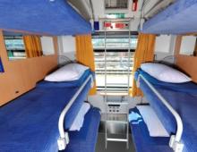
The most famous resort of the valley is a small cozy town Yaremche. There are many cafes, shops, rest houses and hotels where you can stay. Near the city are Probiy waterfall and Yaremche canyon, the most interesting area for rafting. Remarkably, almost along the entire site there is an asphalt road. In winter, outdoor enthusiasts also come here - forty kilometers from Yaremche is the Bukovel ski center, which is rightfully considered the best in Ukraine.
In the river valley there are many more picturesque cities and towns that attract tourists with their hospitality, excursions and even the opportunity to pick mushrooms and berries. Among them, the village Vorokhta, s. Mykulychin, p. Tatarov, p. Midnight, p. Yablunitsa.
Coordinates: 48.45361100,24.55638900
The most popular attractions in the Carpathians with descriptions and photos for every taste. Choose the best places to visit the famous places of the Carpathians on our website.
More sights of the Carpathians

Ukrainian Carpathians from A to Z: map of hotels and ski areas, slopes and pistes, lifts and ski passes. Bright photos and videos. Reviews of mountain skiers about the Ukrainian Carpathians.
- Tours for May around the world
- Hot tours around the world
Weather in the Ukrainian Carpathians
In terms of ecology, the Carpathians are a powerful climate-forming factor, a source of fresh water and clean air for the region. The climate of the region is temperate continental, in the lowlands winters are short and mild, summers are warm with an average temperature of +19..+21°C. In the mountains, winters are cold and snowy, summers are short and cool. Snow in the mountains lies from mid-December to early March, and in some places even from November to May.
Nature of the Ukrainian Carpathians
The flora and fauna of the Carpathians is rich and varied, many plants are found only in this region, and some animals are on the list of rare species. A large number of mountain rivers and lakes are full of fish, in particular trout. As you know, this fish is found only in clean water, and its ubiquitous distribution in the Carpathians indicates the purity of the local reservoirs. The most famous of the lakes is Synevyr, it is recognized as the cleanest in the region. Large rivers are suitable for timber rafting. The mountains themselves are flat, full of spacious plateaus, there are no rocks here, so the terrain is distinguished by smooth lines and is very picturesque.
Treatment and sources
The Carpathians are of interest as a region rich in mineral waters of all types. A huge number of natural springs, more than 800 in total, made the region attractive not only for recreation, but also for health improvement. Almost every region can boast of its own numerous sources of this or that water. Some of its species are known throughout the world: Naftusya, Morshinskaya, Truskavetskaya, Rapa, Polyana-Kvasova. The well-known resort Truskavets, the treatment of which is based on the use of Naftusya water, specializes in the treatment of diseases of the digestive system and kidneys, diabetes. Svalyava region has water sources such as Borjomi and Vichy. The composition of these waters is indicated for the treatment of metabolic diseases, gastrointestinal tract, and tuberculosis. Staying in the fresh air, which is literally saturated with phytoncides of the local coniferous plants, combined with hydrotherapy, gives an amazing long-term effect in the treatment of diseases of the upper respiratory tract. Some sources are associated with ancient touching legends, some of them are revered by the local population as holy sources.
Ski resorts
The Carpathians are also well known to fans of mountain skiing. Bukovel, Dragobrat, Slavske are the main ski resorts in the region. Snow stays here for a long time, thanks to the mild winter (in the coldest month of January, the temperature rarely drops below -6 degrees), you can ride from the end of December to the end of March. These resorts are becoming more and more popular, they are developing dynamically and in recent years offer a level of service and infrastructure comparable to European ones. Many lifts, schools for beginner skiers, well-groomed slopes, many of which are illuminated in the evening, equipment rentals are waiting for athletes.
You can relax and unwind in numerous places of entertainment that offer a varied menu and entertainment programs. With the end of the ski season, interest in recreation in the Carpathian Mountains does not subside: numerous routes for horseback riding, hiking and cycling are interesting for outdoor enthusiasts of all ages.
Maps of the Ukrainian Carpathians
Popular hotels in Ukrainian Carpathians
Entertainment and attractions
There are many interesting towns and villages, castles, natural sights in the Carpathians, so there are all opportunities for implementing an extensive excursion program. The original way of life has been preserved in the mountain villages, and a trip through the Carpathians will clearly show: the higher people live in the mountains, the less fuss there is in their lives. However, civilization is also less. Extremely interesting for their original architecture and rich history of the city, which are located in the Carpathians. First of all, this is Lviv. One of the largest cities in Ukraine and the most beautiful. The central part of the city was included in 1998 in the UNESCO World Cultural Heritage List. The city was founded in 1256, it was incredibly lucky: it was almost not destroyed during both world wars, so more than 2,000 monuments of history and architecture have been preserved in it.
Some Lviv cafes were opened even before the First World War and have preserved to this day the magical aura of the beginning of the last century.
Popular with tourists Ivano-Frankivsk, one of the largest cities in Ukraine. It is traditionally considered a city more European than Ukrainian, this can be seen both in architecture and in the way of life. Numerous historical sights of the city speak eloquently of the former Polish rule. Mukachevo, Uzhgorod, Ternopil, Truskavets are unusually cozy and attractive, and their sights can compete with what can be seen in recognized European tourist centers.