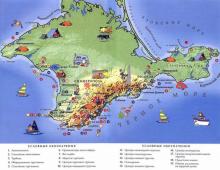
Hiking trails. Hiking in Russia
Walking around Moscow
Tired of sitting at home? Then let's go for a walk! We present you a selection of the most beautiful places for hiking:
Including observation deck, embankment, Moscow State University, the area around Moscow State University.
Location: Moscow, metro stations “Universitet”, “Vorobyovy Gory”

2. Park "Tsaritsyno"
Architectural and historical complex
Location: Moscow, metro stations “Orekhovo”, “Tsaritsyno”

Pond near st. Malaya Bronnaya
Location: Moscow, Mayakovskaya metro station

4. Sokolniki Park
Including ponds.
Location: Moscow, Sokolniki metro station

Chistoprudny Boulevard, the territory from metro station Chistye Prudy to the pond
Location: Moscow, Chistye Prudy metro station

6. Park "Kolomenskoye"
State United Museum-Reserve Kolomenskoye.
Location: Moscow, metro station “Kolomenskoye”
From Arbatskaya metro station to Smolenskaya metro station, including cafes, adjoining houses, lanes, monuments and more.
Location: Moscow, metro stations “Arbatskaya”, “Smolenskaya”, “Biblioteka im. IN AND. Lenin"

Exhibition center, including cafe, ferris wheel, etc.
Location: Moscow, metro stations “VDNKh”, “VVTs”

Located between the streets of the Soviet Army, Olympic Avenue and Suvorovskaya Square. Monument of garden and park art.
Location: Moscow, metro stations “Prospect Mira”, “Tsvetnoy Bulvar”, “Novoslobodskaya”

Including the temple itself, the square near the temple, a monument to the Emperor of Russia Alexander II
Location: Moscow, Kropotkinskaya metro station

Views of fountains, trees of love with locks. It connects Bolotnaya Square with Kadashevskaya Embankment. From the side of Bolotnaya Square, the bridge goes to the monument to I. E. Repin, from the opposite side - to Lavrushinsky Lane

12. Tretyakov Gallery
Including Lavrushinsky lane, fountain, Tretyakov Gallery.
Location: Moscow, metro station “Tretyakovskaya”

Memorial complex "Victory Park", the park around it, the Central Museum of the Great Patriotic War.

14. Neskuchny garden
One of the oldest parks in Moscow, consists of three estates of the 18th century, there is an “Alley of Love”.
Location: Leninsky Prospekt, 30, Leninsky Prospekt metro station, exit to the Spartak store, then 5 minutes walk to Leninsky Prospekt or Oktyabrskaya metro station and on tr. 4, 33, 62 to the stop metro station "Leninsky Prospekt"

15. Kuskovo Park
The Kuskovo estate is an architectural and artistic ensemble of the 18th century, a park, ponds.
Location: metro station “Ryazansky Prospekt”, then bus. 133, 208 to the stop "Museum Kuskovo" or st. Youth, 2
![]()
16. Hermitage Garden
Monument of garden and park art.
Location: Moscow, Chekhovskaya and Tsvetnoy Bulvar metro stations, opposite Karetny Ryad street

Passes along the Moskva River, from the metro station "Park Kultury" to the street. Khamovnichesky Val, Vorobyovy Gory metro station
Location: Moscow, metro station “Park Kultury”
18. Pushkinsky bridge - Andreevsky bridge old
The pedestrian bridge connects the Pushkinskaya embankment of the Neskuchny Garden with the Frunzenskaya embankment.
Location: Moscow, metro station “Frunzenskaya”

It consists of two parts: PKiO Izmailovsky and Izmailovsky Forest Park, which are separated by the Main Alley
Location: Moscow, metro stations “Partizanskaya”, “Izmailovskaya”

20. Botanical Garden
Ponds, paths, alleys, Japanese garden.
Location: Moscow, metro stations “Vladykino”, “Botanical Garden”

Homestead, park, pond.
Location: Moscow, metro stations “Volzhskaya”, “Kuzminki”

22. Pushkin Square
Including a monument to Pushkin, Pushkin cinema, fountains, Strastnoy Boulevard.
Location: Moscow, metro stations “Pushkinskaya”, “Chekhovskaya”
23. Arc de Triomphe
Established in honor of the victory of the Russian people in the Patriotic War of 1812. Located on Victory Square (Kutuzovsky Prospekt) in the area of Poklonnaya Gora.
Location: Moscow, metro station “Park Pobedy”

24. Manor Arkhangelskoe
The estate is located on the banks of the old river of the Moscow River in the Krasnogorsk district of the Moscow region.
Location: Moscow, metro station "Tushinskaya", bus. No. 549 or No. 541 to the stop “Arkhangelskoye” or minibus No. 151 to the stop “Sanatorium”

25. Tsvetnoy Boulevard
Fountain, sculptures, square. It runs from Trubnaya Square to the Garden Ring.
Location: Moscow, metro stations “Tsvetnoy Boulevard”, “Sretensky Boulevard”

26. Historic Center
Alexander Garden, grotto in Alexander Garden, Red Square, Kremlin, St. Basil's Cathedral
Location: Moscow, metro stations “Teatralnaya”, “Okhotny Ryad”

27. River station
Through the Druzhba park and directly to the embankment itself near the Moskva River, the Northern River Port.
Location: Moscow, metro station “River Station”

28. Tverskoy Boulevard
Monument to Sergei Yesenin, square, fountain.
Location: Moscow, metro stations “Tverskaya”, “Pushkinskaya”
Beautiful view of the Moscow River, near Bolotnaya Square and the Luzhkov Bridge. It starts from the western arrow of the island between the Vodootvodny Canal and the Moscow River, ends at the Maly Moskvoretsky Bridge. Serafimovich Street, Bolotnaya Square, Faleevsky Lane overlook the embankment.
Location: Moscow, metro stations “Tretyakovskaya”, “Borovitskaya”

30. Kitay-Gorod
Historical Center. Within Kitai-Gorod there are such famous architectural and historical monuments as the Resurrection Gate, GUM, the Cathedral of the Kazan Icon of the Mother of God, etc.
Location: Moscow, metro station “Kitai-Gorod”

Forest area in the west of Moscow, in the bend of the Moscow River, on an artificial island formed by the Khoroshevskoye straightening channel. It is connected with Marshal Zhukov Avenue by a road bridge.
Location: Moscow, Krylatskoe metro station

Museum-Estate Ostankino, pond, television center.
Location: Moscow, VDNH metro station

It is located next to the Spassky Gates of the Kremlin, connects Vasilyevsky Spusk, Varvarka Street with Bolshaya Ordynka Street.
Location: Metro stations “Kitay-Gorod”, “Tretyakovskaya”, “Okhotny Ryad”

A beautiful view of the Moscow River, a beautiful, cozy pedestrian bridge near the Kievsky railway station.
Location: Moscow, Kyiv metro station

The old street of Moscow, goes from Manezhnaya street.
Location: Moscow, metro station “Biblioteka im. Lenin” to Arbat Gate Square, located between Znamenka and Bolshaya Nikitskaya
Own cor.
Photos from open sources
We continue our walk through the center of Moscow. Those who have just joined can see the beginning here: but since we have returned to the starting point of the first part of the route, we can consider the following suggested route as an independent one. Here's a plan for my next trip:
So, we start from the intersection of st. Vozdvizhenka and Nikitsky Boulevard (Arbatskaya metro station). We cross the road on the underpass to the right and go out to such a beautiful house - the city estate of the Shakhovskys - Krause - Osipovskys (Vozdvizhenka St., 18/9). This two-story house with a mezzanine floor, wings and front gates was built in 1783 by Prince Alexei Yakovlevich Shakhovskoy. Since 1842, the property has passed into the hands of doctors. At first, it was owned by the famous doctor I. I. Krause, and in 1852, when the house belonged to the staff captain Nikolai Yakovlevich Kozlakov, the architect N. I. Kozlovsky rebuilt the house. The changes mainly concerned the decor of the facade and interior. The house received a very spectacular facade, made in the Rococo style with very interesting decorations in the form of flower garlands and shells. In 1868 the estate was bought by the doctor Dmitry Timofeevich Osipovsky (1812-1881). On June 14, 1878, he was granted the nobility, and since that time the coat of arms of the Osipovskys has been located in the pediment of the house.

1 of 2
We turn to Nizhny Kislovsky lane. By the way, lanes are called Kislov lanes, where people once lived, engaged in sourdough cabbage, cooking kvass and similar products. These names are typical for Moscow, where many streets are named after the nature of the work done by people who lived in the area.
We reach the house number 5, which now houses the Residence of the Ambassador of Switzerland. This mansion, built in the 18th century, changed owners and was rebuilt several times. The end part of the house goes out onto the street, which in 1894 received a new facade, designed by the architect P. M. Samarin, and the letters “VD” appeared on the pediment of the house - the initials of its then owner Vladimir Dumnov, the owner of a well-known publishing house in Moscow, which published the first works of Turgenev and Gogol. By the way, the Turgenev family also lived in this house in 1832-1833. The composer P. I. Tchaikovsky also visited here, who often stayed here with his student and friend V. S. Shilovsky, who also owned this house since 1872.
1 of 3

We go further along the lane, and we reach the house 13 (Bolshaya Nikitskaya street, 19/13). The famous Mayakovsky Theater is located here. It received its original name "Paradise Theater" after the German Georg (George) Paradise (1846 - 1901), an actor and owner of his own enterprise, who began theatrical performances in this building in 1886. The building was designed by the architect K. V. Tersky (the author of the facade is F. O. Shekhtel, we will get to know the most famous house of this architect a little later). At first, European stars who came on tour performed at the premises; world-famous artists played on this stage, but after the revolution, these tours stopped. Over the years, the theater has been headed by various well-known directors, and many famous actors have played and continue to play on its stage. I will not dwell on this topic, otherwise the story will be endless. But going to this theater has always been very prestigious, so I recommend it!
1

We turn left along Bolshaya Nikitskaya Street and almost immediately on the right we see another very famous TASS building (Tverskoy Boulevard, 2). The body of the new TASS building, built on the site of the old buildings in 1977, was called one of the successful architectural projects of the 1970s. The windows of the building resemble TV screens, which reflects the essence of the organization that is located here.
1

And we cross Nikitsky Boulevard (by the way, from Arbatskaya to this place it was possible to walk along the boulevard, there is also a lot of interesting things), and turn onto the continuation of Bolshaya Nikitskaya Street. There, our attention was attracted by an ensemble of previously tenement houses built in 1901-1903. on B. Nikitskaya, 31, built in the Art Nouveau style according to the project of architects N. D. Strukov and V. P. Zeidler. Now it is an administrative building.
NOTE: If you walk further along this street, then cross the Garden Ring and turn right, then you will come to the Moscow Planetarium, or you can go a little forward along Barrikadnaya Street, which is a continuation of B. Nikitskaya, there will be the Moscow Zoo.
1 of 2
In general, our goal was the Church of the Great Ascension (B. Nikitskaya St., 36).
In one of the aisles of the still unfinished Church of the Ascension of the Lord, A.S. Pushkin married Natalia Goncharova. In honor of this event, in 1999, a fountain "Natalya and Alexander" with figures of the poet and his wife was opened near the church. On a granite pedestal there are columns made of gray marble brought from Italy, crowned with a golden dome, symbolizing the dome of the Church of the Ascension of the Lord. Inside the rotunda are sculptures by Goncharova and Pushkin, made by Mikhail Viktorovich Dronov. The sculptures are very hard to see, it is quite difficult to photograph them.
2

The church building of the Great Ascension in its present form was built on the site of the old church, and was finally completed in the 1830s. The consecration of the Great Ascension Cathedral took place on September 19, 1848. After the revolution, the bell tower was demolished, and the church was used first as a warehouse, then as a laboratory. On May 20, 1999, on the feast of the Ascension of the Lord, the temple was re-consecrated by His Holiness Patriarch of All Russia Alexy. And in 2002-2004 the bell tower was restored. Now the temple looks like this.

The interior of the temple:

Having visited the temple, we crossed to the other side, to Malaya Nikitskaya Street.
I really liked the façade of house No. 10, the former tenement house of A. I. Toropova (1906, architect O. O. Shishkovsky).

Then we moved on to house number 6, known as the Ryabushinsky house (Gorky's house-museum). We arrived here at 17:00 (2 hours after the start of our walk, including the first part). The museum is open until 17:30. We had half an hour for a cursory inspection of this beautiful house-museum. I wrote about this separately.
3

NOTE: If you go further from Ryabushinsky's house along the street. Spiridonovka, and then turn into Bolshoi Patriarchal Lane, then you will come out to the Patriarch's Ponds. Bypassing this famous place along Malaya Bronnaya to the left, you can go to the Garden Ring. Turning to the right and going forward a little, you will see the house with the famous Bulgakov's apartment No. 50 (Bolshaya Sadovaya St., 10), where the writer's museum is now located. Going further, you will reach the Triumphal Square, where there are a lot of attractions: the Peking Hotel, the Satire Theater, the Concert Hall. Tchaikovsky. Triumfalnaya Square has also recently completed a large reconstruction, and now there is a wonderful recreation area around the Mayakovsky monument. After walking, you can go down to the subway to the beautiful Mayakovskaya station.
6

Well, after visiting a wonderful museum, we returned to Bolshaya Nikitskaya Street and walked along it towards the center. The buildings on it are interesting and beautiful, especially after restoration. But we won't dwell on them, we'll just have a look.
1


2

On this street at 18 Bolshaya Nikitskaya Street there is the Church of the Ascension of the Lord (Small Ascension). This temple was first mentioned in Moscow chronicles in 1548. Since the 1830s, it has been called the "Small Ascension", so as not to be confused with the "Big Ascension" temple, which we recently visited. It is believed that the new stone church was erected on the site of the ancient church by Tsar Theodore Ioannovich, the son of Ivan the Terrible, in memory of his wedding to the kingdom on the feast of the Ascension of the Lord on June 10, 1584. The head of the temple is crowned with a beautiful cross with a crown and with a tsata (the so-called "crescent" or "new moon") - a symbol of grand ducal and patriarchal power, which dates back to the end of the 18th century. It survived and was restored to its original location in 1992. This year is the second year of the birth of the temple, which was closed in 1937 and completely lost its decoration, but in recent years it has been restored and painted by famous artists Ivan Glazunov, Irina Starzhenetskaya, Dmitry Alimov. The temple is small but very cozy. It contains several rare icons and church valuables. Since the temple is located opposite the Moscow Conservatory, many of its students and graduates sing in the church choir.
3

Across the street from the church, at Bolshaya Nikitskaya st., 13, the Moscow Conservatory is located. The building was designed by the architect V. I. Bazhenov and bought in 1766 for Ekaterina Dashkova. In 1812, the house belonged to Count M. S. Vorontsov, during the war the house burned down and was restored by 1824. In 1878, the building was bought by the Moscow Conservatory, founded in 1866. Soon this building became small and the Small (1898) and Large (1901) halls were completed with donations. In 2011, the reconstruction of the Great Hall was completed, which was carried out in just a year, so now this place has become even more beautiful. If you have time, I highly recommend going here!
1

And we turn into Bryusov Lane. Walking along it, you can see part of the Anglican Church, located at Voznesensky per., 8/5, building 3. This church, built for the English community of Moscow in 1885, was closed during the Soviet years and was used, including , for the all-Union company "Melody" - many famous records were recorded here. And the revival of worship in the church began in 1991, which are now held here every Sunday in English, and organ concerts are also organized.
1

We didn't go to church. We had more fleshly needs. In house 2/14 on Bryusov Lane, there is this restaurant of the street format "Meat Point", where Turkish national cuisine is prepared. A kind of “Window to Turkey” was recommended to me by my son, who said that there is a very tasty Turkish kufta (lavash with lamb, vegetables and spices) for 200 rubles, which is cooked in front of you (you can watch the cooking process on the monitor screen). You can also order Turkish coffee, tea or other drinks. The establishment proved popular. There were several people in front of us, and the girl took the order, which she left, as I understood, by phone. For the ever-running Moscow, this format of food is very suitable. And we also liked the kufta.

Resurrection on the Assumption Vrazhek (Bryusov lane, 15/2, building 3). The church survived many fires, and yet it was never closed, even in Soviet times, which is a rarity in Moscow. It was not closed at the request of many famous actors and composers who lived in the area. Therefore, this church was and to this day remains one of the most visited in the center of Moscow. It has a special atmosphere, the interiors of the last quarter of the 19th century have been preserved, when the church was repainted and received the existing iconostases, in which old icons are located, some of them especially revered. Unfortunately, we did not have time to visit this temple normally, but just running into such a place is not worth it. So we went further.
2

In this area, due to the proximity to the conservatory, many cultural figures have lived and still live. The House of Composers is also located here. There are several monuments to famous composers around. Opposite the church in 2012, in honor of the 85th anniversary of his birth, a monument to Mstislav Rostropovich was erected, created by the famous sculptor Alexander Rukavishnikov.
2

And in the courtyard of the House of Composers there is a monument to Aram Ilyich Khachaturian, which was created at the expense of the Yerevan Municipality and donated to Moscow in 2006, the year of Armenia in Russia. The authors of the monument were sculptor Georgy Frangulyan and architect Igor Voskresensky.
1

We pass by the House of Composers and past the Church of the Assumption on Uspensky Vrazhek (15 Gazetny Lane), exit to Gazetny Lane, turn left to Tverskaya Street. At the clock of the Central Telegraph 18-20, it means that we reached this place from the Gorky Museum in 50 minutes. The building of the Central Telegraph was decided to be built in 1925, it included a radio center and an intercity telephone exchange. The open competition was won by the project of Ivan Rerberg, according to the project of which the building of the Kievsky railway station in Moscow was already built. Notice the coat of arms near the clock. Here the hammer and sickle are not located side by side, but at the edges. This was one of the first versions of the coat of arms of the Soviet Union.

For fans of fast food, McDonald's is located opposite the Telegraph (the second one opened in our country, the first was on Tverskaya, near the Tverskaya metro station). And we reach the crossing over Tverskaya. We cast a glance at the expanded and renovated pedestrian zone, at the Kremlin and Manezhnaya Square ahead.
5

And we ourselves go to the pedestrian zone, which was opened not so long ago in the center of Moscow, but it has become so loved by residents and guests of the capital. This zone begins from Tverskaya from Kamergersky lane, to which we exit.
Love romance? Do you mind testing yourself on an extreme journey? "My Russia" tells about hiking routes that will surprise you with their beauty and test your character.
"Frolikha"
Lake Frolikha. Photo: turizm.ngs.ru- Location: northeast coast of Lake Baikal
- Length: about 95 km (12 days of travel)
- Sightseeing: Frolikha Reserve, Khakusy thermal springs, Lake Frolikha.
Baikal is the center of the Earth's power for most people on the planet. Foreigners (and many Russians) imagine the lake as a mysterious and endless body of water in the "heart" of the continent. In many ways, this description fits the object. There are many ways to get up close and personal with the “sea,” as the indigenous people call the lake. One of them is the Frolikha trail.
12 days on the northeastern, most virgin coast of Lake Baikal, will be an excellent test of your strength. The route has been sponsored by investors from Dresden since 2010, it is so attractive!
Its length is small - "only" 95 km. But it passes through the natural landscapes of the Siberian taiga. The center of the trail can be considered the Frolikha Reserve, the hallmark of which is the beautiful mountain lake Frolikha. The protected area was created in order to preserve the relict population of red fish - Arctic char (salmon family, included in the Red Book of Russia).
The route is adorned with numerous glacial streams, rock ledges and ends with the mouth of the Upper Angara.
 Great Baikal trail. Photo: baikal-info.ru
 - Location: along the perimeter of the lake (constantly updated)
- Length: many sections, from 1.5 km to several tens of kilometers in length
- Attractions: Museum of Baikal, Pribaikalsky National Park.
The term "Great Baikal Trail" also hides an organization involved in the development of hiking in the Baikal region. The main goal of the project is to create a developed network of trails for tourists. The number of routes is growing every year. Volunteers carry out projects in summer and winter to develop the trail system, laying new routes, developing infrastructure and compiling maps. With such a pace, within 10 years, an extensive system of hiking trails will be formed along the coast of the lake. The prospect looks "crazy" - a single trail around Baikal! Such an object will definitely become the center of world tourism.
On the way, steep ascents and sharp descents are constantly changing. From the very start, tourists will climb 400 meters vertically with access to the top, which offers a view of Lake Baikal. Part of the trail goes along the coastline, on rocky cliffs. Here you will have to use the rope sections of the passage.
Eco-tourist route No. 1
 Ecological and tourist route No. 1. Photo: zozhnik.ru
 - Location: northwestern Caucasus
- Length: 93 km
- Sightseeing: Khadzhokh gorge, Rufabgo waterfalls, cave systems, Mount Fisht, glaciers.
The route acts as the "successor" of the famous All-Union tourist route No. 30 and has the second name "Through the mountains to the sea." The route is high-altitude and requires special physical training. In the USSR, this trail was one of the first and most developed. By the mid-1930s, numerous groups were already walking here.
Today the route was "shrunk" to 5 days of travel. Now the trail does not reach the sea: it connects the village of Guzeripl and the village of Solokh-Aul. On the way, tourists overcome ice areas, steep cliffs and vast mountain meadows. The trail is not the longest, but covers landscapes characteristic of the Caucasus. Tourists pass through an ecologically clean and practically untouched territory.
All-Union tourist route No. 55
 Lake Aushkul. Photo: kudatotam.ru
 - Location: South Ural, Chelyabinsk
- Length: 487 km
- Sights: Lake Uvildy, Ilmenskoye Lake, Mount Kruglitsa, Lake Aushkul.
Another "mastodon" of hiking. A difficult and long route, which takes 21 days to overcome. The trail can be covered on foot or by bus. Usually travelers combine these types of travel, supplementing them with a train. During the hike, tourists visit many reservoirs of the South Ural region, and also pass through virgin forests. The rich wildlife and dense vegetation create a feeling of pioneers and help to relax from the hustle and bustle of the city.
The trails are not everywhere equipped and maintained in good condition, but the route attracts with acquaintance with the Urals and its beauty.
Multinskie lakes, Altai
 Multinsky lakes. Photo: altayer.ru
 - Location: Gorny Altai
- Length: about 30 km
- Attractions: Multinskie lakes system
The natural monument of Altai, the system of glacial high mountain lakes, is one of the tourist "symbols" of Altai. Lakes with crystal clear water are located in small mountain hollows. Snow-covered slopes of the Katunsky Ridge Lower Multinskoye Lake, Transverse, Middle Multinskoye, Talmen - and a large number of small reservoirs. On the way, tourists are waiting for:
- Glacial waterfalls.
- Crossings over mountain rivers.
- Rock climbs.
- Overnight stays on the shores of the lakes.
- Routes at the foot of snow-capped mountains.
Khibiny. big circle
 Umbozero. Photo: hibiny-land.ru
 - Location: Kola Peninsula
- Length: about 75 km
- Attractions: Khibiny passes and lakes
Circular route between lakes Bolshaya Imandra and Umbozero. "Classic" Karelia in all its beauty! Glacial relief with cleared rock ledges and glacial reservoirs and streams.
A distinctive feature of this trail is the numerous ascents and descents along streams flowing from the Khibiny mountain ranges. On the trail you will have to climb to the highest point in the north-west of Russia - Mount Yudymchvumchorr (1.206 meters above sea level). Many passes (1-3 such objects will have to be passed per day) require special training and skills. Tourists must have special equipment and go on the trail under the supervision of an experienced instructor.
Plateau Manpupuner. Hiking through the Dyatlov pass
 Plateau Manpupuner. Photo: tonkosti.ru
 - Location: Komi Republic.
- Length: from 11 km to 230 km (depending on the chosen route).
- Sights: Dyatlov Pass, Mount Otorten, Pechora River, geological monument "Poles of weathering" - one of the 7 wonders of Russia.
But here there is no definite path - in a relatively small area, several routes have been laid that intersect at certain points on the map. A visit to the mysterious Mount Otorten and the Dyatlov Pass is included in the mandatory program of the trail. And of course the legendary "Mansiysk blockheads" - unusual natural objects created by the wind. The locals call the mountain Man-Pupu-ner “Bolvano-iz” or “mountain of idols”. The giants created by nature are somewhat reminiscent of the famous heads on Easter Island.
The Pechoro-Ilychsky Reserve, through which the hiking route passes, is a mountain tundra covered with swamps. The terrain is very "fragile" and impassable. But in 2016, more than a hundred volunteers laid a safe path, along which tourists go to the pillars, 30 to 42 meters high.
The trail is fascinating, but requires tourist training. If you choose to walk 11 km along the mountainside to the pillars, then you can do without equipment. But a multi-day hike becomes a serious test: crossing rivers, climbing passes and mountains, spending the night in the taiga - the whole flavor of Siberia!
Around Elbrus
 around Elbrus. Photo: athletics-club.ru
 - Location: Caucasus
- Length: about 60 km
- Sights: the highest point in Europe - the Elbrus volcano, glaciers, waterfalls, sources of mountain rivers.
The route is mountainous and belongs to the 1st category of difficulty. The trail attracts with its concept - going around the highest mountain of the Caucasus becomes a memorable adventure. The region is well developed from a tourist point of view and travelers do not have to worry about how to get to the Elbrus region. But the terrain is treacherous - the recent gathering of the villages is a confirmation of this. Therefore, the route should be accompanied by an experienced instructor.
What awaits along the way? First, height. Some points lie at an altitude of 3700 meters, which can cause manifestations of altitude sickness. Glacial lakes such as Syltrakel are characterized by clear water and beautiful views. Real mountain glaciers, from which small rivers and streams begin. Passes and gorges are "mixed" with rocky peaks and peaks. Classic mountain route through the alpine meadows of Elbrus.
Shikotan. Following in the footsteps of Robinson Crusoe
 Japanese Lighthouse Spamberg
 - Location: Kuril Islands
- Length: up to 20 km
- Attractions: Cape Land's End, Mount Shikotan (405 meters), exotic nature
Lianas, dwarf bamboo and the Japanese lighthouse Shpamberg (1943) - the most remote island of Russia bears little resemblance to Russia. It is 100 km to Japan, and 7119 km to Moscow.
There are practically no trees on Shikotan, but a film about Robinson Crusoe was filmed here in 1972. Stanislav Govorukhin chose this island not in vain - the landscapes are very similar to the uninhabited area. Many capes jut deep into the sea, forming attractive landscapes for travelers. The trail is easy and can be covered in a couple of hours. And it’s not a trail, but just a walk along a small island on the very “edge” of the country. The route will definitely be remembered and not many passed it ...
The really interesting trekking routes are not only the path under your feet, but also the rich history and culture of the place. National Geographic magazine named the 20 best trekking routes in the Epic Trail nomination.
Pilgrimage to Mount Kailash, Tibet
Best choice for: yogis and other seekers of spiritual enlightenment. Length: 51 km. Hindus believe that on the top of Kailash, at an altitude of 6680 meters, there is the abode of the god Shiva, where he meditates. According to the Vishnu Purana, the peak is a reflection or image of Mount Meru, the cosmic mountain at the center of the universe. The mountain is also a holy place for Buddhists, Jains (a branch of Hinduism) and followers of the ancient Tibetan Bon religion, who consider this unusual mountain to be the “heart of the world”, the “axis of the earth”. The top of the mountain remains unconquered, although in recent years the Chinese government has begun building a road to a sacred pilgrimage route known as the kora. As the Earth makes a circle around the luminary that gives it life, so Tibetan pilgrims make a detour around the sacred Mount Kailash. Kora (ritual detour) around Kailash. Most pilgrims and pilgrims get to Kailash precisely for the purpose of making a kora. Before starting the tour, make a wish.
Israeli National Trail, Israel
Best choice for: Long-distance hikers interested in ancient and modern history. Length: 940 km
The famous route, opened in 1995, provides an opportunity to see the sublime beauty of the Middle East's wildlife and the daily life of modern Israelis, visit biblical sites and the cities of Tel Aviv and Jerusalem. The route allows tourists to see everything that is of great value to Jews and Christians. He walks through the area Sharon descending to the lake Kinneret, runs parallel to the biblical Jordan River and gets to the Khatsbani stream in the very north of the country. The trail consists of 12 small parts, each of which is a self-sufficient route. As a one-day trek, you can take a five-kilometer climb up the mountain Tavor (Favor), to Basilica of the Transfiguration overlooking the Jezreel Valley ridge Carmel, Mount Hermon, walks in the Galilee and the Golan Heights. The biggest blessing here comes in the form of "path angels" - volunteers who are ready to lend a helping hand and offer free accommodation and food.
Cinque Terre (Five Lands), Sentiero Azzurro, Italy
Best choice for: families; seekers of romance; lovers of Europe; older tourists.Length: 12 km. Travel time is 3-4 hours.
Start / Finish: Riomaggiore(Riomaggiore) Monterosso(Monterosso al Mare). Both points are accessible from regular rail links. No map needed, just follow the coastline. Sentiero Azzurro (Cote d'Azur) strings five towns like beads on a string: Riomaggiore, Manarola, Corniglia, Vernazza and Monterosso al Mare. Bring a bottle of water, sunscreen, a good appetite and a hat.

Yoshida Trail, Mount Fuji, Japan
Best choice for: Those who want to take part in what is a cultural tradition in Japan. Distance: There are several trails to Mount Fuji, but the most popular is the Yoshida trail is about 13 km long.
Many hikers would put Mount Fuji on their list of worst climbing routes because of the crowds that can be found here. 3776-meter volcano - the highest point in Japan, one of the most visited places in the world, more than 300.000 tourists try to reach the summit every year. Whatever it was, it will be an unforgettable ascent. You can stop for a bite to eat or sit by the fire at the huts along the way, and if you want to watch the sunrise from the top, you'll likely be doing so with over a thousand new friends. Crazy experience? Of course not. But this can only be done once in a lifetime. Just remember what the Japanese say: "A wise man climbs Mount Fuji once in his life, only a fool climbs it twice." Tip: You won't avoid the crowds, but there will certainly be fewer people ahead of you on the trail if you take a less frequented route to the summit, such as the Gotemba trail, which is about 16 km long and has a vertical drop of 1,400 meters.

Dragon Mountains, South Africa / Lesotho, Drakensbear Park
This is a big, long backcountry route without a real trail that requires outdoor skills and some familiarity with African travel. Many people travel here with guides. Length: round trip 64 km, from Mont-Aux-Sources to Cathedral Peak. The Dragon Mountains are a mountain system located in South Africa, Lesotho and Swaziland. The highest point - Mount Thabana-Ntlenyana (3482 m) in Lesotho. The Zulus (Zulu tribe) call them "Ukashlamba", which means "ridge of peaks". Dizzying slopes of volcanic basalt rise above ancient sedimentary rocks. The Dragon Mountains is the highest mountain range in South Africa, which is crowned with an amphitheater - a stone wall a kilometer high and 5 kilometers long. This mountain range forms a natural border between South Africa and Lesotho.

Laugavegur route (Fimmvurduhauls pass), Iceland
Best choice for: volcanologists and hikers who wish to admire the wild beauty of Iceland while spending the night in huts. Length: round trip 80 kilometers. The opportunity to see what is left of the recent volcanic eruption is not the only thing that attracts tourists to these places. A quarter of Iceland's population says they believe in elves and other mythical creatures, and if you walk through the hardened lava fields and mountains that you will meet along this route, you will probably begin to believe in them too. These intricate landscapes feature the ice caps of two glaciers and the stretching North Atlantic on the horizon. The road goes deep into Thorsmork, a park where you can find rare trees for these places. The final leg of the path leads to the village of Skogar and the gorge, where you can watch a cascade of waterfalls, including one of the largest and most beautiful waterfalls in Iceland Skogafoss. Shortened route: You can drive only 20-25 kilometers along the Fimmvürduhauls pass, cross the Thorsmörk park and reach the Skogafoss waterfall. This will take one day.

Way of Saint James (El Camino de Santiago), Spain
Best choice for: pilgrims and tourists, lovers of long walks in Europe. Length: 760 kilometers. The main pilgrimage road, the Way of St. James leads to the cathedral in the city of Santiago de Compostela in northern Spain, where, according to legend, the greatest relic of Spain is located, Relics of the Apostle James, the heavenly patron of the country. During the Roman Empire and in the Middle Ages, it was a trade route. Due to its popularity and branching, the route had a great influence on the dissemination of cultural achievements in the Middle Ages. This route is still popular today and is considered one of the best hiking trails in Europe. Along the way, you can stop in small towns, listen to the stories of pilgrims, enjoy a glass of local wine. If you're walking at night, don't forget to look up at the sky: the path of St. James runs parallel to the Milky Way. According to legend, the saint inscribed it in the sky to show Charlemagne the way to the Saracens. Saint James began to be considered the patron saint of travelers. The emblem of this saint is the image shells. Shells were a distinctive sign of the pilgrims who entered the Way of St. James, sewn, for example, on clothes. Shell images decorate the buildings and the road along the entire route.

Bigfoot Trail, Bhutan
Best choice for: the most experienced thrill-seekers. Distance: over 320 kilometers, as a rule, this is a 25-day trip. You must travel with Bhutan tour guides. The Bigfoot Path is one of the hardest long trails on the planet. Although it covers a little over 320 km, most of the route lies above the highest points of the continental United States, crossing 11 passes over 4900 m and climbing the Rinchen Zoe La pass (5300 m). The track passes through places like Laya, Layap Indigenous House, and Village Tanza at an altitude of 4200 meters, where the guides change horses for yaks to pass even more difficult terrain ahead. Here, above the clouds, 7000-meter giants such as Zogophu Gamp and Masang Gang rise. Trek around the soaring Jomolhari peak(7350m) is a challenging week-long adventure in the high Himalayas. The Dragon Trail takes five days and crosses the highlands between the city of Paro, where the country's international airport is located, and the capital, Thimphu, which is famous for its lack of traffic lights. The government of Bhutan has introduced a minimum rate of $250 per day for foreign tourists staying in Bhutan. While this price includes accommodation, prepare to spend at least $8,000 on the Bigfoot trail. There are no budget options here, and you cannot travel on your own.

Bibbulmoon Trail, Australia
Best choice for: Just about everyone, from families to brisk walkers looking for an adventure to see the Australian Southwest. Length: 965 km from Calamunda to Albany in Perth on the south coast. The route is divided into 58 parts. There are 49 hideouts along the trail for real hikers. The Bibbulmun Trail, named after the indigenous peoples of the area, will allow you to observe the wonders of Australia's endemic flora and fauna. Starting in Kalamunda, 45 minutes east of Perth, the trail passes through eucalyptus forests where snakes abound. Along the way, you can also see many rare animals, poisonous cane toads. This route has another social aspect that makes it truly Australian. in campsites, you can meet tourists from all over the world and Australians who travel for weeks to test themselves and get to know the unique places they live in.

Copper Canyon, Mexico
Best choice for: those who want to see wildlife and local culture. Length: about 65 kilometers with a vertical height difference of 6 thousand meters.
Copper Canyon, about 1500 meters deep, is one of the best places for hiking, especially due to the thermal springs at its bottom, an ideal opportunity to recuperate during long hikes. The path through the canyon and back lies in places where rivers meet on the way, and requires the skills of crossing such obstacles. There are also steep detours where ropes are needed. The Tarahumara inhabited the canyons long before the conquistadors and continue to live there according to ancient tradition.
The Undiscovered World also organizes trekking through the Copper Canyon in Mexico.
Western Highland (West Highland), Scotland
Best choice for: Anyone who is in decent shape and wants to feel the taste of remote mountain areas. Length: 155 kilometers from Milngavie to Fort William.
The trail goes through the Scottish Highlands, which helped the Scottish highlanders in antiquity to stop the onslaught of the Romans and maintain their independence throughout history. At times, the route may seem very long, windswept, but along the way you can admire the rocky peaks and the fabulous beauty of the Glencoe Gorge, climb the Devil's Staircase Pass (700 meters above sea level and descend) and pass by the calm Loch Lomond.

Great Himalayan Way, Nepal
Best choice for: epic adventurers. Length: The Nepalese part of the route covers 1,700 kilometers in the high Himalayas and is divided into ten relatively easy-to-travel sections. With good weather, the entire journey can be covered in 4-6 months if everything goes according to plan. Although the concept of the Great Himalayan Way (GHT) is new, the hiking route has been known for a long time. In fact, the VGP is not a track, but a vision that connects the alpine way through the Himalayas - through India, Pakistan, Tibet, Nepal, Bhutan and - along existing footpaths and ancient trade and pilgrimage routes. Remaining just a concept in other countries, in Nepal the VGP has been made a reality: the 1600 km adventure route includes difficult trails near many of Nepal's 8000 m peaks, including Everest, Makalu, Dhaulagiri, Manaslu, Annapurna and Kanchenjunga . Along the way, the trail passes through famous peaks and passes, including a trio of passes. Sherpani (6146 m), West Kol (6148) and Amfu Labst (5845) between Everest and Makalu
"Unknown World" also organizes on various routes

Shipwreck Bay, Olympic Peninsula, Washington, USA
Best choice for: Almost any traveler. It's an easy hike in good weather and the perfect family adventure. The route goes mainly along the Pacific coast.. Length: 3 2 kilometers from the beach of Rialto to the forestry on Lake Ozette. The place is not in vain dubbed "Shipwreck Bay". If you go up from Rialto Beach, you will pass the Norwegian memorial, erected in honor of 18 young people who died and were buried here in 1903 in the sinking of the sailing ship Prince Arthur, and the Chilean memorial, the burial place of dozens of other sailors who died in 1920- m as a result of the wreck of the ship WJ Pirrie. But not everything in this route is sad. The beaches, which are part of the Olympic Coast National Marine Sanctuary, are full of life and change. Spend a few days here and you'll feel like you've traveled back in time before America knew Europeans. There are many raccoons along the coast. It is better to hang products at night higher.

Hayduke Trail, Utah and Arizona, USA
Best choice: for those who like to travel alone in the wild, lovers of red rocks. Length: over 1300 kilometers, the path is divided into 14 sections. The trail passes through six Colorado Plateau National Parks: Arches, Canyonlands, Capitol Reef, Bryce Canyon, Grand Canyon and Zion. She climbs to a height of about 3480 meters on Mount Ellen near Capitol Reef, and then descends to the bottom of the Grand Canyon to a height of 550 meters.
If you can only get through one of them, choose the second one, covering 75 kilometers along the Colorado River and the Needles area of the Canyonlands National Park. The trail crosses numerous highways and dirt roads, providing an opportunity to stock up on food and water.
"Unknown World" organizes
Benton McKay Trail, Georgia, Tennessee, North Carolina, USA
Best for: Long-distance hikers looking to replicate the founder's experience Appalachian trail. Length: 480 kilometers
The lonely, steep, sometimes foggy route starts at Springer Mountain in Georgia and crosses the Great Smoky Mountains National Park. On the way, there are eight protected areas, as the embodiment of the desire of its founder to preserve ecosystems without human intervention. This is a route for creative tourists. Because starts and ends at the Appalachian Trail and crosses it before entering the Great Smoky Mountains National Park, forming a big eight, this allows hikers to take different trails.
International Appalachian Trail, USA, Canada, Greenland, Scotland, Spain, Morocco
Best choice for: Those travelers with experience of the Appalachian Trail who are looking for new adventures with a love of geology. Length: The current route is about 3,000 kilometers from the end of the Appalachian Trail in Maine to where the North American Trail ends at Crown Head, Newfoundland. Appalachian Trail- an attempt to link an ancient mountain range that crossed part of Pangea more than 200 million years ago before splitting into several mountain ranges. What remains of these peaks in North America has become the famous Appalachians of the United States, but few who have climbed the American Appalachian Trail will want to admit that the mountains continue in Canada and will not stop there. The remains of those mountains stretched from Labrador to Greenland and on to the European continent - Scotland, France, Spain, and even through Gibraltar to Morocco. MAT can be symbol of the globalism of the new millennium

Trek Santa Cruz, Cordillera Blanca, Peru
Best choice for: South American travelers and those interested in inca experience; lovers of high-altitude hiking trails other than the Himalayas. Length: over 48 km. While the Himalayas are the main focus when it comes to high-altitude hiking, the Cordillera Blanca in Peru offers big-mountain retreats with far less hassle compared to routes in Asia. It is also a less touristy alternative for those on their way to Machu Picchu on the Road of the Incas.

Laugavegur route, Iceland
Suitable for: volcanologists and hikers who want to admire the wild beauty of Iceland.
Distance: about 80 kilometers. One of Iceland's most popular hiking trails was closed when the Eyjafjallajökull volcano erupted in the spring of 2010, blocking all air traffic over the Atlantic and Europe. A quarter of Iceland's population claims to believe in elves and other fairy tale characters, and if you walk through the hardened lava fields and see the mountains that you meet along this route, you will probably begin to believe in them too. These intricate landscapes with the ice caps of two glaciers and the stretching North Atlantic on the horizon will blow your mind. The road goes deep into Tormerk, a park where you can find very few trees, which are very rare in these places. Along the way, you can meet well-equipped huts and many locals. The final stretch of the path leads to the village of Skogar and the gorge, where you can see one waterfall after another, including the stunning giant Skogafoss waterfall, 60 meters high. If the volcano does erupt, then this route will be closed again or changed, so it's worth going to Iceland before it's too late.