Subject: Introduction (1). Topic: Introduction (1) Natural unique Primorye of the Far East
Answers (2)
The position of the territory of the Far East on the border of the largest continent and the largest ocean of the Earth significantly influenced the features of the natural-territorial complexes of the region and their location. Maritime air masses arriving on land in summer are colder than the continent.
Therefore, due to the cost of heat for their heating, summer air temperatures over the coast are much lower than in the interior parts of the mainland. Sea air brings a lot of moisture, which leads to an increase in precipitation compared to inland areas.
These conditions are the main reason for the sharp shift in the Far East to the south of the boundaries of natural zones in comparison with the mainland territories.
Using the maps of the atlas, establish how far to the south in the Far East the border of the tundra and taiga zones passes in comparison with Eastern Siberia.
The physiographic zoning of the Far East is based on two factors: the structural features of the surface and the nature of the vegetation. Let us consider the most typical physiographic regions of the Far East: the Chukchi tundra highlands, the Kamchatka young tundra-wooded mountains, Sakhalin Island with coniferous-deciduous forests, the Ussuri taiga.
Chukchi highlands. The climate of the Chukchi Highlands is one of the most severe in the Far East.
Therefore, the Chukchi Plateau is a combination of plain and mountain tundra with a mountainous Arctic desert.
In the north of the Chukotka Peninsula, the mountain tundra rises no higher than 100-200 m, in the south the tundra is located much higher. Common inhabitants of the tundra are reindeer, arctic fox, lemmings and tundra partridges. A lot of waterfowl nest on the swampy lowlands. There are walrus rookeries on the coast of the Chukchi Sea, and bird colonies on the coastal cliffs.
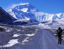
Peninsula Kamchatka. Kamchatka is a country of natural contrasts, extraordinary originality, captivating beauty. Mountains, active and extinct volcanoes, vast valleys and lowlands, mountain and lowland rivers, cold and hot mineral springs- all this is on the peninsula.
This is one of the most remote corners of the country from the European center of Russia. About 2/3 of the area of Kamchatka is occupied by mountains. This is an area of young folded-volcanic mountains with tundra and wooded vegetation. Two ridges stretch along the entire peninsula - Sredinny and Vostochny, separated by the Central Kamchatka depression with the Kamchatka River flowing through it. The ridges are crowned with volcanic cones with snow caps and glaciers. From time to time Kamchatka is shaken by volcanic eruptions. On the peninsula, there are about 30 operating and more than 130 extinct volcanoes. One of the most active and highest volcanoes world - Klyuchevskaya Sopka, its height is 4750 m.
On the map in the atlas, find the active volcanoes of Kamchatka, write their names on contour map. Remember the names.
Active volcanic activity affects many other features of nature. So, as a result of eruptions, soils periodically receive additional portions of primary minerals, which ensures their high fertility.
Forecast volcanic eruptions engaged in the science of volcanology. Almost all large volcanoes Special stations have been set up where, with the help of modern instruments, the temperature of the rocks is monitored, the chemical analysis of gases is carried out, and the crater of the volcano is listened to. In a few days, it is possible to predict the beginning of the intensification of volcanic activity and warn residents of the surrounding cities and villages.
Volcanologists are people of a dangerous profession. Sometimes they have to work on flows of lava that has not yet cooled down, descend into the crater of a volcano, be under the “fire” of red-hot stones, near red-hot lava with a temperature of about + 1300 ° C.
Climate of Kamchatka characterized by excessive humidity throughout the year. The driest and warmest place is the Central Kamchatka depression.
Explain the distribution of heat and moisture in Kamchatka by comparing the climatic and physical maps of the atlas and the textbook.

Rice. 131. Volcano on the Kamchatka Peninsula
The Kamchatka Peninsula is occupied by a subzone of coniferous-birch park forests. The specificity of this subzone is the predominance of small-leaved trees (stone and Japanese birches) over conifers and the wide distribution of tall grasses.
Stone birch has a gray or reddish bark and a dense curly crown: the height of trees usually does not exceed 10 m. Due to the curvature of the trunk, stone birch is little used in construction, but mainly goes for firewood and handicrafts. However, stone birch forests play an important water and soil protection role.
Among the herbs, the silkworm, cornflower, bear's pipe and other umbrella are common.
The mountain ranges are covered with thickets of dwarf pine and dwarf alder, mountain tundras are even higher, alpine meadows and the snow zone of Kamchatka glaciers.

Rice. 132. Scheme of monsoon circulation in summer and winter (arrows show wind direction, numbers show atmospheric pressure, in mb)
A very large brown bear, Kamchatka sable, squirrel, chipmunk, lynx, Kamchatka nutcracker, etc. live in cedar elfin forests. Reindeer live in mountain tundra, and snow sheep graze in alpine mountain meadows.
History reference. The first information about Kamchatka was obtained from the "fairy tales" (reports) of explorers. The honor of discovering Kamchatka belongs to Vladimir Atlasov, who made trips there in 1697-1699. Soon Kamchatka was included in Russia. He also made a drawing (map) of Kamchatka and gave its detailed description.
As a result of the First (1725-1730) and Second (1733-1743) Kamchatka expeditions under the leadership of the famous Russian navigator Vitus Bering, the division of Asia was confirmed and North America, the Aleutian and Commander Islands were discovered, maps were drawn, and the most valuable material about Kamchatka was collected. S. P. Krasheninnikov took part in the Second Kamchatka Expedition, whose work “Description of the land of Kamchatka” is one of the classic works of geographical literature.
In the 19th century sailings began from St. Petersburg to Russian America with an obligatory call to Kamchatka, to Petropavlovsk. During this period, Petropavlovsk became Russia's main base in the Far East. The city is spread out on the banks of the extraordinarily beautiful Avacha Bay, a part of the Avacha Bay deeply protruding into the land. Avachinskaya, Koryakskaya and Vilyuchinskaya hills rise above it.
Sakhalin is the most big Island Russia, its area is 76,400 km 2, the length from north to south is more than 900 km, the largest width is 160 km, the smallest is 47 km.
What strait separates the island from the mainland and where is the border between Russia and Japan?
The island is mountainous, but the mountains are low - the average height is 500-800 m. The highest elevation of the island is Mount Lopatina in the East Sakhalin Mountains. Its height is 1609 m above sea level. Sakhalin is located in the seismically active zone of the Pacific Ring of Fire, with which frequent earthquakes are associated within it. The last force of 8 points occurred in 1995. In the geological structure of Sakhalin, mainly sedimentary rocks are involved, with which deposits of oil, gas, and building materials are associated.
A characteristic feature of Sakhalin's climate- high relative humidity and frequent winds. Precipitation is clearly distributed over the seasons of the year, which is explained by the dominance of monsoon circulation.
There are many short, rapid mountain rivers and mountain and valley lakes on the island. The flora and fauna of the island is poorer than on the mainland. But in the adjacent sea waters species that have disappeared or are very rare on the mainland have been preserved here, for example, a one and a half meter sea otter and a two-meter fur seal. In the north of the island you can find deer moss, and in the extreme south - blooming magnolias.
Two thirds of the territory of Sakhalin is occupied by forests. In the north, light-coniferous taiga dominates from Daurian larch with an admixture of birch and alder; in the south - dark coniferous forests of Ayan spruce, fir with an admixture of broad-leaved species - oak, yew. Thickets of bamboo and creepers are widespread everywhere in the south.
Primorye, or Primorsky Krai , is located in the southern part of the Far East, on the coast of the Sea of Japan. On its territory, such European countries as Belgium, the Netherlands, Denmark and Switzerland, taken together, could freely accommodate. The appearance of the region is characterized by numerous ridges, ridges and separate hills. Tectonically, they are quite young. Almost all the mountains of Primorye belong to the mountainous country of Sikhote-Alin.
The monsoon climate characteristic of the entire Far East in Primorye is most pronounced.
In terms of the amount of solar heat, Primorye occupies one of the first places in Russia, not inferior to the Black Sea coast of the Caucasus.
Using the maps of the textbook, determine how much solar radiation the districts of Vladivostok receive, what is the duration of the frost-free period there.

Rice. 133. Ussuri Nature Reserve
The abundance of moisture in summer contributes to the development of a powerful vegetation cover. Most of the territory of Primorye is occupied by the famous Ussuri taiga, which combines coniferous and broad-leaved species in the most bizarre way. Cedar and larch grow next to Manchurian walnut and Amur velvet. More than 250 species of trees and shrubs grow in the forests of the region. Primorye occupies one of the first places in Russia in terms of the number of endemics - plants that are common only in this area. Only here grow Amur velvet (cork tree), iron birch, etc. There are many relic plants in the region that have been preserved since the Neogene.
The fauna of Primorye is diverse and rich. The endemics include the Ussuri tiger, the leatherback turtle, the remains of the Neogene and Quaternary fauna include the spotted deer, the black Ussuri bear, the Amur goral antelope, the small graceful mandarin duck, which strikes with the beauty of its plumage, the ground thrush, etc.
Up to a hundred species of fish live in the lakes and rivers of the region. In coniferous-deciduous forests there are many midges and ticks that are harmful to humans and animals.

Stepan Petrovich Krasheninnikov (1711-1755)
Stepan Petrovich Krasheninnikov - famous traveler, geographer, botanist, ichthyologist, ethnographer, historian and linguist - was born in Moscow on October 31 (November 11), 1711.
In August 1733, S. Krasheninnikov was included in the Kamchatka expedition, whose task was to explore and describe the little-known regions of Siberia and Kamchatka. During 1733-1736. S. P. Krasheninnikov studied the nature of Siberia, visited Tobolsk, Altai, Transbaikalia, Irkutsk, Yakutsk. From October 1737 to June 1741 Stepan Petrovich lived and worked in Kamchatka. The result of the expedition work was the publication of the work "Description of the land of Kamchatka" (1756). Scientists - geographers and historians, and writers, including A. S. Pushkin, also read it. A volcano in Kamchatka, a cape on Karaginsky Island, a cape on Novaya Zemlya bear the name of a scientist-traveler.

Nikolai Mikhailovich Przhevalsky (1839-1888)
N. M. Przhevalsky is a famous Russian traveler, explorer of Central Asia. For his services he was elected an honorary member of the St. Petersburg Academy of Sciences.
He made his first trip to the Ussuri region. After that, he led five large expeditions to Central Asia (from 1870 to 1888). Przhevalsky discovered the giant Altyn-tag ridge, visited Lake Lobnor, described the sources of the Huang He and the upper reaches of the Yangtze, explored the Takla-Makan desert, discovered hundreds of species of plants and animals, including a wild horse, later named Przhevalsky's horse, Tibetan bear.
During the fifth expedition, N. M. Przhevalsky fell ill and died on the shore of Lake Issyk-Kul in the city of Karakol.
The expeditions of M. I. Venyukov (1858), N. M. Przhevalsky (1867-1869), V. K. Arsenyev (1906-1910) were engaged in the study of the nature of the region.

Rice. 134. Research of the Far East
Natural uniques of the Far East. Valley of Geysers.
Eastern Kamchatka is the only region in Russia with periodically spouting geysers.
Most active volcanoes are on the Eastern Volcanic Plateau, which is elevated up to 600-1000 m. Numerous geysers are confined to these volcanoes. The Valley of Geysers is the biggest landmark of Kamchatka, which was mentioned in the "Description of the Land of Kamchatka" by S. P. Krasheninnikov. For the first time, geysers were described in detail by G. I. Ustinova, an employee of the Kronotsky Reserve, in 1941. Having penetrated the river, which later became known as Geysernaya (a tributary of the Shumnaya River), she discovered several groups of geysers in a deep canyon-like gorge. Among them are Pervenets, Giant, Triple, Fountain, Zhemchuzhny, Double and others - a total of 20 geysers, 10 large pulsating springs and more than 300 small, boiling and freely flowing. The largest geyser Giant acts in a very original way. Its eruption does not last long - two minutes, but thick steam continues to rise for another 10-15 minutes, clouding the adjacent parts of the valley. In 2007, the Valley of Geysers suffered from a mudflow.

Rice. 135. Autumn in Primorsky Krai
Grand fir grove(Kamchatka) on the eastern coast of Kamchatka is part of the Kronotsky Reserve. These are unusually slender and beautiful trees, their height reaches 13 m, the diameter of the trunk is 20-25 cm, the needles contain essential oils and smell pleasant. Botanists attribute grandiose fir to ancient (pre-glacial) vegetation.
Lake Khanka- the largest in the Far East. Located at an altitude of 69 m above sea level. Its length is up to 95 km, its width is up to 65 km, the area is more than 4 thousand km 2, the average depth is about 4 m. 13 rivers flow into it. The lake is rich in fish. A relict lotus plant, a giant water lily, the leaves of which reach 2 m in diameter, and a water chestnut grow on the lake.
Lazovsky (Sudzukhinsky) Nature Reserve(area 116.5 thousand hectares) on the coast of the Sea of Japan, in the cedar-broad-deciduous forests of which tigers, lynxes, sables, bears, wild boars, spotted deer and red deer, pheasants and hazel grouses live. A part of the reserve is a small (about 30 ha) Petrov Island, located 1 km from the shore of Xiaohe Bay. Petrov Island is an archaeological and natural landmark of Primorye. It was inhabited several centuries ago. In the relic yew grove, some trees reach 200-300 years.
Questions and tasks
- Indicate what are the main factors underlying the physical-geographical zoning of the Far East, and name the most typical natural complexes for it.
- Compare the natural complexes of the northern and southern parts of the Far East.
- Describe the natural complexes of Kamchatka.
- What is the main difference between the natural complexes of the island parts of the Far East and the continental ones?
- On the contour map of the region, put all the geographical objects indicated in the text, underline the names of those that are associated with the names of the researchers of the region.
155.34kb.
abstract
by geography
Subject: Peninsula Kamchatka.
Natural uniques of the Far
East.
Completed by: Tykvenko Marina.
Checked by: Tykvenko N.V.
Looked 2007
Peninsula Kamchatka. Kamchatka is a country of natural contrasts, extraordinary originality, captivating beauty. Mountains, active and extinct volcanoes, vast valleys and lowlands, mountain and lowland rivers, cold and hot mineral springs - all this is on the peninsula.
This is one of the most remote corners of the country from the European center of Russia. About ⅔ of the area of Kamchatka is occupied by mountains. This is an area of young folded-volcanic mountains with tundra and wooded vegetation. Two ridges stretch along the entire peninsula - Median and Oriental, shared Central Kamchatka depression with the river Kamchatka flowing through it. The ridges are crowned with volcanic cones with snow caps and glaciers. From time to time Kamchatka is shaken by volcanic eruptions. There are about 130 extinct volcanoes on the peninsula. One of the most active and highest volcanoes in the world - Klyuchevsky, its height is 4750 m.
Active volcanic activity affects many other features of nature. So, as a result of eruptions, soils periodically receive additional portions of primary minerals, which ensures their high fertility.
Volcanology is the science of forecasting volcanic eruptions. Almost all large volcanoes have special stations where, with the help of modern instruments, they monitor the temperature of the rocks, conduct a chemical analysis of gases, and listen to the crater of the volcano. In a few days, it is possible to predict the beginning of the intensification of volcanic activity and warn residents of the surrounding cities and villages.
Volcanologists are a dangerous profession. Sometimes they have to work on the channels of lava that has not yet cooled down, descend into the crater of a volcano, be under the “fire” of red-hot stones, near red-hot lava with a temperature of about +1300 ° C.
The climate of Kamchatka is characterized by excessive humidity throughout the year. The driest and warmest place is the Central Kamchatka depression.
The Kamchatka Peninsula is occupied by a subzone of coniferous-birch park forests. The specificity of this subzone is the predominance of small-leaved trees (stone and Japanese birches) over conifers and the wide distribution of tall grasses.
Stone birch has a gray or reddish bark and a dense curly crown: the height of trees usually does not exceed 10 m. Due to the curvature of the trunk, stone birch is little used in construction, but mainly goes for firewood and handicrafts. However, stone birch forests play an important water and soil protection role.
Among the herbs, the common herb is the shalamynik, the cornflower, the bear's pipe and other umbellifers.
The mountain ranges are covered with thickets of dwarf pine and dwarf alder, mountain tundra, alpine meadows and the snow zone of Kamchatka glaciers are even higher.
A very large brown bear, Kamchatka sable, squirrel, chipmunk, lynx, Kamchatka nutcracker, etc. live in cedar forests. Reindeer live in mountain tundra, and snow sheep graze in alpine mountain meadows.
History reference. The first information about Kamchatka was obtained from the "fairy tales" (reports) of explorers. The honor of discovering Kamchatka belongs to Vladimir Atlasov, who made trips there in 1697-1699. Soon Kamchatka was included in Russia. He also made a drawing (map) of Kamchatka and gave its detailed description.
As a result of the First and Second Kamchatka expeditions led by the Russian navigator Vitus Bering, the separation of Asia and North America was confirmed, Aleutian and Commander Islands, maps are drawn.
Natural uniqueness of the Far East. Valley of Geysers. Eastern Kamchatka is the only region in Russia with periodically spouting geysers.
Most active volcanoes are on the Eastern Volcanic Plateau, composed of lava covers, tuffs, ash and elevated up to 600-1000 m. Numerous geysers are confined to these volcanoes. The Valley of Geysers is the biggest attraction of Kamchatka. For the first time, geysers were discovered by an employee of the Kronotsky Reserve G. I. Ustinova in 1941, penetrating to the river, which later received the name Geysernaya(inflow R. noisy). Here, in a deep canyon-like gorge, there are several groups of geysers. Among them "Firstborn", "Giant", "Triple", "Fountain", "Pearl", "Double" and others - a total of 20 geysers, 10 large pulsating springs and more than 300 small, boiling and freely flowing. The largest geyser "Giant" acts in a very original way. Its eruption does not last long - two minutes, but thick steam continues to rise for another 10-15 minutes, clouding the adjacent parts of the valley.
Grandiose fir grove (Kamchatka) on the eastern coast of Kamchatka is part of Kronotsky Reserve. These are unusually slender beautiful trees, their height reaches 13 m, the trunk diameter is 20-25 cm, the needles contain essential oils and smell pleasant. Botanists attribute grandiose fir to ancient (pre-glacial) vegetation.
Lake Khanka - females are large in the Far East. Located at an altitude of 69 m above sea level. Its length is up to 95 km, its width is up to 65 km, and its area is more than 4 thousand square meters. km, the average depth is about 4 m. About 13 rivers flow into it, the lake is rich in fish. A relict lotus plant grows on the lake, a giant water lily, the leaves of which reach 2 m in diameter, and a water chestnut.
Lazovsky (Sudzukhinsky) Nature Reserve (area 116.5 thousand hectares) on the coast of the Sea of Japan, in the cedar-broad-leaved forests of which tigers, lynxes, sables, bears, wild boars, spotted deer and red deer, pheasants and hazel grouses live. A part of the reserve is also a small (about 30 ha) petrov island, located 1 km from the shore of the bay Xiaohe. Petrov Island is an archaeological and natural landmark of Primorye. It was inhabited several centuries ago. In the relic yew grove, some trees reach 200-300 years.
Glyadenskaya basic comprehensive school №11.
abstract
by geography
Subject: Peninsula Kamchatka.
Natural uniques of the Far
East.
Completed by: Tykvenko Marina.
Checked:
Looked 2007
Peninsula Kamchatka. Kamchatka is a country of natural contrasts, extraordinary originality, captivating beauty. Mountains, active and extinct volcanoes, vast valleys and lowlands, mountain and lowland rivers, cold and hot mineral springs - all this is on the peninsula.
This is one of the most remote corners of the country from the European center of Russia. About ⅔ of the area of Kamchatka is occupied by mountains. This is an area of young folded-volcanic mountains with tundra and wooded vegetation. Two ridges stretch along the entire peninsula - Median and Oriental, shared Central Kamchatka depression with the river Kamchatka flowing through it. The ridges are crowned with volcanic cones with snow caps and glaciers. From time to time Kamchatka is shaken by volcanic eruptions. There are about 130 extinct volcanoes on the peninsula. One of the most active and highest volcanoes in the world - Klyuchevsky, its height is 4750 m.
Active volcanic activity affects many other features of nature. So, as a result of eruptions, soils periodically receive additional portions of primary minerals, which ensures their high fertility.
Volcanology is the science of forecasting volcanic eruptions. Almost all large volcanoes have special stations where, with the help of modern instruments, they monitor the temperature of the rocks, conduct a chemical analysis of gases, and listen to the crater of the volcano. In a few days, it is possible to predict the beginning of the intensification of volcanic activity and warn residents of the surrounding cities and villages.
Volcanologists are a dangerous profession. Sometimes they have to work on the channels of lava that has not yet cooled down, descend into the crater of a volcano, be under the “fire” of red-hot stones, near hot lava with a temperature of about +1300 ° C.
The climate of Kamchatka is characterized by excessive humidity throughout the year. The driest and warmest place is the Central Kamchatka depression.
The Kamchatka Peninsula is occupied by a subzone of coniferous-birch park forests. The specificity of this subzone is the predominance of small-leaved trees (stone and Japanese birches) over conifers and the wide distribution of tall grasses.
Stone birch has a gray or reddish bark and a dense curly crown: the height of trees usually does not exceed 10 m. Due to the curvature of the trunk, stone birch is little used in construction, but mainly goes for firewood and handicrafts. However, stone birch forests play an important water and soil protection role.
Among the herbs, the common herb is the shalamynik, the cornflower, the bear's pipe and other umbellifers.
The mountain ranges are covered with thickets of dwarf pine and dwarf alder, mountain tundra, alpine meadows and the snow zone of Kamchatka glaciers are even higher.
A very large brown bear, Kamchatka sable, squirrel, chipmunk, lynx, Kamchatka nutcracker, etc. live in cedar forests. Reindeer live in mountain tundra, and snow sheep graze in alpine mountain meadows.
History reference. The first information about Kamchatka was obtained from the "fairy tales" (reports) of explorers. The honor of discovering Kamchatka belongs to Vladimir Atlasov, who made trips there in the years. Soon Kamchatka was included in Russia. He also made a drawing (map) of Kamchatka and gave its detailed description.
As a result of the First and Second Kamchatka expeditions led by the Russian navigator Vitus Bering, the separation of Asia and North America was confirmed, Aleutian and Commander Islands, maps are drawn.
Natural uniqueness of the Far East. Valley of Geysers. Eastern Kamchatka is the only region in Russia with periodically spouting geysers.
Most of the active volcanoes are on the Eastern Volcanic Plateau, which is composed of lava covers, tuffs, ash and uplifted to m. Numerous geysers are confined to these volcanoes. The Valley of Geysers is the biggest attraction of Kamchatka. For the first time, geysers were discovered by an employee of the Kronotsky Reserve in 1941, penetrating to the river, which later received the name Geysernaya(inflow R. noisy). Here, in a deep canyon-like gorge, there are several groups of geysers. Among them "Firstborn", "Giant", "Triple", "Fountain", "Pearl", "Double" and others - a total of 20 geysers, 10 large pulsating springs and more than 300 small, boiling and freely flowing. The largest geyser "Giant" acts in a very original way. Its eruption does not last long - two minutes, but thick steam continues to rise for another 10-15 minutes, clouding the adjacent parts of the valley.
Grandiose fir grove (Kamchatka) on the eastern coast of Kamchatka is part of Kronotsky Reserve. These are unusually slender beautiful trees, their height reaches 13 m, the trunk diameter is 20-25 cm, the needles contain essential oils and smell pleasant. Botanists attribute grandiose fir to ancient (pre-glacial) vegetation.
Lake Khanka - females are large in the Far East. Located at an altitude of 69 m above sea level. Its length is up to 95 km, its width is up to 65 km, and its area is more than 4 thousand square meters. km, the average depth is about 4 m. About 13 rivers flow into it, the lake is rich in fish. A relict lotus plant grows on the lake, a giant water lily, the leaves of which reach 2 m in diameter, and a water chestnut.
Lazovsky (Sudzukhinsky) Nature Reserve (area 116.5 thousand hectares) on the coast of the Sea of Japan, in the cedar-broad-leaved forests of which tigers, lynxes, sables, bears, wild boars, spotted deer and red deer, pheasants and hazel grouses live. A part of the reserve is also a small (about 30 ha) petrov island, located 1 km from the shore of the bay Xiaohe. Petrov Island is an archaeological and natural landmark of Primorye. It was inhabited several centuries ago. In the relic yew grove, some trees reach 200-300 years.
Lesson Objectives: To form students' knowledge about the natural complexes of the Far East, to develop students' knowledge about the natural regions of Russia, to instill in students a respect for nature.
EDUCATIONAL TASKS
I. Educational
To form students' knowledge about the natural complexes of the Far East
To form students' knowledge about the features of the nature of the Chukchi Highlands
To form students' knowledge about the nature of the Kamchatka Peninsula
To form students' knowledge about the features of the nature of Sakhalin
To form students' knowledge about the nature of Primorye
To form students' knowledge about the natural uniqueness of the Far East
II. Educational
The ability to work with various sources of information, the ability to highlight the main thing, to systematize the material, the ability to see cause-and-effect relationships;
Independence in replenishment of knowledge, education of patriotism, environmental awareness, interest in the subject
III. Educational
Convince students that the study of the Far East is necessary for the socio-economic development of the country, human economic activity
Facilities and equipment: textbook, atlas, contour maps, notebook, map of the Far East, map of Russia
DURING THE CLASSES
I. Organizational moment
Greeting, checking absentees, checking preparedness for the lesson
II. Examination homework
When checking homework, we use the frontal type of survey
General geographical position Eastern Siberia
Climate features (climate type, its main characteristics)
General characteristics of the relief
What natural regions of Eastern Siberia have we studied?
What types of natural resources are found in Eastern Siberia? (examples)
Knowledge update
Motivation for learning new material
Teacher : So, we have already studied almost all natural regions of Russia. Today we will start studying the last region - the Far East. Let's get acquainted with the natural complexes of the Far East, the peculiarities of the nature of the region and some of the unique ones of the Far East
Natural complexes of the Far East. Natural uniques.(writing on the board)
The method of presenting new material is a story-conversation.
Teacher : The position of the territory of the Far East on the border of the largest continent and the largest ocean of the Earth significantly influenced the features of the natural territorial complexes of the region and their location. Maritime air masses arriving on land in summer are colder than the continent. Therefore, due to the cost of heat for their heating, summer air temperatures over the coast are much lower than in the interior parts of the mainland. Sea air brings a lot of moisture, which leads to an increase in precipitation compared to inland areas. These conditions are the main reason for the sharp shift in the Far East to the south of the border of natural zones in comparison with the mainland territories.
Teacher : Let's remember what factors underlie the zoning of natural regions?
Student : Relief
Student : Animal world
Student : Vegetation
Teacher
:
The physical-geographical zoning of the Far East is based on two factors: the structural features of the surface and the nature of the vegetation. Let us consider the most typical physiographic regions of the Far East: the Chukchi tundra highlands, the Kamchatka young tundra-wooded mountains, Sakhalin Island with coniferous-deciduous forests, the Ussuri taiga.
Chukchi highlands.
Teacher : Let's mark the Chukchi Plateau on contour maps
The climate of the Chukotka Highlands is one of the most severe in the Far East. Therefore, the Chukchi Plateau is a combination of plain and mountain tundra with a mountainous Arctic desert. In the north of the Chukotka Peninsula, the mountain tundra rises no higher than 100-200 m, in the south the tundra is located much higher. Common inhabitants of the tundra are reindeer, arctic fox, lemmings and tundra partridges. Many waterfowl nest on the swampy lowlands. There are walrus rookeries on the coast of the Chukchi Sea, and bird colonies on the coastal cliffs.
Peninsula Kamchatka.
Teacher : No less interesting is the nature of Kamchatka. But before proceeding to the study of this complex in more detail, let's get acquainted with the history of the development of the complex.
An oral response from one of the students is heard
History reference.
The first information about Kamchatka was obtained from the "fairy tales" (reports) of explorers. The honor of discovering Kamchatka belongs to Vladimir Atlasov, who made trips there in 1697-1699. Soon Kamchatka was included in Russia. He also made a drawing (map) of Kamchatka and gave its detailed description.
As a result of the First (1725-1730) and Second (1733-1743) Kamchatka expeditions led by the famous Russian navigator Vitus Bering, the separation of Asia and North America was confirmed, the Aleutian and Commander Islands were discovered, maps were drawn, and valuable material about Kamchatka was collected. S. P. Krasheninnikov took part in the Second Kamchatka Expedition, whose work “Description of the land of Kamchatka” is one of the classic works of geographical literature.
In the 19th century sailings from St. Petersburg to Russian America began with an obligatory call to Kamchatka, to Petropavlovsk. During this period, Petropavlovsk became Russia's main base in the Far East. The city spreads out on the banks of the extraordinarily beautiful Avacha Bay, a part of the Avacha Bay that goes deep into the land. Avachinskaya, Koryakskaya and Vilyuchanskaya hills rise above it.
Teacher
:
Kamchatka is a country of natural contrasts, extraordinary originality, captivating beauty. Mountains, active and extinct volcanoes, vast valleys and lowlands, mountain and lowland rivers, cold and hot mineral springs - all this is on the peninsula.
This is one of the most remote corners of the country from the European center of Russia. About 2/3 of the area of Kamchatka is occupied by mountains. This is an area of young folded-volcanic mountains with tundra and wooded vegetation. Two ridges stretch along the entire peninsula - Sredinny and Vostochny, separated by the Central Kamchatka depression with the Kamchatka River flowing through it. The ridges are crowned with volcanic cones with snow caps and glaciers. From time to time Kamchatka is shaken by volcanic eruptions. There are about 30 active and more than 130 extinct volcanoes on the peninsula. One of the most active and highest volcanoes in the world is Klyuchevskaya Sopka, its height is 4750 m.
Teacher : Find active volcanoes on the maps of the atlas, mark them on the contour map (Ichinskaya Sopka, Mutnovskaya Sopka, Koryakskaya Sopka, Shuveluch volcano, Kronotskaya Sopka)
Teacher : In your opinion, do volcanoes influence the natural features of Kamchatka?
Active volcanic activity affects many other features of nature. So, as a result of eruptions, soils periodically receive additional portions of primary minerals, which ensures their high fertility. Volcanology is the science of forecasting volcanic eruptions.
Teacher : Do you think it is necessary to monitor volcanoes and why?
Almost all large volcanoes have special stations where, with the help of modern instruments, they monitor the temperature of the rocks, conduct a chemical analysis of gases, and listen to the crater of the volcano. In a few days, it is possible to predict the beginning of the intensification of volcanic activity and warn residents of the surrounding cities and villages.
The climate of Kamchatka is characterized by excessive humidity throughout the year. The driest and warmest place is the Central Kamchatka depression. The Kamchatka Peninsula is occupied by a subzone of coniferous-birch park forests. The specificity of this subzone is the predominance of small-leaved trees (stone and Japanese birches) over conifers and the wide distribution of tall grasses. Among the herbs, the common herb is the shalamynik, the cornflower, the bear's pipe and other umbellifers. Mountain ranges are covered with thickets of dwarf pine and shrub alder, mountain tundra, alpine meadows and the snow zone of Kamchatka glaciers are even higher. A very large brown bear, Kamchatka sable, squirrel, chipmunk, lynx, Kamchatka nutcracker, etc. live in cedar forests. Reindeer live in mountain tundra, and snow sheep graze in alpine mountain meadows.
Sakhalin- the largest island in Russia, its area is 76,400 sq. km, the length from north to south is more than 900 km, the largest width is 160 km, the smallest is 47 km.
The island is mountainous, but the mountains are low - the average height is 500 - 800 m. The highest elevation of the island is Mount Lopatina in the East Sakhalin Mountains. Its height is 1609 m above sea level. Sakhalin is located in the seismically active zone of the Pacific Ring of Fire, with which frequent earthquakes are associated within it. The last force of 8 points occurred in 1995. In the geological structure of Sakhalin, mainly sedimentary rocks are involved, with which deposits of oil, gas, and building materials are associated.
A characteristic feature of Sakhalin's climate is high relative humidity and frequent winds. Precipitation is clearly distributed over the seasons of the year, which is explained by the dominance of monsoon circulation.
There are many short, rapid mountain rivers and mountain and valley lakes on the island. The flora and fauna of the island is poorer than on the mainland. But in the adjacent sea waters, there are species that have disappeared or are very rare on the mainland, for example, a one and a half meter sea otter and a two-meter fur seal. In the north of the island you can find deer moss, and in the extreme south - blooming magnolias.
Two thirds of the territory of Sakhalin is occupied by forests. In the north, dominated by light coniferous taiga from Daurian larch (let's remember for which complex this species is typical) with an admixture of birch and alder; in the south - dark coniferous forests of Ayan spruce, fir with an admixture of broad-leaved species - oak, yew. Thickets of bamboo and creepers are widespread everywhere in the south.
Primorye, or Primorsky Territory, is located in the southern part of the Far East, on the coast of the Sea of Japan. On its territory could freely accommodate such European countries as Belgium, Holland, Denmark and Switzerland combined. The appearance of the region is characterized by numerous ridges, ridges and separate hills. Tectonic they are quite young. Almost all the mountains of Primorye belong to the mountainous country of Sikhote-Alin.
The monsoon climate characteristic of the entire Far East is most pronounced in Primorye.
Teacher : Let's remember what is typical for this climate
The monsoon climate of the temperate zone is typical of the southern regions of the Far East. Usually, when the mainland cools in winter and the atmospheric pressure rises in connection with this, dry and cold air rushes towards warmer air over the ocean. In summer, the mainland warms up more than the ocean, and now the colder oceanic air tends to the continent, bringing clouds and heavy precipitation; sometimes even typhoons form. The average January temperatures here are -15, -30 °С; in summer, in July, +10, +20 "C. Precipitation - 600-800 mm per year - falls mainly in summer. If snow melting in the mountains coincides with heavy rains, floods occur. Humidification is excessive everywhere (humidity coefficient is greater than one).
In terms of the amount of solar heat, Primorye occupies one of the first places in Russia, not inferior to Black Sea coast Caucasus.
The abundance of moisture in summer contributes to the development of a powerful vegetation cover. Most of the territory of Primorye is occupied by the famous Ussuri taiga, which combines coniferous and broad-leaved species in the most bizarre way. Cedar and larch grow next to Manchurian walnut and Amur velvet. More than 250 species of trees and shrubs grow in the forests of the region. Primorye occupies one of the first places in Russia in terms of the number of endemics - plants that are common only in this area. Only here grow Amur velvet (cork tree), iron birch, Maak's euonymus, etc. There are many relict plants in the region that have been preserved since the Neogene.
The fauna of Primorye is diverse and rich. The endemics include the Ussuri tiger, the leatherback turtle, the remains of the Neogene and Quaternary fauna include the spotted deer, the black Ussuri bear, the Amur goral antelope, the small graceful mandarin duck, which strikes with the beauty of its plumage, the ground thrush, etc.
Up to a hundred species of fish live in the lakes and rivers of the region. In coniferous-deciduous forests there are many midges and ticks that are harmful to humans and animals.
Natural uniques of the Far East.
Teacher : Let's listen to the messages of your classmates about the natural uniqueness of the Far East
Valley of Geysers. Eastern Kamchatka is the only region in Russia with periodically spouting geysers.
Most active volcanoes are on the Eastern Volcanic Plateau, composed of lava covers, tuffs, ash and elevated up to 600-1000 m. Numerous geysers are confined to these volcanoes. The Valley of Geysers is the biggest attraction of Kamchatka. For the first time, geysers were discovered by an employee of the Kronotsky Reserve G. I. Ustinova in 1941, penetrating to the river, which later became known as Geysernaya (a tributary of the Shumnaya River). Here, in a deep canyon-like gorge, there are several groups of geysers. Among them are "Firstborn", "Giant", "Triple", "Fountain", "Pearl", "Double" and others - a total of 20 geysers, 10 large pulsating springs and more than 300 small, boiling and freely flowing. The largest geyser "Giant" acts in a very original way. Its eruption does not last long - two minutes, but thick steam continues to rise for another 10-15 minutes, clouding the adjacent parts of the valley.
Grand fir grove(Kamchatka) on the eastern coast of Kamchatka is part of the Kronotsky Reserve. These are unusually slender and beautiful trees, their height reaches 13 m, the diameter of the trunk is 20-25 cm, the needles contain essential oils and smell pleasant. Botanists attribute grandiose fir to ancient (pre-glacial) vegetation.
Lake Khanka- the largest in the Far East. Located at an altitude of 69 m above sea level. Its length is up to 95 km, its width is up to 65 km, and its area is more than 4 thousand square meters. km, the average depth is about 4 m. 13 rivers flow into it. The lake is rich in fish. A relict lotus plant grows on the lake, a giant water lily, the leaves of which reach 2 m in diameter, and a water chestnut.
Lazovsky (Sudzukhinsky) reserve (area 116.5 thousand hectares) on the coast of the Sea of Japan, in the cedar-broad-leaved forests of which tigers, lynxes, sables, bears, wild boars, spotted deer and red deer, pheasants and hazel grouses live. A part of the reserve is a small (about 30 ha) Petrov Island, located 1 km from the shore of Xiaohe Bay. Petrov Island is an archaeological and natural landmark of Primorye. It was inhabited several centuries ago. In the relic yew grove, some trees reach 200-300 years.
IV. Fixing new material
Mark geographical objects on the contour map
What are the main factors underlying the zoning of the Far East
What type of climate is typical for the region
Compare the natural complexes of the northern and southern parts of the Far East, indicate their significant differences. 3. Describe the natural complexes of Kamchatka.
What is the main difference between the natural complexes of the island parts of the Far East and the continental ones?
VI. Homework instruction
Paragraph 42, start filling out the table, prepare contour maps
Topic: Population and economic development of the Far East
Lesson Objectives:
1. To study the population and specialization of the economy of the economic region.
Show the influence of EGP features on the development of the economy of the Far East.
2. Improve the ability to work according to a standard plan, analyze statistical data, atlas maps.
Students should know:
1. EGP of the Far East.
2. Population and specialization of the economy of the region.
3.Shortage of labor resources .
Students should be able to:
1. Perform practical tasks on the contour map.
2. Be able to analyze statistical data, atlas maps.
3. Show objects of the nomenclature.
Type of lesson: Practicum with lecture elements.
Lesson equipment:
Physical and economic map Far East.
Map of distribution and population density of the Far East. Statistical table "Territory and population of subjects of the Russian Federation". Tasks for practical work.
During the classes.
| 1. Org. moment. 2. FNZ. 2.2. Work with thematic maps of the atlas. 2.4. Compilation of the table by students. 3.Practical work: “Identification of the features and problems of the development of the Far East. 5. Homework. | Communication of the goals and objectives of the lesson. For a long time, the area remained sparsely populated. During the years of Soviet power, the population has grown 8 times, but, despite this, the need for labor resources is constantly felt. The intensity of migration is the highest in the country. At present, the outflow of the population from the north is characteristic. The urban population predominates. Using a population location and density map, name and point to major and Largest cities Far East. Describe the population density of the Far East. Farm specialization. The economic specialization of the district is the mining production of non-ferrous metallurgy, timber, fish processing industries According to natural and economic conditions, zones are distinguished: 1. In the south, the fertile plains of the Amur Region, Primorsky and Khabarovsk Territories are populated. The monsoonal climate provides good conditions for Agriculture and people's lives. Industry, population and main cities are concentrated along the Trans-Siberian Railway. The South Yakutsk (coal, electric power, metallurgy) and Amur (Komsomolsk-on-Amur - mechanical engineering centers) In the Magadan region and the Republic of Sakha harsh conditions north hinder the economic development of the territory. The main transport axes - r. Lena, Northern Sea Route. On the Pacific coast, Kamchatka, Sakhalin, the Kuriles, economic development is constrained by the poor development of the social sphere and transport. Development prospects: 1. Creation of technopolises; 2. In the south, develop the fuel industry, electric power industry, machine building, and the defense industry. 2.Specialization (for each district). 3. Factors stimulating the development of this production (fertile lands, monsoon climate, unfavorable natural conditions, access to the ocean). 1. Features of the EGP. 2. Economic development of the region. 3. Problems of the Far East and ways to solve them. 4. Economic relations of the Far East, contributing to its development. 1. How does the EGP of the Far East affect the development of the economy of the region? 2. Describe the structure of the economy of the Far East. What industries can be called industries of specialization? 3. The Far East is a territory with a free economic zone in the Nakhodka region. What do you think caused the creation of a free economic zone here? 4. Using Figure 88 (p. 327 of the textbook), analyze the process of interaction between the Far East and other economic regions of Russia. 5. Analyze the main statistical indicators of the economy of the Far East. 2. Finish the practical work: "Identification of the features and problems of the development of the Far East." 3. Learn geographical nomenclature on the topic "Far East". |
Topic: Economy of the Far East
Tasks: 1. Repeat and test students' knowledge of the nature and population of the Far East.
2. To give knowledge to schoolchildren on the economy of the Far East.
3. To develop geographical thinking, memory, attention of students.
4. Stimulate an emotional attitude, interest in solving the social and environmental problems of the Far East, in the prospects for the development of this part of Russia.
Lesson type: combined.
Visibility: atlas of Russia, contour map, physical map Russia, computer disk.
During the classes
Organizing time.
Repetition and knowledge testing
Questions.
Almost the entire territory of the Far East belongs to the area of Cenozoic folding.
Earthquakes and seaquakes are frequent in the area.
The main rainfall in the south of the Far East falls in winter.
The Far Eastern rivers are predominantly flat.
Amur is the largest waterway in the Far East.
The largest lake in the region is Khanka.
The flora and fauna of the Far East is poorer. Than Siberia and the European part of Russia.
Volcano Klyuchevskaya Sopka is located on about. Sakhalin.
Primorye has a monsoonal climate.
The Ussuri tiger lives in the taiga of the Far East.
The shores of the Far East are washed by 3 seas.
Whales and seals are found in the Chukchi Sea.
Strips of paper with students' answers are handed over to the teacher.
There is an unfinished test on the board, complete it
(I call the students to the board one by one)
1. The population of the Far East …………….
2.Average population density …………..
3. Indigenous people: Chukchi, ………….
4. Population prevails (urban, rural) ……….
5. For 500 thousand people. only in two cities …………
6.Problems of the district …………..
3. Study of new material.
The teacher asks questions:
1. What wealth does the Far East have?
2. Why are these resources poorly used?
3. After reviewing the material on the disk on the topic, highlight the leading sectors of the economy of the Far East?
Work with atlas and contour map.
Assignment: label 5 large industrial centers of the Far East on the contour map.
The student's message about the city of Vladivostok is heard.
Working with student and workbooks.
From the text of paragraph 60 - write out the main problems of the Far East in a workbook.
Checking independent work.
The message of the student about the prospects for the development of the Far East is heard.
4. The final part of the lesson.
Teacher: What did you learn about the economy of the Far East?
Giving marks for class work.
Houses: on the album sheet, come up with and colorfully depict the coat of arms of the Far East, prepare a message about Khabarovsk, working with additional literature.
Topic: Economy of the Far East (2nd version of the lesson)
The motto of the lesson: “Who, if not us?
When, if not now?
Teaching and educational goals:
1. Formation of independent activity of students in groups in assessing the natural resource potential and specialization of the economic region.
2. Be able to analyze cause-and-effect relationships.
3. Work on general educational skills: generalize and compare, listen, be able to answer questions on the merits.
4. Form key competencies.
Equipment:
Physical and political-administrative map of the Far East, landscapes of the Far East.
Methods and forms of educational activity:
Using the interactive method. Collective work in groups in discussing the questions posed by the teacher using "Brainstorming".
Work organization:
1. Creation of four groups and appointment of commanders.
2. Give a lead task