S. V
Lesson of Kuban studies in the 5th grade on the topic "Toponyms of the Kuban"
Kononets Elena Vladimirovna, primary school teacher
The purpose of the lesson:
To acquaint students with toponymy as a linguistic phenomenon, with toponyms Krasnodar Territory, their meaning and origin.
Lesson objectives:
1. Give an idea of toponymy.
To form the ability to distinguish toponyms of different groups and use them in speech.
To form spelling vigilance when writing simple and compound toponyms.
To acquaint with the etymology of the toponyms of the Kuban.
To instill a sense of love for the native land, to form the civil-patriotic qualities of the personality of schoolchildren.
Design: map of the Krasnodar Territory, handout, flags for the map, multimedia presentation.
During the classes:
Organization of the beginning of the lesson.
- You have materials for the lesson. Please take them out of the files and put them in front of you. Put a number on the first page. Write down your first and last name.
slide 1.
Geographical names (toponyms).
We will talk about geographical names in the lesson.
We will make a trip on the map of the Krasnodar Territory, marking the stops. Are you ready to hit the road? Pick up magical flowers, wave them 3 times, look at the sky, at the door, at me. Guess the password for the start of the journey.
The common name for all places on Earth. Add the word topos (place) with the word onym (Name).
Now we come to the topic of the lesson. What do you think, if you add up a trip around the map of the Krasnodar Territory and the word "toponym", what topic will you get? That's right, "Toponyms of the Krasnodar Territory."
Write down the topic of the lesson.
Have you forgotten about magical flowers? Take a closer look at them. On the colored side of the flower are written words that are familiar to you. Read them.
By turning the petals over, you will find out which Greek root these words correspond to. Fold the Greek roots with the word "name" (onyma), what happened? That's right, hydronyms, oikonyms, oronyms, dryonyms and urbanonyms, call groups of toponyms that have different meanings.
Complete the definitions of toponym types:
Names of water bodies (seas, ___________________, ____________, _______________) - ____________________.
Names of mountains, ridges, passes - ____________________.
Names of cities, _____________, villages, _______________ - _____________________.
Names of streets, lanes, squares, squares, avenues, embankments - _____________________.
Now you are ready to make a trip on the map of the Krasnodar Territory. Let's hit the road!
The meaning and origin of some toponyms of the Krasnodar Territory.
Before you sheet number 2. Route sheet. In order to check the route, distribute the listed toponyms by type.
Fill in the table by distributing the toponyms of the Krasnodar Territory into groups. Work in pairs.
Slide 3.
Kuban River, Krasnodar city, Black Sea, Sochi city, Angelinsky erik, Tuapse city, Park of the 30th anniversary of the Victory, Lake Baikal, Gorky park, Mount Tsokhvoa, Dzhubga village, Lake Ritsa, St. Petersburg city, Lake Karasun , Pervomaiskaya park, House-Museum of the Bursakov family, monument to Catherine II, Youth Palace, St. Catherine's Cathedral, Red Street.
Toponym Language Meaning Other names and notes
slide 4.
hydronyms
Angelinsky erik Turksky
Turkish "angali" - having a mother;
Engelik - expanse, space.
Erik - Angelik
Engelik
Karasun Lake Turkic Kora - black, su - water -
Kuban river Karachay-Balkar "kobkhan" - fast, turbulent, restless, overflowing 300. Kobkhan, Koban,
Gopanis (Greek) (horse river (violent, strong),
Black Sea Slavic "dark" - severe 500. Scythian, Upper Sea of Sunset (Central Asian geographers), Pontus Euxine - hospitable (Greeks)
Slide 5.
Oronyms
Caucasus (mountainous country) Scythian
Old Iraqi
Indian
Ossetian-Alanian
snow white
icy shiny
"Graukasim" - snow-white mountain
"Khokh-az" - mountain of Azov (Ossetians) Lagonaki upland Adygeysk. "legune" - a place for newlyweds and "ku" - valley;
"l'egapIenekIy" - a hill, devoid of vegetation. Lago - Naki
Tsokhvoa mountain Abadzinsk. Sharp peak (mountain) Highest point Krasnodar Territory (3345 m.)
slide 6.
Drionims
Park named after the 30th anniversary of the Victory Russian In honor of the Victory of the Soviet people over Nazi Germany Victory Park (colloquial)
Maxim Gorky Park Russian In honor of the writer Maxim Gorky Gorky Park (colloquial)
Forest park Krasny Kut Russian "Red" - beautiful;
"Kut" - a corner, a dead end Slide 7.
Oikonyms
City of Sochi Ubykhsky
Shabshugsky From "shacha" - the name of the Ubykh tribe;
"Sette" - they accept the City of Krasnodar Russian "Red" - beautiful,
"gift" is a gift. Yekaterinodar
City of Tuapse Persian
Circassian Peach;
“tu” - two, “apse” - waters (souls);
place of the Apses (Abkhazians) City-colony Topsida (“topos” - place,
"indros" - iron)
slide 8.
Urbanonyms
House-Museum of the Bursak family House of Bursak (colloquial)
Monument to Catherine II Palace of Youth St. Catherine's Cathedral Red Cathedral
Krasnaya Street Let's check if you filled out the route sheets correctly.
Spelling of toponyms.
slide 9.
A great opportunity to help an unlucky cartographer (mapper) who does not know how to spell toponyms correctly.
Fill in the missing letters by selecting the one you want.
(W, w) ____ okaya (B, b) ____ alka, (M, m) ____ bear (Sch, w) spruce, (C, c) ____ Emesskaya (D, d) ____ olina, (N, n) ____ avaginsky (X, x) ____ rebet, (G, d) ____ ora (S, s) ____ sugar (G, d) ____ tin, (H, h) ____ Erkes (U, y) ____ gap, (P, n) ____ ereval (V, c) ____ deer (V, c) ) ____ rotation, (C, s) ____ Udzhuk (K, k) ____ wasp, (M, m) ____ s (D, d) ____ ob.
Creative task.
slide 10.
Imagine that you need to tell a passer-by with a hearing impairment how to get from your house to school. What type of speech do you use to be understood by a deaf person (written language).
Write down which streets he needs to go, where to turn, what landmarks he will meet on the way.
Summing up the lesson.
Slide 11.
It's time to return from your trip. Tell me, what impressions experienced on the way left the most vivid memories? What nouns were the object of our close attention? (proper nouns). Remind me what toponyms are and what types of toponyms did you meet?
Would you dare to take another trip like this? What parts of the country would you like to visit on your own? Who would you take on the road? Who was appointed as a guide?
Thank you, it was a pleasure to travel with you. See you. And it will definitely be, because the Earth is round!
An important component of the cultural and historical heritage of the Kuban Cossacks are geographical names (toponyms). The totality of toponyms in any territory constitutes its toponymy. (one)
The study of the Cossack toponymy of the Kuban helps to clarify a number of issues: the linguistic and dialectal affiliation of the Cossack settlers; the main stages of the settlement of the Kuban and its military-administrative division; demographic situation; military operations in the Northwestern Caucasus; activities of individuals; mutual influence of the language and culture of the Cossack population and neighboring peoples, etc.
The first Cossacks who settled on the banks of the Kuban at the end of the 17th century were the Nekrasov Old Believers. The names of the towns founded by them are known: Bludilovsky, Golubinsky, Chiryansky (Chirsky) - and settlements: Irla, Zolnik, etc. (2) In the 70s. In the 18th century, pressed by the Russian government, the Nekrasov Cossacks moved to Turkey. Their settlements existed for about 90 years, without having a noticeable impact on the subsequent formation of the East Slavic toponymy of the Kuban. Only in 1843, on the site of the former Nekrasov town on Laba, a village was founded, named Nekrasovskaya in memory of the first Kuban Cossacks.
In 1792-1794. the settlement of the northwestern part of the Kuban by the Black Sea Cossacks (former Cossacks) began. It is noteworthy that the Black Sea people completely preserved the division of the army into kurens that existed in the Sich. The Cossacks of each kuren settled in separate kuren villages (until 1842, villages were called in Chernomorie, which received names from the names of the corresponding kurens. “Thirty-eight kurens were the same names that existed in the Zaporizhzhya army, and two were added again; the first Ekaterinovsky - in honor of Empress Catherine, and the last Berezansky - in remembrance of the capture of the Turkish fortress of Berezan by the Black Sea." (3)
Most of the smoking names were formed on the basis of the Ukrainian language already in the 16th-18th centuries. According to their origin, they can be divided into two groups:
1. The name of the kuren is derived from the names of some settlements. It is generally accepted that each kuren was founded by people from a particular locality, from where it got its name. D.I. writes about this. Evarnitsky: “Remaining on the Bottom, they gradually formed into separate and small groups, communities or kurens, representing at first a kind of community.” (4)
For example, Baturinsky kuren - Baturin; Irklievsky kuren - Irkliev city; Kalnibolotsky kuren - the village of Kalniboloto.
2. Some kurens got their names by the name of a person - most often the founder of a kuren or chieftain. Here is a whole gallery of prominent figures of the Sich:
Rogivsky kuren - between November 1664 and February 1665, "the Cossacks ... chose Ivan Zhdan, or Rog, as a kosher." (5)
Priest's hut - named after hetman Ivan Samoilovich, who was called hetman-priest, since "Ivan Samoilovich was the son of a priest on the western side of the Dnieper from the village of Krasnoe." (6)
Shkurinsky kuren - named after the ataman Lesko Shkura. (7)
Of particular note is the Plastunivsky Kuren. Scouts were called Cossack infantry scouts. “One of the 38 kurens of Zaporozhye apparently had largest number such “hunters”, which is why he received the name Plastunovsky. ”(8)
In addition to smoking villages, the Black Sea army organized a number of cordons and posts, the names of which remained with the future villages. (9)
In the early 1820s, smoking villages were founded on the site of the former posts: Elizavetinskoye (1821), Pavlovskoye (1822), Maryanskoye (1823), Petrovskoye (1823). (10) The posts received their names: the first three are in honor of the persons of the imperial family - Elizabeth Alekseevna (wife of Alexander I), Maria Feodorovna (wife of Paul I). The latter got its name, according to S. I. Vakhrin, by the name of General Peter Tekelli. (11) However, according to our field materials, the patronal Peter's Church existed in this village, which explains this toponym differently.
An indicator of some improvement in the demographic state of a number of kurens can be the emergence of new kuren villages in the Black Sea coast, in the names of which there are word-forming particles “new-” and “old-”. With a certain overabundance of the adult population, the smoking village had the opportunity to relocate part of the Cossacks to an additional allotment. A smoking village is formed with the same name, but with the addition of the “new-” particle. The old village receives the particle "old-". For example, Staroderevyankovskoye and Novoderevyankovskoye, Starovelichkovskoye and Novovelichkovskoye, Starominskoye and Novominskoye, etc. The resulting pair is called an antonymic pair, since “old-” and “new-” are contrasted here. In toponymy, there are also other types of antonymic pairs: “small” and “large”, “right” - “left”, “upper” - “lower”, etc. (12)
From 1809 to 1823 in the Black Sea army, 9 antonymic pairs "old-new" were composed. Subsequently, antonymic pairs became widespread in Kuban toponymy, but a different, slightly modified model was used, where the secondary toponym was formed by adding the topoformant “new-” to the primary toponym, but the primary one retained the former name without adding the particle “old-”.
In 1842, in connection with the publication of the "Regulations on the Black Sea Cossack Host", new stage administrative changes in the Black Sea coast. (13) Kuren, according to this Regulation, were renamed into villages. In addition, the Ukrainian-language names of kurens were subjected to significant "Russification". So, for example, the hut of Vedmedivsky became the village of Medvedovskaya.
Almost simultaneously with the Black Sea coast, the eastern part of the right bank of the Kuban, the so-called Old (Kuban) Line, began to be settled. Unlike the Ukrainian-speaking Black Sea people, the Cossacks of the line were mostly Russian-speaking. The Old Line included the villages of the Kuban (1794), Caucasian (1802-1804) and Khopersky (1825) regiments. The formation of the toponymy of these regiments was significantly influenced by the names of fortresses and redoubts built in the period from 1788 to 1791. "The names of some redoubts were named after the regiments that were located here." (14) So, for example, the Caucasian redoubt, on the site of which the village of the same name was founded in 1794, was built by the Caucasian Chasseurs Regiment. (15) The redoubts of Ladoga, Tiflis, Kazan and Voronezh also received names from their respective regiments. Other villages were named after nearby forest areas(Temnolesskaya and Vorovskolesskaya) and even in memory of the victory in 1790 of General Herman over the Turkish commander Batal Pasha (village of Batalpashinskaya). (sixteen)
At the end of the 18th - beginning of the 19th centuries. on the Old Line, in addition to the Cossack villages, peasant villages also appear. The first villages in terms of time of occurrence were Novomaryinskoye, founded in 1794, and Staromaryinskoye, founded a year later. By 1801, there were already 11 villages with a population of 21337 people within the Old Line. (17)
In 1832, the Caucasian linear Cossack army was formed from nine linear regiments. By decree of December 2, 1832, a number of peasant villages were transformed into villages. The villages of Dmitrievskoye, Rasshevatskoye, Uspenskoye, Novoalekseevskoye, Novotroitskoye were included in the Kuban regiment. . (19) In 1848, with the transfer of the Tikhoretskaya volost to the Caucasian line army, the villages of Novopokrovskoye, Ternovobalkovskoye, Tikhoretskoye and Novorozhdestvenskoye also became the villages of the Old Line. (20) Thus, the Cossack toponymy of the Kuban was supplemented by the names of former peasant villages.
Many peasant villages in Staraya Liniya owe their names to Orthodox holidays. Settlements receive such names most often on the day of foundation, when they are consecrated and named according to the canons of Orthodoxy. (21) In the names of the linear villages, Church Orthodox vocabulary is absent at first. F. L. Shcherbina explains this by the fact that the original composition of the Line Cossacks was the Old Believers. “... Only schismatics were transferred to the Kuban, and the schism, as a sect undesirable to the government, was persecuted. The spiritual needs of the masses were therefore met secretly and carefully guarded from prying eyes. (22)
Nevertheless, the main reason here seems to be the fact that the first linear villages were founded on the site of former fortifications, from which they got their names. There was no need to give them other names (including from the Orthodox calendar).
With the transformation of peasant villages into villages in the Cossack toponymy of the Old Line, such names appeared as Rozhdestvenskaya, Uspenskaya, Arkhangelskaya, Novopokrovskaya, Novorozhdestvenskaya, Novotroitskaya, etc. The macrotoponym Staraya Liniya probably appeared later, in 1841, when the cordon line was transferred from the Kuban to Lab. The plain between these rivers was called the Labinskaya Line, or New, in contrast to the former, "Old". All the same phenomenon of antonymy. The New Line was a single whole with the Old Line and was in the fortification of the Caucasian linear Cossack army. (23)
In the toponymy of Novaya Liniya, a whole layer of names of Cossack villages stands out, testifying to the former border significance of the region and reflecting the features of military life. For example, the village of Nadezhnaya “was surrounded on one side by trenches, which represented a reliable defense against the enemy. This sign formed the basis of the name. (24)
The village of Convenient, "according to the old-timers, represented a very convenient position in terms of natural and geographical conditions." (25) According to the same principle, the villages of Upornaya, Peredovaya, Watchtower, Barrier, etc. were named. Some villages take their names from the Orthodox calendar: Voznesenskaya - “the name is due to the Orthodox holiday “Ascension of the Lord”, which is movable in the calendar, (26) Petropavlovskaya - “owes its name to the Christian holy apostles Peter and Paul, whose holiday - June 29, 1845 - was on the day of the founding of the village next to the fortification of the same name. ”(27)
Other villages are named after military leaders or persons of the Imperial family: Mikhailovskaya and Konstantinovskaya - named after the sons of Nicholas I, the village of Zassovskaya and Zassovskoye fortification (28) - are named after General G. X. von Zass. “Many villages,” according to S.A. Zagainy, - they received the name of the regiments operating in the Caucasus ... The Tenginsky regiment - the Tenginsky village. (29) The name of the village of Vladimirskaya is probably also of “regimental” origin. (thirty)
A foreign language substrate, primarily hydronymy (that is, the names of rivers, lakes, estuaries, etc.), had a great influence on the formation of the Cossack toponymy of the Kuban. To the north of the Kuban River and in the interfluve of the Kuban and Laba, hydronymy of Turkic origin prevails. It formed the basis of many names of Cossack settlements, for example, r. Beisug - the village of Beisugskaya, r. Chelbasy - the village of Chelbasskaya, etc. After the formation in 1860 of the Kuban region and the Kuban Cossack army, an active Cossack settlement of Zakuban begins. Here in the period from 1861 to 1865. more than 80 villages were founded. (31)
The names of many of them have Adyghe roots. Some villages got their names from hydronyms: r. Pshekha - the village of Pshekhskaya; R. Gubs - the village of Gubskaya, etc. Others have an ethnonymic basis, that is, they are named after the Adyghe tribes: Makhoshevtsy - the village of Makhoshevskaya; Abadzekhs - the village of Abadzekhskaya. Some villages are named after some local features For example, the village of Kelermesskaya - from the Adyghe kyelir - "ramson", mez - "forest". "Cheremshin forest". (32)
Of interest is the issue of renaming in 1807 a number of Trans-Kuban villages. (33) Before the renaming, 15 villages had names with an Adyghe basis, the new names were consonant with the names of Russian cities. (34) The village of Pshishskaya became Chernigovskaya, Gabukaevskaya - Ryazanskaya, Psefirskaya - Kostroma. The villages were named after the regiments that fought in the Caucasus. This is confirmed by P. O. Kirillov on the example of the village of Ryazanskaya. (35) Regiments in the Russian army traditionally bore the names of the cities where they were formed.
Another major campaign to rename the villages and farms of the Kuban region was carried out in 1909-1914. on the initiative of the Military archivist I. I. Kiyashko. As a result, a number of names associated with the history of the Kuban Cossacks appeared on the map of the Kuban: the village of Chepiginskaya, the village of Atamanskaya, the village of Vostochnaya (in memory of the participation of the Kuban Cossacks in the Russian-Japanese war), the village of Zaporozhskaya, etc. (36)
In the modern toponymy of the Kuban Cossacks, three main areas can be distinguished:
1. Research. This includes the collection and scientific processing of toponymic material, the compilation of toponymic dictionaries and reference books, (37) the writing of special studies.
2. Popularization. Popularization of toponymic knowledge in periodicals, radio and television appearances, development of a university special course on Kuban toponymy, etc.
3. Applied. In connection with the revival of the Kuban Cossacks, the issue of returning the lost historical names of streets, villages, farms is of particular relevance. When nominating new streets and settlements, one should take into account the recommendations of toponymic commissions and the experience of similar work in the pre-revolutionary period.
All this puts toponymy in a number of promising areas of knowledge, makes the work of a toponymist important and necessary for society.
Bibliographic footnotes
1. Linguistic encyclopedic dictionary / Ed. V, N. Yartseva. - M., "Soviet Encyclopedia", 1990. S. 515.
2. Korolenko P. P. Nekrasov Cossacks. Historical essay compiled from printed and archival sources / Izvestia OLIKO. Issue. 2. - Ekaterinodar, 1900. S. 18; Shkuro V.I. Free Cossack Republic in the Kuban and the fate of its inhabitants / From the pre-revolutionary past of the Kuban Cossacks. Collection of scientific papers. - Krasnodar, 1993. S. 9.
3. Korolenko P. P. Chernomortsy. SPb., 1874. S. 62.
4. Evaritsky D. I. History of the Zaporizhian Cossacks. T. 2. St. Petersburg, 1895. S. 63.
5. Evarnitsky D. I. Decree. op. T. 2. S. 371-372.
6. Evarnitsky D. I. Decree. op. T. 2. S. 469.
7. Evarnitsky D. I. Decree. op. T. 2. S, 371.
8. Ratushnyak VN From the historical past of the Kuban scouts // From the pre-revolutionary past of the Kuban Cossacks. Collection of scientific papers. - Krasnodar, 1993. S. 23.9. Zagayny S.A. The origin of the names of some settlements in the Krasnodar Territory // Dokl. Sochi Department of the Geographical Society of the USSR. - L., 1968, S. 193.
10. State Archive of the Krasnodar Territory (hereinafter GAKK), f. 250, op. 2, d. 536, l. 8-11.
11. Vakhrin S. I. Biographies of Kuban names (popular toponymic dictionary of the Krasnodar Territory]. - Krasnodar-Armavir, 1995. P. 51.
12. Nikonov V, A, Brief Toponymic Dictionary. - M., 1966. S. 496.
13. Main administrative-territorial transformations in the Kuban (1792-1985). - Krasnodar, 1986, p. 14.
14. Shcherbina F. A, History of the Kuban Cossack army. T. 1. Ekaterinodar, 1910. S. 653.
15. Gulieva L.G. To the study of the toponymy of the Kuban //Soviet ethnography. 1968, No. 3. S. 94.
16. GAKK F. 396, op.1, file 10228, l.62.
17. Shcherbina F.A. Decree. op. T.2. - Ekaterinodar, 1913. S. 186.
18. GACK, f. 396, op. 1, d. 8407, l. fourteen,
19. GACK, f. 318, op. 1, case 125, sheet. 1,4-38, 131-157.
20. GACK, f. 670, op. 1, d. 34, l. 39.
21. V. B. Vinogradov. Toponymy of the Middle Kuban. - Armavir, 1993. S. 56.
22. Shcherbina F.A. Decree. op. G. 1, - Ekaterinodar, 1910. S. 700.
23. PSZ. Sobr. 2. T, 35 (1860). SPb., 1862. Art. 36268.
24. Gulieva L.G. To the study of the toponymy of the Kuban //Soviet ethnography. 1968. No. 3, S. 95.
25. Ibid.
26. V. B. Vinogradov. Decree, op. S. 18.
27. Ibid. S. 39.
28. Ibid. S. 24.
29. Zagayny S. A. Decree. op. S. 193,
30. Vinogradov B. B. Decree. op. S. 18.
31. Main administrative-territorial transformations in the Kuban (1792-1985). - Krasnodar, 1986. S. 22.
32. Meretukov K.Kh. Adyghe toponymic dictionary. - Maikop, 1981. S. 65.
33. Samovtor S.V. Toponymy of the Trans-Kuban region (On the issue of renaming a number of Kuban villages in 1867) // Archeology and local history of the Kuban. Materials of the first student scientific conference. - Krasnodar, 1993. S. 26-28.
34. Complete collection of laws Russian Empire. Sobr. 2. (1867). - St. Petersburg, 1871. Art. 44968,
35. Kirillov P.O. Stanitsa Ryazanskaya (former Gabukaevskaya). Historical and statistical description // Kuban collection. T. 9. - Ekaterinodar, 1903. S. 127.
36. G "AKK, f. 396, op. 1, file 10228; f. 396, op. 1, file 10020.
37. Samovtor S. V. Basic principles for compiling the Kuban toponymic dictionary // Materials of the meeting dedicated to the 30th anniversary of the scientific, creative, pedagogical and social activities of the school of academician V.B. Vinogradov (1964-1994). Part 2. - Armavir, 1994. S. 50.
Names of the Krasnodar Territory history
Hundreds of names are marked on the map of our region, but what is their origin, their meaning? Why was one city of the region called Krasnodar, and the other - Sochi? Why are the rivers named Laba, Belaya, Tikhonkaya, and the villages - Persistent, Vasyurinskaya, the sea - Azov, etc.
Study of geographical names(toponyms) deals with a special science - toponymy.
Geographical names are not random, they are given by society, therefore they are historically determined. In some historical epochs, geographical names were given according to the natural or economic features of the object, in others, the object was more often called by its belonging to the owner, in the third, names - dedications prevailed. In our country, the people immortalized in many geographical names memorable historical dates, the names of prominent public figures, scientists, and writers.
The names of geographical objects of our region are very different in their origin and time of occurrence. Basically, toponyms of Caucasian, Turkic and Slavic origin are distinguished here, and ancient Greek ones are also found. Caucasian toponyms - the earliest in origin - include Adyghe and Circassian geographical names, for example, the names of rivers - Pshish, Psou, Psekups or mountains - Oshten, Autl, Abadzesh, as well as auls - Ponezhukai, Koshekhabl and others.
Slavic toponyms are the latest and most common in the Kuban. The origin of geographical names, their content and changes over time are of great interest to geographers, ethnographers, historians and linguists. This interest is explained by the fact that geographical names can reflect the natural features of the object, its history, features of economic life, life and language of the people living or living in this territory.
For example, the Sea of Azov for its shallow water and low swampy shores, the ancient Greeks called "Meiotis estuary", the Romans - "Meotian swamp".
The names of some rivers reflect the nature of their flow, the color of the water, for example, the Tikhonkaya River (a tributary of the Chelbas), Belaya (a tributary of the Kuban).
The name of the city of Maykop, apparently, from the Adyghe - meykueps - "apple beam river" - here is also a hint at the natural features of the area.
The names of a number of settlements in our region are given by the name of the rivers on the banks of which they are located: the cities of Belorechensk - along the Belaya River, Yeysk - along the Her River, the villages of Pshekhskaya - along the Pshekha River, Kurdzhipskaya - along the Kurdzhips River, the village of Ilsky - along the Il River and other.
Sochi received its name in 1896 after the Circassian tribe Soatshe. Kropotkin - previously the village of Romanovsky Khutor at the Kavkazskaya railway station - was renamed in 1921 in memory of the public figure and scientist-geographer P.A. Kropotkin.
Some geographical names are associated with the history of the settlement of the Kuban.
So, Krasnodar, founded in 1793, when Catherine II transferred the Zaporizhzhya Cossacks to the Kuban, was called Yekaterinodar, since the allotment of land for the Cossacks was presented as a "gift of Catherine". After the October Revolution in 1920, the city was renamed Krasnodar. Here Red is the symbol of revolution.
Many villages of our region have retained the names of the kurens of the Zaporizhzhya army. Former Cossacks-Cossacks founded 40 kurens in the Kuban, and 38 of them bore the same names that existed in the Zaporizhzhya army. Later, these kurens turned into villages, for example, Dinskaya, Vasyurinskaya, Shcherbinovskaya, Kalnibolotskaya, Bryukhovetskaya, Kushchevskaya and others. 
Some villages were named after military fortifications - redoubts that previously existed near the Cossack villages settled near them. So, the village of Prochnookopskaya is named after the redoubt Prochny Okop, Barrier - by the name of the fortification Barrier Stan, Ladoga, Voronezh and other villages are named after the redoubts.
Some geographical names are associated with the stay in the Kuban of the famous Russian commander A.V. Suvorov. There is a legend that the name of the rivers 1st, 2nd, 3rd Kochety is explained by the fact that during the hostilities here A.V. Suvorov chose the cry of a rooster as a signal for offensives (kochet - in Ukrainian).
The village of Yeisk Fortification was built by the Russian army as a stronghold in the fight against Ottoman Empire at the mouth of the Bolshaya Eya River in July 1774, after the conclusion of the Kainardzhi peace, as an outpost of the Russian border.
Local residents consider themselves descendants of Suvorov soldiers, which, in their opinion, is evidenced by the Central Russian dialect, which is unusual for the Kuban. 
The village of Lazarevskoye on the Black Sea coast is named after Admiral M.P. Lazarev, a Russian naval commander and navigator who brought up a galaxy of talented naval commanders and commanders.
The names of some Trans-Kuban foothill villages reflected the features of the military life of the Cossacks, for example, Sentry, Persistent, Courageous, Fearless.
The origin and content of many place names in the Kuban is unclear or controversial, for example, such as the rivers Kuban, Laba, Eya, Beisug, Chelbas, Lake Khanskoye, the Black Sea, the Taman Peninsula, the cities of Tuapse, Gelendzhik and many others, although there are a range of interpretations. Scientists and amateur local historians have yet to unravel the mysteries of a number of geographical names.
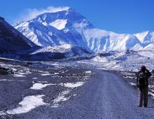
Kuban- a river, one of the largest water arteries of the Caucasus. It originates on the northwestern slopes of Elbrus (5642m) from the confluence of the Uchkulan and Ullukam rivers, flows into the Sea of Azov in the Temryuk region of the Krasnodar Territory, flows through the territories of Karachay-Cherkessia, Stavropol and Krasnodar Territories. The length of the river is 941 km. One of ancient names rivers - Antikines (options and distortions: Antikates, Antikata, Antikitos, Antikelt, Antikeit, Antikeita, Antisetas, Antisites, Anticetas, Antitsita, Anticea, Attikit, Attikites, Ahtatsita, etc.), from ancient Greek antikeith - "sturgeon", "sturgeon river", "sturgeon-river". Such an interpretation of the hydronym does not contradict the geographical reality, since not only during the time of the Bosporan kingdom, but also in the Middle Ages, caviar and balyks of sturgeons caught in the lower reaches of the Kuban were known far beyond the Azov-Black Sea basin and were exported to Greece, Italy and other Western European countries . Although it is possible that the Kuban was called Antikines by the name of the South Slavic tribe of Ants who lived on its shores. This is also typical for other variants of the names of the Kuban river: hippomolgi - river Gipp; ramparts - river Val; Apsars - the river Apsar; apsils - r. Psi; Achaeans - the river Akheunta; Kalkans - the river Kalkan; Buy-Bulgars - the river Kupi; Khazars - Small river Khazareti, etc. The later name of the Kuban River is Gipanis. For the first time this name is found in 63 BC. During the war that the Bosporus waged with the aborigines of the Kuban, King Farnak diverted the flow of Gipanis aside, and its waters, spilling over the low-lying plains, flooded all the fields they cultivated near the Dandaris ... The etymology of this hydronym goes back to the ancient Greek hippos (hippos) - "horse" , therefore, most commentators translate this name as “horse river”, especially since the deification of this animal can be traced in the Nart epic. Similar toponyms have been preserved in a number of regions of the Black Sea region almost to the present day. In turn, L.G. Guliyeva allows the translation of this hydronym as “big”, “strong”, “violent” (like a horse), drawing a parallel with the Karachay-Balkarian kobkh an - “furious”, “rushing”. In ancient times, in the lower reaches of the Kuban, there was the city of Gipanis, which is also characteristic of other variants of the names of the Kuban River: the fortification of Kumania - the Kuman River; the city of Kut - the river Kut; the city of Staraya Aheya - the river Akheunta; the city of Kopa - the river Kopa; the city of Kuban - the river Kuban. The Adyghe, aboriginal layer, the lower boundary of which dates back to the 1st millennium BC, and the upper one to the present, is the most productive. For the first time, the Adyghe variants of the name of the Kuban River (Psyzh) were recorded in the Nart epic, which began to take shape about 3000 years ago, as well as in ancient sources dating back to the first centuries of our era (Ptolemy, Arrian, Diodor Siculus). Despite the distortions caused by the inaccuracy of the records of foreign authors and errors in translation, in all the identified forms, the same roots are traced, which are characteristic of the language of the natives of the Kuban - the Meotian tribe of Psiss, or Apsils. In total, in ancient and medieval sources, about 70 variants of the same name of the Kubani River, dating back to the ancient Adyghe dogs - “water”, “river” (for example, Psyzh, Psyz, Psishe, Psitskhe, Psi, Pshiz, Pshish, etc.). It should also be noted the clearly Greek character of such hydronyms of the Kuban as: Opissas, Psapos, Psarus and Psevhors, as well as a typical example of the transition of the common name dogs - “water”, “river” into the proper name of the river Psi. At the same time, the explanation of the ancient names of the Kuban River from the Adyghe pse - "soul" or pshi - "prince" seems to be completely wrong. Of particular interest is the study of the origin of another variant of the name of the Kuban River - the Vardan River, since some data suggest the substrate nature of this toponym. The hydronymic formant dan (don) is well known for its productivity not only in the south of the CIS, but also in the vast territory of Eurasia (Ramadan, Hamadan, Aldan, Razdan, Khaltsy-don, etc.). The element dan (don) dates back to the Scythian-Sarmatian period (Tanais, Danube, Dniester, etc.). It is more difficult to explain the first component given name. Since in the 4th century BC. in the Kuban region, the Vars (Avars, Uvars) roamed, displacing the ancient Hungarian tribes to the north, a plausible explanation of the hydronym Vardan as “the river of the Vars (Avars)” suggests itself at first glance. According to G.A. Galkin and V.I. Korovin, var came from the Indo-European languages, where var, ar, arre, varr in combination with the formant dan means “stormy, overflowing river”. Under the Khazar domination, the hydronym Vardan was transformed into Varsan (Varshan, Varishan), but in the 18th century it reappears in written sources as Vardan. In the geographical nomenclature of the Kuban River, there are also such names, the meaning of which seems simple, but not justified from the point of view of correspondence to geographical reality. The hydronym Kut is a single name of the Kuban river, noted only by one author - Moses Khorensky. The dictionary of V.I.Dal explains this word as “back street”, “end of a deaf bay”, “dead end”. It must be said that this toponym is widespread in the Kuban (Karasunsky Kut, Krasny Kut, Pansky Kut, etc.). However, the application of the term Kut to the name of the Kuban River is doubtful, therefore it is quite possible that the name Kut was given by Moses Khorensky to one of the estuaries in the lower reaches of this river. The existence in this region in ancient times of a city called Kut and the tribes of Kuts (Kutets) confirms this assumption. At the same time, the possibility of an even more ancient substratum character of this hydronym cannot be ruled out. The lexeme kut (Vakhani kut, Mordovian kud, Sanskrit kot, Sogdian kat, Old Russian and Old Indian kot, kotets), which has the same meaning in all languages - “fortress”, “house”, “shelter”, is widespread in many areas Eurasia. Some ancient authors (Diodorus Siculus) applied the name Fat to the Kuban, which was also applied to the rivers: Araks, Rioni. Fat, Phasis, Phasis is explained from the Sanskrit vizan - "water", "moisture". The reality of the existence of this version of the name of the Kuban river is also confirmed by the testimony of the ancients about the tribe of Fateev or Tateyan, who lived in the time of the Bosporus on east coast Sea of Azov near the river Fat (Phasis), from which they got their name. The age of the hydronym of the Kuban River - Burlik, first recorded in the works of Emperor Konstantin Porphyrogenitus, some authors date back to the 10th century, i.e. the heyday of the Tmutarakan principality. However, due to the short stay of the Slavs in the lower reaches of the Kuban River, the Old Russian origin of this hydronym seems doubtful. It should be noted at the same time that already in Ptolemy there are phonetically close names of the Kuban River - Burka, Buria, Burlyk. The lexeme bur is also productive in the modern toponymy of Central Asia and the Middle East (the villages of Burlik, Burla, Burli, the rivers Burluk, Burchak, Ak-Bura, Kara-Bura, etc.) Moreover, in the letter of the Khazar king Joseph, the city of Bur- to the west of Khazaria, and in the 15-16 centuries in the same area Taman Peninsula Nogai tribes Burkut and Burlak roamed. The first part of this hydronym is explained from the Mongolian bur - "god", "holy" or the ancient Turkic bur - "evaporate", "dry up". In turn, the ancient Turkic suffix -lik, -lyk, meaning the presence or abundance of an object or feature, is also common in the North Caucasus (rivers: Egorlyk, Avdalyk, Karlyk, Chamlyk, Chilik, etc.). In this case, the hydronym Burlik does not mean "boisterous" at all, but "sacred" (from Mongolian) or "drying" (from Turkic) river, which corresponds to the geographical reality. The assumption of some researchers about the origin of one of the variants of the name of the Kuban River - Kuman (Kuman) from the ethnic name of the Polovtsian tribe - Kuman, is allegedly quite convincing, and the Idrisi map, dating back to the time of the Polovtsian raids on North Caucasus(1154), confirms the presence of White and Black Cumania on both banks of the Kuban River. However, the first mention of the Kuman (Kaman) people living in Ciscaucasia dates back to the beginning of the 1st millennium AD. (Pliny, Ptolemy). At the same time, the explanation of the name of the river Kuman from the Polovtsian kum - men - "light-like" or "steppe dwellers" becomes unconvincing. More reliable is the origin of the name of the Kuman (Kamans) tribe and, consequently, of the Kuban River (Kumans) itself from the Persian, Old Turkic and Old Indian kat with the common meaning for all these languages is “river” or “stream”. In literary sources relating to the early Middle Ages, there is another version of the name of the Kuban River - Bal. It should be noted that toponyms for bal (bol) cover a vast area and modern map Eurasia (Balkar, Bolgard, Balbak, Balkhab, Balgart, etc.). At the same time, hydronyms with a “fish” theme have the largest share: Balyksu, Balakley, Balykdere, Balykchi, etc. From the point of view of geographical reality, the most acceptable explanation of this hydronym is from the common Turkic bal (bol, balchug) - “swamp”, “wet land ", "dirt". In one of the philosophical essays of Yuri Honorius (6th century AD), the Kuban River is mentioned under the name Meote, “flowing from Mount Gipania and flowing into the Meotian Lake” (Sea of \u200b\u200bAzov). It is possible that both the river and the sea were named after the Meots - the ancestor of the Circassians. The Meots lived in the Eastern Sea of Azov in the 1st millennium BC; the name of this tribe is repeatedly found in the writings of ancient authors (7th century BC - 6th century AD), as well as in numerous epigraphic sources - ancient Greek and Latin inscriptions of the Northern Black Sea region. N.G. Lopatinsky explains this ethnonym from the ancient Adyghe me - "stink" and late - "swamp", "mud", "puddle", which together means - "stinking swamp"; especially since the Meots themselves called themselves "inhabitants of the swamps." In the manuscripts relating to the era of the medieval colonization of the Eastern Azov Sea by Italians, the Kuban River appeared under the name Kopa. But there is an assumption that the age of this hydronym is much older. Already from the 5th-6th centuries. AD in written sources (Nikiphoros, Moses Khorensky, Feofan, and from the 10th century - Emperor Constantine Porphyrogenitus) the names of the northern branch of the Kuban River appear similar in structure: Kofin, Kofeen, Kopkhen, Kupis, Kupi. At the end of the 12th century in the area modern city Slavyansk-on-Kuban, one of the Circassian tribes laid a small fortification, which then, during the period of the Genoese and Venetian colonization of the Eastern Sea of Azov, grew into a large shopping center . The city was named after the river (Copa, Copa, Coppo, Lo Copario, etc.). "Traces" of the medieval Venetian trading post have survived almost to the present (15th century - Kopa, 16th century - Kopa, 17th century - Kapulu, 18th century - Kapyly, 19th century - Kopyl cordon, 20th century - Novokopylsky village ). Some authors explain this hydronym from the ancient Bulgarian kop - "heap", "stack" or the Kazakh kop - "swamp", "small lake". The first assumption is more realistic; it was the Bulgars, living in the middle of the 1st millennium in the south of the European part of Russia, who gave the name of the river Kuban - Kofin. In the toponymic nomenclature of the Kuban River, there is the Tatar hydronym Kumli, which goes back to the common Turkic kum - "sand". But the Kum (Kom) topographic base is weakly expressed in the North-Western Caucasus. One can only note the Ata-Kum River (now the Adagum River), the Kumatyr River (now the Akhtyr River), the Kumli-Ada Island in the lower reaches of the Kuban River. But Qom is very productive in Kazakh, Tajik, Persian, Afghan and a number of other oriental languages. In turn, the range of -li covers the vast territory of Eurasia: Bitli, Raguli, Kucherli, Kaili, Chanli, etc. For Ptolemy, the Kuban River is known under the name Korak. The indications of Skylaks about the powerful tribe of the Koraxes, who lived in ancient times in the North-Western Caucasus, confirm the origin of this hydronym from the ancient Greek Kor - the tribal name of the Colchians, whose expansion area captured the lower reaches of the Kuban River in those days. In the works of Pomponius Mela, Arrian and other ancient authors, the river Korakanda (Karakanda, Korokondama) is mentioned. The suffix -anda, (-unda) is productive not only in the Caucasus, but also in the Crimea (Karasunda, Karakunda, Karakunga, etc.), according to A.V. Superanskaya, it is of ancient Persian origin. The Turkic layer in the spectrum of geographical names of the Kuban River is represented by the hydronym Karakul (Karagul, Kara-Gul, Kharakul, Horakul). Toponyms from Kara are very widespread in the territory where Turkic-speaking peoples live or lived. And in the basin of the Kuban River, numerous “traces” of their stay have been preserved (rivers: Kara-Nagai, Karasun, Karakent, Karabizhgon; lakes: Kara-Kel and Karachel; Mount Kara-Kaya; the city of Karachaevsk). Some authors admit the possibility of explaining the adjective kara from the ancient Turkic “land”, “land” (for example, karasu - “land - water” in the meaning of “water from the earth” or “spring river”). However, from the point of view of conformity with the geographical reality, this interpretation is not applicable to the swampy massifs of the Lower Kuban. Much more plausible is the explanation of the hydronym Karakul from the common Turkic and Indo-European kara (gara, hara) - “black”. In turn, the explanation of the topographic base -gul (-kul) does not present any particular difficulties. The range of the Turkic-Mongolian root -kol, -kool, -kulu, -kul, meaning "lake", "wetland", covers a vast territory from Western Siberia to the Caucasus. However, -kol (-kul) has another meaning - “duct”, “log”, “river branch”, “hollow”, which is more applicable to the name of the northern branch of the Kuban river. The name of the river Kuban in the form of Kalkan is found in the 7th century by Feofan, and then, after a millennium, it is repeated in the records of Jean de Luc. For most Turkic and Mongolian peoples -kan (-kang, -gang, -khan) combines related concepts: “river”, “channel”, “pool”. If we assume that the first part of the hydronym Kalkan is explained from the common Turkic kale (kala) - “fortress”, “fortification”, then in general this version of the name of the Kuban river should be understood as “fortified river”. In the report of Prince Apraksin in 1711, one of the branches of the Kuban River is called Kura-Kuban or Kaura. It should be noted that the topographic basis of kur(y) is distributed from Central Asia to the Crimean Peninsula. The hydronym Kura-Kuban is explained from the common Turkic kuru (kurak) and the Mongolian kuruk, which in both languages means “dry”, - “dry (drying) Kuban”. According to G.A. Galkin and V.I. Korovin, the modern name of the river is the final link in the toponymic chain dating back to the ancient Bulgars of the 1st millennium BC: Coffen (6th c.) - Kufis (7th c. .) - Kupis (7th-10th centuries) - Buy (13th century) - Kupa (15th century) - Cuba (17th century) - Kuban (17th century) - Guban (18th century) - Kuban. In their opinion, the possibility is not ruled out that the earliest forms date back to the common Aegean kofu - “water”, “river”, “river”. In this case, the Kuban River is nothing but a "river"
There are possible, and even certainly there are typos and inaccuracies caused by both scanning and post-processing. There is not enough strength to "catch" them all alone, but you can - I will fix it. Also, due to the fact that this collection of dictionary entries contains books by several authors, different interpretations of the same name are possible - this is normal - truth is born in a dispute. I will be grateful for the sent additions, clarifications and other works on toponymy
Koveshnikov V. N.
Essays on the toponymy of the Kuban.
Krasnodar, 2006, 252 pages.
The book contains essays on the toponymy of the Kuban (the Republic of Adygea and the Krasnodar Territory). More than 300 hydronyms, at least 450 oronyms are considered, 61 names of cities and regional centers are also given. Almost all toponyms are given an etymology. In addition, at least 400 geographical names are associated with the names of mountains and rivers, i.e. at least 1200 terms are given. For this, the author used more than 200 different printed sources.
It is intended for a wide range of readers interested in local history, as well as students, teachers, guides, tourists.
It can be used as a manual in the classes of tourist and local history circles of institutions of additional education for children, in kindergartens, schools and other educational institutions in the lessons of Kuban studies.
© Maket E.A. Koveshnikova, 2006
1. TO THE READER 3
2. RIVERS OF KUBAN 4
2.1. ZAKUBAN RIVERS 6
2.1.1. INTRODUCTORY 6
2.1.2. VOCABULARY PART 6
2.1.3. CONCLUSION 19
2.2. STEPPE RIVERS OF KUBAN 19
2.2.1. INTRODUCTORY SPEECH 19
2.2.2. VOCABULARY 20
2.2.3. CONCLUSION 25
2.3. RIVERS OF THE RUSSIAN BLACK SEA REGION 26
2.3.1. INTRODUCTORY 26
2.3.2. VOCABULARY 26
2.3.3. CONCLUSION 42
2.4. AFTERWORD 42
3. CITIES AND REGIONAL CENTERS OF KUBAN 45
3.1. INTRODUCTORY 45
3.2. VOCABULARY PART. 46
3.3. CONCLUSION 62
4. MOUNTAIN PEAKS AND RANGE OF KUBAN 64
4.1. INTRODUCTORY WORD. 64
4.2. VOCABULARY 72
4.3. CONCLUSION. 93
5. APPENDICES 94
5.1. LIST OF RIVERS AND RIVERS GIVEN IN THE TEXT 94
5.2. LIST OF GEOGRAPHICAL NAMES (TOPONYMS) FOUND IN THE TEXT ASSOCIATED WITH THE NAME OF RIVERS, RIVERS AND OTHER WATER OBJECTS. 99
5.3. SCROLL SETTLEMENTS GIVEN IN THE ESSAY "ABOUT CITIES AND REGIONAL CENTERS OF KUBAN" 105
5.4. LIST OF PEAKS AND RANGE GIVEN IN ESSAY 106
5.5. A LIST OF GEOGRAPHICAL NAMES DESCENTED FROM ORonyms GIVEN IN THE ESSAY (OR GIVING THEM THEIR NAME). 112
5.6. LIST OF PASSES OF THE MOUNTAIN PART OF THE KRASNODAR REGION AND THE REPUBLIC OF ADYGEA 113
5.7. REFERENCES: 137
1. TO THE READER
The science of geographical names is called toponymy(from the Greek words topos - "place", "locality" and onoma - "name"). “Toponymy is the language of the Earth, and the Earth is a book where human history is recorded in geographical nomenclature” - these catchwords, expressed back in 1837 by the scientist N.I. Nadezhdin, have not lost their significance even now.The book publishes five essays on the toponymy of the Kuban ( Krasnodar region and the Republic of Adygea): three about rivers (steppe, trans-Kuban and the Russian Black Sea), about mountain peaks and ridges, cities and regional centers of the Kuban. The appendices contain lists of: passes of the mountainous part of the Kuban; geographical names given in the text (five in total); list of used literature.
Kuban (Republic of Adygeya and Krasnodar Territory), as an integral part of the Black Sea-Caspian Isthmus, has been a zone of intense interaction between indigenous and newcomer ethnic groups for many centuries. On a relatively small area of the territory, a number of toponyms are represented: Abaza, Abkhazian, Adyghe, Greco-Roman, Slavic, Turkic-Mongolian, Circassian, etc.
But often there are inexplicable toponyms. This is apparently due to the fact that in the absence of writing local residents geographical names have been subjected to distortions for centuries, which are now practically untranslatable, because. the dialects in which they are given have been lost. Changes in names also occur over several decades, i.e. within one lifetime, tk. new words and terms appear, some words become obsolete and forgotten, which also makes it difficult to identify the initial meaning of toponyms.
Sometimes toponyms unexpectedly correspond to dialects from completely different countries. Perhaps travelers, settlers or captives gave the name to the geographical feature in their own language, and it was retained by the indigenous population.
Therefore, there are still many geographical names on the map of the region, the etymology of which is difficult or has several interpretations, often dissimilar.
Often in local history publications, the toponym is presented (translated) without any linguistic, historical or geographical basis, which causes some harm.
The etymology of geographical names is not an easy task, and sometimes attempts to explain many of them are random.
In deciphering the origin of the toponyms given in the text, not everything should be considered indisputable. “Even the most successful interpretation of the history of a word can be revised as soon as new data are found. Nothing wrong with that". (L. Uspensky, 1960).
It should be noted that the translations of some toponyms are proposed by the author for the first time and are not unconditional.
Terminological explanations for the text of essays:
ANTHROPONYM - a name derived from the names, surnames, nicknames of people;
HYDRONIM - proper name of a river, stream, lake (water body);
OIKONIM - the proper name of any settlement (city, village, village, farm, etc.);
ONOMASTICS - a section of linguistics that studies any proper names (geographical names, names of people, names of stars, etc.);
ORONIM - proper name for peaks, ridges, etc.;
POTAMONIM - from the Greek "potamos" - a river, "onoma" - a name, i.e. river name;
TOPONIM - (geographical name) - the name of any geographical object;
TOPONYMICS - a section of onomastics that studies geographical names (toponyms);
TOPONYMY - a set of geographical names, any region, region, etc.;
ETYMOLOGY - a section of linguistics that studies the origin of words;
ETHNOTOPONYMS (ETNONYMS) - names that arose from the names of peoples, tribes, clans.
To work on this collection, the author used more than 200 publications (books, articles from scientific collections, periodicals, maps). All of them were mostly published in small editions in the 20th century. and therefore inaccessible to a wide range of readers. As a rule, the publications give an unambiguous answer to the question of deciphering the toponym, which is not similar in meaning to the answers of other authors, which is not always the desired (reliable). Therefore, the text of the collection contains all the etymology options available to the author.