Kalos Limen short description. Kalos Limen is a beautiful harbor in
Kalos Limen: the history of the walled city
The fate of the Kalos Limen fortress can safely be called tragic. The hillfort arose around the 4th century. BC e. It was built by members of the Ionian Greek tribe, who arrived in the Crimea in order to seize land. The colonialists liked the place on the banks of the "beautiful harbor" in the north-west of the Crimean peninsula, which gave such a romantic name to the city they built.
At the end of the IV century. BC e. the fortress, unable to resist the attackers, falls under the sphere of influence of Tauric Chersonesos. In the III century. BC e. the settlement began to be stormed by the Scythians. The locals greatly reinforced Kalos Limen with additional fortifications, but they were never able to hold back the advance. Old enemies became the owners of the policy from the II century. BC e.

|
|
| Corner tower and soldiers' barracks Kalos Limen on the reconstruction sketch |
The further fate of the fortress is connected with the foreign policy activities of Tauric Chersonesos. After the Chersonesites asked for military assistance from the Pontic kings, Kalos Limen was conquered from the Scythians by the army of Diophantus. The victory did not bring anything good to the settlement. Being part of Tauric Chersonesus, it begins to gradually decline.
1st century BC e. - I century. n. e. - this is another period in the history of Kalos-Limen as part of the Scythian kingdom. It ends with the death of the settlement after the invasion of the Sarmatians.
About Kalo-Limen (distorted name) is remembered for the last time in Italian maps XIII-XIV centuries. It is known that in the 18th century a Russian redoubt was located near the Uzkaya Bay, and later - the structure of a border cordon.
Architectural features of the settlement Kalos Limen
Kalos Limen stood on 4 hectares of territory on the shore of the bay. A fortress wall was erected around the city. This fortification complemented by towers with right angles. Huge gates led inside the fortress.

|

|
| Northern gate Kalos Limen, through them brought fallen warriors into the city |
Ruins of the northern watchtower Kalos Limen |
As the Scythian-Sarmatian threat grows, the fortification intensifies. Then a multi-towered citadel appears. Archaeologists have discovered a 16-meter lighthouse tower, from which the Kalos-Limenians controlled the entrance to the bay with the help of stone throwers. In the basement compartment of this structure, the locals stored food that could be used in the event of a siege of the fortress. A little later, the tower was reinforced with a stone wall.

|

|
The principle of development of the settlement practically did not differ from that which was taken during the construction of Tauric Chersonesos. Through the whole of Kalos Limen there was a central street, covered with strong rammed crumbs, carts drove along it. Their traces can be seen on a stone slab near the entrance to the fortress. There was a drain running through the city. The neat architectural style of the Greeks is very different from that later used by the Scythians. The barbarians never learned to build the way the natives of Hellas did.

|

|
Around the settlement there was an agricultural district. Scientists managed to determine its radius - 2 km. The land plots that were part of the choir were approximately the same. Each of them occupied 9 hectares of land. Houses or towers were erected on the plots. Those farmers who, apparently, were not afraid of the enemy, attached utility yards to their dwellings.
From the very beginning of the existence of the policy, its inhabitants were engaged in agriculture, and later trade and handicraft became the main activities of the Kalos-Limens.
Fortress Kalos Limen in our time
The location of the settlement of Kalos-Limen was unknown for a long time. Ancient travelers wrote a lot about it, but scientists still could not determine the territory on which the policy was located. The hint for the discovery of this historical monument was a clearly man-made hill, which later turned out to be a 16-meter tower covered with earth. The excavations of the settlement of Kalos Limen began in 1929. Since then, archaeologists have found the remains of fortress walls, towers, a citadel, the ruins of residential buildings and soldiers' barracks.
1987 was marked by the opening of the Kalos Limen Historical Museum of Local Lore, which was already in the center of the Chernomorskoye village at that time.
Since 1997, the historical and archaeological reserve "Kalos Limen" has been operating on the site of the fortress. Its activity today is difficult to imagine without the Black Sea Local History Museum, which houses an exposition of artifacts found during excavations.
Today the complex is called: Historical and Archaeological Museum-Reserve "Kalos Limen".
Where is Kalos Limen located and how to get there?
The ruins of Kalos Limen are located 140 kilometers from Simferopol. Between the fortress, the distance is half less. Regular buses and minibuses run from both cities. You will have to spend 1.5 - 3 hours on the way.
The ruins of an ancient fortress are located on a land plot near the Uzkaya (Tarkhankut) bay, which is adjacent to the Chernomorskoye village. This is Embankment Street. You need to go along the paved road to the sea. You don't need an entrance ticket to see what's left of Kalos Limen. You can touch its buildings absolutely free of charge.
The museum is located in the center of the village of Chernomorsky, at the address: Revolution Street, 8.
INLIGHT
To get in Black Sea I have been wanting for several years now - since I read that during the period of the development of the Crimea by the Greeks, here, in addition to Chersonese and the then distant Bosporan kingdom, there were two more more or less major cities: Kerkinitida(now Evpatoria) and Kalos Limen(current Black Sea). And if Chersonesos is familiar for a long time, Evpatoria is close enough, then the Black Sea seemed to be in a distant steppe. But it turned out that the steppe is not so far away - a little more than 800 km from Kyiv, and only 15 km from (where I rested).
So, one day I set aside half a day to “as a first approximation” see Kalos Limen and the famous Cape Tarkhankut. 20 minutes drive from Mezhvodny - and I'm already in the Black Sea.
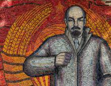
Having entered the town (more precisely, into an urban-type settlement) from the side of Razdolnoye, we turn right - closer to the sea and park. Of course, this is cooler than Mezhvodnoe - there are already monuments (in the center we are met by the unforgettable Vladimir Ilyich), shady parks and even speed bumps.
But, as always, first, a little history.
The settlement was founded here by the ancient Greeks, who arrived here in the 4th century BC. It is possible that they sailed here from Olbia, which was located at the mouth of the Southern Bug, a little south of modern Nikolaev. They sailed into the bay, looked around and exhaled: “Wah! What a beautiful harbor! So the Hellenes called their city "Kalos Limen" (that's how it sounds in Greek).
But the Beautiful Harbor was not independent for long - soon the Chersonesites subjugated it (it’s good that the Greeks were also). In those ancient times, the territory of the city was about 4 hectares, and surrounded by its land plots, on which grains were grown - the main export commodity. local residents. In the III century BC. Scythians approached from the mainland close to the coastal cities of the Crimea, and the policy had to be significantly strengthened. For this, a defensive wall one and a half meters wide was built, as well as a 16-meter watch tower-lighthouse. But in the II century BC. both Kalos Limen and Kerkinitida did not resist and fell at the feet of the Scythians, becoming the main ports of the late Scythian state. Not resigned to such losses, the Chersonesites asked for help from the Pontic king Mithridates VI Eupator, whose troops helped return the captured cities. However, not for long - in the second half of the 1st century BC. the Sarmatians had already conquered the Beautiful Harbor, and the beating of life in it began to gradually fade.
Since the time of the Crimean Khanate, the settlement on the shore of the Uzkaya Bay (this is such a boring name the Beautiful Harbor began to bear) was called Ak-Mechet, i.e. "White Mosque" In 1944, destroying any memory of the Crimean Tatars who lived here, the village was renamed simply Black Sea.
At times Russian Empire the local lands belonged to the governor-general of the Novorossiysk Territory, Count Mikhail Vorontsov. In Ak-Mosque, he built a stone pier, the church of Saints Zakhar and Elizabeth, opened a parochial school.
In Soviet times, Chernomorskoye was a closed military town, where an air defense regiment and a division of military boats were based. Now the military formations have been disbanded, and the village, thanks to the proximity of Chernomorneftegaz, considers itself the capital of oil and gas production in Crimea. However, this is not entirely accurate, since the port of Chernomorneftegaz is located nearby in the bay (former lake) Panskoe.
So, leaving the car in the center of the village, passing the quarter with resort shops, we go out to the seashore. Unlike Mezhvodny, not the entire shore of the bay is given under the beach, but only a small part of it. Most of the coastline is occupied by berths - apparently, it was here that military boats were based.
And we went to the beach right at the Dynamics base (number 20 on the map), near which, on a small cape, a small lighthouse is installed.
Actually, the Black Sea beach does not really interest us - it is three times shorter than the Mezhvodnensky one, and two times Already. There are a lot of people here, not everyone has enough space on the sand, so some lucky ones while away the summer heat in a nearby park. After passing through the beach, we find ourselves in the point we are looking for - the excavations of the ancient Greek Kalos Limen (number 10 on the map).
The settlement is located directly at the end of the city beach.
It is immediately striking that the excavations are not protected by anything, and vacationers walk along the ancient stones from the beach to the beach.
Systematic archaeological work in Kalos Limen has not been carried out for so long - about 20 years. While no more than 10% of everything possible is open, most of the ancient city is now under water.
Here, on a small hill, there is another small lighthouse.
Of the attractions of the Chernomorskoye, one can note the local history museum, consisting of eight rooms, and the church of Saints Zakhar and Elizabeth built by M. Vorontsov in 1838. Both of these facilities are located on central square village (in the same place as the market).
However, in Soviet times, the temple was so architecturally mutilated that, even being next to it, I could not guess that I was standing next to the church. I looked at some stone parallelepiped covered with a gray cement coat, at something like a town hall with a broken clock and could not believe that this was a church built in the middle of the 19th century. That’s why I didn’t photograph such ugliness. But it turned out - it did not seem.
Now, with difficulty, I found a photo of the Church of Saints Zakhar and Elizabeth on the forum of the site "Globus of Belarus". Thanks
The name of this city literally translated from ancient Greek means " beautiful harbor". Here is what an ancient geographer writes about this place - the author of "Periplus Pontus Euxinus" (VI century AD): " From Kherson to ... Kerkinitida 600 stadia ... from Kerkinitida to the Scythian Kalos Limen in the Kherson land 700 stadia ... From Kalos Limen to the river Istra or Danuvia, the Scythians again live. Behind Kalos Limen begins the bay, called Karkinitsky and extending to Tamiraki; it has a length of 2250 stades...(Anon. PPE, 83).
It is worth giving some explanations to the text of the source. 1 stadia in various systems was 177 - 210 m. This distance was calculated not in a straight line, but along the coastline. Istrom or Danuvius was called in ancient times the Danube. "The gulf called Karkinitsky" - the modern Kerkinitsky gulf. Tamiraka is perhaps modern river Kalanchak in Kherson region. Thus, Kalos Limen was located to the north of Kerkinitida, on the coast of the Kerkinit Gulf, and the distance from Kalos Limen to Kerkinitida along the coast exceeded the distance from Kerkinitida to Chersonese. The name itself suggests that Kalos Limen had an excellent harbor.
Based on all this, scientists have suggested that the ancient Kalos Limen was located on the northwestern coast of the Tarkhankut Peninsula, where its coast turns to the northeast, in the depths of Uzkaya Bay, near the modern regional center of Chernomorskoye. The first excavations at this site were undertaken by the director of the Chersonesos Museum L. A. Moiseev in 1929. most interesting monument are still ongoing.
Interestingly, in ancient times, to the north and south of Kalos Limena, there were not even one, but two excellent harbors. Now they have dried up, and the settlement once located on the cape turned out to be on top of a rocky ridge, which is limited by a sandy spit from the south, and low rocky cliffs from the north.
Kalos Limen was founded by the Ionian Greeks in the 4th century BC. BC e. The city with an area of about 4 hectares was surrounded by a fortress wall with quadrangular towers. The surrounding lands were divided into allotments. In the center of each allotment there was usually a manor - either a round residential tower, or (if the owners were not afraid of the raids of the steppe nomads) - a rectangular building with a central courtyard, around which there were living and utility rooms.
In many ways, the history of Kalos Limen repeats the history of Kerkinitida. The favorable strategic position of the city, fertile lands in its vicinity and a convenient harbor attracted stronger neighbors. Therefore, the period of independence was short-lived - by the end of the 4th century, the city was captured by the Chersonesites. In the III century. new contenders appear - the Scythians and Sarmatians. Their raids forced the Greeks to strengthen the already existing fortifications and build a new line of defense - a multi-towered citadel near the bay itself.
These measures delayed the fall of Kalos Limen, but already in the II century. BC e. the city passes into the hands of the Scythians. Soon he, along with Kerkinitida, became the most important seaport Late Scythian state.
At the end of the II century. in the northwestern Crimea again finds itself in the center of hostilities. Here an expeditionary corps appears under the leadership of the commander Diophantus. The Greeks defeated the Scythians and their allied Sarmatians and again subjugated Kerkinitida and Kalos Limen. We were told about this by honorary decrees - one in honor of Diophantus and the second - in honor of the Chersonesite detachment that captured Kalos Limen. However, the Chersonesites returned here for a short time - in the middle of the 1st century. BC e. Kalos Limen again falls under the rule of the Scythians. The end of the existence of the city dates back to the 1st century. n. e., when the Sarmatians invaded from the northern steppes and finally destroyed this once prosperous center.
In the western part of the Tarkhankut peninsula, in the vicinity of the village of Chernomorskoye, there is a unique landmark of Crimea, the remains of the ancient Greek city of Kalos Limen. Entrance to the ancient ancient city is free, so every tourist can touch the past completely freely. You can get to Kalos Limen both from Simferopol and from railway station Evpatoria. Regular buses run daily to the village of Chernomorskoye and fixed-route taxis, the road from Simferopol will take about 2-3 hours, and from Evpatoria about 1.5 hours.
From the history of Kalos Limen
The name of the city is due to its geographic location. Kalos Limen was located on the shore of the Gulf of Kerkinitis and had a very convenient bay for ships to enter. The name of the city itself is translated from ancient Greek as “beautiful harbour”, where “Kalos” means “beautiful”, and “Limen” means harbor.
The city was founded around the 4th century BC by the Ionian Greeks on an area of 4 hectares. Like other cities of that time, Kalos Limen was surrounded by fortress walls with towers, which provided protection from nomads. The territory of the city was divided into small plots or allotments, in the center of which there were residential towers or estates. The inhabitants of Kalos Limen were engaged in agriculture, fishing and various crafts.
Since the city had not only an advantageous location, but also fertile land, it often became the target of stronger neighbors. Because of this, the period of independence of Kalos Limen did not last long and in the second half of the 2nd century BC the city passed into the possession of the Scythians, and then became the port of the Late Scythian state. At the end of the 2nd century, Kalos Limen again became the center of hostilities between the Scythians and the Pontic kingdom, the latter recaptured the city, but this did not bring him a second life. Kalos Limen began to gradually collapse, and Limen or once a beautiful harbor became shallow and separated from the sea by a sandy embankment.
In the 18th century, during the annexation of Crimea to Russia, there was a redoubt on the site of the ancient city, and in the 20th century, the building of a border cordon. Today, the village of Chernomorskoye carefully preserves what once was called Kalos Limen, only parts of the fortress walls and towers, as well as the remains of residential buildings and utility rooms, remain from the ancient city.

Archaeological excavations of the ancient city
The excavations of Kalos Limen began in 1929, and the work of archaeologists continues to this day, revealing more and more mysteries. So it was found out that the pyramid on the site of the ancient city was once a huge tower 16 meters high. It was the tallest building in the fortress wall and served as a kind of beacon for ships. A fire was lit at the top of the tower at night, stone-throwing tools were stored on the middle floors, and food supplies were stored in its cellars. During the period of the Scythian attack, the tower served as the main defensive point, and was surrounded by an additional stone wall, which gave it the shape of a pyramid.
During excavations, archaeologists found the remains of the Kalos Limen fortress wall, several defensive towers at the gates, foundations of residential buildings, various items everyday life, earthenware vessels, weapons and simple decorations. Many finds are stored in the historical and archaeological reserve "Kalos Limen", which is located in the building of the music school in the village of Chernomorskoye. Thanks to excavations, historians managed to understand that the city was equipped with a drain, the main street that connected the harbor and the gates reached a width of about six meters and was paved with rammed crumbs, which in terms of fortress is not inferior even to asphalt.
Crimea is rightly called unique museum which is located under open sky. A direct confirmation is the ancient city of Kalos Limen on Tarkhankut. Every year, thousands of tourists visit the museum-reserve to breathe in the memory of two millennia among the once non-criminal walls.
Photo Kalos Limen from users:


This is interesting:
The name of the settlement Kalos Limen means "Beautiful Harbor". Located 1.5 km from resort village Chernomorskoye on the coast of the Karkinitsky Gulf. This is the center Western Crimea. Ancient city was part of the ancient state of Chersonese.
The history of the settlement
The Tarkhankut Peninsula is an exceptional territory in all natural, geographical and cultural parameters. Since ancient times, there have been complex ethnic processes associated with the constant influx and settlement of peoples. People rushed here in search of fertile land, abundant pastures, water sources, building stone and other natural resources. The first people appeared on the territory of the Tarkhankut region more than 4 thousand years ago. They were still representatives of primitive society. They did not know how to work metal, but used flint tools to extract food sources.

In the 4th century BC, numerous settlements appeared on Tarkhankut, the inhabitants of which were Ionian Greeks, immigrants from modern Turkey. Relations between the Greeks and the Scythians developed contradictory. The Scythians often disturbed the Greek settlements with attacks, but tried to maintain trade relations. A hundred years later, the city was captured by the Dorians, Spartans and Chersonesites.
Kalos Limen was the third largest of the settlements that were part of the Chersonesus policy. The settlement occupied a vast territory - about 4 hectares. Big number ancient unique buildings have survived to this day: living quarters, towers, some fragments of defensive walls and the city citadel. The tower, which formed the citadel, is framed by an anti-ram belt. This pyramidal structure was necessary to protect against the barbarian raids of the Scythians and Sarmatians, who lived on the mainland of the Crimean peninsula. In the 3rd century BC, a series of Greco-Scythian wars began, and the settlement changed hands several times.
On the left side of the tower there were structures that adjoined the defensive wall, the so-called barracks. It was in them that young Greeks underwent compulsory military training. Arrowheads and a unique coin of Diophantus, a commander who was in the service of Mithridates, were found here.
Video review:
Archaeological site of the Beautiful Harbor
No one knew the exact location of the Greek-Scythian settlement, which was described by many ancient medieval authors. Archaeologists and historians for a long time could not determine exactly where the settlement was located. After the discovery of a man-made hill, which contained the ruins of a 16-meter tower, it became a pointer for archaeologists. The study of the cultural and natural resources of the area began almost immediately after the annexation of the Crimea to Russia and the acquisition of the town of Ak-Mechet by Count Vorontsov. The first large-scale archaeological expeditions began work in 1929.
In the center of the excavations there is a building that is very reminiscent of a Scythian sanctuary. It is believed that the Scythians worshiped many gods, but the main goddess was Tabiti. Her sanctuary was located on the coast, but after a landslide came down, it was destroyed. The remains of lacquer ceramics speak of its existence. The eastern gate completes the expedition to the ancient settlement of Kalos Limen. It was in this part that the settlement ended. On the threshold of the gate, two ruts left by the chariots are clearly visible.
Note:
To date, the settlement has been excavated by 10 percent, and its 70 meters have gone under water due to changes in the coastline.
In the museum-reserve, in addition to valuable finds of antiquity, exhibits from different times are shown. The history of the region from primitive times to the present is collected in the vastness of 8 halls of the museum. Historical and archaeological museum-reserve "Kalos-Limen" was founded on April 22, 1997. This event was preceded by a long and difficult journey aimed at studying this unique historical complex, which is located on the shore of the Narrow Bay. In 2001, the Black Sea Historical and Local Lore Museum Complex was added to the territory of the reserve.

In 2011, a lapidarium was opened at the museum - a collection of stone objects found on the territory of the Black Sea: architectural fragments, tools, household items, artifacts related to the spiritual life of a person. The collection of ancient amphoras is recognized as the gold fund of the Kalos Limen Museum-Reserve.
In the 4th century AD, Crimea was captured by the process of the great migration of peoples. It was visited by different tribes and nationalities. In the VIII-X centuries AD. e. the Polovtsians roamed the territory of the peninsula, who left statues in the form of stone guards in memory of themselves. One of these statues is presented in the museum, and a tractor driver discovered it during field work.
In total, the museum has several main areas: archeology, things, nature, documents, photographs, numismatics, weapons. The museum's funds began to form from the moment the Black Sea Museum of History and Local Lore was founded, and today there are more than ten thousand exhibits. This figure is growing rapidly, thanks to new finds from archaeological excavations.

How to get there
The most convenient route to Kalos Limen is a departure from the Evpatoria bus station. Buses to Chernomorskoye go every 1.5 hours. From the Black Sea bus station, you can walk to the place on foot. You should go to the sea and poison yourself along the beach strip, focusing on the lighthouse.
A visit to the ancient settlement remains in the memory for a long time, leaving amazing impressions that are difficult to convey in words.
Kalos Limen on the map of Crimea
GPS Coordinates: 45°31’0″N, 32°42’46″E Latitude/Longitude