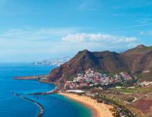
Not a single river flows. Where is the red sea on the map
The Red Sea is an inland sea indian ocean located between Africa and the Arabian Peninsula. It washes the shores of Sudan, Egypt, Eritrea, Djibouti, Yemen, Saudi Arabia, Jordan and Israel. It has not been established why the sea is called the Red Sea.
The Red Sea adjoins in the north to the Isthmus of Suez, which separates two gulfs: Aqaba and Suez and is connected through the Suez Canal with mediterranean sea. In the south, it connects with the Arabian Sea through the Gulf of Aden by the Bab el-Mandeb Strait, called the "Gate of Tears".

One of the first to describe the Red Sea in the 2nd century BC was the Greek geographer and historian Agatarchides of Cnidus. His work was called "On the Red Sea (Eritrean)".
In the 16th century, such a name for the Red Sea as "Suez" was allowed.
Its area is 450 thousand km2, the average depth is 437 meters, and the volume of water is 250 thousand km3.
According to various estimates, its length from North to South is from 1932 kilometers to 2350 kilometers, and its width is from 305 km to 360 km.

The coasts of the sea are slightly indented, their outlines are mainly predetermined by fault tectonics. Almost along its entire length, the western and eastern shores run parallel to each other.
The northern part of the sea has few islands (for example, the island of Tiran), and only south of 17°N latitude, they form a small number of groups with numerous islands. There are also separate islands such as Kamaran.
The peculiarities of the Red Sea are that not a single river flows into it. Therefore, the water in this sea is crystal clear. Rivers, as a rule, carry sand and silt with them, which significantly reduces the transparency of the seas into which they flow.

The Red Sea is the most salty sea World Ocean. One liter of water can contain up to 41 grams of salts.
No more than 100 mm of atmospheric precipitation falls over the sea during the year (and even then, it does not fall everywhere and only in the winter months). And it evaporates over the same period of time twenty times more - 2000 mm. This means that more than half a centimeter of water evaporates from the sea surface every day. With the complete absence of water coming from land, such a deficit is compensated only by water from the Gulf of Aden.
Why the Red Sea, no one knows for sure. There are several versions of this.
1. The first version explains the origin of the name of the sea from a misreading of the Semitic word, which consists of three letters: "m", "x" and "r". In the ancient writings of the Himyarites, who lived in South Arabia before the conquest by the Arabs, short vowel sounds were not graphically depicted in writing. Therefore, an assumption arose that when the Arabs deciphered the South Arabian inscriptions, the combination of "x", "m" and "r" was read as the Arabic "ahmar" (red).
2. In the second version, the name of the sea is made dependent on some part of the world. In the mythical traditions of most peoples of the world, cardinal points are associated with specific color shades. For example, white represents east, red represents south, and black represents north. Hence, in the name of the Red Sea, the prefix "red" most likely means the southern location, and not the color of its water.
3. According to the third version, the name of the Red Sea was due to algae, which, during the seasonal growth of water, color the sea water in a red-brown hue (shades of red).

4. Researchers and historians believe that in ancient times this name was given to the Red Sea by sailors who observed the red rocks located along sea coast. Red rocks, reflected on the surface of the sea and turning it red, amazed the ancient travelers.

5. The fifth version is biblical. In ancient times, Jews made the transition to Israel from Egypt. This path passed through the sea. And then Moses ordered the depths of the sea to part in front of the people who were able to walk along the seabed. The pursuers rushed after the travelers, but the sea converged and killed them. The waters turned red with blood, and the sea acquired the name Red.

Interesting fact: The Red Sea is called only in European languages. In Hebrew, it is called Yam Suf, which means "reed", "reed". The Egyptians call their sea Vazi-Vr, which translates as "green expanse".
Climate of the Red Sea
On the coast of almost the entire Red Sea, there is a tropical desert climate, and only Far North. During the coldest period (December-January), the air temperature is 20-25 degrees during the day, and during the hottest month (August) it exceeds 35-50 degrees.
Biological resources of the sea
In terms of quality and diversity of corals, marine life, the Red Sea has no equal. The tourist boom that has swept the Egyptian coast in recent years is to a large extent associated precisely with the incredibly rich and unique underwater world and, in connection with this, the popularity of scuba diving.
Coral reefs create a kind of life center that attracts many fish. The variety of coral forms is simply amazing. They are flat, round, branched and other unusual shapes. Their colors range from pink and pale yellow to blue and brown. Color is retained only in living corals. After death, they lose their integumentary soft tissues, leaving only a white calcium skeleton.

Various species of striped and bottlenose dolphins and killer whales are quite widespread in the Red Sea. There are chances to meet under water with a green turtle. Unusual echinoderms with an elongated shape, sea cucumbers live at the bottom of the sea.
Some of the divers and ichthyologists claim that sharks have a rather peaceful disposition, and are very timid. Seeing a person, they tend to retreat faster.

Moray eels, which are adapted to live on reefs, reach a length of three meters, and have an intimidating appearance. However, if they are not teased, they do not pose a danger to humans.
In the Red Sea, you can meet the Napoleon fish, which got its name from the characteristic protrusion on its head, reminiscent of the headdress of the French emperor. Napoleon fish have chosen the southern tip Sinai Peninsula where the fish of the Red Sea live:
- butterfly fish,
- angel fish,
- sultans,
- clown fish.

Rivers are picturesque arteries through which the blood of the earth flows. From the very beginning of human history, people have tried to set up settlements and build houses in the coastal zone. Water gave them life. Here they watered the cattle, bathed and cultivated the land. AT Ancient Rus' rivers were called "God's roads."
Both in winter and in summer they had their own strategic importance. In the warm season, merchant ships glided along large waterways, and in winter, when the surface of the reservoir was covered with ice, merchants transported their goods on sledges right across the ice.
Just as blood is important for the human body, so is it necessary for the vital activity of nature. fresh water. Rivers are the main element of the blue planet Earth. As you know, each of them has its own beginning - the source.
Where do they flow from?
Almost all rivers have a different source: somewhere a seething stream begins with a small source, somewhere - with a huge waterfall, some rivers are born as a result of snow caps. Such waters are called mountain streams. They are distinguished by their high speed and low temperature, their current can easily carry away even huge boulders. Such rivers are dangerous and unpredictable.
In fact, each begins with its own drainage basin, which, in turn, is fed by many sources. In the spring, during the melting of snow and ice, the rivers are regularly replenished with new water and become more full-flowing, as a result of which they sometimes even overflow. This can be a big problem for coastal residents. As a result of such spills, farmers can lose their crops, and houses built near the river will get wet and collapse.

Rivers and their course
The Blue Highways form a giant water grid on the surface of the earth. There are more than 2 million rivers in Russia, 200 of which are quite large. Even huge ships are able to sail on them. The more modest ones barely cover their muddy bottom. As you know, it forms a valley and forms wide bends in it. Each channel is unique, it has its own slope, individual width and course. Each "blue ribbon" has its own beginning, its own character and activity. The flora and fauna of the rivers are often similar due to the presence of fresh water.

Where do rivers flow and where do they end?
In summer, when the temperature rises and the evaporation of moisture increases many times, the sources of the rivers become shallow, and the water flows themselves narrow somewhat. After the spring melting of the ice, the river returns to its original course to flow further towards its end. Wherever the currents of the rivers go! They flow into oceans, lakes, seas, and other rivers. It is generally accepted that they flow from a hill, heading down.
If we take into account the water flows of Russia, then most of them carry their waters to the Northern Arctic Ocean, and only a few - to the Atlantic. In the place where the river flows into the sea, the water is desalinated, thanks to which some species of living beings were able to adapt to life in fresh water.

Volga - the largest water artery
This is one of the most picturesque and big rivers not only countries, but also Europe. It stretches for almost 4,000 kilometers. So, where does it flow? Taking its beginning in the Tver region, it travels along a winding route, is divided into many branches and flows into the Caspian Sea. This amazing river has about 200 tributaries, the largest of which are the Oka and Kama. It is worth mentioning that some rivers flow into endorheic lakes, where their violent activity ends.
Current direction
How can you tell where a river flows in your area? In fact, everything is extremely simple. You don't have to be a geologist to understand where rivers flow. First of all, you need to pick up a map and find the desired water stream on it. If the reservoir is marked on the drawing, then the direction of its channel will be clearly indicated by a blue arrow. It happens that this needs to be determined, being in nature without a map. What to do in this case? Looking closely, you can see in which direction the current is moving.

Where in the Northern and Southern Hemispheres? Both in the first and in the second case they flow towards their mouths. Curious to know what the difference is? Their currents are directed in opposite directions. This is regulated not only by the position of the equator, but also by the terrain. For example, we can say with confidence that the source is invariably located significantly higher than the mouth, so the water mass, obeying the physical law of universal gravitation, flows from top to bottom.
Unique water streams
The question of where and where the rivers flow, people asked even at the dawn of human history. Since then, amazing and unusual natural phenomena have been opened to their eyes more than once. Rivers that can change are a vivid example of this. Previously, people explained this by the intervention of the gods and interpreted it in their own way, perceiving such changes as signs from above. With the advent of new technologies, it became obvious that there really are reservoirs where the mouth and source sometimes change places, but modern scientists have found a more logical explanation for this.
It turned out that the main factor provoking a change in the flow was groundwater. When the water level in them begins to fluctuate, this affects the surface flow. Sometimes it is difficult to understand the world around us: where do rivers flow, why do certain phenomena occur? However, it is worth remembering that there is nothing meaningless in nature, everything is created for a specific purpose and functions properly, supporting the life of every living being.
Practice shows that despite the fact that we live in an age of technology and general technical progress, the purpose of the water arteries of the earth has not changed, although the reservoirs themselves have become the subject of careful study and scientific experiments. In recent decades, scientists have been absorbed in studying the structure and molecules of water. Their research proves that this unique liquid is incomparable to any other, it is truly alive! Where do rivers flow? The surrounding world and nature gave exhaustive answers to this and many other questions.
There are very special rivers that do not flow anywhere. There are those who change the direction of the current several times during the day.
Among the snows and ices of the Pamir-Altai, the Zeravshan River originates. Escaping from the mountains, it spreads through hundreds of canals and thousands of ditches of the Bukhara and Karakul oases. Like many other rivers in the desert regions, it has neither a delta nor an estuary. In other words, Zeravshan does not flow anywhere.
Everyone knows that the water in rivers and lakes is fresh. But there are rivers with salty and sweet water.
In the north, a river flows, which is distinguished by a very high salinity. They call her that - Solyanka. Where did the salt in the river come from? Many millions of years ago, there was a huge sea on the site of modern Yakutia. Then the earth's crust rose and fell, in some places closed lagoons formed, in which, as a result of increased evaporation, powerful layers of salt settled, subsequently covered by limestones. Groundwater seeps through these deposits and, saturated with salt, enters the river.
On Victoria Land in Antarctica, scientists have discovered a lake in which the water is 11 times saltier than sea water and can only freeze at a temperature of -50 °.
There is a lake called Sladkoe in the Urals, in the Chelyabinsk region. Locals wash clothes only in it. In water without soap, even oil stains are washed off. It is established that the water in the lake is alkaline. It contains baking soda and sodium chloride. The presence of these substances gave the water special qualities.
There are "vinegar" rivers and lakes on the globe. "Vinegar" river flows in Colombia (South America). This is El Rio Vinegre (one of the tributaries of the Cauqui River), which flows in the area active volcano Purase. The water of this river contains 1.1% sulfuric acid and 0.9% hydrochloric acid, so no fish can live in it.
On the island of Sicily there is a lake of Death. Two sources of acid of high concentration are beating from its bottom. This is the most "dead" lake on our planet.
There are rivers that have one common source, but they flow in different directions and often flow into different basins. This natural phenomenon is called river bifurcation. Orinoco river flowing through South America, in the upper reaches is divided into two. One of them retains its former name Orinoco, flows into Atlantic Ocean, and the other, Casiquiare, flows into the Rio Negro, the left tributary of the Amazon.

In Antarctica there is amazing lakes. One of them - Wanda - all year round covered with a thick layer of ice. At the very bottom, at a depth of 60 meters, a layer of salt water with a temperature of + 25 ° was found! The riddle is all the more curious because there are believed to be no hot springs or other sources of heat deep within the Earth.
Usually rivers flow into lakes or seas. But there is a river that flows ... from the bay into the depths of the mainland. This is the Tadjoura River on the northeast coast of Africa. It flows from the bay of the same name into the depths of the mainland and flows into Lake Assal.
There is an amazing river in Europe: it flows to the sea for six hours and back for six hours. The direction of its current changes four times a day. This is the river Avar (Aviar) in Greece. Scientists explain the “whims” of the river by fluctuations in the level of the Aegean Sea as a result of the tides.
"Ink" lake! It is located in Algiers, near locality Sidi Bel Abbes. Water from this lake can be written on paper. Two small rivers flow into the natural "inkwell". The waters of one of them are rich in iron salts, and the waters of the other are rich in humic substances. They form a liquid like ink.
Where does the Kuban river flow? “Of course, to the Sea of Azov,” you say. True, but it turns out it wasn't always like that. Even 200 years ago, this river flowed into the Black Sea. It would have flowed there even now, if in 1819 the Cossacks from Staro-Titarovskaya and Temryukovskaya villages had not decided to desalinate the salty estuaries of Azov. The Cossacks dug a canal between the Kuban and the Akhtanizovsky estuary. But the wayward river “liked” the new channel more than the former, and it rushed along it, washed away and expanded the banks, demolished everything that it met in its path, and carried its waters to the Sea of \u200b\u200bAzov. And the old channel, laid for the river by nature itself, is overgrown.

The Diala River, which flows through Iraq, was sentenced to death. She was judged by none other than the great Persian king Cyrus. Crossing the Diala, the king lost his "sacred" white horse, which drowned. Enraged, Cyrus ordered 360 canals to be dug in order to divert water from the river. It ceased to exist for a thousand years. Over time, the sands of the desert dried up and brought the channels, and the river returned to its former course.

There are many amazing lakes, but there is no one like Mogilnoye anywhere. It is located on the small island of Kildin off the Murmansk coast, somewhat east of the entrance to Kola Bay. The shores of the bay are rocky and steep, but in the southeastern part they drop and form a beautiful bay. The lake adjoins it, separated from the sea by a high sand and pebble shaft. The area of the lake is a little over one square kilometer, the greatest depth is 17 meters. But, despite these modest sizes, the layers of water in it never mix. Vertically, the lake is clearly divided into five “floors”. At the very bottom, the water is saturated with hydrogen sulfide. Above it is a “floor” of red water from many purple bacteria. Then comes a layer of sea water, in which dwarf marine fish, sea anemones and starfish are found. Above, the water is brackish - jellyfish and crustaceans live here, as well as freshwater fish. The upper layer - fresh - is inhabited by freshwater. At high tide, through the shaft of sand and pebbles that separates the lake from the sea, sea water seeps into the lake. Heavier water - sea - and less heavy - fresh - almost do not mix with each other, since salt water enters the lake from the side, through the shaft, and fresh water - from above, from rains and melting snow.

The water of some salt lakes has healing properties. Lake Duzkan in Turkmenistan is located on the left bank of the Amu Darya, near the western outskirts of the village of Sayat. The concentration of the brine is so high that it forms a thick crust. In summer, especially on weekends, on Duzkan, or, as it is called locals, Sayaksky lake, hundreds of people take salt baths - are treated for rheumatism.
Baikal is not just a legendary lake, it is also very deep.
The water in it is always clean and cold, and it owes it to the rivers and streams that flow to it from all over the world.
What rivers flow into and out of Baikal
Researchers still cannot accurately calculate how many rivers this lake has that flow into it. The rivers flowing into Baikal have beautiful names.
It is interesting that there are such rivers as the Kotochik River, which flows into Turku, and already that into Baikal itself. The tributary Upper Angara often misleads geographers who confuse it with the beautiful Angara.
There are a little more than a thousand small rivers and streams, so we’ll better deal with large rivers.
Many rivers of Baikal have their own history. The largest is the Selenga. It crosses two states and breaks up into a delta, flowing into Baikal. 
This full-flowing beauty brings almost half of all water to the lake, and it receives it from its four tributaries.
The Upper Angara is considered to be the next in terms of beauty and abundance of water; this mountainous and capricious beauty can be very unpredictable even on the plain. Near Baikal it forms a bay - the Angarsk Cathedral.
The very famous Baikal-Amur Mainline stretches along most of the river. Just like the Selenga, this river has tributaries.
The waters of all the rivers flowing into Baikal bring some surprises with them. And Barguzin is no exception. Along with the waters, silt, sand and small pebbles enter Baikal.
The river was named so most likely because of the Barguzin sable, which lives here in large numbers. Barguzin carries its unruly waters through the vast expanses of the Buryat Republic.
It originates on the mountain slopes, filled mainly with rain. This river has a small lake formed by it - Balan-Tamur.
The turbulent waters of the Turks are collected from melting snow and rains, they also have tributaries. Not only tributaries, but also Lake Kotokel fills this river with water.
There are still two rivers beautiful names Sarma, Snow. That's all the rivers flowing into Baikal.
 Now we can talk about what rivers flow from Baikal. This is only one river - the Angara. Proud and rebellious, whose waters are directed to meet the handsome Yenisei, being its largest tributary.
Where it originates lies the legendary shaman stone. Anglers love the river because it great amount different fish. The river has many tributaries.
Four road bridges are thrown across it, but there is no railway bridge. In the warm season, ships go along it. Angara has many islands.
So we learned what rivers Baikal has.
Related materials:

Rest on Arahlea
Far, far away, in the Trans-Baikal Territory there is wonderful lake Arahley. It is located only thirty-five kilometers from the city of Chita, the capital of the region, so in summer it is almost...

Railroad around Baikal
Circum-Baikal Railway- known mainly for the number architectural structures, it is the largest in the world. It is important that this railway passes through...

Trip to Baikal. Chelyabinsk lake Baikal distance by car
The distance from Chelyabinsk to Lake Baikal is approximately four thousand nine hundred thirty-six kilometers. For such a journey, about twenty-five thousand for fuel will be required. Comes to Baikal...