Novaya Zemlya to which subject does it belong. new earth
The material was found and prepared for publication by Grigory Luchansky
Source:Novaya Zemlya excursion. Collection edited by R. L. Samoilovich and M. M. Ermolaev. Part one. General. International Geological Congress. XVII session of the USSR 1937 Leningrad, Glavsevmorput publishing house, 1937
Physical and geographical outline of Novaya Zemlya
V. D. Aleksandrova and A. I. Zubkov
I. Climate
The insular position of Novaya Zemlya gives its climate a maritime character, which manifests itself in cold summers with frequent fogs and light rain and relatively light frosts in winter, as well as somewhat higher precipitation than in the more continental parts of the Arctic. In addition, the presence of the Barents Sea warmed by the Gulf Stream in the west, and the cold Kara Sea in the east leads to great weather variability and causes some difference in the climate of the western and Kara coasts of Novaya Zemlya.
1. Wind mode
The most characteristic feature of Novaya Zemlya's climate is the frequent recurrence of strong winds.
Changes in wind strength by months are shown in the table at the end of the text. From its consideration it follows that the highest average annual wind speed is observed in the Small Karmakuly; in second place is Cape Desire. But with regard to the frequency of lulls, these two stations change places. An intermediate position is occupied by Matochkin Shar and Russkaya Gavan, which are characterized by lower wind speeds and more calms. In terms of wind strength, Novaya Zemlya ranks first in the Union, only in some mountainous areas the wind speed exceeds Novaya Zemlya (for example, the Marchotsky Pass, where bora rages).
The strongest winds fall on the winter months - from November to March.
The most frequently repeated wind is the bora. The direction of the wind during the bora is perpendicular to Novaya Zemlya, i.e. on its western coast, in various places along the coast it is respectively: EtN, ESE and SSE, and on the east - WtN, WNW, NNW (The first observations of the bora were made in the Small Karmakuly camp , on the western coast of the southern island, where its direction is from the east. Hence its local name - "drain"). The wind blowing from the side of the mountains reaches the strength of a hurricane in the coastal strip. With the distance from the coast, it noticeably weakens, and at a distance of 10-15 miles, in the open sea, it calms down completely. These features of the Novaya Zemlya bora forced us to consider it a local phenomenon, but the studies of V. Yu. Vize showed that the bora depends on the general movements of the atmosphere in the region of the Barents and Kara Seas, deformed by the Novaya Zemlya mountain range. The wind crossing the Novaya Zemlya Rise changes its strength and direction: it turns perpendicular to Novaya Zemlya (passing along the shortest path) and intensifies from the leeward side. Origin of boron west coast predominantly cyclonic and is usually caused by the appearance of a baric depression to the west of Novaya Zemlya.
The course of meteorological elements during bora is currently sufficiently studied and in most cases allows us to suggest its appearance 6-8 hours before the onset of the storm (V. Yu. Vize). The air pressure gradually drops 10 hours before the bora. When the wind is already blowing from the coast, characteristic motionless clouds appear over the mountains, similar to pieces of cotton wool, while the overall cloudiness noticeably decreases. At the same time, there is a sharp drop in the relative humidity of the air. At the height of the storm, cloudiness, humidity and pressure increase again. The air temperature during bora usually decreases. Significantly less pronounced hair dryers are observed, which are accompanied by a slight increase in temperature.
The wind speed during bora is very high. The highest speed measured by the anemometer was 38.5 m/s. The average bora speed in the Small Karmakuly is 14.4 m/s. However, these data poorly reflect the true nature of the wind during bora, the distinguishing feature of which is extreme gustiness (as well as inconstancy of direction), and individual gusts, separated by intervals of relative calm, reach enormous strength. During such gusts, the wind rolls heavy barrels, throws karbas into the sea, raises and carries dust, sand and small stones. In winter, during strong storms, the air is filled with snow, and therefore visibility is reduced to a few meters.
Bora lasts on average about a day, but there were cases when the most severe storm lasted up to 6 days or more. So, for example, according to the Karmakulskaya station, in 1935. bora, which began on February 20, continued until March 3 at a speed of up to 40 m/sec.
2. Temperature
Despite its northern location, Novaya Zemlya has warm winters compared to other parts of the Soviet Arctic.
Medium annual temperature in the northernmost point of Novaya Zemlya - at Cape Zhelaniya - only 9 °.3, while at the mouth of the Lena, i.e., at a point located at 6 ° south of the cape Desires, the average annual temperature is - 17 °.
Average monthly air temperatures in Novaya Zemlya are presented in Table. 12, which shows that at Cape Zhelaniya the average monthly air temperature stays below 0°C for 10 months, and in Russkaya Gavan, Matochkin Shar and Malye Karmakuly - 8 months.
The coldest month on Novaya Zemlya is March, the average temperature of which is - 21°.4, and in the Small Karmakuly - 15°.5.
The warmest month is August, with an average temperature of 7°.0 for Small Karmakuly, and only 2°.1 for Cape Zhelaniya.
The minimum temperature on Nozoy Zemlya was observed during the wintering of G. Sedov in Foka Bay - 50 °.2. In January 1913 in the Small Karmakuly, during the entire observation period, the temperature did not fall below -39°.6. The maximum temperature observed in the Small Karmakuly was 23°.0.
The absolute minima for all months of the four stations turn out to be negative, and the absolute maxima (except for 3 months of Cape Zhelaniya) are positive. Therefore, a thaw is possible in all months, but on the other hand, we do not have a single month without frost.
3. Harsh weather
Due to the extremely strong winds, the severity of the weather on Novaya Zemlya is very high, despite the relatively high temperatures.
Let us point out that Verkhoyansk, which lies near the cold pole, has half as severe weather as Novaya Zemlya, and therefore winter in Verkhoyansk is easier for a person than on Novaya Zemlya, despite the fact that the average January temperature in Verkhoyansk is -50 °, 1 , and the absolute minimum reaches -69°.8.
This is due to the calmer state of the atmosphere in Verkhoyansk, where the probability of calm in January reaches 69%. while for the Small Karmacules it does not exceed 7% (V. Yu. Vize, 1928). In general, in terms of weather severity, Novaya Zemlya is in the first place in the Soviet Arctic.
4. Precipitation
The amount of precipitation falling on Novaya Zemlya is relatively small. The average annual precipitation is expressed in numbers:
Cape Desire - 115 mm
Russian Harbor - 156 mm
Matochkin Ball - 224 mm
Small Karmakuly - 238 mm
It follows that the amount of precipitation decreases markedly from south to north. June, August, September are the largest in terms of precipitation, and March, April, and May are the least. At the same time, it should be added that precipitation falling in winter is not fully taken into account, since snow from the rain gauge is partially blown out by strong winds.
5. Relative humidity
Below are the data regarding the relative humidity of the air and cloudiness.
Average annual humidity:
Cape Desire - 89%
Russian Harbor - 81%
Matochkin Shar - 82%
Small Karmakuly - 83%
6. Cloudy
Cloudiness on Novaya Zemlya is high: overcast skies with low clouds are observed most often. The maximum average cloudiness at Cape Zhelaniya occurs in June, the minimum - in February. In the Small Karmakuly, the maximum cloudiness falls in July. In general, the period from December to May has less cloudiness, which coincides with the period of low temperatures. With the onset of spring, when melting begins, cloudiness increases; at this time on Novaya Zemlya clear days are only occasionally, but usually the sky is overcast with low clouds; fogs are quite frequent.
Average annual cloudiness:
Cape Desire - 7.9%
Russian Harbor - 7.6%
Matochkin Shar - 7.8%
Small Karmakuly - 7.6%
II. Vegetation of Novaya Zemlya
1. General remarks
Short summers with low temperatures and high air humidity, long cold winters, and most importantly, strong winds that create extreme weather harshness and an extremely uneven distribution of snow, determine, in general, the poor development of vegetation on Novaya Zemlya.
The mountainous nature of the country also contributes to this, since with an increase in altitude, the conditions of existence worsen. Novaya Zemlya is dominated by stony placers, bare rubble areas, polygonal soils with sparse vegetation, and only in the flat parts of the southern island, on moraine deposits washed out by the sea, do we observe swamps with a continuous moss-herbaceous cover and spotted tundras with a variegated composition of vegetation.
Thanks to harsh conditions the existence of mosses and lichens prevail over the flowering ones. Flowering plants are undersized, their height in most cases is in the range of 10 - 15 cm. Pillow-shaped (for example, Silene acaulis), turf, creeping forms are extremely developed, most adapted for protection from the wind and use of the warm surface layer of air. Adverse climatic conditions are an obstacle to the propagation of plants by seeds, therefore all representatives of the Novaya Zemlya flora are perennials. Many species have a highly developed ability for vegetative reproduction.
Currently, 208 species of vascular plants are known on Novaya Zemlya (including 2 species of ferns, 3 species of horsetails, 1 club moss and 202 flowering plants) and about 400 species of mosses, lichens, and fungi. With the advancement to the north, the flora of the Novaya Zemlya Islands becomes poorer, and north of 75 ° N. sh. there are already only 78 flowering species.
2. Age of flora
The flora of Novaya Zemlya is relatively young. It was formed in geologically recent times, since the settlement of plants became possible only at a time when Novaya Zemlya began to free itself from the ice sheet that covered it during the era of maximum glaciation. This is also confirmed by the absence of pre-glacial relics on Novaya Zemlya and the very weak development of endemism. Purely Novaya Zemlya forms are only three species of dandelion and one race of the polar poppy - plants generally prone to very rapid formation and isolation of new forms.
The flora of Novaya Zemlya, represented mainly by circumpolar or very common species in the Arctic, is generally similar in composition to the flora of Vaigach and, together with it, to the flora of the parts of polar Siberia closest to Vaigach, i.e., it is predominantly Siberian. A small group of species common with Eastern Siberia is absent from Vaigach and the nearest parts of the Arctic. At the same time, some plants are common for Novaya Zemlya with Svalbard, Franz Josef Land and Greenland and are either absent or rarely found in the nearest parts of the European and Asian North. Some of these plants were found on Novaya Zemlya only on the northern island. Analyzing these features of the Novaya Zemlya flora, A. Tolmachev suggests that the settlement of Novaya Zemlya proceeded in different ways: the largest number of species penetrated from the south, through Vaigach, in addition, there was an older settlement route through Svalbard, and, finally, part of the plants migrated directly from Eastern Siberia at a time when land existed in the Kara Sea, now hidden by water.
3. Botanical-geographical zones
On Novaya Zemlya, as mentioned above, plants usually do not form a continuous cover. A well-developed vegetation cover, consisting of a number of associations, we find only in the flat parts of the southern island, where there are favorable conditions for the existence of vegetation; on the northern island and in the mountains, open groups play the main role in the landscape. Depending on the distribution of plant formations, we distinguish the following botanical and geographical zones on Novaya Zemlya: in the south, in the flat parts of the southern island, formations of the tundra zone are developed, in the form of its northern subzone of the arctic tundra, characterized by the absence of shrub cenoses, the dominance of patchy tundra in upland conditions and the development of flat-hilly peat bogs.
Finally, on the northern island, at a latitude of about 75°, we observe a transition from the tundra zone to the zone of arctic deserts or the American authors' Barren ground.
Due to the mountainous nature of the country, on Novaya Zemlya, in addition to latitudinal, vertical zonality is manifested. In the subzone of the Arctic tundra, a belt of upland arctic tundra stands out, in the zone of arctic deserts - a belt of upland arctic desert. Upland Arctic tundras are developed in the mountainous part of the southern island up to the latitude of Pankova Land, where, due to its more northerly position, as well as due to an increase in altitude, it shifts to the coast and is replaced, in the central part, by a belt of upland Arctic deserts. The highland arctic tundra moves along the coast of the northern island to a latitude of 75°. The belt of upland arctic deserts begins at the highest points of the northern part of the southern island and extends to the north, occupying the southern part of the northern island up to a latitude of 75 ° and spreading to all mountain areas free of ice cover.
Subzones of the arctic tundra. In the arctic tundra subzone, on heavy loams containing only a small admixture of small pebbles and boulders, spotted grass-shrub-moss tundras are found. Vegetation occupies 65 - 75% of the area, the rest of the surface is occupied by bare loamy patches.
Moss-lichen spotted tundras are developed on rubble-loamy soils.
Spotted tundras are often found on polygonal soils. Polygonal soils are diverse in nature, depending on the ratio of stony and loamy parts, on the position in the relief, on the conditions of moisture, the depth of the snow cover, etc. Here we find the so-called cellular soils, stone nets, stone rings, stone strips. In the arctic tundra subzone, patchy tundras develop on polygonal soils, and both the stony part (stone strips) and the bulges of fine earth between them are usually devoid of vegetation (except for scale lichens on stones). The vegetation forms a ridge around bare rubble-loamy patches and is located in hairs and clumps along the stone strips. Here, mainly moss-lichen associations develop.
On elevated areas of relief that remain free of snow in winter, on the tops of hills, on steep bends of slopes, along the edges of high banks of rivers, plants do not form a continuous cover, but grow scattered as individual specimens or small fragments of phytocenoses on a gravelly surface. Freed early from the snow, these places are already in mid-June pleasing to the eye with lovely lilac flowers of saxifrage, blue - forget-me-nots, yellow - cinquefoil, poppy, etc.
Under conditions of good drainage and favorable exposure to solar radiation, small areas of meadow tundra develop with a variegated cover of grasses and herbs. Meadows often develop in burrowing areas for lemmings and arctic foxes.
Hypnum-sedge and hypnum-cotton grass species are developed in the depressions, occupying large areas on the western coast and the southern tip of the southern island. Grass Diipontia Fischerii sometimes dominates in herbage, grass Arctophyla fulva usually grows near the shores of lakes. In swamps, flat peat mounds are often observed with a mineral core of loam containing ice inclusions. Often there are relic peat bogs with peat, more than a meter thick, which are in the stage of degradation, erosion and re-bogging. They are witnesses of the climatic optimum that used to be here. In modern peatlands, the thickness of peat usually does not exceed 25-30 cm.
On the Kara side, lichen tundras are widespread. On the western side, lichen tundra occurs in small areas.
Moving inland from the coast, we enter a mountainous country. The predominant landscape of the upland belt of the Arctic tundra is stony placers and stone fields with sparse vegetation. On mountain slopes, in hollows and saddles on loamy-stony polygonal soils, tundras develop with a sparse and open vegetation cover of poor species composition. Scale lichens and mosses predominate. In some of the most favorable conditions, in well-protected areas on polygonal soil, spotted moss-lichen tundra with moss, lichens, and oxen develops. On loamy soils, polygonal tundras develop, the surface of which is divided into polygons; willows and saxifrage grow in the depressions between the latter. Occasionally there are hypnum-cotton grass and hypnum-sedge marshes. Above 250 - 300 m above sea level, they are replaced by tussocks on moist loam. In the case of good water flow, grass settles on a bare loamy substrate.
The vegetation of the river valleys in the lower and middle reaches of the rivers is much richer. Here we observe well-developed swamps and spotted tundras on deluvial soils with a richer species composition, as well as tundra meadows. Along the river valleys and the most protected parts of the slopes, the types of vegetation characteristic of the flat parts of the coast penetrate quite far into the interior of the island and to the north.
The Arctic desert subzone is characterized by an almost complete absence of plant associations. Rare and sparse vegetation is scattered by single specimens, and fragments of phytocenoses are found only in small areas. Polygonal soils predominate; swamping processes are absent. In the distribution of vegetation, the main role is played by the nature of the snow cover, which is determined by the position in the relief in relation to the prevailing winds. On the tops of bottom moraines, along gentle slopes, wherever during the winter the snow cover is blown away by strong winds, single specimens of saxifrage and a few other species grow under the protection of the microrelief on the leeward side. On the slopes, in places of accumulation of snow cover, the vegetation has the character of small fragments of phytocenoses. Here, mainly, we meet lichens with a few flowering species, such as, for example, single specimens of saxifrage, saxifrage, grains, etc., and Cetraria hiascens, scale lichens and mosses from the genus Drepanocladus develop along the edges of polygons and on stony rings. In highly moist areas of the relief, there are small fragments of Deschampsia arctica tussock bush or grass-hypnum associations.
In the mountainous part of the northern island, devoid of ice cover, and at the highest altitudes of the northern part of the southern island, we enter the belt of the upland Arctic desert, characterized by the complete absence of plant associations. Here, associations of crustaceous lichens on stones and exposed rocky spaces with single specimens of flowering vegetation are developed, the number of species of which is insignificant: at an altitude of 400–500 m above sea level, at the latitude of Russian Harbor, only two or three species of flowering plants are found. The last two species are pioneers in settling new spaces, penetrating far inland along the nunataks.
III. Animal world
1. General remarks
The fauna of Novaya Zemlya is not distinguished by a wide variety of forms. The fauna of terrestrial mammals and birds of Novaya Zemlya is represented by the following biological groups: 1) terrestrial mammals and birds biologically associated with vegetation; 2) predators; 3) birds - inhabitants of coastal rocks and islands, biologically connected by the sea.
Within the limits of the plant subzones and belts that we have identified, the fauna of terrestrial mammals, as well as some representatives of the avifauna, are concentrated mainly in the subzone of the arctic tundra and in the coastal parts of the upland arctic tundra. The arctic desert subzone is less populated; the highland arctic desert belt is almost uninhabited. The subzone of the Arctic tundra, having the richest vegetation, is also the most favorable station for representatives of these groups of fauna. However, human influence is forcing some species to leave areas more favorable for existence and move north. Here we are referring to the reindeer, which is now found mainly in the arctic desert subzone.
2. Land mammals
Of the representatives of land mammals on Novaya Zemlya, only five species are found: reindeer, arctic fox, two species of lemmings and a polar bear.
The reindeer used to live on Novaya Zemlya in numerous herds, living mainly in the Arctic tundra subzone. Deer hunting occupied one of the prominent places, providing meat and skins to the local population, in addition, a significant number of skins were exported to the mainland. Irrational fishing was the main reason for the decline in the number of reindeer. At present, deer are kept in small numbers, mainly on the northern tip in the area of Cape Zhelaniya and on the Kara side of both islands. In the arctic tundra subzone, reindeer are quite rare; Reindeer make their migrations within the islands depending on the state of pastures. In winter, on the southern island, deer roam on the Kara side, moving south of the river. Savina, where in the interfluve spaces they find more favorable conditions for obtaining food than in the northern part of the island. In spring, deer migrate to the north, as well as to the mountainous regions. On the northern island in winter, deer roam along the Kara side and in the area of Cape Zhelaniya. In spring and summer, they keep to glacier-free spaces on both coasts.
Currently, in order to protect deer from final extermination, the Committee for Reserves under the All-Russian Central Executive Committee has banned deer hunting for a period of five years.
The arctic fox is distributed throughout Novaya Zemlya, and most of it lives in the Arctic tundra subzone, where there are great opportunities for obtaining food both in winter and summer, since in winter the arctic fox finds more lemmings here, and in summer many birds nest here and, moreover, here more favorable conditions for burrowing. Novaya Zemlya arctic fox belongs to the subspecies Alopex lagopus spitzbergensis Barr. The number of arctic foxes on Novaya Zemlya is subject to large fluctuations from year to year, depending on the state of the food supply. In some years, the Arctic fox is found on the islands in large numbers, and in other years, the Arctic fox is scarce. Years abundant in polar fox are repeated on Novaya Zemlya in two years.
The Arctic fox arranges holes near the seashore on the dry slopes of the hills, as well as along the coastal slopes. Puppies appear in May - June in the amount of 3 - 12 pieces.
During the spring period, arctic foxes molt. Molting ends in June, at which time the Arctic fox has a brown color. The summer cover changes to winter cover in September. In December, the polar fox has a winter coloration; from that time on Novaya Zemlya the fox fishing season begins.
Polar bear. The polar bear off the coast of Novaya Zemlya appears mainly in winter, when the ice is approaching. Previously, the bear was distributed along the coast of the entire island, now it is found at the northern tip and on the Kara side. In summer, bears are a rather rare sight on Novaya Zemlya. Sometimes in summer you can meet on the Kara coast and the northern tip of the bears left after the retreat of the ice, which stay near the bays, sometimes going far inland. Bears feed mainly on seals, lying in wait for them on the ice of the bays near the vents.
3 Marine Mammals
Of the marine mammals off the coast of Novaya Zemlya, there are walrus, seal, bearded seal, harp seal and white whale.
The walrus, which was previously distributed in large numbers in the Barents and Kara Seas, suffered greatly from predatory fishing in the pre-October period, therefore, at present, walruses are found in small numbers off the coast of Novaya Zemlya. In autumn, small herds of walruses appear on rookeries at the southern tip, as well as in the north of Novaya Zemlya.
The bearded seal and the seal are distributed off the coast of Novaya Zemlya in fairly significant numbers. These two species are the main objects of the coastal hunting of the local population. In spring, herds of harp seals appear off the coast of Novaya Zemlya, which also enter the bays during migration.
In autumn, large herds of white whales come to the shores of Novaya Zemlya.
4. Avifauna
With the onset of spring, the coast and tundra come alive with migratory birds. Guillemots and gulls appear in the bazaars, the tundra resounds with the cries of geese, swans and loons, couples of waders fly along the shores of lakes and bays.
The avifauna of Novaya Zemlya is represented by 40 species, of which only the snowy owl, the black gull and two species of gulls are permanent residents. The rest of the bird population arrives at Novaya Zemlya for the nesting period. In the spring in May, as soon as the first thawed patches appear, huge flocks of geese fly here, most of which nest in the subzone of the Arctic tundra (Goose Land, Mezhdusharsky Island, Kara side), where there are the most favorable conditions for their life (an abundance of lakes, rich vegetation ). Here we meet the white-fronted goose, gray goose. In addition, the black goose and barnacle goose nest in the mountains and on small islands.
At the end of July, during molting, in the area of their mass habitat, on Gusinaya Zemlya, Rogacheva Zemlya, geese gather on the shores of lakes in thousands of flocks. The swan also nests in the arctic tundra subzone, arranging its nests on the tops of hills near lakes.
Particularly rich in quantitative terms is the bird population of coastal cliffs, the so-called bird colonies.
The main population of bird colonies is formed by guillemots, in relatively small numbers kittiwakes are found here. Bird bazaars on Novaya Zemlya are spread along the entire western coast, there are about 45 of them. The largest bazaar is located in Bezymyannaya Bay, whose population reaches up to 1,500,000 birds. Guillemots arrive at Novaya Zemlya at the end of May. Egg laying begins in mid-June. Kaira lays one egg on a small bare rock ledge. The chicks appear at the end of July and remain in the bazaar until the end of August, when the guillemots leave the bazaars with their offspring.
The eider nests on the small islands of the Novaya Zemlya archipelago. Eider flies to the shores of Novaya Zemlya in May and stays until the end of October. This bird, which is very important in terms of trade, is distributed along both coasts of Novaya Zemlya. The eider nests in colonies, sometimes together with the black goose. Quite significant eider colonies are concentrated on the islands in the southern part of Novaya Zemlya. In addition to the sea eider, on Novaya Zemlya there is a comb eider that nests on the shores of lakes in the tundra.
Of the other representatives of the avifauna of Novaya Zemlya, we should note the long-tailed ducks living in huge numbers in the bays and bays, then the mergansers.
5. Fish fauna
The ichthyofauna of fresh water bodies of Novaya Zemlya is poor. Here we find one representative of salmonids - char, which is found in lakes, as well as in large rivers, where it spends the winter, and in the spring goes to sea and returns to the lakes at the end of August. Charr is also common in closed water bodies, devoid of runoff, sometimes located high above sea level (for example, in the Rogachev mountains).
From marine fish to the west coast, cod comes in large numbers. Cod appears at the end of June and stays in the coastal strip until mid-October. In autumn there is a mass approach of Arctic cod.
In 1936 The ichthyological expedition of the Arctic Institute found herring, mackerel, saithe and haddock off the western coast of Novaya Zemlya. The appearance of these heat-loving fish, belonging to the boreal element of the ichthyofauna, in the Barents Sea is an indicator of the warming of the waters of the Atlantic current.
IV. Population and industry
1. History of colonization on Novaya Zemlya
Novaya Zemlya has long been visited by Russian industrialists. It is impossible to say for sure when the Russians first appeared on Novaya Zemlya, since historical documents about this have not been preserved, and on the basis of the available historical material relating to a later time, one can only speak presumably. The movement of Russians to the north to the shores Arctic Ocean started in the 12th century.
Velikiy Novgorod in pursuit of expanding his colonies, he gradually founded his settlements in Pomorye and the Pechora Territory, where in the 15th and 16th centuries. there were already significant centers of Novgorod colonization. Access to the sea, of course, was the impetus for the development of navigation, and the rich hunting trades forced industrialists to undertake long-distance voyages in the Arctic Sea. During these voyages, brave Russian industrialists discovered Novaya Zemlya.
In 1556 English navigator Stephen Borro, following from the mouth of the Pechora to the east, reached unknown island, where he met Russian industrialists, and one of them, the feeder Loshak, told him that the coast of the “large islands” visible from the island is called Novaya Zemlya and that there is a high mountain on Novaya Zemlya.
In 1594, when the Barents expedition visited Novaya Zemlya, they discovered in the Stroganova Bay a Russian settlement of the Stroganovs, who moved to Novaya Zemlya and soon died of scurvy. In addition, the expedition found traces of the presence of Russians at various points on the western coast of Novaya Zemlya. All this indicates that in the XVI century. Novaya Zemlya was quite well known to the Russians, who, obviously, penetrated there at the beginning of the 15th century, when navigation and fur hunting were significantly developed and the Novgorodians “passed further on Novaya Zemlya and even to the Kara Bay”.
Until the end of the last century, there was no permanent population on Novaya Zemlya. The industrialists who visited Novaya Zemlya worked mainly during the summer season, sometimes wintered and, in exceptional cases, stayed for a longer time. Above, we pointed out that in the XVI century. there was a settlement of the Stroganovs on Novaya Zemlya, there are other cases when a person moved to Novaya Zemlya and tried to settle there for a permanent settlement, but all these attempts ended in the death of the settlers.
In 1763 from Kem, the Paikachev family moved to Novaya Zemlya in Chernaya Bay, forced to leave their homeland "because of the persecution they had from the priests." Soon after the resettlement, the Paikachevs died of scurvy.
Shortly before the start of government colonization in 1896. from the Bolshezemelskaya tundra, the Nenets Foma Vylka moved in a boat to Novaya Zemlya.
In 1877 Seven Nenets families (35 people) were resettled in the Small Karmakuly, and in the same year a rescue station was founded here. Later, two more camps were opened - in the Pomorskaya Bay (1894) and in the Belushya Bay (1897), where eleven Nenets families settled. Finally, in 1910 on the northern island in the Krestovaya Bay, the fourth camp was founded, where 11 Russians from the Shenkur district were resettled. Thus, in 1910 The population of Novaya Zemlya in four camps was 108 people. To supply the colonists, since 1880. steamship flights were established to Novaya Zemlya. The undertaking of the tsarist government in the field of colonization of Novaya Zemlya was extremely frivolous. The hunting equipment and vehicles of the industrialists were primitive and did not sufficiently provide the opportunity to use the fishing wealth of the island. The fox fishing, for example, was carried out mostly with the help of wooden traps - "sack", traps were rarely used. They also practiced a predatory method of extracting arctic fox by poisoning it with strychnine, which was supplied to industrialists by the Norwegians. Associated almost all seasons of the year with the sea, industrialists had, in the form Vehicle, only small shooting boats. During the period of fishing, the chum or tiny huts built by the industrialists themselves from driftwood served as a dwelling.
Fishing was carried out unevenly, its course was uneven throughout the seasons. Both the primitive methods of extraction and the absence or poor quality of processing reduced the quantity and value of the extracted products. The lack of proper transport led to the fact that industrialists often left their products on the Kara side, unable to deliver them to settlements. This situation led to the plunder of natural productive resources, which was facilitated by the lack of protection of natural resources: birds were rapaciously exterminated in the bazaars for food for dogs, eider down was collected from a dead bird, etc. Private entrepreneurs, both Norwegian and Russian, who visited Novaya Zemlya , soldered the local population, exchanging fishery products for a pittance. As a result of such colonial activity, the industries fell, and the Novaya Zemlya population was indebted to merchants and kulak industrialists.
2. Population of Novaya Zemlya and development of fisheriesafter the October Revolution
After the October Revolution, when intervention was eliminated in the Northern Territory, an era of economic and cultural prosperity began on Novaya Zemlya. Along with improving the living conditions of local industrialists, the Soviet government took steps to settle the Novaya Zemlya Islands. If before 1925 there were 4 camps on Novaya Zemlya, of which the Krestovaya Bay was the northernmost, now there are 10 fishing camps, 9 of them are located on the western coast from the southern tip of Novaya Zemlya to Cape Zhelaniya and one on the Karskaya side (Pakhtusov Islands).
The table below gives an idea of housing and industrial construction in Novaya Zemlya.
Housing and industrial construction
1. Russkaya Gavan - the camp was founded in 1932. – 1 house, 5 rooms, 95 sq.m
2. Arkhangelsk Bay - camp was founded in 1932. – 1 house, 6 rooms, 95 sq.m
3. Smidovich - the camp was founded in 1930. – 1 house, 7 rooms, 95 sq.m
4. Krestovaya - the camp was founded in 1910. – 2 houses, 9 rooms, 188 sq.m
5. Camp camp was founded in 1933. – 3 houses, 20 rooms, 344.3 sq.m
6. Karmakuly - camp founded in 1877 – 4 houses, 17 rooms, 331.6 sq.m
7. Selushya - camp was founded in 1897. – 4 houses, 14 rooms, 234.81 sq.m
8. Krasino - camp was founded in 1925. – 1 house, 3 rooms, 39 sq.m
9. Rusanovo camp was founded in 1927. – 3 houses, 11 rooms, 175 sq.m
10. Pakhtusovo camp was founded in 1933. – 1 house, 3 rooms, 32 sq.m
In the fishing areas, in addition, 56 fishing houses and huts were built for living during the fishing season, 13 of them - on the Kara side.
In 1937 for the construction of the islands of the Arctic Ocean, the Main Directorate of the Northern Sea Route allocated 434,000 rubles. A large office house will be built in the camp of Lagernoe, 9 industrial houses (2 of them on the Karskaya side); in Lagerny they are equipping a mechanical workshop, on about. Kolguev will build a house of culture. In addition, 54 000 r. released for the overhaul of existing industrial houses.
Before the revolution, there was one meteorological station in Novaya Zemlya in the Small Karmakuly, where observations were made by a psalmist or a priest of the local church.
Currently, eight meteorological stations are operating on Novaya Zemlya (Cape Zhelaniya, Russkaya Gavan, 3 stations in Matochkin Shar, Malye Karmakuly, Iron Gates and the Bay of Prosperity), equipped with radiotelegraph. Over the past 3 years, Glavsevmorput has organized four radio meteorological stations.
The population on Novaya Zemlya has grown significantly. If in 1910 there were only 108 people on Novaya Zemlya, and in 1927 - 187 people, then in 1935. the population increased to 398 people. The distribution of the population by camp and by nationality is shown in the table below.
Novaya Zemlya is governed by an island council elected at the congress of delegates from all the camps that gather in Belushya Bay on May 1 of each year. The native inhabitant of Novaya Zemlya, the Nenets Ilya Konstantinovich Vylka, was unanimously elected chairman of the island council every year, holding this honorary post for eleven years. The administrative center of Novaya Zemlya is Belushya Bay. In connection with the advancement of the fishery far to the north of Novaya Zemlya, it became necessary to transfer the administrative center to Matochkin Shar (in the camp of Lagernoe).
National composition of camps
Russian Harbor: Russians - 18
Arkhangelsk Bay: Russians - 20
Smidovich: Russians - 17
Cross: Russians - 33
Matochkin Shar: Russians - 80
Pakhtusovo: Russians - 11, Nenets - 27
Small Karmakuly: Russians - 38
Belushya: Russians - 48, Nenets - 49
Krasino: Russians - 36, Nenets - 6
Rusanovo - 26, Nenets - 9
There is a boarding school in Belushya Bay. Every autumn, children of industrialists come to study in Belushya Bay from all camps. The policy of the Soviet government, aimed at steadily improving the culture of the small peoples of the North, was also reflected in Novaya Zemlya. Semi-savage and downtrodden, almost without exception illiterate in tsarist times, the inhabitants of our northern outskirts during the existence of Soviet power went an enormous path to culture. Before the revolution, none of the 26 peoples of the North had their own written language, Russian literacy was taught in churches in Russian, such schools numbered in units and covered an insignificant percentage of the population. Now almost all the peoples of the North have their own written language, developed by the Academy of Sciences of the USSR, they have not only primers and textbooks in their native language, but also their own national literature, as well as translations of Russian classics (mainly Pushkin). In 1925/26 there were 35 schools in the North, in 1929/30 there were 132 schools with an enrollment of 20% of school-age children, in 1933/34 - 338 schools with an enrollment of 60.5% of school-age children, in 1936 . - 500 schools, in 1937. 50 more schools will be built; literacy rose from 6.7% in 1926 to up to 24.9% in 1933/34. After graduating from a local school, young people go to study at technical schools or at a specially organized Institute of the Peoples of the North in Leningrad, where only representatives of small peoples of the North study. On about. Kolguev Nenets children study at a seven-year school. On Novaya Zemlya, illiteracy of local residents has been completely eliminated, all the children of industrialists study at the Novaya Zemlya school (in 1935 there were 43 students).
Culture touched not only education, but also everyday life. Chum and tiny makeshift fishing huts were replaced by spacious clean houses.
In each camp there is a paramedic's station, in the camp of Lagernoe there is a hospital with 30 beds and an office for physical methods of treatment. The doctor and paramedic have great authority among the population.
All industrialists are united in collective farms, each of which is assigned a fishing area. Artels are equipped with appropriate fishing tools, motor boats, karbas. Fishing fleet in 1935 consisted of 46 floating units with motors of various power and 70 units of karbas and kungas.
In 1937 Glavsevmorput allocates 204,000 rubles for the construction of the industrial fleet. Will be built:
25 HP motor bots - 3 pcs.
motor boats of 12 HP - 2 pcs.
motor boats of 6 HP - 4 pcs.
unloading karbasov 35 tons - 7 pcs.
karbas of different sizes - 30 pcs.
An illustration of the growth of commercial and cultural construction of the island economy are the amounts of capital investments:
1932 - 100 000 p.
1933 - 200 000 rubles
1934 - 300 000 rubles
1935 - 540 000 p.
1936 - 670,000 rubles
(Since 1935, the island economy has been under the jurisdiction of the Glavsevmorput).
3. Current state crafts
Fishing, which is the basis of the Novaya Zemlya economy, is carried out all year round, only the composition of commercial objects changes. Fishing objects are arctic fox, sea animal, fish, eiderdown, as well as polar bear, guillemot eggs and moulting birds.
The arctic fox plays the main role in the fishing economy of Novaya Zemlya. Arctic fox is hunted in all fishing points from December to March 15. The fishing tool is exclusively a trap, which replaced the wooden traps used in the old days (paws or kulems). Seal carcasses, animal meat and lard, fish, carcasses of guillemots and their eggs are used as bait. The production of arctic fox has greatly increased in comparison with the pre-revolutionary period, both as a result of the development of new fishing areas, and due to the rationalization of fishing and the Stakhanov methods of industrialists.
Sea animals (nerpa, hare, beluga whale, walrus) are hunted with rifles, or net fishing gear is used. In winter, they beat the beast from the fast ice, in the spring - the seal and the bearded seal on the ice near the holes. The walrus is beaten in autumn on haulouts. The fat of the sea animal is transported to Arkhangelsk, belts are cut from the skins of the hare, the carcasses are used for fox baits or for dog food. The extraction of sea animals has increased significantly in recent years, as follows: the production of a belt from 1927 to 1932. increased from 274 to 7055, fat - from 4781 to 48706, skins - from 2257 to 3040 (in monetary terms).
The table gives an idea of the growth in the production of sea animals in recent years:
Extraction of shelega lard on Novaya Zemlya (in centners)
1932-33 – 791.3
1933-34 – 1610.7
1934-35 – 2154.2
Fishing continues all summer and autumn until October. In the rivers and bays they catch char, in the coastal strip of the sea - cod. Until recent years, char fishing was carried out exclusively on the western coast (mainly in Nekhvatova, Gusina, Krestovaya and Poohovaya), and in recent years also on the Kara side (pp. Abrosimova, Savina). Char is caught during its annual move from the rivers to the sea and back; thus, there are 2 periods of fishing: spring, when they hunt with draft and fixed nets, and autumn, when set nets and fences are used, with the main role played by autumn fishing (August - September). Local residents also practice ice fishing for char in the lakes in winter. The charr, whose production is expressed in several tens of tons, serves mainly for local consumption, and the fishery has no prospects for significant expansion. However, it started in 1934. Coastal fishing for cod, approaching the shores of Novaya Zemlya in summer, promises great prospects. Cod production is expressed by the numbers presented in the table:
Mining by Novaya Zemlya industrialists (in tons)
1934 – 7
1935 – 120
1936 – 255
Plan for 1937 - 310
Cod fishing was carried out along the western coast of the southern island of Novaya Zemlya, and in 1936 . all 255 t were caught by hooking. With the use of more advanced fishing gear (longlines, set seine, twin fishing), as well as with the expansion of the fishing area to Mount Krestovaya, cod production per season can be increased to 10,000 tons (according to G. N. Toporkov).
Eider down is harvested by industrialists in the spring in June in all fishing areas on small islands. Most of all, down is mined in the Rusanovo camp on about. Downy, where there are more than 1000 nests. Data characterizing the growth of eiderdown production in Novaya Zemlya are given in the table:
Extraction of eider down (in rubles)
1927 – 2530
1928 – 803
1929 – 5797
1930 – 3677
1931 – 4740
1932 - 8771
The collection of murre eggs was carried out until 1932. in small sizes, only for local consumption. Since 1932 a specially equipped egg expedition annually collects eggs for their export to Arkhangelsk, and at present the egg trade plays a prominent role in the marketable production of the island. So (in value terms): in 1932. egg fishing accounted for 26% of all production (62,409 rubles), in 1934. - 34.7%. In 1936 350,000 eggs were collected, in 1935 - 300,000 eggs. Guillemot eggs are much larger than chicken eggs, not inferior to the latter in taste and nutritional value.
For local consumption, geese are taken in large numbers, mainly during the molting season. The stocks of this bird in some areas (for example, on Gusinaia Zemlya, on Mezhdusharsky Island) are large.
The polar bear is also an object of fishing, although its number on Novaya Zemlya has greatly decreased and it has been completely ousted from some of the most populated fishing areas. Currently, the bear is hunted on the Kara side and on the northern island.
In the past, Novaya Zemlya was inhabited by wild deer in such numbers that per industrialist often reached more than 100 head per year, and deer hunting not only provided the local population with meat and skins, but also served as an export item.
The table shows the number of reindeer skins exported from Novaya Zemlya from 1891 to 1923.
1891-1895, 1898-1906 - 2580 skins
1907 - 384 skins
1908 - 115 skins
1909 - 90 skins
1910 - 210 skins
1911 - 480 skins
1917 - 200 skins
1919 - 475 skins
1920 - 295 skins
1921 - 3242 skins
1922 - 271 skins
1923 - 377 skins
Total 8620 skins
The following data also give an idea of the change in the number of wild deer on Novaya Zemlya: in the winter of 1881/82, on the Kara side, 7 industrialists hunted 700 deer, in 1918 an industrialist on Gusinaya Zemlya hunted 170 deer, and in 1932/33 deer hunting throughout the island was expressed in 90 heads, and 70 deer were killed on the northern island and only 20 - on the southern one. A sharp decline in the number of wild deer occurred in 1920/21, when, according to industrialists, there was ice on Novaya Zemlya; irrational fishing also played an important role. In order to preserve and increase the reserves of wild deer, at the request of the Arctic Institute, by a special resolution of the Northern Regional Executive Committee of the Council of the R. K. and K. D., any hunting for wild deer has been prohibited since 1934. to 1939
4. The cost of marketable products
In 1930/31, the total value of the marketable products of the fishery for all the islands (Novaya Zemlya, Kolguev, Vaigach) was 125,874 rubles. In 1933 goods worth 340,549 rubles were exported from Novaya Zemlya alone, and in 1936 - for 1,200,000 rubles.
To supply the local population with food and fishing tools, as well as to export fishing products from Novaya Zemlya, three regular steamship voyages have been established. During the navigation season, they serve all fishing camps, delivering everything necessary to Novaya Zemlya, from food, cultural equipment to building materials and buildings. The rapid rate of growth in output has a positive effect on the earnings and economic well-being of industrialists. Thus, in 1935/36, the earnings of individual Stakhanovist industrialists reached several tens of thousands of rubles. For example, Kosenkov, an industrialist in Matochkin Shar, earned 33,048 rubles over the course of 3 1/2 months; Pypepko, a Nenets industrialist, earned 28,382 rubles.
Stakhanovite Pyrerko Akim Grigorievich (Nenets) since October 1, 1935 to October 1, 1936 delivered the following products:
Arctic fox - 174 pcs.
Seal skins - 66 pcs.
Hare belt - 443 m
Shelegi fat - 700 kg
Eider down - 16 kg
Guillemot eggs - 980 pcs.
In total for the amount - 30737 rubles.
The Pyrerko family consists of a wife and 6 people. children. He handed over 30% of his earnings to the artel, 7537 rubles. 12 k. spent on his own needs, therefore, his annual balance is equal to + 13978 rubles. 79 k.
Among the items that the Stakhanovite industrialists buy with the money they earn, in addition to the products necessary to satisfy the urgent needs of the family, there are such things as watches, binoculars, cologne, silk stockings, ladies' shoes, etc., etc.
5. Reindeer herding
In order to supply meat to the local population on Novaya Zemlya in 1928. An experimental reindeer farm was organized. From o. Kolguev, a small herd of deer was delivered to Novaya Zemlya, which was then replenished with new herds of Kolguev deer over the course of three years. Despite the harsh climatic conditions, the experience of breeding domestic reindeer on Novaya Zemlya gave excellent results. In 1934 in the experimental herd there were 550 deer, and in 1935. the number of the herd reached up to 809 heads. At present, there are about 1,000 reindeer heads in the experimental reindeer herding farm. The annual increase in livestock is on average 25%; in this respect, the Novaya Zemlya Olensovkhoz does not differ from the deer farm in Alaska during the heyday of reindeer breeding (before the crisis), where the herd doubles in 3-4 years. The further development of Novaya Zemlya reindeer breeding will make it possible to supply the local population with its products; the latter will also be subject to commodity exportation. The products of the Novaya Zemlya deer sovkhoz are of especially high quality, because, thanks to the excellent conditions for summer grazing, the slaughter weight of reindeer is much higher than average (the average weight of the carcass of an olenka in the fall of 1934 is 65 kg), and due to the complete absence of gadflies, the skins are devoid of fistulas and can be used as raw hides (for the production, mainly, haberdashery leather or for dressing first-class suede).
In the arctic tundra subzone, especially on the Kara side south of the river. Savina, there are large areas of reindeer pastures that can serve as a base for increasing the deer population up to 4000 heads.


In 1937 The All-Union Arctic Institute is organizing a scientific-research fishing-biological station on Novaya Zemlya, which will be engaged in the study of hunting, fishing and animal slaughter, as well as reindeer breeding.
Thus, Novaya Zemlya has dramatically changed its appearance in recent years. Radio meteorological stations, fishing camps with spacious bright houses were built, schools, a hospital, first-aid posts and other buildings were built, the output of marketable products of crafts is steadily growing, and the cultural and economic well-being of the local population has significantly increased.
Outline of the geomorphology of Novaya Zemlya
R. L. Samoilovich
ChapterI
Coastline and horizontal dissection
The western coast of Novaya Zemlya is indented much more than the eastern one, which is a characteristic feature of many other Arctic islands.
The southern part of Novaya Zemlya is also distinguished by the presence of fiords deeply protruding into the coast. Along with small bays, like the Kalesnik Bay, which extends only 2 miles NW, we have here a number of typical fiords that cut through the coast parallel to the strike of the rocks. These are the Loginov Bay, stretching in a northwesterly direction for 15 miles, the Reineke Bay, cutting into the coast for 10-15 miles, the vast Sakhanikha Bay, filled with a large number of islands, and, finally, the Chernaya Bay, which is a large bay over 10 miles long. . Having a width of about 1200 m at the entrance, this bay widens at a distance of 4.5 miles from the entrance to 5.5 miles. On the eastern side there is a bay bordered by hills. In the northwestern side of Chernaya Bay there are two bays, elongated to the northwest, separated by Cape Tizenhausen, of which the western bay, about 2 miles long, is called Pestsovaya. In addition, in the western part of the Black Bay there are heavily indented bays - Domashnaya and Voronina. At the exit to the lip are located about. Rosé and Fr. Black.
The most extensive islands off the western coast of Novaya Zemlya should include about. Mezhdusharsky (an area of 747.4 sq. km), which stretched from north to south, for about 28 miles with a width of two to one mile. It is separated from Novaya Zemlya by a rather wide but shallow Kostin Shar strait, impassable for large ships. It contains numerous islands. From the side of the strait, large bays protrude deep into Novaya Zemlya, from which it is necessary to mention the lips of the Lost, Unknown, Pomorka on east coast strait.
On the northern coast of the strait, there is Belushya Bay, which protrudes into the land in the N - NW direction for 6.5 miles, and Rogachev Bay.
The western coast of Novaya Zemlya proper starts from Cape South Gusiny Nos (the southwestern cape of Gusinaya Zemlya) and is a typical coastal plain 43 miles long.
One of the vast bays on the western coast is Pukhovy, which extends in a latitudinal direction, cuts into the coast for 10 miles. From the sea side, the entrance to the bay is closed. Pukhov.
To the north of it is Bezymyannaya Bay, completely open from the sea, into which the r. Nameless, which is the southern boundary of the modern Novaya Zemlya glaciation.
A vast coastal plain extends even further north, bearing the name Pankova Land, adjoining directly to Samoylovich Bay, and further north to the Matochkin Shar Strait.
To the north of the latter are the Serebryanka and Mityushikha inlets, the width of the latter varies from 4.5 to 2.5 miles.
Among other bays on the western coast of Novaya Zemlya, one should point out Melkiy Bay and the vast Krestovaya Bay, which cuts into Novaya Zemlya 13.5 miles to SO. It is followed by the southern and northern Sulmeneva lips, then the Mashygin lip, which extends 18 miles deep into the mainland.
Behind the peninsula of the Admiralty west coast Novaya Zemlya acquires a northeasterly direction. Here are located: Glazov Bay, Krivoshein Bay, Gorbovy Islands, consisting of about. Berha, oh Lichutin and the islands of the Big and Small Hare.
This archipelago covers the Arkhangelsk Bay from the sea.
To the north of the Gorbovye Islands are the Krestovye Islands, to the east of which the Pankratiev Peninsula protrudes into the sea, with Pankratiev Island adjacent to it from the north. To the northeast of the latter lies the group of Barents Islands.
Inconspicuous on the northwestern coast of Novaya Zemlya is Cape Nassau, gently descending to the sea. From it to the very Russian Harbor stretches a coast inaccessible for landing.
Russkaya Gavan Bay is one of the most convenient anchorages on the northwestern coast of Novaya Zemlya. The entrance to Russkaya Gavan, 4 miles wide, lies between two capes, the high Cape Makarov in the west and the rather low Cape Consolation in the east.
The most noticeable point at the entrance to the Russian Harbor is Mount Ermolaeva, 275 m high and about. Rich with a sign, 41 m above sea level.
The Schmidt Peninsula is separated from Russkaya Gavan by Chaev Bay, in the depths of which Cape Conglomerat is located.
To the north of Russkaya Gavan there are no convenient campsites, although there are several fairly significant bays here - Legzdina, Maka and Inostrantseva.
Finally, in the extreme northwest, the beautiful bay juts out into the shore, the width of which reaches three miles.
As for the eastern coast of Novaya Zemlya, starting from Cape Menshikov and up to the area of Matochkina Shara, we have here several rather significant bays. Such are the wide, but shallow Abrosimov Bay, the bay at the mouth of the river. Galla, r. Savina, Litke Bay, etc. However, these bays, surveyed by R. Samoylovich, do not have convenient anchorages.
In this regard, the Stepovoy Bay and further the Schubert, Brandt and Klokov Bays, which, like the bays of the western coast, are of fiord character, are of greater interest.
On the northern island, directly behind Cape Vykhodny, which lies at the exit from the Matochkin Shar Strait, there is Kankrina Bay, and to the north - Chekina Bay, about 6 miles long in a north-westerly direction, branching into two bays. Further - the Neznaniy or Rozmyslova Bay, from which you can go through the Rusanov Valley to the Krestovy Bay. Behind it comes Bear Bay, which extends 18 miles into the coast with a width of 2 to 3.5 miles. To the north of it there are a number of fairly significant bays, not yet mapped, to which the Pakhtusovy Islands archipelago adjoins from the sea.
From Cape Vikulov to Cape Dalniy, the coast extends in general to NO and has three bays, discovered by the expedition of R. Samoylovich in 1925 - the bays of Sedov, Neupokoev and Rusanov.
Further to the northeast, an inaccessible coast stretches, partly representing a cliff of the central ice sheet, and 17 miles from Cape Edward is the vast Bay of Prosperity, surrounded by mountains with heights from 240 to 300 m. This bay cuts in a direction from south to north 10 miles deep into the northern island of Novaya Zemlya.
To the north of Cape Dangerous, at the entrance to the Bay of Prosperity, the elevations gradually decrease and have a height of 145 - 190 m. This coast is distinguished by the absence of any bays, except for Whitney Bay, which protrudes into the coast for only 0.3 miles.
To the east of it is Cape Sporiy Navolok, and to the north of it is Ice Harbor, where in 1596. wintered Willem Barents.
From here to Cape Zhelaniya, the coast of Novaya Zemlya is slightly indented, and there are no convenient anchorages. The northern coast of Novaya Zemlya from Cape Zhelaniya to Cape Carlsen is distinguished by the same calm coastline, which is a terraced surface that gradually rises to the central part of the island. Off the northern coast lies a small group of the Orange Islands.
ChapterII
Relief, orography and hydrographic network
Novaya Zemlya can be divided into three parts according to its orographic features:
1) The region of the southern part of the island, approximately up to the line Bezymyannaya Mountain - Savina Bay, which is a hilly plain, intensively rising from south to north to a height of 300 - 500 m.
2) The region located to the north of Bezymyannaya Bay, occupying the entire space of Novaya Zemlya from 73 to 76 ° N. sh.
The southern plain gradually turns into a mountain plateau with heights of 500 - 800 m, extending to Matochkin Shara.
The area of Matochkina Shara and the central part of Novaya Zemlya to the north of it are a plateau strongly indented by glacial and erosional processes with individual heights of sharp, but mostly smoothed nunataks, reaching 1100 m above sea level.
3) Finally, the extreme northern part of Novaya Zemlya is a hilly plain, heavily indented by river valleys, gradually decreasing to the north, with high ridges of Lomonosov and TsAGI in the western part.
1. Southern region. As we pointed out above, the southern coast of Novaya Zemlya is skerry in nature with many large and small islands. Their heights, as well as the coasts, in the extreme south of the island range from 9 - 12 m (Britvin Island near B. Oleniy Island) to 40 m above sea level (M. Oleniy Island on the eastern outskirts of Petukhovsky Shara).
The region of the southern island of Novaya Zemlya, adjacent to Petukhovsky Shar, is an abraded surface with several ancient marine erosion terraces.
Above the lowlands with numerous lakes of glacial origin, isolated rocky hills rise up to 30 m in height. Between the individual rocky capes of the coast, which are typical cliffs 10 - 30 m high, there are wide marshy valleys plowed by glaciers, bearing the names "chevruev".
Alluvial shafts and spits are widespread along the coast, which M. Ermolaev, referring to the class of hydrogen formations associated with the configuration of the coast, divides into two main types: a) coastal shafts that do not violate the main direction of the coastline (having a direction parallel to the coastline , they separate relict lakes), and b) spits that violate the original direction of the coast. Like ramparts, spits can separate relict lakes or represent an isthmus connecting the islands with the native coast. Applying the theory of gross alluvial formations, Ermolaev calculated the time of formation of some shafts and spits on Novaya Zemlya. So, for example, the consideration of alluvial formations near the Barents Islands led this author to the conclusion that in the indicated area the horizontal growth of the earth is 80 times greater than the vertical one, due to which it can be expected that in about 100 years the western island will unite with Novaya Zemlya and that no more 400 years ago, the Barents Islands were a group of three islands, two of which merged together, forming one island.
But even at present, the growth of braids occurs in short periods of time. As Alferov points out, a few years ago, small fishing vessels and boats could enter the creek, crashing into the western coast of Valkova Bay; at present, it can only be reached by boat.
The presence of spits and ridges is undoubted evidence of epeirogenic processes in the area of Novaya Zemlya, expressed in the negative movement of its coasts.
The southwestern coast of Novaya Zemlya is distinguished by the consistency of orientation of both individual sections of the coast, and especially by the strike of bays, bays, the location of islands and peninsulas, which coincide with the general strike of rocks from southeast to northwest. Positive landforms - ridges and ridges - also correspond to the dominant strike of rocks to the northwest (B. Alferov, V. Chernyshev and R. Getsova, V. Lazurkin, R. Samoilovich, V. Kuznetsov).
The orography of the central part of the southern island of Novaya Zemlya can be drawn from the data obtained as a result of crossings of its Acad. F. Chernyshev, V. Lazurkin and E. Freiberg, V. Kuznetsov.
Between the lip of the Lost and pp. The Savina and Butakova region of the southern island is a hilly peneplanized plain, which, according to orographic features, can be divided into three sections: 1) the western part, 2) the central part, and 3) the eastern part (V. Lazurkin).
The western part is a gentle rise with a wavy, slightly hilly surface. As the central watershed is approached, the relief becomes more dissected; there are prominent smoothed hills covered with deluvial scree and isolated sharp rocks. Round isolated hills ("loaves" in the local language), resembling sheep's foreheads, are typically glacial. The highest point of the region is Mount Propashchaya, located 8 km southeast of Yunko Bay. Composed of igneous rocks, it has an absolute height of 120 m. Individual smoothed peaks have an absolute height of up to 80 m.
According to V. Kuznetsov, the western slopes of the central Novaya Zemlya watershed represent a gradual gentle rise, complicated by waviness, giving rows of ridges (rise and fall). The depressions take place in the valleys of small rivers and streams and in marshy, grassy areas. The elevations represent in some places a smooth, as if rolled surface, on which scallops of denser rocks are extended. In some places there are prominent circumferential hills and individual sharp rocks. The latter are usually composed of limestones. When approaching the central watershed, the relief becomes more dissected, especially near the river. Nakhvatova. Sharp, bare ridges and small ridges with steep and sometimes steep slopes create a picture of a mountain landscape. The destruction of rocks is very intensive, the entire surface is covered huge boulders, randomly stacked on top of each other. Blocks often reach several meters in diameter, have a plate-like shape with an uneven surface. Such a stone sea, starting at the approach from the west to the central Novaya Zemlya ridge, occupies a wide strip of the ridge and descends about 5 - 6 km to the eastern slope.
The central part is a flat, slightly undulating plain, 8-10 km wide (V. Kuznetsov), which gradually rises from south to north. According to the observations of V. Lazurkin and E. Freiberg, it is represented by several ridges, each about 600 m wide, composed of sandstone, elongated in accordance with the general strike of the rocks in a northwestern direction. The absolute mark reaches 110 m. Primary outcrops of rocks have been preserved only in places, a significant part of the surface is covered, thanks to arctic weathering, with huge blocks, chaotically piled on top of each other, and deluvial scree.
The highest parts of the relief are confined to outcrops of solid massive limestones or to outcrops of igneous rocks, near which the area takes on the appearance of a mountainous landscape. Such are the Rogachev Mountains, stretching in narrow peaked ridges along the coast of Kostin Shar. The slopes of the ridges are set quite steeply, in some places sheer, their foothills are usually covered with a plume of sharp-angled debris.
The highest points of the region are the tops of the diabase ridges: Mount Nekhvatova (133 m), Pornei massif (209 m), Mount Purig (176 m) (B. Alferov).
According to Acad. F. Chernysheva, to the south of Mount Bezymyannaya lies an area of flat elevation, the orography of which is simple: both inland from the shores of the sea and from river valleys, the terrain rises in terraces, on which short ridges protrude, elongated along the strike of the rocks. In this area, the absolute heights are already much higher than in the more southern parts of the island, and reach a height of 600 m.
The region of Novaya Zemlya, adjacent to the eastern coast, is a flat plateau descending in four terraces to the Kara Sea and turning into swampy tundra. There are no separate hills on it. To the east of the central ridge, sinkholes of karst genesis are strongly developed, almost completely covering vast areas, which were apparently formed due to the peculiarities of the thermal regime of the soil.
The entire space of the southern island of Novaya Zemlya up to the river. Nameless is devoid of glaciers, only extensive firn fields were encountered by Acad. F. Chernyshev during his crossing of Novaya Zemlya from the Small Karmakuly and the river. Abrosimova, and the firn ice, descending in steep walls to rivers and streams, is apparently completely immobile.
The southern part of Novaya Zemlya is occupied by the coastal plain ( Strandflat), which extends over the vast space between the western and eastern coasts from the southern cape to about 71º 20 "N. Starting from here, the coastal plain is divided by the central elevation of the island, the absolute height of which is 200 meters or more, into two wide strips running along the western and eastern coasts towards the north.On the western coast, the plain includes Mezhdushharsky Island and the Gusinaya Zemlya Peninsula, to the north of it, the Strandflat narrows to 5-10 km wide, so that at Pankova The Earth will expand to 20 - 30 km... A wider strip is located along the eastern coast of Novaya Zemlya, a spherical triangle with a base that has a length of 50 - 60 km at 79 ° 20 "N and with its top located at Matochkin Shara. Although the coastal plains are also observed to the north of Matochkin Shar, they do not reach such a strong development here as to the south of it. Only at 76° along the northeastern coast, the coastal plain expands again, is 15–20 km wide, is cut in places by glaciers and, narrowing, then turns along the coast to Cape Zhelaniya and further west from it. In the coastal plain of the southern part of Novaya Zemlya, two large steps can be distinguished. The first step is up to 50 m in height. The contours of the relief are rounded, the surfaces of the hills are smoothed. The second step is located at a height of 100 m, and, according to the observations of M. Klenova, the surface of the plain was apparently subjected to less intense erosion. The hydrographic network of the southern island, due to milder climatic conditions than in the northern part of the island, is much more developed. Originating on the central watershed, which, apparently, is located closer to the western coast, the consequent rivers flow towards the western and east coast, having its general direction - latitudinal. However, some of them, which are among the largest in their length, such as the Nekhvatova or the river. Savina, are tortuous in nature. The last of them in its upper reaches flows in a latitudinal direction, changes it to the southeast, and then, turning to the east, pours its waters into the Kara Sea. Among the largest rivers in Novaya Zemlya are: r. Savina and R. Nameless on the western bank and river. Nakhvatov on the east, from the source to the lake. Fresh about 35 km (according to Kuznetsov). The river along its length has a significant number of tributaries flowing into it from the right and left banks, cutting through deep ravines with hanging valleys.
The Savina River in its upper reaches has a tributary of the river. Malaya Savina, after the confluence with which it flows as a high-water river with significant depths (Kuznetsov). The mouth of the river Savina lies in a large basin with gentle slopes. 18 km from Malaya Savina river. Bolshaya Savina merges with the r. Deep (Iore-yaga), high-water and rapids, flowing in a narrow gorge.
The total length of the river is 64.5 km.
Of the rivers on the western coast of Novaya Zemlya, the largest is the river. Nameless. When it flows into the bay of the same name, it forms a vast delta, turning into a shallow and occupying the entire southeastern part of the Nameless Bay for several kilometers up to the island. The latter in the near future should turn into only a small hill above the plain formed by river sediments. The largest channels of the delta have a free cross section of 100 - 150 m. As you move away from the coast, the fall of the river becomes steeper, and at the same time the river valley narrows, the bottom of which is filled with blocks of bedrock. In this part of the river flow, lateral erosion is replaced by deep erosion. The mountain ranges bordering the valleys rise to the central part of Novaya Zemlya and already 10 - 15 km from the sea coast reach 200 - 250 m in height. The general direction of the river flow is from northeast to southwest, but in some areas the river flows in sharp bends. R. length. Nameless 76.5 km.
The rivers of Novaya Zemlya in terms of hydrogeographic characteristics can be classified as mountain-flat (Ogievsky), with snow-glacier and partly rain feeding.
According to morphological features, Novaya Zemlya rivers should be divided into two groups. The first group includes rivers flowing directly into the sea (not into bays). These are on the western bank of the Pan'kov River, and on the eastern - pp. Kolodkina, Butakova, Kazakova and others. The second group consists of rivers flowing into bays, and only some of the rivers, like the river. Nameless, form wide deltas with shallow branches. Others, like R. Nakhvatov, form a lake-river system. Lake belongs to this system. Rassolnoye, located to the north in 3 - 4 square meters. km from a small lake located northeast of the Nakhvatova Bay. Lake Rassolnoye is about 15 km long and 3-5 km wide and is elongated in a northeasterly direction. The water in the lake is salty, partially desalinated by the rivers flowing into it. A wide strip of sediments of the river. This steep lake is connected to the lake. fresh, having fresh water. This lake is 15 km long and 2-3 km wide. It is curved in an arc with a bulge facing the east (Kuznetsov).
2. The central region, located between Bezymyannaya Bay to the Admiralty Peninsula, up to approximately 76 ° N. sh. The coastline of the western coast, as already mentioned above, is much more indented than the eastern one. Here We have the most extensive bays and coves of Novaya Zemlya. All of them have the character of transverse fiords located in the beds of ancient tectonic valleys, which were further affected by glacial and water erosion. In particular, Matochkin Shar, which is not the boundary of any landscape zone, was formed as a result of the connection of two fiords.
The coastal plain in this region does not have such a development as in the more southern part of Novaya Zemlya, although it is observed almost along the entire western coast and near Dry Nose, in Krestovaya Bay. In the east, it is located along the coast of such bays as Chekina, Neznaniy and Medvezhiy bays.
The eastern and western shores of the northern island are interconnected by several through valleys, of which the Rusanov valley, which runs from Krestovaya Bay to the Neznaemoi Bay on the eastern shore, is especially characteristic.
According to the observations of M. Lavrova, who passed through this valley in 1925, its western coastal part expanded for 15.5 km and breaks off to sea level with cliffs 10–20 m high, being a typical coastal plain, well preserved here. Further to the east, it rises to a height of 250 - 300 m, and as you move deeper into the island, the total height of the mountains increases, reaching up to 1 km above sea level.
As M. Lavrova points out, here we have three valleys connecting the western coast of Novaya Zemlya with the eastern coast for 39.5 km.
The observations of this researcher showed that the modern glaciation of the valleys is only an insignificant remnant of the ancient one, which spread over the entire island. Even the highest elevations of the island, such as Mount Velikaya, reaching 943 m above sea level, bear traces of glacial influence. According to M. Lavrova, the thick ice cover in this area reached at least 1000 m, and the entire Rusanova valley was filled with ice.
Relief decrease is observed towards both the Barents and Kara seas. Between the individual ridges there is a small, up to 100 m long, lake. Watershed, whose height above sea level does not exceed 80 m; towards the west - Long and to the east of the watershed - Lake. Average.
3. Northern region. The northernmost part of Novaya Zemlya is occupied by a hilly plain, which has a width of 14.5 km in the area of Cape Zhelaniya, expanding near the northeastern coast of Novaya Zemlya and reaching 76 ° 20 "N to a width of 35 km. This plain is strongly indented by rivers and streams originating from the ice sheet and flowing to the northern and northeastern shores.
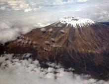
Significant mountain heights are concentrated mainly along the western and northwestern coasts of this part of Novaya Zemlya. Along the northwestern coast, we have a group of the Lomonosov Ridge with altitudes of 1000 - 1100 m, with spurs running in a southwestern direction, called TsAGI Ridge by M. Ermolaev.
In the central part of Novaya Zemlya, only isolated nunataks up to 1100 m high are observed, which were well observed during a zeppelin flight in 1931.
According to the observations of I. Pustovalov, the Lomonosov Ridge, separated from the coastal plain by a sharp ledge, is a highly dissected weedy upland, which sharply differs in its orographic features from the surrounding plain. It stretches from Inostrantsev Bay to Legzdina Bay
Most high peaks The Lomonosov Ridge is located, according to the observations of this geologist, in the central part of the region in the vicinity of Maka harbor. Here the ridge comes closest to the sea, and its highest peak is Mount Blednaya, which has 1052 m above sea level. It stands out sharply above the surrounding area with its flat top with a residual ice sheet located on it.
In the region of Inostrantseva Bay, the highest peaks - Mount Astronomicheskaya and Mount Iskaniy - have a height of 753 and 616 m, respectively.
To the south-west of Maka Harbor, individual nunataks that protrude from the ice sheet reach a height of 650-700 m.
The Lomonosov Ridge is connected by a number of nunataks with the aforementioned TsAGI Ridge.
With distance to the north, a decrease in the heights of this ridge is observed, and near the northern coast of Novaya Zemlya it passes into a low area, which is an abrasion coastal plain, without any sharp relief elements, descending in large steps to the sea and completely free during the summer period from snow, which accumulates mainly in the gorges of rivers and ravines.
As B. Miloradovich points out, in the northeastern region of Novaya Zemlya the valleys are diagonal, with alternating longitudinal and transverse sections. In limestone, the slopes of the valleys are often sheer and form canyons, and in the lower reaches of the rivers, according to the observations of this researcher, the valleys are often asymmetric and do not have deltas when they flow into the sea, but in some cases they fill negative relief forms, forming small alluvial plains.
Also on the east coast, north of Cape Middendorf, the mountains are high and prevent the mainland ice from moving towards the coast (Grenley).
The hydrographic network of the northern island of Novaya Zemlya is much less developed than on the southern island. The rivers are fed mainly by the ablation of glaciers. They are especially full-flowing in spring and early summer. Flowing first along an icy channel, the river then flows on the surface of the soil, making a shallow path for itself among the deluvial deposits. Permafrost, which thaws in Novaya Zemlya to a depth of 50 to 70 cm in different places, prevents rivers from deepening their channels significantly.
The further north, the more reduced the number and size of river flows. However, even at the northernmost tip of Novaya Zemlya, near Cape Mauritius and Cape Zhelaniya, significant furrows are observed, along the bottom of which minor streams flow, increasing in size only on days of more significant ablation of the central glaciers.
ChapterIII
Glaciation
Modern glaciation of Novaya Zemlya is developed mainly on its northern island. By type, glaciers can be divided into wind-blown, valley, cirque and reticulate. Insular glaciation is distributed mainly on the northern island.
1. Wind-blown glaciers, which also persist during the summer period, can be observed in various regions of Novaya Zemlya, including the most southern ones.
This type of glacier is widespread within the coastal plain. They are found in relief depressions, as well as along the ledges of the coastal plains, often abruptly dropping off to the sea.
In the Matochkina Shara area, glaciation becomes more intense. Appearing at first as separate spots along this strait, spreading east and west, as well as south from Matochkin Shar, it gives rise to separate valley glaciers, which do not descend to sea level even in the strait itself.
As you move north, the number of glaciers and their size increase. Even in the area of Mount Mityusheva, glaciers descend to a height of 180 m, and the largest of them are up to 70-75 m above sea level. But further north, both to the western and eastern shores of Novaya Zemlya, the glaciers reach the very sea, forming producing barriers from which individual icebergs break off. However, the latter never reach the size of the icebergs of the Franz Josef Land region.
The dominating place among the forms of glaciation in this part of Novaya Zemlya is occupied by valley-type glaciers, which are widespread and most thoroughly studied by M. Lavrova in the area of Krestovaya Bay. Most of these valley glaciers descend to the main valley and have distinct lateral and terminal moraines, which are often located in the form of separate parallel ridges, corresponding to individual stages of the gradual reduction of glaciers.
AT central area In this part of the northern island, glacial cirques descending to the foot of the slopes are widespread. M. Lavrova at the same time points out that there is no continuous network of valley glaciers passing between the nunataks, as Grenley pointed out, but there are more or less isolated individual snow fields that serve as feeding basins for independent glaciers of various types.
If it can be said that the area of Matochkin Shara and to the north from it to the Admiralty Peninsula is subject to alpine-type glaciation, then further north, in the central part of Novaya Zemlya, we have a net ice cover, from which glaciers flow in the eastern and western directions and reaching sea level. Glaciers of this kind are especially widespread in the area of Arkhangelskaya Bay, in Russkaya Gavan and to the north of it, and on the eastern coast of the Nordenskiöld glaciers, in Rusanov Bay and in Medvezhye Bay. The longitudinal profile of such glaciers, according to the observations of I. Pustovalov, is a slightly wavy line, gradually rising from the edge of the glacier to the feeding area, where the glaciers, losing their net character, form a continuous ice field, also gently rising to the center of the island. The transverse profile of such glaciers has a convex shape with a gradual decrease towards the lateral moraines.
The marginal parts of the glaciers descending into the sea are highly fractured, and the cracks are both longitudinal and transverse in nature, increasing in number and size depending on the relief underlying the bed.
All glaciers, descending to the sea, form steep cliffs, rising above sea level from 5 to 20 m.
Often, glaciers are connected to each other, as, for example, in Inostrantsev Bay, forming a median moraine at the confluence. The total width of the glacier in this area reaches 11 km (I. Pustovalov).
Other glaciers in this region, such as the Karbasnikov glacier, are 7.5 km wide, the Vize glacier is 4.5 km wide, and the Anuchin glacier is 3.75 km wide.
All these glaciers, as I have already pointed out, receive their food from the central ice dome covering the northern island of Novaya Zemlya and originate on its ice sheet.
According to the observations of M. Ermolaev, the central shield of Novaya Zemlya has no snow supply. When crossing the island, they did not encounter an accumulation of firn snow anywhere. I. Pustovalov also claims the same, pointing out that all glaciers in the area of Inostrantsev Bay are devoid of snow cover.
The slight accumulation of snow in this area is apparently due to its removal from higher places by strong Novaya Zemlya winds.
According to Grenley's observations, the snow line in the area of Matochkina Shara is located, apparently, at an altitude of 580 - 590 m, in the area of Mashigin Bay at an altitude of 450 m.
M. Ermolaev's observations in Russkaya Gavan showed that the glaciers in this region exist at the expense of old accumulated reserves, and due to the absence of firn, these reserves are not renewed in the future, which contributes to the rapid retreat of glaciers.
Not only are individual glaciers shrinking in size, but also the insular cover of Novaya Zemlya is shrinking significantly, occupying a much smaller space now than it was relatively recently.
Also, a number of facts observed by various researchers indicate an intensive retreat of glaciers on Novaya Zemlya at the present time. Particularly characteristic in this respect is the presence of lateral moraines in Inostrantsev Bay, which currently extend 1.5 km from the glacier edge towards the sea. Another moraine of the same type stretches for 3 km along the southwestern coast of the bay from the edge of the glacier.
During the last ice age, Novaya Zemlya was covered with a continuous ice sheet, which is confirmed by the nature of the relief of both islands. Even the highest peaks of the Novaya Zemlya mountain heights are of a flattened character, and erratic boulders are scattered on their surface. So, on Mount Wilchek, which has a height of about 900 m, we find a small flat area. In particular, it was possible to observe the ancient flattening plain from the Zeppelin airship during the author's flight over Novaya Zemlya in 1931.
Almost all the highlands of the central part of Novaya Zemlya, like the Lomonosov Ridge, nunataks and the ice cover, are on the same level.
The fact that the southern island of Novaya Zemlya is now almost completely free of ice indicates that the southern island was freed from the ice cover much earlier than the northern one. Accordingly, Matochkin Shar was freed from the ice cover earlier than the Rusanov valley in Krestovaya Bay.
Modern glaciation of Novaya Zemlya not only occupies most of the surface of the northern island, but the soil itself contains a significant amount of ice, sometimes forming accumulations in the form of so-called fossil glaciers. The latter are widespread on Novaya Zemlya and were found both on its western and eastern shores.
According to the observations of G. Gorbatsky, the coastal plains of the Krestovaya Bay are dotted with a very large number of fossil glaciers that cannot be accurately counted, since in places they merge with each other. According to G. Gorbatsky, these glaciers formed part of the insular ice sheet during the last glaciation and, spreading from the hills surrounding the Krestovaya Bay, united at the foot of the mountains, for the most part, into one glacial tongue, which descended directly to the sea.
ChapterIV
Ancient glaciation and transgressions
The general picture of the influence of the cover of the glacial and post-glacial periods on Novaya Zemlya was drawn by Granley in his well-known work on the Quaternary geology of Novaya Zemlya.
According to this researcher, the masses of ice probably crossed the boundaries of the land that existed at that time, partly following in their movement along the existing valleys and fiords, and their movement should have been delayed by a less mobile ice barrier near the mouths of the fiords.
It is difficult to ascertain the number of glaciations that Novaya Zemlya has undergone, but in all likelihood, Granley thinks, some of its periods coincided with periods in Northern Europe. In his opinion, it is possible that during the great ice age in Europe, the glaciation of Novaya Zemlya was moderate. It increased here as it weakened in Europe, and the last period here is the most intense. Apparently, the glaciation on Novaya Zemlya corresponds to its last period in northern Europe, namely the Mecklenburg period according to A. Penk.
Granley believes that the depression during the last glaciation of the islands was at least 370 m, but it is possible that it reached 400 m.
In reality, it was probably much more significant, since M. Ermolaev discovered a sea terrace in the area of \u200b\u200bthe Russian Harbor at an altitude of 420 m. On this terrace he discovered a fin. Thus it is possible that the depression was the same as that seen in Svalbard and Greenland.
According to Granley, the course of ice melting can be traced along Matochkin Shar in the following way: in the wide bay between Cape Stolbov and Dry Nose, the leading part of the ice was probably preserved for quite a long time. The sea had no approach to the northern end of Mount Matochka, where the ledge indicates the lowering of the left side of the ice cliff until the time when the land rose to a height of 215 m above sea level. Large masses of ice here probably appeared due to the position of the bay near the mouths of large tributaries - Matochkina Bay and Serebryanka Bay, located in the most mountainous area on Novaya Zemlya.
No traces of the 215-meter terrace were found on the eastern bank. Here, the ice probably still descended into the sea in the form of a continuous barrier.
The edge of the ice, according to Granley, when the wave-cutting line was developed at a height of 215 m and at a height of 198 m, was between Mount Litke and Mount Matochka.
The eastern part of Matochkina Shara was released a little earlier. Here the terrace is observed at an altitude of 204.8 m above sea level. At that time, the end of the glacier occupied the strait at Cape Poperechny, remaining for a long time in the same place.
This stage of the state of the glaciers Granley conditionally refers to the stage " Ra Salpausselka».
To the northeast of Serebryanka Bay, on the eastern slope of the valley of the same name, Granley found two very distinct coastlines, one of which was at an altitude of 180 m above sea level. The strait, apparently, was still filled with ice at that time, at least in part, probably because the Litke and Lozhkin mountains protected the glacier from the sea. He ate through the river valleys. Chirakin and r. Shumilikha, and from the east across the strait. These valleys were undoubtedly filled with ice during this period. The Matochkina valley at this time, according to Granley, and later was filled with ice south of the moraine ridges. In the period following this, the ice retreated on the western side of the strait beyond the mouth of the river valley. Shumilikha, and to the east the glacier in the strait advanced west of Belushya Bay and the river. Gubina, into the narrow part of the strait, west of the Baer valley, where he stopped for a while. This retreat was followed by a rise of land along the coastline by 146 m. The rise in the east was thus greater than in the west.
Granley points out that at the time when this coastline was designated, the edge of the glacier fell along the moraine ridges lying there.
Along the Baer valley, a large glacier descended into the strait in the form of a fan-shaped blade, almost blocking it, in the valley of the river. Chirakina and r. Shumilikha, undoubtedly, there were still large glaciers.
In the process of further melting, this ice disappeared, and the land rose to 121 m, since this level is the first that can be traced along the entire Matochkin Shar Strait.
As Granley points out, large glaciers still exited the strait. Such glaciers include, for example, the Great Tretyakov Glacier, the Bera Glacier, and the glacier in the Shelonnik Valley, where it is noticeable that further ice retreat occurred intermittently. Three successive moraine scarps indicate not only a delay in retreat, but also give an idea of the size of the glacier.
The time of intense ice melting Granley refers to the boreal time. As the ice cover was released, Novaya Zemlya was gradually uplifted, as evidenced by the presence of a number of ancient coastlines at various, gradually lowering heights.
At a time when the land was only a few meters above the current sea level, there were apparently changes in climatic conditions. The retreat of the glaciers stopped, and the period of advance of the ice cover began.
It is not necessary to speak in this case of a new glaciation, because the old ice has not yet completely disappeared. New glaciers began to move along the old paths. In the north, glaciers jutted out onto the coastal plain, so that, for example, the Arkhangelsk glacier, as Granley points out, crossed the upper coastlines, and the Pankratiev glacier gave impetus to the moraine lying in front of it and caused the formation of folds in it. Apparently, the coastlines at that time were between 10 and 20 m.
The appearance of peat over fossil glaciers was discovered by Malyarevsky during the author's expedition to Novaya Zemlya in 1921. It contains Hy p num with y re r aceae. According to the late prof. Dokhturovsky, peat was formed, apparently, during the climatic optimum of the postglacial period.
However, as A. Zubkov proved, peat can form on Novaya Zemlya at the present time as well.
M. Lavrova, pointing to the fact that the peat horizon was covered by marine sediments, believes that two subsidences of land occurred after the last ice age. Two transgressions - the first late glacial, with the upper level of the coastlines, and the latest - postglacial, not exceeding a height of 54 m.
The New Earth is still in the process of being raised. Many circumstances point to the negative movement of the coastline. We have already had occasions to emphasize the importance of the formation of braids in this respect. At present, the uplift appears to be slow, as the recent coastline is better developed than the former.

Residential building of the station at Cape Zhelaniya

Polygon soils in winter. Arctic desert zone; Russian harbor

Upland arctic tundra.In the foreground, polygon tundra

Bird market in Small Karmakuly. (Photo by L.A. Portenko)

An old fishing hut on the Karskaya side of the southern fort of Novaya Zemlya. (Photo by V.D. Aleksandrova)

Part of the Lagerny camp: warehouses and workshops (Photo by G.N. Toporkov)

School Pioneer Group

Packing murre eggs

Deer from an experienced herd. (Photo by M. Kuznetsov)

The family of the Novaya Zemlya Nenets. Photo by V.D. Alexandrova)

Stanovishche Belushye; spit. Taken from a zeppelin. (Photo by Dr. Basho)

Nunataks of the ice sheet on the northern island of Novaya Zemlya. Filmed from a zeppelin. (Photo by Dr. Basho)

Terraced surface on the east coast south island. (Photo by Dr. Basho)

The southern boundary of the Novaya Zemlya glaciation, the upper reaches of the river. Nameless

Eastern part of Matochkina Shara.View from Cape Snezhnoy to Cape Zhuravlev

Schematic map of the vegetation of Novaya Zemlya. Compiled by A.I. Zubov.1 - glaciers; 2 - arctic tundra; 3 - upland arctic tundra; 4 arctic desert; 5 - highland arctic desert
Map of the islands of the Novaya Zemlya archipelago.
New Earth - island archipelago, located almost at the junction of the Barents, Kara and Pechora seas of the Arctic Ocean, distant to the north from Vaigach Island by the Kara Gate Strait for about 50 kilometers. It is generally accepted that the islands of the archipelago got their common name "Novaya Zemlya" from Novgorod merchants and explorers, who considered the lands they saw across the strait to be new.
The Novaya Zemlya archipelago consists of the two largest islands, Southern and Northern, separated by a narrow strait Matochkin Shar, as well as many small islands and rocks located nearby. Among other smaller islands and island groups, the Mezhdusharska Islands (the third largest in the archipelago), Bolshoi Oransky, Petukhovsky, Pynina, Pastukhov and Gorbovy Islands are distinguished.
The total area of the islands of the archipelago exceeds 83 thousand square kilometers.
The Novaya Zemlya archipelago belongs to the territory of the Russian Federation and is administratively included in the Arkhangelsk region in the status of a territorial municipality.

View of the Severny Island from the aircraft.
Story.
In ancient times, the islands of Novaya Zemlya were inhabited by representatives of unknown tribes, which belong to the Ust-Polui culture. The reasons that led to the decline of this tribe are not known. Scientists argue that the climate on Novaya Zemlya over the past 1000-1200 years has become much more severe than it was before.
It is believed that the Novaya Zemlya archipelago, which was empty and depopulated by the 10th century, was discovered in the period of the 12th-13th centuries by Novgorod merchants and explorers, who, having reached the Yugorsky Peninsula, saw new lands in the distance beyond Vaigach Island. This name subsequently stuck to the islands of the archipelago.
In the summer of 1553, the Englishman Hugh Willoughby, who led an expedition to discover the northern routes to India, was the first European to see the islands of the archipelago.
According to the records of Hugh Willoughby, the Dutch geographer and cartographer Gerard Mercator in 1595 published a map on which Novaya Zemlya was plotted as a peninsula.
The Dutch expedition of Willem Barents in 1596 circled the Novaya Zemlya archipelago from the north, and also wintered in the Ice Harbor north island.
The Frenchman Pierre-Martin de la Martiniere visited Novaya Zemlya with Danish merchants in 1653 and found local residents of the Samoyed tribe on the coast of the South Island, who arrived on the island in search of a fur-bearing animal.

Cape Desire (Severny Island).
The Russian Tsar Peter I had plans to build a fort on Novaya Zemlya to mark the Russian presence in these lands.
In the period 1768-1769, the first Russian explorer and traveler Fyodor Rozmyslov visited Novaya Zemlya.
In the 19th century, Russia officially announced territorial claims to the islands of the Novaya Zemlya archipelago and began to forcibly populate them with Nenets and Pomors.
In 1910, the village of Olginsky was founded on Severny Island, which at that time became the northernmost settlement in the Russian Empire.
On September 17, 1954, a Soviet nuclear test site was created on the islands of Novaya Zemlya. Its center was in Belushya Guba, and it included three more sites in different parts of the archipelago.
In 1961, the most powerful explosion of a 58-megaton hydrogen bomb in the history of mankind was carried out at the Novaya Zemlya test site.
At present, the nuclear test site on the Novaya Zemlya archipelago is the only operating nuclear test site in Russia.

View of Mount Kruzenshtern.
Origin and geography of the island.
The Novaya Zemlya archipelago is quite impressive in area, so its geographical coordinates it is customary to determine by the approximate geographical center: 74 ° 00′ s. sh. 56°00′ E d.
The islands of the archipelago stretch in a wide arc 120-140 kilometers wide from southwest to northeast for about 925 kilometers. The northernmost point of the Novaya Zemlya archipelago is Vostochny Island as part of the Greater Orange Islands, the southernmost point is the Pynina Islands in the Petukhovsky archipelago, the westernmost point is Cape Bezymyanny of the Gusinaya Zemlya Peninsula on Yuzhny Island, and the easternmost point is Cape Flissingsky on Severny Island, which is the easternmost point of Europe.
The coastline of the islands of the Novaya Zemlya archipelago is quite winding and forms many bays and fjords that go deep into the land. The largest bays are considered to be on the western coast - Mityushikha Bay, Krestovaya Bay, Mashigin Bay, Glazov, Borzov, Inostrantseva, Russian Harbor and Nordenskiöld Bays, on the east - Rusanova, Oga, Medvezhiy, Neznaniy and Schubert.
The relief of the islands of the archipelago is mountainous, and the shores are rocky and mostly impregnable. Towards the central part of the islands, the height of the mountains increases. The highest point of the archipelago is a nameless mountain on Severny Island, 15 kilometers south of the Nordenskiöld Bay (sometimes called Kruzenshtern Mountain), 1547 meters above sea level. Most of the North Island is covered with glaciers, which, descending to the coast from the mountains, can even form small icebergs.
On the South and North Islands mountainous areas many small rivers flow into the Kara and Barents Seas. Among the lakes, it is worth noting Lake Goltsovoye, located in the southern part of the Severny Island, and Gusinoye, located in the west of the South Island.
By their origin, the islands of the archipelago are classified as mainland islands. Most likely, they were formed during the movement of the continents in a period remote from us by 26 million years, and are the same age as the Ural Mountains, the continuation of the system of which they are. There is a hypothesis that the islands (at least Yuzhny Island) were a peninsula until about the middle of the 16th century (originally it was designated as such on the maps of that time), and then, when the seabed subsided in the Kara Gate Strait, it became an island. Opponents of this theory argue that the islands are part of a powerful ancient geological platform, and the likelihood of such cataclysms in the area is negligible.
The geological structure of the islands of the Novaya Zemlya archipelago consists mainly of basalts and granites. Of the minerals, there are large deposits of manganese and iron ores, in addition to them there are small deposits of tin, silver and lead, as well as rare earth metals.

Lake Gusinoe (Southern Island).
Climate.
The climate on the islands of Novaya Zemlya is severe, it should be classified by type as arctic. Winter here is long and quite cold, with strong gusty winds, the speed of which sometimes exceeds 40-50 meters per second. In winter, blizzards and snowfalls are also frequent. Frosts during this period can reach -40 ° C. In summer, the air temperature never rises above +7 degrees.

View of the village of Belushya Guba from the aircraft.
Population.
After the creation of the Soviet nuclear test site on Novaya Zemlya, indigenous people, settled here since the time of the Russian Empire, was taken to the continent. The military settled in the deserted villages. technical staff, which ensured the vital activity of the landfill objects. Currently, only two settlements function on Yuzhny Island - Belushya Guba and Rogachevo, there is no permanent population on Severny Island and other islands of the archipelago.
The total population of the archipelago currently does not exceed two and a half thousand people. These are mainly meteorologists, military and technical personnel of military facilities.
Administratively, Novaya Zemlya, as a closed territorial municipality, is assigned to the administration of the Arkhangelsk region of the Russian Federation.

Residential buildings in the village of Belushya Guba.
Flora and fauna.
The ecosystem of the islands of Novaya Zemlya is classified as a biome characteristic of the Arctic deserts (the northern part of Severny Island) and the Arctic tundra (Southern Island).
Under these conditions, only mosses and lichens survive well from plants on the islands. In addition to them, especially in the southern regions of the archipelago, arctic herbaceous annual herbs also grow, most of which are classified as creeping species. Among them, naturalists in these places distinguish creeping willow (Salix polaris), saxifrage opposite-leaved (Saxifraga oppositifolia), as well as mountain lichen. On the South Island, there are also quite frequent dwarf birches and low grasses. Mushrooms are found in the river valleys and the lakeside, among which mushrooms and milk mushrooms stand out for their quantity.
In the lakes and rivers of the islands, fish are found, among which the vast majority of arctic char prevails.
The fauna of the islands is represented by such mammals as arctic fox, lemming and reindeer. During the winter period for south coast The South Islands are always full of polar bears. Of the marine mammals on the coast of the islands, harp seals, seals, sea hares and walruses arrange their rookeries. Whales enter the coastal waters and even the inland bays of the islands.
The bird world on the islands is represented by guillemots, puffins and gulls, which form here perhaps the largest bird colonies in Russia. Among the non-sea birds nesting on the islands is the white partridge.

Typical landscape of the Novaya Zemlya islands.
Tourism.
The islands of the Novaya Zemlya archipelago continue to be closed for visiting by a large number of people. The presence of the nuclear test site mothballed here and other military facilities of the Russian army make tourism to these places almost impossible. Visiting the islands of the archipelago is carried out exclusively with special permission from the Russian authorities with the strictest observance of secrecy. The entry of scientists and naturalists to the islands is also this moment remains practically impossible, which causes a lot of complaints about this from the world community. Environmental organizations are seriously concerned about the environmental situation on the islands of the archipelago, which became much more complicated during the period of nuclear testing. On this occasion, UNESCO tried to create a special commission on environmental problems in Novaya Zemlya, but the decision was categorically blocked by the Russian side.

South coast of South Island.
According to many geologists: Vaigach Island and Novaya Zemlya - are an ancient ridge -! Indeed, together they represent, albeit a curved, but solid line, which and.
On ancient maps (for example, by Mercator, which will be indicated in the article), Novaya Zemlya was a single island, and even a peninsula, which was connected to the continent in the area of the Yugorsky Peninsula, that is Ural mountains in ancient times they went in a continuous chain far to the Arctic. Legends about Hyperborea also take place here, because this ancient ridge continues north of Novaya Zemlya along the bottom of the Arctic Ocean, that is, geologically - the Urals turn out to be longer, at least another thousand kilometers!
What lands were here before the onset of cooling and the rise of the ocean - this is a question for modern scientists!

And for ordinary people - Novaya Zemlya is known, first of all, for testing the most destructive hydrogen bomb in the history of mankind, or as it is called - the Tsar Bomba! The power of the bomb was more than 60 megatons, which is about 30 thousand bombs dropped on Hiroshima! A terrible force, a well of the abyss, but life has shown that those countries that do not have nuclear weapons cannot, in principle, have an independent and independent policy! The nuclear shield is one of the few allies of Russia, it is worth sawing or disposing of the last nuclear charge or delivery vehicle, as we will actually find out - what Western democracy is worth!
The shock wave circled the globe several times! And the surface of the landfill melted and swept clean. Test details will be below.
Novaya Zemlya from the satellite, the Matochkin Shar Strait is visible
GENERAL INFORMATION
Novaya Zemlya is an archipelago in the Arctic Ocean and; part of the Arkhangelsk region of Russia in the rank of the municipality "Novaya Zemlya".
The archipelago consists of two big islands- Northern and Southern, separated by a narrow strait (2-3 km) Matochkin Shar and many relatively small islands, the largest of which is Mezhdusharsky. The northeastern tip of the North Island - Cape Flissing - is the easternmost point of Europe.
It stretches from the southwest to the northeast for 925 km. The northernmost point of Novaya Zemlya east island the Greater Orange Islands, the southernmost - the Pynina Islands of the Petukhov Archipelago, the western - an unnamed cape on the Gusinaya Zemlya Peninsula of the South Island, the eastern - Cape Flissingsky of the Severny Islands. The area of all the islands is more than 83 thousand km²; the width of the North Island is up to 123 km,
South - up to 143 km.
In the south, a strait (50 km wide) separates from Vaigach Island.
The climate is arctic and harsh. The winter is long and cold, with strong winds (the speed of katabatic (katabatic) winds reaches 40–50 m/s) and snowstorms, which is why Novaya Zemlya is sometimes referred to in the literature as the “Land of Winds”. Frosts reach -40 °C.
The average temperature of the warmest month - August - is from 2.5 ° C in the north to 6.5 ° C in the south. In winter, the difference reaches 4.6°. The difference in temperature conditions and exceeds 5 °. Such a temperature asymmetry is due to the difference in the ice regime of these seas. There are many small lakes on the archipelago itself; under the rays of the sun, the water temperature in the southern regions can reach 18 ° C.
About half of the area of the North Island is occupied by glaciers. On the territory of about 20,000 km² there is a continuous ice cover, extending almost 400 km in length and up to 70-75 km in width. The thickness of the ice is over 300 m. In a number of places, the ice descends into the fjords or breaks off into the open sea, forming ice barriers and giving rise to icebergs. The total glaciation area of Novaya Zemlya is 29,767 km², of which about 92% is ice cover and 7.9% is mountain glaciers. On the south island- areas of the arctic tundra.
cruiser Peter the Great near Novaya Zemlya 
Minerals
On the archipelago, primarily on the South Island, deposits of minerals are known, mainly ores of ferrous and non-ferrous metals. The most significant is the Rogachevsko-Taininsky manganese-ore region, according to forecast estimates, the largest in Russia.
Manganese ores are carbonate and oxide. Carbonate ores, with an average manganese content of 8-15%, are distributed over an area of about 800 km², the predicted resources of the P2 category are 260 million tons. Oxide ores, with a manganese content of 16-24 to 45%, are concentrated mainly in the north of the region — in the Severo-Taininsky ore field, the predicted P2 resources are 5 million tons. According to the results of technological tests, the ores are suitable for obtaining metallurgical concentrate. All deposits of oxide ores can be mined in an open way.
Several ore fields have been discovered (Pavlovskoye, Severnoye, Perevalnoye) with deposits of polymetallic ores. The Pavlovskoye deposit, located within the ore field of the same name, is so far the only deposit on Novaya Zemlya for which balance reserves have been approved. The balance reserves of lead and zinc in categories C1 + C2 are more than 2.4 million tons, and the forecast resources of category P1 are 7 million tons (approved by the Ministry of Natural Resources of Russia on 01.01.2003).
The content of lead in ores varies from 1.0 to 2.9%, zinc - from 1.6 to 20.8%. The predicted resources of the Pavlovsky ore field of P2 category in total for lead and zinc are 12 million tons (approved by the Ministry of Natural Resources of Russia on 01.01.2003). In addition, silver reserves are estimated as associated. The development of the deposit is possible by an open method.
The remaining ore fields have been studied much less. It is known that the Northern ore field, in addition to lead and zinc, contains as associated components silver (content - 100-200 g/t), gallium (0.1-0.2%), indium, germanium, yttrium, ytterbium, niobium .
In the South Island, occurrences of native copper and cuprous sandstones are known.
All known ore fields require additional study, which is difficult natural conditions, insufficient economic development and the special status of the archipelago.
In the waters of the seas surrounding the archipelago, a number of geological structures have been identified that are promising for the search for oil and gas fields. The Shtokman gas condensate field, the largest on the Russian shelf, is located 300 km from the coast of Novaya Zemlya.

Story
In ancient times, Novaya Zemlya was inhabited by an unknown tribe, possibly belonging to the Ust-Polui archaeological culture. It is possible that in the mythology of the Samoyeds (Nenets) it was known under the name Sirtya.
Presumably Novaya Zemlya was discovered in the 12th-13th centuries by Novgorod merchants, but there is no convincing historical and documentary evidence of this. Failed to prove the primacy in the discovery of the archipelago and the ancient Scandinavians.
Of the Western Europeans, the first to visit the archipelago in 1553 was the English navigator Hugh Willoughby, who, by decree of King Edward VI (1547-1553), led the expedition of the London "Moscow Company" to "find the Northwest Passage" and establish relations with the Russian state.
On the map of the Flemish scientist Gerard Mercator in 1595, Novaya Zemlya still looks like a single island or even a peninsula.
The Dutch traveler Willem Barents rounded the northern tip of Novaya Zemlya in 1596 and wintered on the east coast of the Severny Island in the Ice Harbor area (1597). In 1871, the Norwegian polar expedition of Elling Carlsen discovered a preserved Barents hut in this place, in which dishes, coins, wall clocks, weapons, navigational tools were found, as well as a written report on wintering, hidden in a chimney.
In 1671, the essay “Journey to the Nordic Countries” was published in Paris, the author of which, a nobleman from Lorraine Pierre-Martin de la Martiniere, visited Novaya Zemlya in 1653 on a ship of Danish merchants. Having descended to the shore of the South Island in three boats, the Danish sailors and Martinier met Samoyed hunters armed with bows who worshiped wooden idols.
The famous Dutch naturalist Nikolaas Witsen in the book "Northern and Eastern Tataria" (1692) - the first in Western Europe scientific work on Siberia and the Russian North - reports that Peter the Great intended to build a military fort on Novaya Zemlya.
The first Russian explorer of Novaya Zemlya is the navigator Fyodor Rozmyslov (1768-1769).
Until the 19th century, Novaya Zemlya was actually an uninhabited archipelago, near which Pomors and Norwegians fished and hunted. Neither one nor the other could settle and live on the islands, and Novaya Zemlya remained only a transit point. From time to time there were minor diplomatic conflicts in which Russian empire invariably stated that "The Novaya Zemlya Archipelago is in its entirety a Russian territory."
Since those who claimed it could not live on the archipelago, several Nenets families were transferred to Novaya Zemlya. More active settlement of the islands began in 1869. In 1877, the settlement Small Karmakuly appeared on the South Island. In the 1980s, Novaya Zemlya already had a small colony.
Belushya Guba Novaya Zemlya 
In 1901, the famous polar artist Alexander Borisov arrived in Novaya Zemlya, where he met and took the young Nenets Tyko Vylka as his guide. During the 400-kilometer trip around Novaya Zemlya on dogs, Borisov constantly made sketches. Noticing the talent of a young Nenets who became interested in painting, Borisov taught Tyko Vylka how to paint. When the artist and writer Stepan Pisakhov was exiled to Novaya Zemlya in 1903, he also noted Vylka's talent by giving him paints and pencils.
In 1909, the polar explorer Vladimir Rusanov came to Novaya Zemlya, who, together with Tyko Vylka and Grigory Pospelov, explored the entire archipelago and compiled its exact cartographic description.
In 1910, the Olginsky settlement was organized on Severny Island in the Krestovaya Bay, which at that time became the northernmost (74 ° 08′ N) settlement of the Russian Empire.
The Novaya Zemlya expedition of 1911, exploring the South Island, came across an extinct settlement of Russian industrialists, the existence of which was not known until that time. Located on the Black Nose in a bay without a name, nowhere marked on the maps, the village was a sad sight: human skulls, skeletons, bones scattered in all directions. The crosses standing right there, apparently in the cemetery, were completely dilapidated and decayed, the crossbars fell off, and the inscriptions on them were erased. In total, the expedition counted the remains of about 13 people here. Three more dilapidated crosses rose in the distance.
Novaya Zemlya polar plane - 30s of the last century 
Cape Flissing is the easternmost insular point of Europe. It is located in the northeast of the Severny Island of the Novaya Zemlya archipelago, Arkhangelsk region, Russia.
It is a rocky massif up to 28 meters high, strongly protruding into the sea. Divides coastal waters into Emergency Bay (in the north) and Andromeda Bay (in the south).
A little south of the cape, the Andromeda River flows into the sea, beyond which there is Cape Burunny. To the north, along the coast, there is a relatively large river Ovrazhistaya. Further along the coast is Cape Dever, which limits the Gulf of Emergency from the north.
The cape was discovered and mapped by the expedition of Willem Barents in 1596, the name was given in honor of the Dutch city of Vlissingen. southwest of the cape in September 1596, the ship of the expedition froze into ice - its participants had to spend the winter on the shore, building a hut from the so-called. "fin" (wood thrown out by the sea). They earned their livelihood, in particular, by hunting polar bears and seals. The following year, from fragments of the ship's hull, which continued to remain in ice captivity, they built two boats and set off on the return journey. During this return, Barents died of scurvy.
This story became the basis for the plot of the Dutch feature film "New Earth", the script of which is based on the memoirs of one of the members of the Barents team, a wintering participant Gerrit de Veer.
settlement Rogachevo Novaya Zemlya 
Population
Administratively, the archipelago is a separate municipality Arkhangelsk region. It has the status of ZATO (closed administrative-territorial entity). A special pass is required to enter Novaya Zemlya. Until the beginning of the 90s. the very existence of settlements on Novaya Zemlya was a state secret. The postal address of the village of Belushya Guba was "Arkhangelsk-55", the village of Rogachevo and the "points" located on the South Island and the south of the North Island - "Arkhangelsk-56", the "points" located in the north of the North Island and Franz Josef Land - " Krasnoyarsk region, island Dixon-2 "(communication with them through Dixon was maintained). In the administrative center - the urban-type settlement of Belushya Guba, located on the South Island - 2149 people live (2013). The second settlement on Novaya Zemlya that currently exists is the village of Rogachevo (457 people), 12 km from Belushya Guba. There is a military airfield - Amderma-2. 350 km to the north on the southern coast of the Matochkin Shar Strait is the village of Severny (without a permanent population), a base for underground testing, mining, construction and installation works. There are currently no settlements on the North Island.
The indigenous population - the Nenets were completely evicted from the islands in the 1950s, when a military training ground was created. The population of the settlements is mainly made up of soldiers and builders.
According to the results of the 2010 All-Russian Population Census, the population of Novaya Zemlya is 2429 people and is concentrated in only two settlements- Belushya Guba and Rogachevo.
Kara Gate Novaya Zemlya 
Flora and fauna
The ecosystems of Novaya Zemlya are usually referred to as biomes of the Arctic deserts (Northern Island) and the Arctic tundra.
The main role in the formation of phytocenoses belongs to mosses and lichens. The latter are represented by species of cladonia, the height of which does not exceed 3–4 cm.
Arctic herbaceous annuals also play a significant role. Creeping species, such as creeping willow (Salix polaris), opposite-leaved saxifrage (Saxifraga oppositifolia), mountain lichen and others, are characteristic of the scarce flora of the islands. The vegetation in the southern part is mostly dwarf birches, moss and low grass, in areas near rivers, lakes and bays a lot of mushrooms grow: milk mushrooms, mushrooms, etc.
The largest lake is Gusinoe. It is home to freshwater fish, in particular arctic char. Of the animals, arctic foxes, lemmings, white partridges, and also reindeer are common. Polar bears come to the southern regions with the onset of cold weather, being a threat local residents. Marine animals include harp seals, seals, bearded seals, walruses, and whales.
On the islands of the archipelago you can find the largest bird colonies in the Russian region of the Arctic. Guillemots, puffins, seagulls settle here.
nuclear test site
The first underwater nuclear explosion in the USSR and the first nuclear explosion on Novaya Zemlya on September 21, 1955. Testing of the T-5 torpedo with a capacity of 3.5 kilotons at a depth of 12 m (Chernaya Bay).
On September 17, 1954, a Soviet nuclear test site was opened on Novaya Zemlya with a center in Belushya Guba. The polygon includes three sites:
Black Lip - used mainly in 1955-1962.
Matochkin Shar - underground tests in 1964-1990.
D-II SIPNZ on the Dry Nose Peninsula - ground tests in 1957-1962.
In addition, explosions were also carried out at other points (the official territory of the test site occupied more than half of the entire area of the island). New Earth 
From September 21, 1955 to October 24, 1990 (the official date of the moratorium on nuclear testing), 135 nuclear explosions were carried out at the test site: 87 in the atmosphere (of which 84 air, 1 ground, 2 surface), 3 underwater and 42 underground. Among the experiments were very powerful megaton tests of nuclear charges, carried out in the atmosphere over the archipelago.
On Novaya Zemlya in 1961, the most powerful hydrogen bomb in the history of mankind was detonated - the 58-megaton "Tsar Bomba" at the D-II "Dry Nose" site. The perceptible seismic wave resulting from the explosion circled the globe three times, and the sound wave generated by the explosion reached Dixon Island at a distance of about 800 kilometers. However, sources do not report any destruction or damage to structures, even in the villages of Amderma and Belushya Guba located much closer (280 km) to the landfill.
In August 1963, the USSR and the United States signed a treaty banning nuclear tests in three environments: the atmosphere, space and under water. Restrictions on the power of charges were also adopted. Underground explosions were carried out until 1990. In the 1990s, in connection with the end of the Cold War, testing abruptly came to naught, and at present, only research is being done in the field of nuclear weapons systems (the Matochkin Shar facility).
Glasnost policy led to the fact that in 1988-1989 the public learned about nuclear tests at Novaya Zemlya, and in October 1990 activists from the environmental organization Greenpeace appeared here to protest against the resumption of nuclear tests on the archipelago. On October 8, 1990, at night, in the area of the Matochkin Shar Strait, the Greenpeace vessel entered the territorial waters of the USSR, and a group of anti-nuclear action activists was secretly sent ashore. After a warning salvo from the XXVI Congress of the CPSU patrol ship, the ship stopped, and Soviet border guards boarded it. Greenpeace was arrested and towed to Murmansk, then released.
However, on the eve of the 50th anniversary of the creation of the landfill at Novaya Zemlya, the head of the Russian federal agency Atomic Energy Director Alexander Rumyantsev said that Russia intends to continue to develop the test site and keep it in working order. At the same time, Russia is not going to conduct nuclear tests on the archipelago, but intends to carry out non-nuclear experiments to ensure the reliability, combat capability and safety of storing its nuclear weapons.
Amderma Novaya Zemlya 
Disposal of radioactive waste
In addition to testing nuclear weapons, the territory of Novaya Zemlya (or rather, the water area adjacent directly to its eastern coast) in 1957-1992 was used for the disposal of liquid and solid radioactive waste (RW). Basically, these were containers with spent nuclear fuel (and in some cases entire reactor plants) from submarines and surface ships of the Northern Fleet of the Navy of the USSR and Russia, as well as icebreakers with nuclear power plants.
Such RW disposal sites are the bays of the archipelago: Sedov Bay, Oga Bay, Tsivolki Bay, Stepovoy Bay, Abrosimov Bay, Prosperity Bay, Currents Bay, as well as a number of points in the Novaya Zemlya depression stretching along the entire archipelago. As a result of such activities and the bays of Novaya Zemlya, many underwater potentially hazardous objects (POHOs) have been formed. Among them: the completely flooded nuclear submarine "K-27" (1981, Stepovoy Bay), the reactor compartment of the nuclear icebreaker "Lenin" (1967, Tsivolki Bay), reactor compartments and assemblies of a number of other nuclear submarines.
Since 2002, the areas where the PPO is located have been subject to annual monitoring by the Russian Emergencies Ministry. In 1992-1994, international expeditions were carried out (with the participation of specialists from Norway) to assess the degree of environmental pollution; since 2012, the activities of such expeditions have been resumed.
Cape Sedova Novaya Zemlya 
DISCOVERY AND EXPLORATION OF THE NEW EARTH
That Novaya Zemlya was known to Russians earlier than to foreigners is evidenced by the very name "Novaya Zemlya", under which this island became known to Western peoples, and which was retained by it in all foreign atlases. Also, Russian industrialists sometimes served as guides to the English and Dutch discoverers on their first voyages to the east, along the northern coasts of Russia, informing them that the coast seen in such and such a direction is “New Earth”.
Findings on its shores by the first foreign sailors of crosses and huts that fell apart from dilapidation, also proving this, at the same time testify that it has been visited by our compatriots for a long time. But exact time When Novaya Zemlya was discovered by the Russians and in what way remains unknown, both of which can only be assumed with greater or lesser probability, based on certain historical data relating to the Russian North.
One of the Slavic tribes, which has long lived near Lake Ilmen and had Veliky Novgorod as its main city, already at the dawn of its history, had a desire to the north, to the White Sea, the Arctic Ocean and further to the northeast, to the Pechora and beyond the Ural Range, to the Yugra Territory , while gradually crowding out their indigenous inhabitants, belonging to the Finnish tribe and called by the Novgorodians with the common name "Zavolotskaya Chud".
Initially, the entire country, lying from Novgorod to the north and northeast to the Ural Mountains, was given by the Novgorodians one common name "Zavolochya", since this territory was located from Novgorod beyond the "portage" - a vast watershed separating the basins of the Onega, Dvina, Mezen and Pechora from the Volga basin, and through this watershed, during campaigns, the Novgorodians dragged ("dragged") their ships.
From the beginning of the 13th century, with the expansion of geographical information about the newly conquered country, only the lands lying between the Onega and Mezen rivers began to be called Zavolochie, while others to the northeast and east of the White Sea received separate names. So, for example, on the northern coast of the White Sea there was a volost "Tre" or "Tersky coast"; the Vychegda river basin was called the "Perm Volost"; the Pechora river basin - "Pechora volost". Beyond the Pechora and on the other side of the northern Ural ridge was the Ugra volost, which, it is believed, included the Yamal Peninsula. Part of the Zavolochye, between the Onega and Dvina rivers, was also called the "Dvina Land".
The primitive inhabitants of Zavolochye were generally separate, with a cult of idolatry, Finnish tribes - Yam, Zavolotskaya Chud, Perm, Pechora and Ugra (or Yugra):
They lived scattered, in small villages, among forests and swamps, along the banks of rivers and lakes, being engaged exclusively in hunting and fishing. Surrounded on the north by the seas, and on the south by dense forests, they were completely independent until the enterprising Novgorodians penetrated into their region.
Cape Zhelaniya - the northern tip of Novaya Zemlya 
The occupation of the region by the Novgorodians was almost exclusively an act of private enterprise. Their movement here, first as conquerors - ushkuins, and then as colonizers - trading guests, went mainly along the course of the rivers, which were the only and most convenient ways of communication in this primitive region, and later the first settlements of Novgorod were based on them.
In the Russian chronicles there are indications that the inhabitants of Zavolochye were already tributaries of the Novgorod Slavs in the first half of the 9th century, and the Lapps (lop) Kola Peninsula in the same century they were their allies, who came for trade and crafts long before the Varangians were called to Russia. But later, when the Novgorodians began to appear here as conquerors, Chud did not immediately submit to the newcomers, rebuffing them sometimes by force, sometimes paying tribute. Only since the conquest of Zavolochye by the Novgorodians did their first settlements appear along downstream Dvina, on the shores of the White Sea and the Arctic Ocean.
At the end of the 9th century, there were no Slavs at the mouth of the Dvina, since the Norwegian Viking Otar or Okhter, sent by the Anglo-Saxon king Alfred the Great to the north in order to find out how far the land extends in this direction, and reaching in the second half of the mentioned century to the mouth Dvina by the sea, found here the tribe of Biorms, who, in his opinion, spoke the same language with the Finns. At the same time, Okhter does not mention anything about the Slavs. Unfriendly met by the Biorms and fearful of their numbers, he did not dare to sail further up the river. The land of the Ter-Finns (Tersky coast), which he saw when sailing here by sea, was not inhabited - he saw only temporarily fishermen and hunters from the Finns who were here.
Novgorod settlements are not visible here even at the beginning of the 11th century, since in 1024 to the mouth of the Dvina, where there was a rich trading city of Chudi and where Scandinavian merchants came for trade in the summer, another Norwegian Viking, Ture Gund, who robbed this time the temple of the Chud deity Yumala. Zavolochye was known at that time to Europe under the name of Biarmia or Permia, the main city of which was located near the present Kholmogory.
But no more than 50 years after the destruction of the temple of Yumala by the Norwegians, the first settlements of Novgorodians with their posadniks appear here, to which the entire local population more or less calmly submits. From that time on, Chud partly merged with the newcomers, became Russified, and partly moved further to the northeast and east. At present, only the names of almost most of our northern rivers, lakes, tracts and localities of various kinds, such as Dvina, Pechora, Pinega, Kholmogory, Shenkursk, Chukhchenema, etc., remind of it.
At the beginning of the 11th century, Novgorodians also appeared on the Murmansk coast of the Arctic Ocean. This is evidenced by one Scandinavian runic letter, from which it is clear that no later than 1030, the sea bay of Lugen Fjord, not far from Tromsø, was considered the border in the north between Russia and Norway. Since it is impossible to think that the chirba, the aforementioned establishment of borders, occurred immediately after the appearance of the first Novgorodians here, it can be concluded with a greater degree of probability that they appeared here earlier, namely in the 10th century. The establishment of the border was probably caused by the already widespread activity of the newcomers. Their appearance here earlier than at the mouth of the Dvina can be explained by the fact that the Novgorodians met little resistance from the Lapps, since this semi-wild nomadic tribe did not have permanent settlements, but moved from place to place in accordance with the movement of their deer for food. Therefore, the squads of Novgorodians could meet a rebuff only from the settled Norwegians. The border was established by agreement between the Novgorod prince Yaroslav the Wise, later the Kyiv prince, with the Norwegian king Olaf Tolstoy, whose daughter Yaroslav was married to.
Without a doubt, the beginning of Russian navigation in the White Sea and the Arctic Ocean must be attributed to the time of the appearance of the Novgorodians in the Dvina Land and on the Murmansk coast. But there is no information about how far these journeys were. One must think that they were not far away, since the Novgorodians, still little familiar with the sea, had to get used to it for some time in order to embark on a distant, unknown and dangerous journey. Indeed, there is reason to believe that the Novgorodians came to Murman not by sea from the Svyatoy Nos, but from Kandalaksha, between which and Kola there is only one portage, about a verst long, and it is known that the Novgorodians made their trips mainly in boats along the rivers, dragging them across the watersheds - drags.
Sunrise in the Kara Sea Novaya Zemlya 
The latter assumption is confirmed by the fact that they founded Kola much earlier than the settlements on the Tersky coast of the White Sea - Ponoy, Umba and Varzuga. If the Novgorodians were going to Murman for the first time from the White Sea, then these rivers, which they could not help but notice, would also serve as the place of their first settlements. Based on the foregoing, it is unlikely that Novaya Zemlya was discovered by the Russians from this side, that is, from the side of the White Sea.
Most likely, this could have been done from the side of the Pechora or Yugorsk Territory, where the Novgorodians also penetrated early, namely in the 11th century, as indicated by the chroniclers. Like the inhabitants of Zavolochye, Yugra also submitted to the Novgorodians, but not immediately - they made repeated attempts to overthrow the yoke of the newcomers, as evidenced by the many campaigns of the conquerors here to pacify some natives:
Having contact with the inhabitants - the nomads of the Pechora and Yugorsky regions - Novgorodians could then learn and hear about Novaya Zemlya, familiar to these nomads for a long time. After all, they could penetrate there through the island of Vaygach, separated from the mainland by a narrow strait and not particularly wide from Novaya Zemlya. You can get to Vaigach in winter on the ice on reindeer, and from it Novaya Zemlya can be clearly seen in clear weather.
Whether the campaign of the Novgorodians to the Iron Gates means a campaign to the Karsky Gates, also called the Iron Gates, cannot be reliably said, since there are quite a few places with that name in the north.
Herberstein, in his memoirs of Muscovy, mentions twice about some country "Engroneland", located in the Arctic Sea, beyond the Riphean and Hyperborean mountains and beyond the mouths of the Pechora and Ob, relations with which are difficult due to constantly floating ice. But is this Novaya Zemlya mixed with Greenland by Herberstein, especially since such a mistake on his part is very possible in view of the fact that geographical description this part of Russia he compiled from the words of narrators, and his personal knowledge of geography could not be particularly extensive and clear? In any case, one must think that the Russians, who gave him geographical information about their country, could not call Novaya Zemlya “Engronelandia”. He gave the last name, forgetting its real name, reported by the Russians. And about Greenland, as an icy country and also in the ocean, he could hear in Europe.
Did the Russian discoverers of Novaya Zemlya know that it was an island and not a mainland? It can be assumed that at first it was considered the mainland, and only this can explain its name and, mainly, the presence of the word "land" in it. In the language of the northern Pomors, it means "mother coast" - the mainland. She could make such an impression on the first newcomers there or those who saw her for the first time since Vaigach. For the enterprising Novgorodians, who were irresistibly striving in their forward movement to the northeast and further, the large island that appeared before them, still unknown to them, could really seem like “land” - it was so big compared to other islands that they had seen before.
But the Novgorodians and their successors, making voyages to Novaya Zemlya, did not leave any written information about it or about their travels there. They were passed on to offspring by oral traditions and in the same way they got acquainted with her. The first printed information about Novaya Zemlya appeared only from the time it was visited by foreign navigators who sought to open the northeastern route to China and India.
Strait Matochkin Shar Novaya Zemlya 
THE LIFE OF A POLAR MONK
Father Innokenty, polar explorer monk. Life on New Earth
Found in the Arctic Ocean mysterious island— New Earth. From Arkhangelsk it is 1200 kilometers towards the North Pole. And people live there, in relation to whom we are southerners spoiled by warmth and natural bounties. It is here, in the very northern point Arkhangelsk region, there is the northernmost Russian Orthodox church in the name of St. Nicholas, whose rector for more than 5 years has been Abbot Innokenty (Russians).
The average summer temperature there is +3, the snow melts by the end of June, exposing a moss-lichen gray-brown desert. Melt water accumulates in lakes, there are no trees at all. And in winter - endless snow, whiteness, from which, according to science, the eyes "starve". Not much is known about Novaya Zemlya: until recently, it was covered in a veil of secrecy. Nuclear test site, closed military zone. The soldiers live there with their families. There is no indigenous population: the Nenets lived here before the creation of the landfill, and then, in the 50s of the last century, they were all evicted. It is here, in the northernmost point of the Arkhangelsk region, that there is an Orthodox church in the name of St. Nicholas, the rector of which for more than 5 years has been Abbot Innokenty (Russians). "How could you volunteer to go to this northern expanse?" - ask the young clergyman. "But someone had to go!" - Father Innokenty calmly answers.
Once upon a time, at the end of the 19th century, there was a temple on Novaya Zemlya, also St. Nicholas, in which missionaries labored - monks of the Orthodox Nikolo-Karelsky Monastery. The old wooden church still exists on the banks of Belushya Bay, a kilometer from the current village. The building was assembled in Arkhangelsk and transported to this island in the Arctic Ocean. The parishioners were Nenets. More than seven years ago, the command and residents of the village of Belushya Bay asked Bishop Tikhon of Arkhangelsk and Kholmogory to send a priest. And in February 1999, Father Innokenty appeared in the military town of Belushya Guba. Due to the constant unfavorable weather, it was decided to arrange a church in the village itself, for this they allocated a large room, the first floor in a residential building - a former cafe. And the life of a parish priest flowed ...
On the " big land"Father Innokenty is rare, mostly on study leave (the priest is educated in absentia in the spiritual educational institution). According to Father Innokenty, the permanent parish of the Novaya Zemlya church is fifteen people, which is 1% of the entire population of the military camp. Mostly women. The community gathered rather quickly, and those who are can be called active and church-going parishioners. They often go to confession and take communion, gather together, observe fasts, and read spiritual literature. On many issues, they turn to the priest for advice, and problems are solved jointly. The priest himself visits military units - he is present at the oaths, conducts conversations, sanctifies the premises. Father Innokenty has many good acquaintances among the local population, mostly officers. The priest also communicates with residents on local television, and regularly delivers sermons. This is the best option for education, because, as experience has shown, a Sunday school for children cannot exist here. During the school year, on weekends, children are used to staying at home: usually the weather is very bad, and you can’t force anyone to go outside. In general, there is nowhere to go especially in the village, people get used to a sedentary lifestyle.
Father Innocent is a monk. It is more usual for a monastic to live within the walls of a monastery, among the brethren, under the direction of the abbot. Here is a completely different situation. Father Innokenty came to Solovetsky Monastery at a fairly young age, he performed his obedience in the kliros, was tonsured a monk. Then he served in the Arkhangelsk Church of All Saints until he volunteered to go to Novaya Zemlya. Now the father lives alone, in an ordinary apartment. In order not to lose physical health at all, he goes in for sports: he goes to the gym, swimming pool, because physical activity in this climate and with a sedentary lifestyle is simply necessary. In addition, Father Innokenty is constantly studying, preparing for sessions at the theological seminary. He often conducts rehearsals with his choir (this priest loves to sing very much).
Father Innokenty realizes that he is doing an important job. Of course, life and priestly service beyond the Arctic Circle is a sacrifice, but every person must sacrifice something. The main thing is that now an Orthodox parish has appeared in that remote point, services are being held, prayers are being offered. People here are already accustomed to the church, and without it it would be hard for them. And the obedience of monk Innokenty is the work of an ordinary parish priest and missionary, on which the hardships and peculiarities of the northern island of Novaya Zemlya are superimposed.

TSAR BOMB TEST
Tsar Bomba (Big Ivan) - tests of a 50 megaton thermonuclear bomb at the Novaya Zemlya test site.
Date of explosion: October 30, 1961
Explosion coordinates:
73 degrees 50"52.93" N (Time zone "November" UTC-1) 54 degrees 29"40.91 E.
The largest hydrogen (thermonuclear) bomb is the Soviet 50-megaton "Tsar Bomba", detonated on October 30, 1961 at a test site on the island of Novaya Zemlya.
Nikita Khrushchev joked that the 100-megaton bomb was originally supposed to be detonated, but the charge was reduced so as not to break all the windows in Moscow.
There is some truth in every joke: structurally, the bomb was indeed designed for 100 megatons, and this power could be achieved by simply increasing the working fluid. It was decided to reduce the energy release for safety reasons - otherwise the landfill would suffer too much damage. The product turned out to be so large that it did not fit into the bomb bay of the Tu-95 carrier aircraft and partially stuck out of it. Despite the successful test, the bomb did not enter service, nevertheless, the creation and testing of the superbomb was of great political importance, demonstrating that the USSR had solved the problem of achieving almost any level of megatonnage of a nuclear arsenal.
Ivan is a thermonuclear device developed in the mid-1950s by a group of physicists led by Academician I.V. Kurchatov. The group included Andrei Sakharov, Viktor Adamsky, Yuri Babaev, Yuri Trunov and Yuri Smirnov.
The original version of the bomb weighing 40 tons, for obvious reasons, was rejected by the designers of OKB-156 (the developers of the Tu-95). Then the nuclear scientists promised to reduce its mass to 20 tons, and the pilots proposed a program for the corresponding modification of the Tu-16 and Tu-95. The new nuclear device, according to the tradition adopted in the USSR, received the code designation "Vanya" or "Ivan", and the Tu-95 chosen as the carrier was named Tu-95V.
The first studies on this topic began immediately after I.V. Kurchatov's negotiations with A.N. Tupolev, who appointed his deputy for weapons systems A.V. Nadashkevich as the head of the topic. The analysis carried out by the Prochnists showed that the suspension of such a large concentrated load would require major changes in the power circuit of the original aircraft, in the design of the cargo bay and in the suspension and drop devices. In the first half of 1955, the overall and weight drawing of the "Ivan" was agreed, as well as the layout drawing of its placement. As expected, the weight of the bomb was 15% of the carrier's takeoff weight, but its overall dimensions required the removal of the fuselage fuel tanks. The new beam holder BD7-95-242 (BD-242) developed for the Ivan suspension was similar in design to the BD-206, but much more powerful. It had three Der5-6 bomber locks with a carrying capacity of 9 tons each. BD-242 was attached directly to the power longitudinal beams, edging the cargo compartment. The problem of controlling the release of the bomb was also successfully solved. Electric automatics ensured exclusively synchronous opening of all three locks, which was dictated by security conditions.
On March 17, 1956, a resolution of the Council of Ministers was issued, according to which OKB-156 was to begin converting the Tu-95 into a carrier of high-power nuclear bombs. These works were carried out in Zhukovsky from May to September, when the Tu-95V was accepted by the customer and handed over for flight tests. They were conducted under the leadership of Colonel S.M. Kulikov until 1959, included the dropping of a "superbomb" model, and passed without any special remarks.
The carrier of the "superbomb" was created, but its real tests were postponed for political reasons: Khrushchev was going to the USA, and there was a pause in the Cold War. The Tu-95V was transferred to the airfield in Uzin, where it was used as a training aircraft and was no longer listed as a combat vehicle. However, in 1961, with the beginning of a new round of the Cold War, testing of the "superbomb" again became topical. On the Tu-95V, all the connectors in the reset electric automatic system were urgently replaced, the doors of the cargo compartment were removed, because. the real bomb turned out to be somewhat larger in size and weight than the mock-up and now exceeded the dimensions of the compartment (the mass of the bomb was 24 tons, the parachute system was 800 kg).
The prepared Tu-95V was transferred to the northern airfield in Vaenga. Soon, with a special white thermal protective coating and a real bomb on board, piloted by a crew led by pilot Durnovtsov, he headed for Novaya Zemlya. The test of the most powerful thermonuclear device in the world took place on October 30, 1961. The bomb exploded at an altitude of 4500 m. The plane shook, and the crew received a certain dose of radiation. The power of the explosion, according to various estimates, ranged from 75 to 120 Mgt. Khrushchev was informed about the explosion of a 100 Mgt bomb, and it was this figure that he called in his speeches.
The results of the explosion of the charge, which received the name Tsar Bomba in the West, were impressive - the nuclear "mushroom" of the explosion rose to a height of 64 kilometers (according to American observation stations), the shock wave resulting from the explosion circled the globe three times, and the electromagnetic radiation of the explosion became cause radio interference for one hour.
The creation of the Soviet super-powerful hydrogen bomb and its explosion on October 30, 1961 over Novaya Zemlya became an important stage in the history of nuclear weapons. V. B. Adamsky and Yu. N. Smirnov, who repeatedly appeared on the pages of our journal, together with A. D. Sakharov, Yu. N. Babaev and Yu. A. Trutnev were direct participants in the development of the design of this bomb. They also participated in her trial.
__________________________________________________________________________________________
SOURCE OF INFORMATION AND PHOTO:
Team Nomads
http://yaranga.su/svedenia-novaya-zemla-1/
Pasetsky V. M. Discoverers of Novaya Zemlya. — M.: Nauka, 1980. — 192 p. — (History of science and technology). — 100,000 copies.
Saks VN Quaternary deposits of Novaya Zemlya. / Geology of the USSR. - T. XXVI, Islands of the Soviet Arctic. 1947.
Robush M.S. On the Arctic Ocean. (From travel notes) // Historical Bulletin. - 1890. - T. 42. - No. 10. - S. 83-118, No. 12. - S. 671-709.
Yugarov I.S. Journal for Novaya Zemlya (climate) for 1881 and 1882 / Extracted from. and comment. M. S. Robusha // Historical Bulletin. - 1889. - T. 36. - No. 4. - S. 117-151. — Under the heading: A Year on Novaya Zemlya.
E. R. a Trautvetter. Conspectus Florae Insularum Nowaja-Semlja (lat.) // Tr. Imp. St. Petersburg. bot. garden. - 1871-1872. - V. I. - T. I. - S. 45-88. (~ 77 Mb)
Martynov V. | Novaya Zemlya - military land | Newspaper "Geography" No. 09/2009
Based on the materials of "The First Russian Explorers of Novaya Zemlya", 1922, compiled by P. I. Bashmakov
http://www.pravda.ru/districts/northwest/arhangelsk/31-12-2004/49072-monah-0/
http://www.nationalsecurity.ru/maps/nuclear/004.htm
http://www.photosight.ru/
http://www.belushka-info.ru/
According to many geologists: Vaigach Island and Novaya Zemlya - are an ancient ridge -! Indeed, together they represent, albeit a curved, but solid line, which and.
On ancient maps (for example, by Mercator, which will be indicated in the article), Novaya Zemlya was a single island, and even a peninsula, which was connected to the continent in the region of the Yugorsky Peninsula, that is, the Ural Mountains in ancient times went in a continuous chain far into the Arctic. Legends about Hyperborea also take place here, because this ancient ridge continues north of Novaya Zemlya along the bottom of the Arctic Ocean, that is, geologically - the Urals turn out to be longer, at least another thousand kilometers!
What lands were here before the onset of cooling and the rise of the ocean - this is a question for modern scientists!
And for ordinary people - Novaya Zemlya is known, first of all, for testing the most destructive hydrogen bomb in the history of mankind, or as it is called - the Tsar Bomba! The power of the bomb was more than 60 megatons, which is about 30 thousand bombs dropped on Hiroshima! A terrible force, a well of the abyss, but life has shown that those countries that do not have nuclear weapons cannot, in principle, have an independent and independent policy! The nuclear shield is one of the few allies of Russia, it is worth sawing or disposing of the last nuclear charge or delivery vehicle, as we will actually find out - what Western democracy is worth!
The shock wave circled the globe several times! And the surface of the landfill melted and swept clean. Test details will be below.
Novaya Zemlya from the satellite, the Matochkin Shar Strait is visible
GENERAL INFORMATION
Novaya Zemlya is an archipelago in the Arctic Ocean and; part of the Arkhangelsk region of Russia in the rank of the municipality "Novaya Zemlya".
The archipelago consists of two large islands, the North and the South, separated by a narrow strait (2–3 km) Matochkin Shar and many relatively small islands, the largest of which is Mezhdusharsky. The northeastern tip of the North Island - Cape Flissing - is the easternmost point of Europe.
It stretches from the southwest to the northeast for 925 km. The northernmost point of Novaya Zemlya is the eastern island of the Greater Orange Islands, the southernmost point is the Pynina Islands of the Petukhov Archipelago, the western one is an unnamed cape on the Gusinaya Zemlya peninsula of the South Island, and the eastern one is Cape Flissingsky of the Severny Island. The area of all the islands is more than 83 thousand km²; the width of the North Island is up to 123 km,
South - up to 143 km.
In the south, a strait (50 km wide) separates from Vaigach Island.
The climate is arctic and harsh. The winter is long and cold, with strong winds (the speed of katabatic (katabatic) winds reaches 40–50 m/s) and snowstorms, which is why Novaya Zemlya is sometimes referred to in the literature as the “Land of Winds”. Frosts reach -40 °C.
The average temperature of the warmest month - August - is from 2.5 ° C in the north to 6.5 ° C in the south. In winter, the difference reaches 4.6°. The difference in temperature conditions and exceeds 5 °. Such a temperature asymmetry is due to the difference in the ice regime of these seas. There are many small lakes on the archipelago itself; under the rays of the sun, the water temperature in the southern regions can reach 18 ° C.
About half of the area of the North Island is occupied by glaciers. On the territory of about 20,000 km² there is a continuous ice cover, extending almost 400 km in length and up to 70-75 km in width. The thickness of the ice is over 300 m. In a number of places, the ice descends into the fjords or breaks off into the open sea, forming ice barriers and giving rise to icebergs. The total glaciation area of Novaya Zemlya is 29,767 km², of which about 92% is ice cover and 7.9% is mountain glaciers. On the South Island there are patches of arctic tundra.
cruiser Peter the Great near Novaya Zemlya
Minerals
On the archipelago, primarily on the South Island, deposits of minerals are known, mainly ores of ferrous and non-ferrous metals. The most significant is the Rogachevsko-Taininsky manganese-ore region, according to forecast estimates, the largest in Russia.
Manganese ores are carbonate and oxide. Carbonate ores, with an average manganese content of 8-15%, are distributed over an area of about 800 km², the predicted resources of the P2 category are 260 million tons. Oxide ores, with a manganese content of 16-24 to 45%, are concentrated mainly in the north of the region — in the Severo-Taininsky ore field, the predicted P2 resources are 5 million tons. According to the results of technological tests, the ores are suitable for obtaining metallurgical concentrate. All deposits of oxide ores can be mined in an open way.
Several ore fields have been discovered (Pavlovskoye, Severnoye, Perevalnoye) with deposits of polymetallic ores. The Pavlovskoye deposit, located within the ore field of the same name, is so far the only deposit on Novaya Zemlya for which balance reserves have been approved. The balance reserves of lead and zinc in categories C1 + C2 are more than 2.4 million tons, and the forecast resources of category P1 are 7 million tons (approved by the Ministry of Natural Resources of Russia on 01.01.2003).
The content of lead in ores varies from 1.0 to 2.9%, zinc - from 1.6 to 20.8%. The predicted resources of the Pavlovsky ore field of P2 category in total for lead and zinc are 12 million tons (approved by the Ministry of Natural Resources of Russia on 01.01.2003). In addition, silver reserves are estimated as associated. The development of the deposit is possible by an open method.
The remaining ore fields have been studied much less. It is known that the Northern ore field, in addition to lead and zinc, contains as associated components silver (content - 100-200 g/t), gallium (0.1-0.2%), indium, germanium, yttrium, ytterbium, niobium .
In the South Island, occurrences of native copper and cuprous sandstones are known.
All known ore fields require additional study, which is hampered by natural conditions, insufficient economic development and the special status of the archipelago.
In the waters of the seas surrounding the archipelago, a number of geological structures have been identified that are promising for the search for oil and gas fields. The Shtokman gas condensate field, the largest on the Russian shelf, is located 300 km from the coast of Novaya Zemlya.
Story
In ancient times, Novaya Zemlya was inhabited by an unknown tribe, possibly belonging to the Ust-Polui archaeological culture. It is possible that in the mythology of the Samoyeds (Nenets) it was known under the name Sirtya.
Presumably Novaya Zemlya was discovered in the 12th-13th centuries by Novgorod merchants, but there is no convincing historical and documentary evidence of this. Failed to prove the primacy in the discovery of the archipelago and the ancient Scandinavians.
Of the Western Europeans, the first to visit the archipelago in 1553 was the English navigator Hugh Willoughby, who, by decree of King Edward VI (1547-1553), led the expedition of the London "Moscow Company" to "find the Northwest Passage" and establish relations with the Russian state.
On the map of the Flemish scientist Gerard Mercator in 1595, Novaya Zemlya still looks like a single island or even a peninsula.
The Dutch traveler Willem Barents rounded the northern tip of Novaya Zemlya in 1596 and wintered on the east coast of the Severny Island in the Ice Harbor area (1597). In 1871, the Norwegian polar expedition of Elling Carlsen discovered a preserved Barents hut in this place, in which dishes, coins, wall clocks, weapons, navigational tools were found, as well as a written report on wintering, hidden in a chimney.
In 1671, the essay “Journey to the Nordic Countries” was published in Paris, the author of which, a nobleman from Lorraine Pierre-Martin de la Martiniere, visited Novaya Zemlya in 1653 on a ship of Danish merchants. Having descended to the shore of the South Island in three boats, the Danish sailors and Martinier met Samoyed hunters armed with bows who worshiped wooden idols.
The famous Dutch natural scientist Nikolaas Witsen in his book Northern and Eastern Tataria (1692), the first scientific work in Western Europe on Siberia and the Russian North, reports that Peter the Great intended to build a military fort on Novaya Zemlya.
The first Russian explorer of Novaya Zemlya is the navigator Fyodor Rozmyslov (1768-1769).
Until the 19th century, Novaya Zemlya was actually an uninhabited archipelago, near which Pomors and Norwegians fished and hunted. Neither one nor the other could settle and live on the islands, and Novaya Zemlya remained only a transit point. From time to time, minor diplomatic conflicts arose, in which the Russian Empire invariably stated that "The Novaya Zemlya Archipelago is Russian territory in its entirety."
Since those who claimed it could not live on the archipelago, several Nenets families were transferred to Novaya Zemlya. More active settlement of the islands began in 1869. In 1877, the settlement Small Karmakuly appeared on the South Island. In the 1980s, Novaya Zemlya already had a small colony.
Belushya Guba Novaya Zemlya
In 1901, the famous polar artist Alexander Borisov arrived in Novaya Zemlya, where he met and took the young Nenets Tyko Vylka as his guide. During the 400-kilometer trip around Novaya Zemlya on dogs, Borisov constantly made sketches. Noticing the talent of a young Nenets who became interested in painting, Borisov taught Tyko Vylka how to paint. When the artist and writer Stepan Pisakhov was exiled to Novaya Zemlya in 1903, he also noted Vylka's talent by giving him paints and pencils.
In 1909, the polar explorer Vladimir Rusanov came to Novaya Zemlya, who, together with Tyko Vylka and Grigory Pospelov, explored the entire archipelago and compiled its exact cartographic description.
In 1910, the Olginsky settlement was organized on Severny Island in the Krestovaya Bay, which at that time became the northernmost (74 ° 08′ N) settlement of the Russian Empire.
The Novaya Zemlya expedition of 1911, exploring the South Island, came across an extinct settlement of Russian industrialists, the existence of which was not known until that time. Located on the Black Nose in a bay without a name, nowhere marked on the maps, the village was a sad sight: human skulls, skeletons, bones scattered in all directions. The crosses standing right there, apparently in the cemetery, were completely dilapidated and decayed, the crossbars fell off, and the inscriptions on them were erased. In total, the expedition counted the remains of about 13 people here. Three more dilapidated crosses rose in the distance.
Novaya Zemlya polar plane - 30s of the last century
Cape Flissing is the easternmost insular point of Europe. It is located in the northeast of the Severny Island of the Novaya Zemlya archipelago, Arkhangelsk region, Russia.
It is a rocky massif up to 28 meters high, strongly protruding into the sea. Divides coastal waters into Emergency Bay (in the north) and Andromeda Bay (in the south).
A little south of the cape, the Andromeda River flows into the sea, beyond which there is Cape Burunny. To the north, along the coast, there is a relatively large river Ovrazhistaya. Further along the coast is Cape Dever, which limits the Gulf of Emergency from the north.
The cape was discovered and mapped by the expedition of Willem Barents in 1596, the name was given in honor of the Dutch city of Vlissingen. Southwest of the cape in September 1596, the ship of the expedition froze into ice - its participants had to spend the winter on the shore, building a hut from the so-called. "fin" (wood thrown out by the sea). They earned their livelihood, in particular, by hunting polar bears and seals. The following year, from fragments of the ship's hull, which continued to remain in ice captivity, they built two boats and set off on the return journey. During this return, Barents died of scurvy.
This story became the basis for the plot of the Dutch feature film "New Earth", the script of which is based on the memoirs of one of the members of the Barents team, a wintering participant Gerrit de Veer.
settlement Rogachevo Novaya Zemlya
Population
In administrative terms, the archipelago is a separate municipality of the Arkhangelsk region. It has the status of ZATO (closed administrative-territorial entity). A special pass is required to enter Novaya Zemlya. Until the beginning of the 90s. the very existence of settlements on Novaya Zemlya was a state secret. The postal address of the village of Belushya Guba was "Arkhangelsk-55", the village of Rogachevo and the "points" located on the South Island and the south of the North Island - "Arkhangelsk-56", the "points" located in the north of the North Island and Franz Josef Land - " Krasnoyarsk Territory, Dikson-2 Island "(communication with them through Dikson was maintained). In the administrative center - the urban-type settlement of Belushya Guba, located on the South Island - 2149 people live (2013). The second settlement on Novaya Zemlya that currently exists is the village of Rogachevo (457 people), 12 km from Belushya Guba. There is a military airfield - Amderma-2. 350 km to the north on the southern coast of the Matochkin Shar Strait is the village of Severny (without a permanent population), a base for underground testing, mining, construction and installation works. There are currently no settlements on the North Island.
The indigenous population - the Nenets were completely evicted from the islands in the 1950s, when a military training ground was created. The population of the settlements is mainly made up of soldiers and builders.
According to the results of the 2010 All-Russian Population Census, the population of Novaya Zemlya is 2429 people and is concentrated in only two settlements - Belushya Guba and Rogachevo.
Kara Gate Novaya Zemlya
Flora and fauna
The ecosystems of Novaya Zemlya are usually referred to as biomes of the Arctic deserts (Northern Island) and the Arctic tundra.
The main role in the formation of phytocenoses belongs to mosses and lichens. The latter are represented by species of cladonia, the height of which does not exceed 3–4 cm.
Arctic herbaceous annuals also play a significant role. Creeping species, such as creeping willow (Salix polaris), opposite-leaved saxifrage (Saxifraga oppositifolia), mountain lichen and others, are characteristic of the scarce flora of the islands. The vegetation in the southern part is mostly dwarf birches, moss and low grass, in areas near rivers, lakes and bays a lot of mushrooms grow: milk mushrooms, mushrooms, etc.
The largest lake is Gusinoe. It is home to freshwater fish, in particular arctic char. Of the animals, arctic foxes, lemmings, white partridges, and also reindeer are common. Polar bears come to the southern regions with the onset of cold weather, being a threat to local residents. Marine animals include harp seals, seals, bearded seals, walruses, and whales.
On the islands of the archipelago you can find the largest bird colonies in the Russian region of the Arctic. Guillemots, puffins, seagulls settle here.
nuclear test site
The first underwater nuclear explosion in the USSR and the first nuclear explosion on Novaya Zemlya on September 21, 1955. Testing of the T-5 torpedo with a capacity of 3.5 kilotons at a depth of 12 m (Chernaya Bay).
On September 17, 1954, a Soviet nuclear test site was opened on Novaya Zemlya with a center in Belushya Guba. The polygon includes three sites:
Black Lip - used mainly in 1955-1962.
Matochkin Shar - underground tests in 1964-1990.
D-II SIPNZ on the Dry Nose Peninsula - ground tests in 1957-1962.
In addition, explosions were also carried out at other points (the official territory of the test site occupied more than half of the entire area of the island). New Earth
From September 21, 1955 to October 24, 1990 (the official date of the moratorium on nuclear testing), 135 nuclear explosions were carried out at the test site: 87 in the atmosphere (of which 84 air, 1 ground, 2 surface), 3 underwater and 42 underground. Among the experiments were very powerful megaton tests of nuclear charges, carried out in the atmosphere over the archipelago.
On Novaya Zemlya in 1961, the most powerful hydrogen bomb in the history of mankind was detonated - the 58-megaton "Tsar Bomba" at the D-II "Dry Nose" site. The perceptible seismic wave resulting from the explosion circled the globe three times, and the sound wave generated by the explosion reached Dixon Island at a distance of about 800 kilometers. However, sources do not report any destruction or damage to structures, even in the villages of Amderma and Belushya Guba located much closer (280 km) to the landfill.
In August 1963, the USSR and the United States signed a treaty banning nuclear tests in three environments: the atmosphere, space and under water. Restrictions on the power of charges were also adopted. Underground explosions were carried out until 1990. In the 1990s, in connection with the end of the Cold War, testing abruptly came to naught, and at present, only research is being done in the field of nuclear weapons systems (the Matochkin Shar facility).
Glasnost policy led to the fact that in 1988-1989 the public learned about nuclear tests at Novaya Zemlya, and in October 1990 activists from the environmental organization Greenpeace appeared here to protest against the resumption of nuclear tests on the archipelago. On October 8, 1990, at night, in the area of the Matochkin Shar Strait, the Greenpeace vessel entered the territorial waters of the USSR, and a group of anti-nuclear action activists was secretly sent ashore. After a warning salvo from the XXVI Congress of the CPSU patrol ship, the ship stopped, and Soviet border guards boarded it. Greenpeace was arrested and towed to Murmansk, then released.
However, on the eve of the 50th anniversary of the creation of the test site at Novaya Zemlya, the head of the Russian Federal Atomic Energy Agency, Alexander Rumyantsev, said that Russia intends to continue to develop the test site and keep it in working order. At the same time, Russia is not going to conduct nuclear tests on the archipelago, but intends to carry out non-nuclear experiments to ensure the reliability, combat capability and safety of storing its nuclear weapons.
Amderma Novaya Zemlya
Disposal of radioactive waste
In addition to testing nuclear weapons, the territory of Novaya Zemlya (or rather, the water area adjacent directly to its eastern coast) in 1957-1992 was used for the disposal of liquid and solid radioactive waste (RW). Basically, these were containers with spent nuclear fuel (and in some cases entire reactor plants) from submarines and surface ships of the Northern Fleet of the Navy of the USSR and Russia, as well as icebreakers with nuclear power plants.
Such RW disposal sites are the bays of the archipelago: Sedov Bay, Oga Bay, Tsivolki Bay, Stepovoy Bay, Abrosimov Bay, Prosperity Bay, Currents Bay, as well as a number of points in the Novaya Zemlya depression stretching along the entire archipelago. As a result of such activities and the bays of Novaya Zemlya, many underwater potentially hazardous objects (POHOs) have been formed. Among them: the completely flooded nuclear submarine "K-27" (1981, Stepovoy Bay), the reactor compartment of the nuclear icebreaker "Lenin" (1967, Tsivolki Bay), reactor compartments and assemblies of a number of other nuclear submarines.
Since 2002, the areas where the PPO is located have been subject to annual monitoring by the Russian Emergencies Ministry. In 1992-1994, international expeditions were carried out (with the participation of specialists from Norway) to assess the degree of environmental pollution; since 2012, the activities of such expeditions have been resumed.
Cape Sedova Novaya Zemlya
DISCOVERY AND EXPLORATION OF THE NEW EARTH
That Novaya Zemlya was known to Russians earlier than to foreigners is evidenced by the very name "Novaya Zemlya", under which this island became known to Western peoples, and which was retained by it in all foreign atlases. Also, Russian industrialists sometimes served as guides to the English and Dutch discoverers on their first voyages to the east, along the northern coasts of Russia, informing them that the coast seen in such and such a direction is “New Earth”.
Findings on its shores by the first foreign sailors of crosses and huts that fell apart from dilapidation, also proving this, at the same time testify that it has been visited by our compatriots for a long time. But the exact time when Novaya Zemlya was discovered by the Russians and in what way remains unknown, and both can only be more or less likely to be assumed, based on one or another historical data concerning the Russian North.
One of the Slavic tribes, which has long lived near Lake Ilmen and had Veliky Novgorod as its main city, already at the dawn of its history, had a desire to the north, to the White Sea, the Arctic Ocean and further to the northeast, to the Pechora and beyond the Ural Range, to the Yugra Territory , while gradually crowding out their indigenous inhabitants, belonging to the Finnish tribe and called by the Novgorodians with the common name "Zavolotskaya Chud".
Initially, the entire country, lying from Novgorod to the north and northeast to the Ural Mountains, was given by the Novgorodians one common name "Zavolochya", since this territory was located from Novgorod beyond the "portage" - a vast watershed separating the basins of the Onega, Dvina, Mezen and Pechora from the Volga basin, and through this watershed, during campaigns, the Novgorodians dragged ("dragged") their ships.
From the beginning of the 13th century, with the expansion of geographical information about the newly conquered country, only the lands lying between the Onega and Mezen rivers began to be called Zavolochie, while others to the northeast and east of the White Sea received separate names. So, for example, on the northern coast of the White Sea there was a volost "Tre" or "Tersky coast"; the Vychegda river basin was called the "Perm Volost"; the Pechora river basin - "Pechora volost". Beyond the Pechora and on the other side of the northern Ural ridge was the Ugra volost, which, it is believed, included the Yamal Peninsula. Part of the Zavolochye, between the Onega and Dvina rivers, was also called the "Dvina Land".
The primitive inhabitants of Zavolochye were generally separate, with a cult of idolatry, Finnish tribes - Yam, Zavolotskaya Chud, Perm, Pechora and Ugra (or Yugra):
They lived scattered, in small villages, among forests and swamps, along the banks of rivers and lakes, being engaged exclusively in hunting and fishing. Surrounded on the north by the seas, and on the south by dense forests, they were completely independent until the enterprising Novgorodians penetrated into their region.
Cape Zhelaniya - the northern tip of Novaya Zemlya
The occupation of the region by the Novgorodians was almost exclusively an act of private enterprise. Their movement here, first as conquerors - ushkuins, and then as colonizers - trading guests, went mainly along the course of the rivers, which were the only and most convenient ways of communication in this primitive region, and later the first settlements of Novgorod were based on them.
In the Russian chronicles there are indications that the inhabitants of Zavolochye were already tributaries of the Novgorod Slavs in the first half of the 9th century, and the Lapps (Lop) of the Kola Peninsula in the same century were their allies, who came for trade and crafts long before the Varangians were called to Russia. But later, when the Novgorodians began to appear here as conquerors, Chud did not immediately submit to the newcomers, rebuffing them sometimes by force, sometimes paying tribute. Only since the conquest of Zavolochye by the Novgorodians did their first settlements appear along the lower reaches of the Dvina, on the shores of the White Sea and the Arctic Ocean.
At the end of the 9th century, there were no Slavs at the mouth of the Dvina, since the Norwegian Viking Otar or Okhter, sent by the Anglo-Saxon king Alfred the Great to the north in order to find out how far the land extends in this direction, and reaching in the second half of the mentioned century to the mouth Dvina by the sea, found here the tribe of Biorms, who, in his opinion, spoke the same language with the Finns. At the same time, Okhter does not mention anything about the Slavs. Unfriendly met by the Biorms and fearful of their numbers, he did not dare to sail further up the river. The land of the Ter-Finns (Tersky coast), which he saw when sailing here by sea, was not inhabited - he saw only temporarily fishermen and hunters from the Finns who were here.
Novgorod settlements are not visible here even at the beginning of the 11th century, since in 1024 to the mouth of the Dvina, where there was a rich trading city of Chudi and where Scandinavian merchants came for trade in the summer, another Norwegian Viking, Ture Gund, who robbed this time the temple of the Chud deity Yumala. Zavolochye was known at that time to Europe under the name of Biarmia or Permia, the main city of which was located near the present Kholmogory.
But no more than 50 years after the destruction of the temple of Yumala by the Norwegians, the first settlements of Novgorodians with their posadniks appear here, to which the entire local population more or less calmly submits. From that time on, Chud partly merged with the newcomers, became Russified, and partly moved further to the northeast and east. At present, only the names of almost most of our northern rivers, lakes, tracts and localities of various kinds, such as Dvina, Pechora, Pinega, Kholmogory, Shenkursk, Chukhchenema, etc., remind of it.
At the beginning of the 11th century, Novgorodians also appeared on the Murmansk coast of the Arctic Ocean. This is evidenced by one Scandinavian runic letter, from which it is clear that no later than 1030, the sea bay of Lugen Fjord, not far from Tromsø, was considered the border in the north between Russia and Norway. Since it is impossible to think that the chirba, the aforementioned establishment of borders, occurred immediately after the appearance of the first Novgorodians here, it can be concluded with a greater degree of probability that they appeared here earlier, namely in the 10th century. The establishment of the border was probably caused by the already widespread activity of the newcomers. Their appearance here earlier than at the mouth of the Dvina can be explained by the fact that the Novgorodians met little resistance from the Lapps, since this semi-wild nomadic tribe did not have permanent settlements, but moved from place to place in accordance with the movement of their deer for food. Therefore, the squads of Novgorodians could meet a rebuff only from the settled Norwegians. The border was established by agreement between the Novgorod prince Yaroslav the Wise, later the Kyiv prince, with the Norwegian king Olaf Tolstoy, whose daughter Yaroslav was married to.
Without a doubt, the beginning of Russian navigation in the White Sea and the Arctic Ocean must be attributed to the time of the appearance of the Novgorodians in the Dvina Land and on the Murmansk coast. But there is no information about how far these journeys were. One must think that they were not far away, since the Novgorodians, still little familiar with the sea, had to get used to it for some time in order to embark on a distant, unknown and dangerous journey. Indeed, there is reason to believe that the Novgorodians came to Murman not by sea from the Svyatoy Nos, but from Kandalaksha, between which and Kola there is only one portage, about a verst long, and it is known that the Novgorodians made their trips mainly in boats along the rivers, dragging them across the watersheds - drags.
Sunrise in the Kara Sea Novaya Zemlya
The latter assumption is confirmed by the fact that they founded Kola much earlier than the settlements on the Tersky coast of the White Sea - Ponoy, Umba and Varzuga. If the Novgorodians were going to Murman for the first time from the White Sea, then these rivers, which they could not help but notice, would also serve as the place of their first settlements. Based on the foregoing, it is unlikely that Novaya Zemlya was discovered by the Russians from this side, that is, from the side of the White Sea.
Most likely, this could have been done from the side of the Pechora or Yugorsk Territory, where the Novgorodians also penetrated early, namely in the 11th century, as indicated by the chroniclers. Like the inhabitants of Zavolochye, Yugra also submitted to the Novgorodians, but not immediately - they made repeated attempts to overthrow the yoke of the newcomers, as evidenced by the many campaigns of the conquerors here to pacify some natives:
Having contact with the inhabitants - the nomads of the Pechora and Yugorsky regions - Novgorodians could then learn and hear about Novaya Zemlya, familiar to these nomads for a long time. After all, they could penetrate there through the island of Vaygach, separated from the mainland by a narrow strait and not particularly wide from Novaya Zemlya. You can get to Vaigach in winter on the ice on reindeer, and from it Novaya Zemlya can be clearly seen in clear weather.
Whether the campaign of the Novgorodians to the Iron Gates means a campaign to the Karsky Gates, also called the Iron Gates, cannot be reliably said, since there are quite a few places with that name in the north.
Herberstein, in his memoirs of Muscovy, mentions twice about some country "Engroneland", located in the Arctic Sea, beyond the Riphean and Hyperborean mountains and beyond the mouths of the Pechora and Ob, relations with which are difficult due to constantly floating ice. But is it Novaya Zemlya, mixed by Herberstein with Greenland, especially since such a mistake on his part is very possible in view of the fact that he compiled a geographical description of this part of Russia from the words of storytellers, and his personal knowledge of geography could not be particularly broad and clear? In any case, one must think that the Russians, who gave him geographical information about their country, could not call Novaya Zemlya “Engronelandia”. He gave the last name, forgetting its real name, reported by the Russians. And about Greenland, as an icy country and also in the ocean, he could hear in Europe.
Did the Russian discoverers of Novaya Zemlya know that it was an island and not a mainland? It can be assumed that at first it was considered the mainland, and only this can explain its name and, mainly, the presence of the word "land" in it. In the language of the northern Pomors, it means "mother coast" - the mainland. She could make such an impression on the first newcomers there or those who saw her for the first time since Vaigach. For the enterprising Novgorodians, who were irresistibly striving in their forward movement to the northeast and further, the large island that appeared before them, still unknown to them, could really seem like “land” - it was so big compared to other islands that they had seen before.
But the Novgorodians and their successors, making voyages to Novaya Zemlya, did not leave any written information about it or about their travels there. They were passed on to offspring by oral traditions and in the same way they got acquainted with her. The first printed information about Novaya Zemlya appeared only from the time it was visited by foreign navigators who sought to open the northeastern route to China and India.
Strait Matochkin Shar Novaya Zemlya
THE LIFE OF A POLAR MONK
Father Innokenty, polar explorer monk. Life on New Earth
There is a mysterious island in the Arctic Ocean - Novaya Zemlya. From Arkhangelsk it is 1200 kilometers towards the North Pole. And people live there, in relation to whom we are southerners spoiled by warmth and natural bounties. It is here, in the northernmost point of the Arkhangelsk region, that there is the northernmost Russian Orthodox church in the name of St. Nicholas, the rector of which for more than 5 years has been Abbot Innokenty (Russians).
The average summer temperature there is +3, the snow melts by the end of June, exposing a moss-lichen gray-brown desert. Melt water accumulates in lakes, there are no trees at all. And in winter - endless snow, whiteness, from which, according to science, the eyes "starve". Not much is known about Novaya Zemlya: until recently, it was covered in a veil of secrecy. Nuclear test site, closed military zone. The soldiers live there with their families. There is no indigenous population: the Nenets lived here before the creation of the landfill, and then, in the 50s of the last century, they were all evicted. It is here, in the northernmost point of the Arkhangelsk region, that there is an Orthodox church in the name of St. Nicholas, the rector of which for more than 5 years has been Abbot Innokenty (Russians). "How could you volunteer to go to this northern expanse?" - ask the young clergyman. "But someone had to go!" - Father Innokenty calmly answers.
Once upon a time, at the end of the 19th century, there was a temple on Novaya Zemlya, also St. Nicholas, in which missionaries labored - monks of the Orthodox Nikolo-Karelsky Monastery. The old wooden church still exists on the banks of Belushya Bay, a kilometer from the current village. The building was assembled in Arkhangelsk and transported to this island in the Arctic Ocean. The parishioners were Nenets. More than seven years ago, the command and residents of the village of Belushya Bay asked Bishop Tikhon of Arkhangelsk and Kholmogory to send a priest. And in February 1999, Father Innokenty appeared in the military town of Belushya Guba. Due to the constant unfavorable weather, it was decided to arrange a church in the village itself, for this they allocated a large room, the first floor in a residential building - a former cafe. And the life of a parish priest flowed ...
Father Innokenty rarely visits the "mainland", mostly on study leave (the priest receives his education in absentia at a theological educational institution). According to Father Innokenty, the permanent parish of the Novaya Zemlya church is fifteen people, which is 1% of the entire population of the military camp. Mostly women. The community gathered rather quickly, and those who are can be called active and church-going parishioners. They often go to confession and take communion, gather together, observe fasts, and read spiritual literature. On many issues, they turn to the priest for advice, and problems are solved jointly. The priest himself visits military units - he is present at the oaths, conducts conversations, sanctifies the premises. Father Innokenty has many good acquaintances among the local population, mostly officers. The priest also communicates with residents on local television, and regularly delivers sermons. This is the best option for education, because, as experience has shown, a Sunday school for children cannot exist here. During the school year, on weekends, children are used to staying at home: usually the weather is very bad, and you can’t force anyone to go outside. In general, there is nowhere to go especially in the village, people get used to a sedentary lifestyle.
Father Innocent is a monk. It is more usual for a monastic to live within the walls of a monastery, among the brethren, under the direction of the abbot. Here is a completely different situation. Father Innokenty came to the Solovetsky Monastery at a fairly young age, performed his obedience in the kliros, and was tonsured a monk. Then he served in the Arkhangelsk Church of All Saints until he volunteered to go to Novaya Zemlya. Now the father lives alone, in an ordinary apartment. In order not to lose physical health at all, he goes in for sports: he goes to the gym, swimming pool, because physical activity in this climate and with a sedentary lifestyle is simply necessary. In addition, Father Innokenty is constantly studying, preparing for sessions at the theological seminary. He often conducts rehearsals with his choir (this priest loves to sing very much).
Father Innokenty realizes that he is doing an important job. Of course, life and priestly service beyond the Arctic Circle is a sacrifice, but every person must sacrifice something. The main thing is that now an Orthodox parish has appeared in that remote point, services are being held, prayers are being offered. People here are already accustomed to the church, and without it it would be hard for them. And the obedience of monk Innokenty is the work of an ordinary parish priest and missionary, on which the hardships and peculiarities of the northern island of Novaya Zemlya are superimposed.
TSAR BOMB TEST
Tsar Bomba (Big Ivan) - tests of a 50 megaton thermonuclear bomb at the Novaya Zemlya test site.
Date of explosion: October 30, 1961
Explosion coordinates:
73 degrees 50"52.93" N (Time zone "November" UTC-1) 54 degrees 29"40.91 E.
The largest hydrogen (thermonuclear) bomb is the Soviet 50-megaton "Tsar Bomba", detonated on October 30, 1961 at a test site on the island of Novaya Zemlya.
Nikita Khrushchev joked that the 100-megaton bomb was originally supposed to be detonated, but the charge was reduced so as not to break all the windows in Moscow.
There is some truth in every joke: structurally, the bomb was indeed designed for 100 megatons, and this power could be achieved by simply increasing the working fluid. It was decided to reduce the energy release for safety reasons - otherwise the landfill would suffer too much damage. The product turned out to be so large that it did not fit into the bomb bay of the Tu-95 carrier aircraft and partially stuck out of it. Despite the successful test, the bomb did not enter service, nevertheless, the creation and testing of the superbomb was of great political importance, demonstrating that the USSR had solved the problem of achieving almost any level of megatonnage of a nuclear arsenal.
Ivan is a thermonuclear device developed in the mid-1950s by a group of physicists led by Academician I.V. Kurchatov. The group included Andrei Sakharov, Viktor Adamsky, Yuri Babaev, Yuri Trunov and Yuri Smirnov.
The original version of the bomb weighing 40 tons, for obvious reasons, was rejected by the designers of OKB-156 (the developers of the Tu-95). Then the nuclear scientists promised to reduce its mass to 20 tons, and the pilots proposed a program for the corresponding modification of the Tu-16 and Tu-95. The new nuclear device, according to the tradition adopted in the USSR, received the code designation "Vanya" or "Ivan", and the Tu-95 chosen as the carrier was named Tu-95V.
The first studies on this topic began immediately after I.V. Kurchatov's negotiations with A.N. Tupolev, who appointed his deputy for weapons systems A.V. Nadashkevich as the head of the topic. The analysis carried out by the Prochnists showed that the suspension of such a large concentrated load would require major changes in the power circuit of the original aircraft, in the design of the cargo bay and in the suspension and drop devices. In the first half of 1955, the overall and weight drawing of the "Ivan" was agreed, as well as the layout drawing of its placement. As expected, the weight of the bomb was 15% of the carrier's takeoff weight, but its overall dimensions required the removal of the fuselage fuel tanks. The new beam holder BD7-95-242 (BD-242) developed for the Ivan suspension was similar in design to the BD-206, but much more powerful. It had three Der5-6 bomber locks with a carrying capacity of 9 tons each. BD-242 was attached directly to the power longitudinal beams, edging the cargo compartment. The problem of controlling the release of the bomb was also successfully solved. Electric automatics ensured exclusively synchronous opening of all three locks, which was dictated by security conditions.
On March 17, 1956, a resolution of the Council of Ministers was issued, according to which OKB-156 was to begin converting the Tu-95 into a carrier of high-power nuclear bombs. These works were carried out in Zhukovsky from May to September, when the Tu-95V was accepted by the customer and handed over for flight tests. They were conducted under the leadership of Colonel S.M. Kulikov until 1959, included the dropping of a "superbomb" model, and passed without any special remarks.
The carrier of the "superbomb" was created, but its real tests were postponed for political reasons: Khrushchev was going to the USA, and there was a pause in the Cold War. The Tu-95V was transferred to the airfield in Uzin, where it was used as a training aircraft and was no longer listed as a combat vehicle. However, in 1961, with the beginning of a new round of the Cold War, testing of the "superbomb" again became topical. On the Tu-95V, all the connectors in the reset electric automatic system were urgently replaced, the doors of the cargo compartment were removed, because. the real bomb turned out to be somewhat larger in size and weight than the mock-up and now exceeded the dimensions of the compartment (the mass of the bomb was 24 tons, the parachute system was 800 kg).
The prepared Tu-95V was transferred to the northern airfield in Vaenga. Soon, with a special white thermal protective coating and a real bomb on board, piloted by a crew led by pilot Durnovtsov, he headed for Novaya Zemlya. The test of the most powerful thermonuclear device in the world took place on October 30, 1961. The bomb exploded at an altitude of 4500 m. The plane shook, and the crew received a certain dose of radiation. The power of the explosion, according to various estimates, ranged from 75 to 120 Mgt. Khrushchev was informed about the explosion of a 100 Mgt bomb, and it was this figure that he called in his speeches.
The results of the explosion of the charge, which received the name Tsar Bomba in the West, were impressive - the nuclear "mushroom" of the explosion rose to a height of 64 kilometers (according to American observation stations), the shock wave resulting from the explosion circled the globe three times, and the electromagnetic radiation of the explosion became cause radio interference for one hour.
The creation of the Soviet super-powerful hydrogen bomb and its explosion on October 30, 1961 over Novaya Zemlya became an important stage in the history of nuclear weapons. V. B. Adamsky and Yu. N. Smirnov, who repeatedly appeared on the pages of our journal, together with A. D. Sakharov, Yu. N. Babaev and Yu. A. Trutnev were direct participants in the development of the design of this bomb. They also participated in her trial.
__________________________________________________________________________________________
SOURCE OF INFORMATION AND PHOTO:
Team Nomads
http://yaranga.su/svedenia-novaya-zemla-1/
Pasetsky V. M. Discoverers of Novaya Zemlya. — M.: Nauka, 1980. — 192 p. — (History of science and technology). — 100,000 copies.
Saks VN Quaternary deposits of Novaya Zemlya. / Geology of the USSR. - T. XXVI, Islands of the Soviet Arctic. 1947.
Robush M.S. On the Arctic Ocean. (From travel notes) // Historical Bulletin. - 1890. - T. 42. - No. 10. - S. 83-118, No. 12. - S. 671-709.
Yugarov I.S. Journal for Novaya Zemlya (climate) for 1881 and 1882 / Extracted from. and comment. M. S. Robusha // Historical Bulletin. - 1889. - T. 36. - No. 4. - S. 117-151. — Under the heading: A Year on Novaya Zemlya.
E. R. a Trautvetter. Conspectus Florae Insularum Nowaja-Semlja (lat.) // Tr. Imp. St. Petersburg. bot. garden. - 1871-1872. - V. I. - T. I. - S. 45-88. (~ 77 Mb)
Martynov V. | Novaya Zemlya - military land | Newspaper "Geography" No. 09/2009
Based on the materials of "The First Russian Explorers of Novaya Zemlya", 1922, compiled by P. I. Bashmakov
http://www.pravda.ru/districts/northwest/arhangelsk/31-12-2004/49072-monah-0/
http://www.nationalsecurity.ru/maps/nuclear/004.htm
http://www.photosight.ru/
http://www.belushka-info.ru/
The Novaya Zemlya archipelago is located in the Arctic Ocean between the Barents and by the Kara seas. In the south, across the Kara Gate Strait, there is Vaygach Island. Administratively, the archipelago is part of the Arkhangelsk region. The area of the archipelago is about 83 thousand square meters. km., and the length from the southwest to the northeast is 925 km.
The Novaya Zemlya archipelago consists of a large number islands, the largest of which are the North Island and the South Island. They are separated by the narrow strait Matochkin Shar, its width is 2-3 km. Cape Flissingsky - the northeastern tip of the North Island - is the easternmost point of Europe.
The islands of Novaya Zemlya are a continuation of the Hercynian folded structures of the Urals. Intense neotectonic movements raised them to a height of more than a hundred meters, so Novaya Zemlya stands out among all the Arctic islands with its heights. In the Pleistocene all the islands were covered continental ice. The center of glaciation was located here, from where the ice slipped to the East European and West Siberian plains.
About half of the North Island is occupied by glaciers. On the territory almost 400 km long and 70-75 km wide there is a continuous ice cover, its thickness is more than 300 meters. In a number of places, ice descends into the fjords or breaks off into the open sea, forming ice barriers and giving rise to huge icebergs, whose weight can reach several million tons.
The Novaya Zemlya archipelago is dominated by a harsh, arctic climate. Winter here is very cold and long with strong winds and snowstorms. The speed of winter winds in the archipelago reaches approximately 40-50 m / s, therefore Novaya Zemlya is sometimes also called the “Land of Winds”. Frosts on the Novaya Zemlya archipelago reach 40 degrees C. The average air temperature of the warmest month - August, varies from +2.5 degrees C in the northern part of the archipelago to +6.5 in its southern part. There are many small lakes on the Novaya Zemlya archipelago, in which, under the rays of the sun in the southern regions, the water can warm up to +18.
Despite the harsh climatic conditions, there is life on the islands: some plant species survive here (mosses and lichens, cereal and carnation species, cruciferous flowers and some flowers like the polar poppy and cinquefoil), covering the southern coasts of the islands with sparse vegetation. Noisy bird markets nest on the rocks (herring and pink gulls, burgomasters - about 15 species of birds in total), and seals and walruses equip their rookeries under them. Earlier (24,000-19,000 years ago), large mammals also penetrated this territory (remains of mammoths were found). Now, in the south of the archipelago, only rare reindeer, lemmings, arctic foxes and wolves can be found. The owner of the territory was and remains a polar bear.
It is interesting:
- Local animal species save heat and try their best to reduce heat transfer. Many species achieve this by reducing their size: shortening their legs, ears, and beaks. And arctic foxes, it seems, pass their burrows from generation to generation (burrows have been found that are tens, if not hundreds of years old): they are incredibly difficult to dig in frozen ground, so animals do not scatter ready-made burrows.
- Cape Zemlyanoy on Schmidt Island of the Novaya Zemlya archipelago is the most remote point from the mainland: 470 km separates it from the Taimyr Peninsula.
— the Severnaya Zemlya archipelago receives the least sunny days on the planet - 12 per year, despite the fact that the polar day here lasts more than 130 days.
- The most powerful ice dome of the archipelago was passed in 2001. It provided scientists with an ice core from a depth of 724 m, which retained information for the last 8000-9000 years. The core is being studied in laboratories in Germany.
- On the island of the October Revolution and Komsomolets, glaciers formed off the coast change the coastline for more than a kilometer during the year. The record size of an iceberg was recorded here in 1953. 12 km long and about 4 km wide.
- Nina Petrovna Demme became the first Russian woman polar explorer who participated in the wintering on Severnaya Zemlya in 1932-1934, and even in the position of chief. Interestingly, two more Ninas followed her in the same direction: actinometrist (specialist in measuring the intensity of electromagnetic radiation) Nina Freiberg and meteorologist Nina Voitsekhovskaya.
- The northernmost island point of Asia is located on Severnaya Zemlya - this is the Arctic Cape on about. Komsomolets. It is 990.7 km from here to the North Pole, so polar expeditions use it as a starting point.