Zion park. Zion National Park (Zion)
US Zion National Park in Utah. Useful information, routes, practical advice. Weather in Zion National Park, what time of year is best to go, infrastructure, moving around the park, overnight stays and the most scenic roads near Zion National Park.
I remind you that for travel in the USA necessary, it is quite simple to do if you follow all the necessary procedures.
Zion National Park is one of the most beautiful parks in the Southwest and Western United States. I would not compare it with, it's completely different there. Zion Park can be compared with even though he is less known. The same picturesque rocks and waterfalls as in Yosemite, routes, ideal infrastructure. Definitely worthy of a separate visit for a few days, if time and funds allow.
Zion National Park, Utah, USA - useful - information
How to get to Zion Canyon National Park
Very convenient to combine travel in zion canyon from grand canyon and other parks in Arizona and Utah, for example, traveling through.

The most interesting places in Zion National Park (Zion)
You need to understand that you can drive a car or a free shuttle to all points with short sorties in the most beautiful places and keep within 3-5 hours. And you can explore the park choosing long routes, slowly admiring the beauty of wildlife.
 Zion National Park map
 You can start from Zion Canyon Visitor Center and move up Temple of Sinawava.
Zion Canyon Visitor Center
This is the starting point on the route to Zion Canyon. There is a picnic area, toilets, an information stand with maps and routes, and many other useful things.
Zion Human History Museum
Many Americans love museums, we traveled the entire route but did not look at the museum because of time savings. The museum has an outdoor exhibition, toilets, book store. As well as in the information center, you can fill the containers with drinking water for free.
Canyon Junction
Point where scenic roads intersect Zion-Mt.Carmel Highway And Zion Canyon Scenic Drive. From here there are beautiful views of virgin river And Zion Canyon. From this place you can go to the track along Pa'rus Trail, which is also available for cyclists.
 Zion National Park, Utah, USA - useful information
 Court of the Patriarchs
A short and steep ascent to the viewpoint with views of the peaks Abraham, Isaac, Jacob as well as mountains Moroni And The Sentinel
 Zion National Park, Utah, USA - useful information
 Zion Lodge
Historic Lodge in Zion Canyon, quite expensive. Conditional center national park with restaurants, bars, toilets, drinking water, souvenir shops and other tourist amenities. Here you can take a break before new tracks, which from this point diverge quite a lot.
Most popular routes – Emerald Pools Trail, The Grotto trail and Sand Bench Trail. Nearby is a picturesque virgin river along which you can meet wild deer and other smaller animals.
 Zion National Park, Utah, USA - useful information
 The Grotto
The shuttle bus stop next to the lodge is Grotto, there is a large picnic area, toilets, drinking water. Views of the Virgin river and Angel Landing (Shelter of Angels) - an observation deck that is worth walking to. Access to the Grotto Trail, Kayenta trail and West Rim Trail.
 Zion National Park, Utah, USA - useful information
 Weeping Rock
From this place you can climb to the rock from which the dripping water source formed hanging gardens. Views on Angel Landing And Big Bend. Access to routes Weeping Rock And East Rim Trail(Eastern cornice), Hidden Canyon Trail And Observation Point Trail. We left a little late, after 16:00 and got to the observation points by sunset, returning almost in the dark. Do not repeat mistakes, start all routes Before lunch, then there is a chance to walk three or four routes in one day and see to the maximum.
 Zion National Park, Utah, USA - useful information
 Big Bend
The bend in the Virgin River and the picturesque overhanging cliffs around it, from here, views of Virgin River, Angel Landing and The Great White Throne.
 Zion National Park, Utah, USA - useful information
 Temple of Sinawava
The final part of the bus shuttle route, but not the end of the national park. Behind TempleofSinawava the route begins to a place called TheNarrows- a narrow crevice along the canyon along which the route is laid, as well as riverside walk- hike along the river. All only accompanied by ranger guides and with a separate permit.
Hiking on the trail The Narrows is more than 20 km. along the river, sometimes along narrow crevices, hence the name of the route-area. It takes a whole day, this must be taken into account when planning. This route requires a separate permit, see point How much does it cost to visit Zion National Park.
 Zion National Park, Utah, USA - useful information
 The most interesting highways in Zion Park with a panoramic view
aforementioned Zion Canyon route- a small part Zion National Park. You won’t be able to see the entire park in any case, but you can see the main places by driving along the steepest view roads of the park. There are only three of them.
 Zion National Park, Utah, USA - useful information
 Kolob Canyons Road
Located in the northwestern part of the park (Interstate 15), this 5 mile road runs along the red rocks of the Kolob canyon and ends observation deck Kolob Canyons Viewpoint.
Zion–Mt. Carmel Highway
12 mile panoramic road connects the southern and eastern entrances to national park Zion, is prohibited for the passage of large trucks.
Kolob Terrace Road
Steep 20 mile road starts at Virgin city and rises north to the place in the park from which you can go to Lava Point. The road is often under repair and is not recommended for heavy trailers and vehicles with a trailer due to its steepness and serpentines.
Where to sleep when visiting Zion National Park
On the zion park area there is a lodge and several hotels, the prices for living in them are high due to the constant good demand, in the season it is more than $200. If you don’t want to sleep in tents on campsites, the best option is to find a hotel in neighboring cities springdale or Kanab.
We liked Kanab town- from there except Zion Canyon you can get into these interesting places like The Wave or, in the city you can find inexpensive comfortable housing for $60-$100 for two.
There are many places on our planet with fantastic views. About some - there is very little information, and more or less good large-scale photographs. Moreover, there is not enough detailed information on the origin of these species.
Zion National Park is a US national park in the state of Utah, near the city of Springdale, Utah. The area of the park is 593 km². The main attraction is [Zion Canyon], 24 km long and up to 800 m deep, allegedly washed out by the northern branch of the Virginia River in the Navajo sandstones.
On a tip from a reader, I propose to see simply fantastic views of the remnants in the canyon of this park.


The park is located in southwestern Utah on the Markagunt and Kolob Plateaus, at the intersection of three North American geographical regions: the Colorado Plateau, the Great Basin, and the Mojave Desert. Link to map
As you can see, the territory is eaten away not just by erosion, which worked along the riverbed, but by straight lines directed from northwest to south.

A section of the ancient surface. Everything to the south and west has been washed out, the soil has disappeared in thickness - hundreds of meters on hundreds, and maybe even thousands of square kilometers.
Only such table mountains remained (with flat ancient surfaces on top).
This could only be done by the rapid melting of the glacier (if earlier the previous geographical pole was in S. America), when once again it moved to its current position (read the works rodline ). Or the waters of the flood, spilling over the mainland. And, of course, I do not leave the option that all this is an ancient giant mine of an unknown civilization of space shift workers.
So, here are these fantastic views from these places:

If you look closely, you can see the flat surfaces of supposedly eroded sandstone layers. How could flat surfaces be left behind supposedly millions of years of these weathering processes?

Here the impression is that it was poured from above and mounds remained in those places where something was pouring.


Canyon view

As you can see, the lower layers formed first, and then the layers that make up this remnant

The layers on top are covered with some kind of crust, as if they were doused with something else.

Remains on top of the platform. The layers show that he has nothing to do with her. Erosion is very reminiscent of the remnants we have in Siberia - the same shells in the rock.

Notice the flat surfaces with tans from old age. Those. this fact suggests that the remnants were not solid, namely, initially with a large number of elements with flat surfaces.

View of the big hill. Strange, because everything else is eaten away by erosion. And his erosion spared.


The breed is close.


Somewhere near this place
Agree, strange remains of sandstone. Erosion should look like this.
Zion National Park - US National Park in Utah, near the city of Springdale, Utah. The area of the park is 593 km². It is difficult to find another such place in the United States, comparable to the grandeur and beauty of Zion National Park. Here in southern Utah, where the sky is amazingly clear and the scenery is breathtaking, there is an unrivaled masterpiece of nature. Zion National Park is a harmony of amazingly beautiful rocks, hills and gorges. The relief of the national park serves as a demonstration of some of the tallest and most beautiful monoliths in the world. Zion is one of the most visited and spectacular parks in the United States. Its landscape varies from typical desert to forested areas.
Zion has mountains, canyons, hills, mesas, monoliths, rivers, slot canyons, and vaults of natural balance.
Zion National Park includes mountains, canyons, hills, plateaus, monoliths, rivers and natural arches. Located on the borders of the intersection points of the Colorado Plateau, the Great Basin and the Mojave Desert, the park has unique natural and geographical zones that provide a variety of animal life. Therefore, it is not surprising that Zion is the natural habitat for more than 78 species of mammals (including 19 species of bats), 291 species of birds, 44 reptiles and amphibians. Of the large animals here you can meet mountain lions, deer, golden eagles, Californian condors.
The most low point Zion Park - Coalpits Wash desert (1118 meters above sea level), the highest point is Mount Horse Ranch Mountain (2661 meters above sea level).
HISTORY OF ZION NATIONAL PARK. USA |
Archaeologists have divided the long period of Zion human history into three periods: archaic, early history, and historical.
Archaic period of Zion Park
The presence of the first man in the region was recorded about 8,000 years ago in areas where they could gather and hunt. Around 2,000 years ago, some family groups began growing corn and other crops and gradually settled into a settled way of life. Later family groups of this period began to develop settlements called pueblos.
Around 300 AD. some archaic groups developed a culture that archaeologists have called the Virgin Anasazi. They were hunters and gatherers who supplemented, on a limited scale, by growing crops.
Early Zion history
Around 1300 AD Virgin Anasazi and Fremont culture were forced to leave the region of southern Utah. Long droughts throughout the 11th and 12th centuries, combined with periods of catastrophic floods, made it impossible to live and grow crops in this arid region.
Some time later, the Ute and Southern Paiute tribes took their place. They migrated here on a temporary basis for hunting and gathering. Some of them, notably the Southern Paiutes, also began growing corn, sunflowers, and squash. They learned how to make pottery, which they used for cooking and storing supplies.
Historic period of Zion National Park
The historical period began at the end of the 18th century with the arrival of the Franciscan friars Sylvester Vélez de Escalante and Francisco Atanasio Dominguez in the territory of southern Utah, who became the first Europeans known to us to visit this region.
In 1847, Young Bringam led members of The Church of Jesus Christ of Latter-day Saints (Mormons) into Utah, establishing settlements in the Great Salt Lake area. Mormon farmers were the first Europeans to settle in the Virgin River area.
Isaac Bewyn was the first European to settle in the Zion Canyon Valley in 1863 to farm. Soon after him, many other settlers settled their farms here. It is Bewyn who is credited with the name Zion (Zion is one of the Hebrew names for Jerusalem). In the valley of the Zion Canyon, the settlers were engaged in agriculture until 1909, when the National Monument was established here.
In 1872, a geographical expedition led by Powell visited Zion and named it Mukuntuweap.
In the first decade of the 20th century, the scenic landscape of southern Utah began to be seen as a potential destination for tourism. In 1909, Mukuntuwip National Monument was established by presidential decree. But it remained virtually inaccessible to visitors, as the existing roads were in very poor condition and the monument was located hundreds of kilometers from railway lines. In the same year, the construction of the network began. highways which ultimately allowed better access to the region. State officials also held talks with the Union Pacific Railroad to build railroads, highways, and tourist facilities in southern Utah. By early summer 1917 cars they were finally able to travel to Wylie Camp, a town that had loggias to receive the first visitors.
In 1917, the acting director of the newly created National Park Service visited the canyon and suggested changing its name from the unpopular Mukuntuweap to Zion. The United States Congress created Zion National Park on the basis of the Mukuntuweap National Monument on November 19, 1919, greatly expanding its territory.
One of the most impressive construction projects in the history of the park, and still considered an engineering marvel, was the 1712 meter tunnel through the hard sandstone. Construction of the tunnel began in the late 1920s and was completed on July 4, 1930. The tunnel has observation "galleries" - a kind of windows carved into the rocks, allowing drivers to better see the canyon below. At the time, it was the longest tunnel of its kind in the United States. The purpose of the tunnel was to provide direct access to Bryce Canyon and the Grand Canyon from Zion National Park. All three parks are located within a radius of 160 km from each other. The completed Zion-Mt Carmel highway allowed motorists to travel to Bryce Canyon through the Zion National Park area and visitation to Zion has increased significantly since then.
In 1920, 3,692 tourists visited the park. In 1996, attendance increased to 2.5 million and this figure has continued to rise. In order to overcome traffic problems, protect the environment, Zion, since 2000, has established a system of movement around the park using buses that make shuttle flights back and forth. This system operates during the period of maximum influx of tourists to the national park from April to October inclusive. Passenger cars are allowed from November to March.
ATTRACTIONS IN ZION NATIONAL PARK |
The main attraction of the park is zion canyon in its southern part with impressive sheer cliffs and a gorge. Zion Canyon is a deep and narrow reddish gorge 24 km long and 800 meters wide, cut through the Navajo sandstone by the northern arm of the Virgin River over millions of years. The river has been the main driving force for carving the canyon, mainly as a result of flash floods, since the average flow of the river is negligible.
Strong winds continue to sculpt the walls of the canyon, forming natural arches. Worldwide, the number of natural arches is in the thousands, but perhaps there is no place on our planet more suitable for their formation than the Colorado Plateau, in which Zion National Park is located. The magnificent geology of Zion has created a natural environment as wide and varied as the landscape of the park itself. Dozens, maybe even hundreds of free-standing arches of all shapes and sizes are hidden in this geological grandeur. Although free-standing arches can be found in various geological formations, the Navajo sandstones that formed the magnificent Zion Rocks created the most favorable conditions for creating these rock bands that last for a while and then succumb and break through under the inexorable forces of erosion.
Among the many arches located in Zion, two hold a special place. Crawford Arc(Crawford Arch) is perhaps the most notable. The National Park Service eventually named it after the Crawford family, who were among the first Mormon settlers to settle here and work hard to cultivate land plot near this arch.
The other, more famous arch in Zion is not so well seen. In a remote part of the park, in a relatively small gorge, high on the wall, like a clumsy giant, settled Kolob Ark(Kolob Arch). Due to its remoteness and inaccessibility, Kolob Ark has challenged hikers, climbers, rangers and photographers over the years. For most of the 20th century, Kolob Ark was widely believed to be the largest free-standing arch in the world, further motivating adventurous individuals to climb its massive span for precise measurement.
Despite its remoteness, Kolob Ark has become a favorite destination for many visitors to Zion. While many experts agree that Kolob Arch is not the world's largest span, most park visitors agree that it is one of the most beautiful and largest arches in the magnificent Zion landscape. In 2006, the Natural Arches and Span Society measured the Kolob Ark. The span was 87.6m, slightly shorter than the world's largest Landscape Arch in Arches National Park.
Hiking is the dominant activity in Zion. Routes range from easy walks to the incredibly difficult and dangerous Angels Landing and Narrows.
Every year, thousands of people flock to Zion to walk the Narrows trail - sections of the canyon along the northern branch of the Virgin River. From the park's inception in 1919 until the 1960s, tourists crossed the Narrows on horseback. All-walking along this route gained popularity beginning in the late 1960s.
virgin river carved a stunningly beautiful gorge in the upper reaches of the Zion Canyon, 26 km long, rocks up to 600 m high, and in some places only 6-9 meters wide. Journey in the shadow of its dizzying walls, sandy caves, natural sources and hanging gardens makes a lasting impression on travelers. This is one of the most unusual excursions walking on the Colorado Plateau. Hiking the Narrows was ranked fifth in National Geographic's 'America's 100 Best Adventures'.
However, this journey should not be underestimated. Walking on the Nerous means traveling on the Virgin River. At least 60% of the entire crossing is occupied by the passage downstream of the river. There is no path - the path goes along the river. The current is fast, the water is cold and often cloudy, and the stones underfoot are round and slippery. There is a constant threat of flash floods and hypothermia. Part of the journey has to be overcome waist-deep in water, and sometimes swim downstream.
The 9.7 km road leading to the canyon ends at Temple of Sinawava dedicated to the Coyote God of the Paiute Indians. After the temple, the road narrows and turns into a hiking trail leading to the Zion Narrows Gorge with a thin and high wall (6-9 meters by 610 m).
Another attraction of Zion is rock Great White Throne (The Great White Throne) 671m high, which is often used as a symbol of the National Park.
Angels Landing - a rock, the top of which is located at an altitude of 1763m above sea level. The trail, carved in 1926, leads to the top of Angels Landing, from where a very beautiful view to Zion Canyon. Climbing to the top is unsafe and sometimes ends in accidents.
Also one of the most famous and interesting sights of Zion National Park is tunnel about 2 km long, punched into a solid rock. It connects the park to the Grand Canyon and Bryce Canyon National Park. Occasionally, the sun's rays reach the bottom of this canyon. And this small light is enough for green algae, which settled in the waters of the stream flowing along the bottom of the canyon. Unusual colors and landscape as if from a fantasy game. By the way, Zion Park appears in one of the addons of the post-apocalyptic video game Fallout. New Vegas— Honest Hearts.
Checkerboard Mesa- this is a grandiose block of sandstone towering above the road, whose surface is as if divided into squares by wind and water. IN Verkin Canyon a natural arch connects the two rocks. The highest point in the park is Mount West Temple, which rises to a height of 1158 m above the canyon floor. Towers of the Virgin is a group of sharp rocks stretching along the western wall of the canyon.
Another well-known attraction in Zion National Park is Viping Rock (Weeping Rock) : water from a spring located high on a slope flows down a rock and drips like tears from its ledges. A similar phenomenon exists at Hunding Gardens, but there the water does not drain, but is absorbed by the plants clinging to the slopes of the rock. On the light slopes of the western rim of Zion Canyon, one can clearly see how the formation of Navajo sandstone proceeded layer by layer. Fast waters washed out caves in the stone, in which many birds, small mammals and insects settled. In some of the larger caves, archaeologists have unearthed artifacts from ancient Pueblo Indian settlements.
Other popular hiking trails - Emerald Pools, Weeping Rock, and Riverside Walk - allow you to see these beautiful rock formations.
VISIT ZION NATIONAL PARK |
Horse riding is available from March to November. Near the national park is the nearby city of Springdale, which offers all the necessary services for tourists: hotels, cafes and restaurants, shopping centers and other entertainment. Also, the park can be reached from Las Vegas (240 km).
Available in the park: cycling, hiking, horseback riding (from March to October). A highway runs through the entire park, along which you can drive slowly and stop at numerous parking lots.
Park climate varies depending on the season.
In summer, the heat reaches 35-43 C, at night the temperature drops to 18-21 C. From mid-July to mid-September, thunderstorms and rains are possible in the afternoon.
Autumn is a very beautiful time of the year in the Canyon, many tourists like to come in the month of October, which is also optimal in terms of weather.
In winter, snow falls in the park. During the day, the air temperature reaches +16 C, at night it drops to -7C. A winter snow storm can last several days and the road freezes. Roads in the park are being cleared, with the exception of Kolob Teracce Road.
The largest amount of precipitation falls in spring, especially in March. From April to June is the time of flowering in the canyon.
Schedule : the park is open to visitors all year round,
- Spring - 8:00 am to 6:00 pm
- Summer - from 8 am to 08:00 pm
- Autumn - from 8 am to 6:00 pm
- In winter - from 08 am to 5:00 pm, some roads are closed.
December 25 the park is closed.
When buying a ticket to the park ($ 25 for a week), they give out a booklet with routes. In the evenings, you can see deer on the banks of the Virgin River. Although in the evening they meet on the road.
PHOTOS OF ZION NATIONAL PARK. USA |
It is located in the USA, near the city of Springdale, in the state of Utah. The total area of the national park is 593 km². The most important attraction of Zion is the canyon of the same name, which is 24 kilometers long and 800 meters deep. It is washed into the Navajo sandstones by the waters of the Virginia River.
Geology zion national park consists of nine geological formations. They contain deposits that are 150 million years old. They belong to the Mesozoic era. In different time periods, this area was affected by vast deserts, lakes, currents, and shallow seas. Thirteen million years ago, an extensive uplift of this region began, as a result of which colorado plateau.
Zion National Park and its relief, climate and general information
is located at the point where three geographic regions of North America intersect: Great Basin plateau, Colorado And mojave desert. The northern part of Zion Park is isolated. It is called Canyon Kolob.most high point in the protected area is considered the top of a mountain called Horse Ranch. Its height is 2660 meters. The lowest point with a height of 1120 meters is located on the rise Cole Pits Wash.

The climate of Zion National Park varies and depends on the season. In summer, the thermometer rises to 35-43 C, while at night the temperature drops to 18-21 C. From about mid-July to mid-September, rains and thunderstorms are not uncommon in the afternoon. It is very beautiful in Zaon Park in autumn. In winter, snow falls in the protected area. Happy average temperature equal to +16 C, at night - 7C. The most precipitation occurs in March.
This area began to be settled about eight thousand years ago. In the protected area, traces of Indian tribes were found. At the same time, these lands were inhabited Fremontians. By 1300, the Paiute tribes had driven out both of these groups. In 1858 the canyon was discovered marmons and settled it in the early 1860s.

Today zion national park is an amazing collection of rocks and rock formations, mostly carved out of sandstone Navajo- the main local breed. Deep abysses, gloomy boulders and high cliffs of the park make an amazing impression.
Zion National Park and its attractions
Zion National Park has many amazing natural attractions. One of them - Checkerboard Mesa, a grandiose block of sand towering above the road. Its surface seems to be divided into small squares by water and wind.
IN Workin Canyon the two cliffs are connected by a natural arch, and among the red rocks rises the imposing Great White Throne with a flat top. Above the bottom of the canyon, West Temple rises to a height of 1158 meters. Along the western wall of the canyon stretches a group of pointed rocks called Towers of the Virgin. A beautiful view of the surrounding hills and rocks offers a natural amphitheater of the Temple of Sinawawa.
Another popular attraction zion national park is Viping Rock, known as weeping rock: high on the slope there is a spring, the water from which flows down the rock and, like tears, drips from its ledges.

Hunding Gardens has something similar, the only difference is that the water does not drain there, but is absorbed by plants that cling to the slopes of the rock. On the slopes on the western side of Zion Canyon, you can clearly see how the Navajo sandstone formed layer by layer. The caves in the stone were washed out by fast waters. Numerous insects, mammals and birds settled in these caves.
). They often combine visits to Zion National Park and Bryce canyon national park in one trip, since the distance between these parks is only about 2 hours, here is a map:
google.com/maps/
We left home (Southern California) at 5 pm, by 12 pm we reached the city of St. George, we spent the night there and at 9 am we went to explore Zion Canyon.
Entrance to the park costs about $20 (2013), cards are accepted. This is the road at the entrance to the park.

We got to Zion Park in mid-December, so it was cold and we could not walk much outside. But I was glad that there were few people. Although even just being in a car and driving around the park is already pleasant, because the views here are beautiful. If you come in the summer at the peak of the season, then, firstly, it can be very hot outside, and secondly, you will have to move around the park on public shuttles, and you will need to park your car. You can come to Zion with a campsite, but places must be booked in advance. There are many equipped picnic areas and bike trails.
First view point. There are trails at every point.


We dressed warmly and nevertheless decided to walk along a small path. We had just got out of the car when we saw a small family of moose or deer. In general, there are a lot of animals in the park, they can be seen everywhere.

The trail led up, so at first it was difficult and very dangerous to go, because. the trail was narrow and slippery, but the views we had were worth it


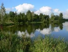
This park is passing, so it is not necessary to return to the entrance to leave the park, you can just drive through it and exit onto Highway 89 leading to Bryce Canyon. On the way we saw a beautiful river

The whole road along highway 89 is very beautiful: around high mountains, rocks, trees. My idiotic smile, which appears when I see something beautiful, again did not leave my face all the way. Zhenya always laughs at her. The road through the park and along the 89 highway just makes you keep the camera in your hands all the time. It's just impossible to resist capturing those amazing views.


Zion Park, of course, is beautiful, but if we compare other canyons, then I would still put Bryce Canyon in the first place (there is a trip report), then the Grand Canyon and only then Zion. But it's still worth going there if you're planning a trip to Bryce or Colorado.