Kola peninsula lip of pechenga linakhamari.
Settlement in the Pechenga district of the Murmansk region, a port in the Pechenga Bay. Since the 1800s, he has been part of Russian Empire. The Grand Duchy of Finland, which separated in 1917, became the independent country of Finland. The first Soviet-Finnish war ended in 1920 with a peace treaty concluded in Tartu. According to this peace treaty between the RSFSR and Finland, the port of Liinakhamari became part of Finland along with the entire Petsamo region. Liinakhamari was the only ocean port in Finland - it had access to the Barents Sea of the Arctic Ocean. During the years of the Soviet-Finnish war of 1941-1944 - the Great Patriotic War, the port of Liinakhamari was one of the most important naval bases of the Kriegsmarine on the coast of the Barents Sea. This base played a huge role in the fight against the Soviet Northern Fleet and the Allied Arctic convoys in the USSR, and was also at the forefront of the defense of German-occupied Norway from the advancing Soviet army. The port and harbor of Liinakhamari was turned into a powerful defensive area in the Petsamovuono fjord. On September 19, 1944, Finland and the USSR signed the Moscow Armistice, which ended the Soviet-Finnish war. According to its terms, Liinakhamari, like the entire Petsamo region, became part of the Murmansk region of the RSFSR. On October 13, 1944, the Soviet amphibious assault captured the port and the village.
In the post-war years, the base of the 42nd submarine brigade, the division of small missile ships (RTOs), the 15th brigade for the protection of the water area (OVR), consisting of patrol ships (SKR) of the 50th project, air surveillance ships ( KVN) and minesweepers of the Northern Fleet. One of the largest torpedo-technical bases of the Northern Fleet was also located. The population living in the territory of the settlement, according to the All-Russian Population Census of 2010, is 475 people. In Liinakhamari there is a port on the coast of the Pechenga Bay (the former base of the Northern Fleet of the Navy). bus service with Murmansk and Nikel. nearest railroad station- Pechenga (15 km).
Gloomy autumn weather set in in Moscow and immediately brought back a lot of nostalgic memories of long journeys. Unfortunately, now there is no way to go on such a journey due to the huge number of projects, so I decided to somehow correct this unfortunate situation and finally write about past adventures on far north.
For the first time on the German peninsula, located near the village of Liinakhamari, I found myself in August 2012, almost by accident. Then I spent about a week on it and explored the area a little. Exactly one year later I returned to mist_bl4
in order to walk along the coast of the Barents Sea in the format of a hiking trip and take a closer look at different interesting places in District.
The village of Liinakhamari is located far beyond the Arctic Circle - on the northern coast of the Kola Peninsula, on the shores of the Pechenga Bay. This is practically the northernmost mainland point of the western part of Russia.
By the time we ended up in Murmansk, we had already spent a lot of time on the Kola Peninsula. Arriving in Murmansk by bus, we immediately rushed to the local border guards, got the necessary papers and boarded another bus to the city of Zapolyarny, which is located in the west of the peninsula, not far from the border with Norway. After several hours of the road, we left, a little before reaching Zapolyarny - at the turn to Pechenga. There we reached the stop and began to wait for the third bus of the day for us to Liinakhamari, from where our walking route began.
It should be noted here that it is simply impossible to get to Liinakhamari. The village is located in the border zone, where you need to get a pass in advance. It was for the sake of the pass that we in Murmansk went to the local border guard department. The process of obtaining a pass is not fast (although something may have changed in recent years) and you need to start it 2-3 months in advance. This is probably why Liinakhamari and its environs are not particularly popular with tourists, unlike, for example, the nearby peninsulas of Sredny and Rybachy, where it is very popular to travel now, not to mention the pop-pop Teriberka on the same Kola Peninsula. Nevertheless, the places there are very beautiful, interesting and wild.
Having waited in Pechenga for a bus to Liinakhamari, which runs three times a day, we loaded into it. The road went past military bases and past beautiful cliffs. We arrived at the checkpoint. A colorful border guard came in. And he went around the cabin, not checking anything, but peering intently into the faces of all the passengers - local residents, in most advanced age. We sat at the very back and clearly stood out, being young, in camping clothes and with large backpacks. When the border guard approached us, we silently handed him passes in the form of A4 paper, he also silently looked at them, returned them and left the bus. And we went further. It wasn't long to go. We got out a few hundred meters to the final bus stop - our road began there. There was also a lake that I wanted to see. A year before, we drove it non-stop at sunset and it looked stunningly beautiful. But this time the weather was gloomy and the lake did not make much of an impression.
Immediately behind the lake you can see several five-story buildings - this is the village of Liinakhamari. In the war and post-war years, it played a very important role, but over time, like hundreds of other towns and cities in the far north, it fell into decay.
Abandoned five-story buildings, abandoned shops, peeling paint - a typical view of many northern towns.
Our bus turned around and got ready to go to Zapolyarny, because there was simply no further road, but we did not particularly walk around the village and almost immediately moved along the road towards the sea. Liinakhamari is located on the shores of the Pechenga Bay and up to high seas several kilometers from it. Through the hills goes the old german road along which you can walk to the sea. I will talk about the road itself a little later.
Here is our six-day autonomous hiking and it began. It is difficult to convey that wonderful exciting feeling when you take your first steps, but it cannot be called otherwise than pleasant and joyful.
We walked just a little more than a kilometer, and began to meet the very first sights. Directly from the road you can see the exploded rock and the darkening passage to the dungeon.
We come closer and see a very old metal partition, which once apparently had an armored door.
Inside, a small rock excavation with traces of boreholes in the end wall is found.
Damp and cold. Remains of wood flooring on the floor.
We get out and go further down the road. Soon the road forks and a side branch goes up to the right. We head along it, make a loop and go up the very rock in which a small tunnel is made. Before us is a view of a large depression in the rock, filled with water. Try to find the person.
Walking around this small lake, sometimes you can see that something round is hiding under the water. We find the most successful angle and yes - huge concrete circles clearly appear under water. I must say that it all looks absolutely fantastic and unrealistic. But it's time for us to move on. We return to the main road and after a couple of hundred meters we again turn onto a branch. Here we see a similar construction, but in a less flooded state (in the background - farms for breeding fish in the Pechenga Bay).
On the net you can find a lot of information about these circles. Many sources claim that this seats for German flying saucers.
And it is affirmed in all seriousness. During the war, the Germans really occupied these places (but Murmansk was never taken). But, of course, stories about flying saucers are complete nonsense. These circles were intended for the installation of powerful artillery pieces, which, being on these hills, could fire at vast territories around, including the Pechenga Bay, which was of paramount military importance.
An example of a gun from another battery. The features of concrete circles are well guessed.
Near each gun were dug service underground tunnels and pillboxes were built.
But the work was not completed. The guns were never delivered. The Germans lost the war. And concrete structures are still in visually very good condition.
This circle is also hidden under a layer of water and sometimes almost invisible.
But, the correct viewing angle and polarizing filter save the situation and we can again see the ominous construction under water.
This site also offers a good view of the Pechenga Bay.
And also to Lake Kantejärvi, which we have to pass by. The lake is also a source of pure fresh water for Liinahamari. In the distance, you can see the pass of the road between the hills, through which we will also go, but today.
We return to the main road and go to the last, fourth, concrete circle.
It is located right next to the road and of all four - in the most completed condition.
Not only the central part was built in it, but also the outer concrete ring, and a rather large area around was concreted.
The size of the building, of course, inspires. Gloomy weather gives some special severity to these places - a cool breeze, icy water, rough concrete, complete desertion and completely unfamiliar nature around. And, most importantly, the feeling of a hike - you move forward in long way and the next few days you will be alone with these rocks, with the weather, with nature. In general, the spirit is breathtaking!
Meanwhile, time was moving towards evening, light rain began and the weather prospects were not very clear, and we were already quite tired, as we got up that day at about five in the morning, and we had to travel about 350 kilometers on the bench. Therefore, it was decided to get up in the parking lot, right here, especially since there was a perfectly flat concrete platform. Set up a tent:
I set off lightly for water to the nearest small lake, a little further down the road. There was nowhere to hurry and it was possible to start enjoying the surrounding nature by getting off the road. Among the thickets, a huge mushroom was immediately discovered.
It’s a pity I’m not a special fan of mushrooms, because we came across them all the following days in huge quantities everywhere. In the same place, on a pebble, surrounded by crowberry, a couple more pretty mushrooms grew:
Later, having moved a little away from the parking lot for natural reasons, I accidentally stumbled upon a concrete pillbox in the thickets.
There are many such pillboxes in those parts. All of them are of approximately standard design.
Inside the pillbox is picturesquely overgrown with moss.
On this, the adventures of the first day of the trip ended for us, and after preparing food and having dinner, we went to bed. They didn’t even try to look at the northern lights - the sky was completely covered with clouds. No less interesting places and adventures awaited us ahead!
The source of the drawings is the book "Hitler's Atlantic Wall", author: Alexander Borisovich Shirokorad
Impregnable Liinakhamari
Glory to the Russian Arctic
Liinakhamari is one of the most amazing and inaccessible places in the Kola Arctic.
About the past and present of the village - in the material of the "Russian Planet". According to the most common version, "Liinakhamari" translated from Finnish means "stone flower". However, the Finns claim that there is no such word in their language. There is "Liina" - "shawl". There is "hama" - skirt, dress, "hamara" - butt or dim.
Liinakhamari is located on the shores of the Pechenga Bay, in Devkina backwater. Since the 11th century, when the Lyuenfjord Bay near Tromsø was considered the border between Russia and Norway, under the agreement of Yaroslav the Wise with the Norwegian king Olaf, and before the revolution, these places were Russian. At the beginning of the 18th century, by decree of Peter the Great, a customs guard was set up in the Liinakhamari area. At the end of the 19th century, barns were built here, which were donated to the nearby Pechenga Monastery by the gold miner A.M. Sibiryakov. On the maps of 1903, a colony is marked in the northern part of Devkina Zavod, and the camp of Koni is marked in the southern part, apparently named after a local resident Vasyunka Konin, mentioned in diplomatic documents on relations between Muscovy and Sweden in 1556-1586.
After the revolution and the first Soviet-Finnish war of 1918-1920, on October 14, 1920, the Tartu Peace Treaty was signed, and Liinakhamari became Finnish. Before the start of the "winter" war, the Finns built roads here, a fish processing plant, a hotel, where, among others, Marshal Mannerheim, Finnish presidents Stolberg, Kallio and Ryti managed to stay. In 1939, the construction of the Liinakhamar port, the only ocean port in Finland, was completed. From Liinakhamari all year round there was free communication with the whole world, the way from here was shorter and cheaper than from the Baltic. Especially for communication with the port, a road was built to Rovaniemi.
German officers in civilian clothes were already frequent guests of Liinakhamari. Among them was Colonel-General Falkenhorst, later commander of the army "Norway", which invaded the territory of the Kola Peninsula on June 29, 1941. During the Soviet-Finnish war of 1939-1940, the Soviet Union occupied the Pechenga region, but returned it to Finland at the end of the war. The Finnish flag was again raised over Liinakhamari, and the Soviet consulate was housed in the hotel building.
Subsequently, the USSR consulate will move to another building, and here on June 22, 1941, one of the biggest failures of Soviet intelligence will happen. The writer and local historian writes about him in his book "Liinakhamari" Mikhail Oreshet: “Having hardly seen how thick gray smoke poured out of the chimney of the building occupied by the Consulate of the USSR, the commander of the Lapland intelligence department of the Suomi front-line intelligence, Captain Paatsalo, gave the command to storm the premises, which violated all conceivable and inconceivable international rights. At this time, the embassy staff hastily burned secret documents. When the front door finally collapsed under the weight of the "hot Finnish guys", a thick cipher book was burning in the firebox with a bright flame. The burglars managed to snatch her out of the fire. For the enemies of the USSR, this was truly a golden find. The Finns and Germans immediately began to decipher the radio messages of the Red Army and the Northern Fleet, which made it possible for them to track the movement of military units and subunits, to obtain information about the location and movement of forces and means of the Northern Fleet. An inconspicuous burnt book claimed the lives of thousands of Soviet soldiers and officers.
10.
During the war years, the Germans turned Liinakhamari into a real fortress. All this was built, as a rule, by the hands of prisoners of war - Russians, Ukrainians, Poles, Czechs, French, Armenians, British. There were several concentration camps around Liinakhamari.
12.
The system of defensive structures was thought out by the best engineers of the Wehrmacht. The batteries at Cape Krestovy and the torpedo tubes at Valkelkivi-Tunturi were intended to control the entrance to the bay. The stronghold "Cap-Romanov" on Cape Romanov made it possible to fire at targets far away on the approach to the bay.
Not all of the planned Germans managed to complete. For example, they did not finish building foundations for future long-range guns that could reach the Sredny and Rybachy peninsulas.
14.
On October 12, 1944, a naval sabotage detachment under the command of Major I.P. Barchenko-Emelyanov and Lieutenant V.N. Leonova attacked two German batteries at Cape Krestovoy and managed to capture them after a short battle. During this operation, 23 people died. They are buried in a mass grave on the very high point Cape Cross. The capture of the batteries gave hope for the landing. On the night of October 13, the North Sea boatmen were able to overcome the "corridor of death" and land troops with marines directly to the Liinakhamari berths. According to the unanimous opinion of historians, it was an exceptional operation in its audacity. By the morning of October 13, Linakhamari was taken.
16.
- It is clear that intelligence worked, we knew how many guns the Germans had, what caliber they were, how many forces they had, who was in command - all this was known. But the Landing operation in Liinakhamari is not mathematics, - says the director of the regional center for civil and patriotic education, writer, local historian Mikhail Oreshta, - this is not some kind of addition-subtraction. This is not a recount of guns and so on and so forth. This is somewhat different. This is the spirit, this is unparalleled loyalty to the Motherland, this cannot be counted, no arithmetic will ever calculate this.
18.
In Soviet times, Liinakhamari was the largest naval base. Water observation ships, missile boats, small missile ships, diesel submarines were on duty here. There was a polyclinic and a hospital, there were several libraries. The local school had a museum with unique documents. A boat station worked on the lake, gazebos with benches stood on the shore.
After 1991, with the collapse of the USSR, Liinakhamari fell into decline.
Text and photo: Galina Sergeeva
"Russian Planet", Murmansk, October 20, 2014
The morning began with the song “Laptev Sea” coming from the radio. Despite the cloudy weather outside the window, the mood immediately rose, and we went to get ready. We quickly washed up, left things, and went to rent a room. Nick and Yulia were already waiting for us in the lobby. After a couple of minutes, Vanya and Sasha also pulled up. Everyone really wanted to have breakfast, and in search of a cafe we went to travel around the city. At an early hour all cafes were closed, so we returned to the hotel. There is a small supermarket nearby, where we decided to pass the time before the opening of the cafe, and at the same time buy the missing products. After that, we walked to the cafe and had a normal breakfast of scrambled eggs with bacon and fresh coffee, after which we jumped on the cars and rushed to one of the main points of our trip, the town of Liinakhamari and its environs.
Kolsky 2013. Liinakhamari.
Before leaving, Gena scolded Gosha a little for bad behavior, well, for the purpose of prevention.
And now we are already passing Pechenga and heading towards Liinakhamari. A checkpoint of border guards appears on the horizon. Since we are entering the border zone, we present the passes we received earlier in Murmansk. A small registration procedure and we open the barrier.
There is almost zero traffic here. In splendid isolation we go towards the town. The road is a little worse, but in general, very even nothing.
The first thing we saw when approaching the city was the nose of a torpedo boat sticking out of the rock. Don't be surprised, it's not a glitch, it's commemorative sign sailors of the OVR (military unit 10678).


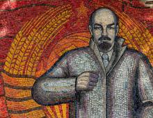
We go further, here is the sign "Liinakhamari". The town makes a depressing impression. Empty houses are adjacent to still residential ones, but basically almost everything is abandoned. On the hill to the right, Father Lenin is watching us with a keen eye. Apparently the paint used to be of high quality, still like new.

We pass the remains of the tank gates, the headquarters of the border guards and turn right onto a narrow path leading along the bay. Almost immediately we run into the gate and the checkpoint. Previously, there was a submarine base here, and now it is private property owned by a fishing collective farm. By the way, there is a ship-hotel where you can stay for the night. Divers often like to stop there. On the same, in addition to all this, the monument to the heroes-submariners, located on the territory of the port, is of interest.


When we parked in the parking lot near the gate, a security guard came out to us. This is an old man who has been living here for a long time. We talked with him for a long time on various topics, he told us a lot of interesting things. It is for the sake of such moments of communication that we travel the world. Not a single Internet or media will tell you as much interesting things as he told us. Then he allowed us to enter the territory and take a walk, which we did.

Buildings on the territory are being restored, they say that a hotel will be built there soon. We took a walk and looked at what we wanted, went back to the cars. From there, by the way, you can see the old fuel tanks located on the other side of the bay. They were used during the war to refuel ships.


On the left is another statue. The bird perched on its head blended very organically into the composition. A coast guard boat was lurking on a nearby pier. We drove a little further and saw another ship being repaired. At low tide, it stands on the shore and the sailor puts it in order and paints it.


We didn’t go any further, there is the territory of the Russian Salmon enterprise. If you look at the bay, you can easily see salmon nets in the water. By the way, Liinakhamarsky salmon is considered one of the best.
Well, now we need to go back a little, to the headquarters of the border guards. Unfortunately, according to the story of the guard at the checkpoint, the museum that used to be in Liinakhamari burned down, and part of the surviving exposition is now located on the territory of the headquarters.
Before entering the territory, we ask permission from the border guard, who stood at the open window on the second floor and thoughtfully smoked a cigarette. After that, they went in and examined everything in detail. There are basically many different types of mines and a cannon, there is also a border sign.


We drove through the abandoned area of the town to its outskirts, then the road lay on the hills, and we need to go there.


Then we went to look at the rings of batteries unfinished by the Germans. There are four of them, all of them in different stages of construction and all flooded. There are many different theories about this, as well as about their purpose, but if you are interested, read about this on the net. On the way we met a small room in the rock, apparently it was used as a warehouse.


And here they are.


And here you can see nets in which salmon are bred.


In the meantime, we are again heading towards the sea. The road is narrow, it will not be easy to pass in case of an oncoming lane, there are a lot of stones.

And here is the same, known in narrow circles, slide, which is called the "devil's descent". It looks like a rather steep rocky staircase. The slope is pretty strong. The descent took some time, but under the strict guidance of my navigator Gena, everything went smoothly and without problems. Then the rest of the guys came down.


Everyone follow me, I know the shortcut :)

A beautiful bay opened before us, where we decided to make our camp. Slowly the tide began to rise, but we managed to walk along the beach.


Having estimated our time a bit, we decided to go to the German Peninsula today. There is no road there, there is only a small path somewhere, but we did not look for it, and it’s not a fact that we would have found it. We just went along the coast along the rocks. The walk to the island took about two hours, you can’t go quickly over the rocks. The views are simply gorgeous, we spent a lot of time taking pictures. Around on the rocks full of remains sea urchins and small crabs, apparently the birds dump them, and then eat them.


And so we got to the main target on the German Peninsula, a double-barreled German gun. Below it are 4 floors of various rooms. The structure is very capital and makes a serious impression. Nearby are the remains of sawn-off trunks and armor, the thickness is incredible.


You can see the Rybachy Peninsula from here. By the way, strong thunderclouds were approaching from there in our direction, so we decided to move back as soon as possible.
The seals are tired.

It took us a little less time to get back, because we went the other way. Upon returning, the track on the navigator turned out to be the same as in the photo, a “run” of about 6 km along the rocks.

Well, now you can safely proceed to the arrangement of the camp and cooking. At that moment, they noticed headlights on the mountain, where the beginning of the "ladder" was. A few minutes later, a Range Rover arrived. It turned out to be men from St. Petersburg, they came to Liinakhamari to dive. But I was struck by the fact that there were 7 or 8 of them in this Range Rover, I don’t know how they got in. We chatted a bit, took 100 grams on the back of the Range, took a swim and left. This is such a fun meeting. Well, we had dinner, sat by the fire for various conversations and retired to sleep.
The morning was sunny and cool. I got up before everyone else and was already making coffee when the others started to wake up. Then everything is as always, breakfast, fees and go. It was a bit sad to leave this unusual and cozy place. The road to yesterday's hill was already easy and after a while we drove to Liinakhamari and slowed down at the exit of the city to pump up the wheels.
Pechenga district located in the western part of the Murmansk region. It is the northernmost and most western section Murmansk region. Washed from the north Barents Sea, in the west, the territory of the district adjoins the Norwegian border, established back in 1826. The Russian-Finnish border runs along the southern and southwestern parts of the region. The entire northern part of the district is separated from the neighboring Kola district in the east by the river Titovka, and the northern border - Barents Sea. The district includes: one city of district subordination ( Zapolyarny), 3 urban-type settlements (Nikel, Pechenga and Prirechny) and 16 rural settlements. The administrative center is an urban-type settlement Nickel.
The area of the district is 8700 sq. km. The population of the district is 38920 people.
In 1945, on the territory of Pechenga, a Pechenga district centered in the village Nickel, which became part of the Murmansk region.
Story Pechengi, being part of the domestic Russian history, is inextricably linked to it. Pechenga has long and firmly entered the history of the Kola North, being an outpost on its extreme northwestern borders. Eventful, both local and international history Pechengi recorded in many documents that have come down to our time, research materials, photographic materials, eyewitness accounts, memoirs of participants in the events of different years.
Near Pechengi the Saami lived.
In Russia Pechenga became known after in 1532-1533, with the blessing of Archbishop Macarius of Novgorod, the Monk Tryphon of Pechenga built Orthodox church and founded a monastery on the Pechenga River in the name of the Holy Trinity, for the conversion of local residents to the Orthodox faith. Half a century later, in 1589, the Swedes destroyed the monastery. Then, by decree of Tsar Fyodor Ioannovich, the monastery was moved across the Kola River "against the prison on the island." And on the site of the destroyed monastery, they built a church named after the Monk Tryphon, "the country of the northern enlightener, the Pechenga miracle worker", and over the grave of the saint - Church of the Presentation of the Lord. In 1764 the monastery was closed, in 1885 it was restored "to counter the propaganda of Catholics, Lutherans and schismatics and to spread Orthodoxy among the Lapps."
In the Russian Empire Pechenga was first part of the Arkhangelsk province, and later - the Arkhangelsk Territory (province).
During the First World War, the nearby port of Liinakhamari was of great importance for the economy of the Principality of Finland and Russia due to the German threat in the Baltic Sea.
In the 60s of the XIX century, the development of the region began, but only with the construction of the Murmansk railway intensive settlement of the region became possible.
In 1920 the territory Pechengi ceded to Finland under a peace treaty with the Soviet state.
In the 1920s in the territory Pechenga region nickel ore deposits were found, as a result of which the area becomes a strategically important place, whose wealth is sought to be used by several countries: Finland, the USA and Canada, Germany, the USSR.
According to the Tartu Treaty signed in 1920, which ended the first Soviet-Finnish war (1918-1920), the area around Pechengi handed over to Finland. In 1921, nickel deposits were found in the region, in 1934 they were estimated at five million tons. In 1935, nickel mining by French and Canadian companies began.
In 1931 the construction of the road between Pechenga and the city of Sodankylä, started in 1916. This attracted the area Pechengi tourists, as there was the only Finnish port at that time on Barents Sea which could be reached by car.
During the Soviet-Finnish war of 1939-1940, the USSR occupied the area Pechengi, however, at the end of the war, he returned it back to Finland, with the exception of the western part of the Rybachy Peninsula.
Since 1941, Pechenga used by German troops and their Finnish allies to attack Murmansk. Here you can see numerous traces of the past war. Approximately halfway from Murmansk to Zapolyarny, on the banks of the river Western Face- several obelisks. This is the "Valley of Glory" - the place where the front from 1941 to 1944 stood motionless, although there were fierce battles all the time, and the losses on both sides were huge. The Germans tried unsuccessfully to break through to Murmansk, the only ice-free port in the North. In the autumn of 1944, Soviet troops managed to break through the front.
Now in the region, most of the population lives in two cities: Nikel and Zapolyarny. The basis of economic life is formed by the Pechenganickel plant, which mines and enriches ore, from which nickel, copper and rare earth metals such as platinum are subsequently obtained.
Territories of urban settlements Zapolyarny, Nickel(excluding Prirechny), Pechenga, the rural settlement of Korzunovo, are included in the border zone. Entry is carried out on individual or collective passes issued by the Border Directorate of the FSB of Russia in the Murmansk Region, with identification documents. The basis for the entry of tourists from among the citizens Russian Federation can serve as travel vouchers.
In the border zone, tourists are required to stay in the places specified in the agreement on the sale of the tourist product, follow the routes agreed with the Border Directorate of the Federal Security Service of Russia by the organization providing tourist services in the border zone.
The climate of the region as a whole is strongly influenced by the warm North Atlantic Current (Gulf Stream), and is also characterized by strong variability. The Pechenga region has the longest polar night and polar day in the Murmansk region. average temperature in winter -17°, in summer +14°.
The landscape of the area is made of stone hills with a rare, low forest and numerous reservoirs.
Main rivers of the region Titovka and Pechenga. Village Pechenga located on the left bank of the river mouth Pechenga. The river flows out of Lake Pieds-Yaur and flows into the Pechenga Bay Barents Sea. The main tributaries of the river: anssem yoki(11 km), sius yoki(7 km), luotti yoki(10 km), Malaya Pechenga(28 km), Nama yoki(41 km). Upstream the river Pechenga flows through several lake-like extensions and flowing lakes, having a length of up to 3 km and a width of up to 150-400 m. The largest lake is Kallo-yaur. Near Pechengi- non-freezing port of Liinakhamari, Nemetskaya and Dolgaya Shchel bays. This place has been known since the beginning of the 16th century.
The following types of fish are found in the rivers of the region: Atlantic salmon (salmon), lamprey, brown trout, brook trout, whitefish, pike, minnow, burbot, 3-spined stickleback, 9-spined stickleback, perch. River Pechenga- salmon reservoir.
On the coast there are amazing places for parking in the warm months of the year, hunting and geological lodges have been built. Rivers Pechenga and Titovka open for licensed salmon fishing (during the summer period June-August).
The north of Russia washes Arctic Ocean- the coastline stretches for thousands of kilometers, and if you swim along it from east to west, then the last hundred westernmost kilometers - the coast Pechengi. This is Kola Peninsula warmed by the warm waters of the Gulf Stream. If you land on a rocky shore covered with lichens and start moving deep into the mainland to the south, then the lichens will be replaced by a birch crooked forest interspersed with low pines, further - the pines will get higher and higher, and in the end, displacing the lichen with crooked forests to the tops of the mountains, merge into an endless forest punctuated by countless lakes. This is Lapland. Somewhere here, lost in the forests, lies the southern border Pechenga region.
The main highway connecting the village Nickel with others settlements Russia - passes 10 km from the center of the village. Buses with routes are used for suburban traffic. Nickel- Murmansk and Nickel- Polar.
The village has a railway station, which is the starting and ending station of the section of the Oktyabrskaya railway Kola - Nickel. Train is used for suburban traffic Nickel- Murmansk,