What is the Caspian Sea like? Resources of the Caspian Sea
The Caspian Sea is the most big lake On the Earth. It is called the sea because of its size and bed, which is folded like an ocean basin. The area is 371,000 square meters, the depth is 1025 m. The list of rivers flowing into the Caspian Sea includes 130 names. The largest of them are: Volga, Terek, Samur, Sulak, Ural and others.
Caspian Sea
It took 10 million years before the Caspian was formed. The reason for its formation is that the Sarmatian Sea, which lost its connection with the World Ocean, was divided into two reservoirs, which were called the Black and Caspian Seas. Between the latter and the World Ocean stretch thousands of kilometers of waterless path. It is located at the junction of two continents - Asia and Europe. Its length in the north-south direction is 1200 km, west-east - 195-435 km. The Caspian Sea is an internal drainless basin of Eurasia.
Near the Caspian Sea, the water level is below the level of the World Ocean, and besides, it is subject to fluctuations. According to scientists, this is due to many factors: anthropogenic, geological, climatic. At present, the average water level reaches 28 m.
The network of rivers and sewage is unevenly distributed along the coast. Few rivers flow into the part of the sea from the north side: Volga, Terek, Ural. From the west - Samur, Sulak, Kura. The east coast is characterized by the absence of permanent watercourses. Differences in space in the flow of water that rivers bring to the Caspian Sea is an important geographical feature of this reservoir.
Volga
This river is one of the largest in Europe. In Russia, it ranks sixth in size. Regarding the catchment area, it is second only to the Siberian rivers flowing into the Caspian Sea, such as the Ob, Lena, Yenisei, Irtysh. For the source, from where the Volga originates, the key is taken near the village of Volgoverkhovye, Tver Region, on the Valdai Upland. Now there is a chapel at the source, which attracts the attention of tourists, for whom it is a pride to step over the very beginning of the mighty Volga.

A small fast stream gradually gains strength and becomes a huge river. Its length is 3690 km. The source is 225 m above sea level. Among the rivers flowing into the Caspian Sea, the largest is the Volga. Her path runs through many regions of our country: Tver, Moscow, Nizhny Novgorod, Volgograd and others. The territories through which it flows are Tatarstan, Chuvashia, Kalmykia and Mari El. The Volga is the location of millionaire cities - Nizhny Novgorod, Samara, Kazan, Volgograd.
Volga Delta
The main riverbed is divided into channels. A certain shape of the mouth is formed. It's called the delta. Its beginning is the place of separation of the Buzan branch from the bed of the Volga river. The delta is located 46 km north of the city of Astrakhan. It includes channels, branches, small rivers. There are several main branches, but only Akhtuba is navigable. Among all the rivers of Europe, the Volga is distinguished by the largest delta, which is a rich fish region in this basin.
It lies lower than the ocean level, at 28 m. The mouth of the Volga is the location of the southernmost Volga city of Astrakhan, which in the distant past was the capital of the Tatar Khanate. Later, at the beginning of the 18th century (1717), Peter 1 gave the city the status of "the capital of the province of Astrakhan." During his reign, the main attraction of the city, the Assumption Cathedral, was built. Its Kremlin is made of white stone, brought from the capital of the Golden Horde, the city of Saray. The mouth is divided by branches, the largest of which are: Bolda, Bakhtemir, Buzan. Astrakhan is southern city located on 11 islands. Today it is a city of shipbuilders, sailors and fishermen.

Currently, the Volga needs protection. For this purpose, a reserve has been established at the place where the river flows into the sea. The delta of the Volga, the largest river flowing into the Caspian Sea, abounds in unique flora and fauna: sturgeon, lotuses, pelicans, flamingos and others. Immediately after the revolution of 1917, a law was passed on their protection by the state as part of the Astrakhan Reserve.
Sulak River
It is located in Dagestan, flows through its territory. It feeds on the waters of melted snows that flow down from the mountains, as well as tributaries: Small Sulak, Chvakhun-bak, Akh-su. Water also enters Sulak through a canal from the Aksai and Aktash rivers.
The source is formed by the confluence of two rivers that originate in the basins: Didoyskaya and Tushinskaya. The length of the Sulak River is 144 km. Its pool has a fairly large area - 15,200 square meters. It flows through the canyon with the same name as the river, then through the Akhetlinsky gorge and finally comes to the plane. Going around the Agrakhan Bay from the south side, Sulak flows into the sea.

The river provides drinking water for Kaspiysk and Makhachkala, and is home to hydroelectric power stations, the urban-type settlements of Sulak and Dubki, and the small town of Kizilyurt.
Samur
The river got its name not by chance. The name translated from the Caucasian language (one of them) means "middle". Indeed, the border between the states of Russia and Azerbaijan is marked along the waterway along the Samur River.
The sources of the river are glaciers and springs, originating in the spurs of the Caucasus Range from the northeast side, not far from the Guton mountain. The height above sea level is 3200 m. Samur has a length of 213 km. The height in the upper reaches and the mouth differs by three kilometers. The catchment basin has an area of almost five thousand square meters.
The places where the river flows are narrow gorges located between mountains of great height, composed of shales and sandstones, which is why the water here is muddy. The Samur basin has 65 rivers. Their length reaches 10 km or more.

Samur: the valley and its description
The valley of this river in Dagestan is the most densely populated region. Derbent is located near the mouth - ancient city peace. The banks of the Samur River are home to twenty or more species of relict representatives of the flora. Endemic, endangered and rare species listed in the Red Book grow here.
In the river delta, a relict forest is comfortably located, which is the only one in Russia. Liana forest is a fairy tale. Huge trees of the rarest and most common species grow here, intertwined with lianas. The river is rich in valuable species of fish: mullet, pike perch, pike, catfish and others.
Terek
The river got its name from the Karachay-Balkar peoples who lived along its banks. They called it "Terk Suu", which means "rushing water" in translation. Ingush and Chechens called it Lomeki - "mountain water".
The beginning of the river is the territory of Georgia, the Zigla-Khokh glacier is a mountain located on a slope Caucasian ridge. It is under glaciers all year round. One of them melts when sliding down. A small stream is formed, which is the source of the Terek. It is located at an altitude of 2713 m above sea level. The length of the river flowing into the Caspian Sea is 600 km. At the confluence with the Caspian, the Terek is divided into many branches, as a result of which a vast delta is formed, its area is 4000 square meters. In some places it is very swampy.
The course in this place has changed several times. The old arms have now been turned into canals. The middle of the last century (1957) was marked by the construction of the Kargaly hydroelectric complex. It is used to supply water to the channels.

How is the Terek replenished?
The river has a mixed supply, but for the upper reaches, water from the melting of glaciers plays an important role, they fill the river. In this regard, 70% of the runoff occurs in spring and summer, that is, at this time the water level in the Terek is the highest, and the lowest - in February. The river freezes if the winters are characterized by a harsh climate, but the freeze-up is unstable.
The river is not distinguished by cleanliness and transparency. The turbidity of the water is large: 400-500 g/m 3 . Every year, the Terek and its tributaries pollute the Caspian Sea, pouring into it from 9 to 26 million tons of various suspensions. This is due to the rocks of which the shores are composed, and they are clayey.
Terek mouth
The Sunzha is the largest tributary flowing into the Terek, the lower reaches of which are measured precisely from this river. By this time, the Terek flows for a long time over the flat terrain, leaving the mountains located behind the Elkhot Gates. The bottom here is composed of sand and pebbles, the current slows down, and in some places stops altogether.
The mouth of the Terek River has an unusual appearance: the channel here is elevated above the valley, along appearance resembles a canal, which is fenced with an embankment of great height. The water level rises above the land level. This phenomenon is due to a natural cause. Since the Terek is a turbulent river, it brings sand and stones in large quantities from the Caucasus Range. Given that the current in the lower reaches is weak, some of them settle here and do not reach the sea. For the inhabitants of the area, sediments are both a threat and a boon. When they are washed away by water, floods of great destructive power occur, this is very bad. But in the absence of floods, the soils become fertile.
Ural River
In antiquity (before the second half of XVIII century) the river was called Yaik. It was renamed into the Russian style by the decree of Catherine II in 1775. Just at this time, the Peasant War was suppressed, the leader of which was Pugachev. The name is still preserved in the Bashkir language, and in Kazakhstan it is official. The Urals are the third longest in Europe, only the Volga and the Danube are larger than this river.

The Ural originates in Russia, on the slope of the Kruglyaya Sopka of the Uraltau Ridge. The source is a spring gushing out of the ground at an altitude of 637 m above sea level. At the beginning of its journey, the river flows in a north-south direction, but after meeting a plateau on the way, it makes a sharp turn and continues to flow in a north-westerly direction. However, beyond Orenburg, its direction again changes to the southwestern, which is considered the main one. Having overcome the winding path, the Ural flows into the Caspian Sea. The length of the river is 2428 km. The mouth is divided into branches and tends to shallow.
The Ural is a river along which the natural water boundary between Europe and Asia passes, with the exception of the upper reaches. This is an internal European river, but its upper reaches to the east of the Ural Range are the territory of Asia.
Importance of the Caspian rivers
The rivers flowing into the Caspian Sea are of great importance. Their waters are used for human and animal consumption, domestic needs, agricultural and industrial needs. Hydroelectric power plants are being built on the rivers, the energy of which is in demand by man for various purposes. river basins full of fish, algae, shellfish. Even in ancient times, people chose river valleys for future settlements. And now cities and towns are being built on their banks. Rivers plow passenger and transport ships, performing important tasks for the transport of passengers and goods.
The Caspian Sea is simultaneously located on the territory of 5 countries, including not only Russia and Kazakhstan, but also Turkmenistan, Iran and Azerbaijan. This is the world's largest closed reservoir, which has long been characteristic and known to everyone as the sea. But the question is, why is the Caspian Sea called the sea, because in reality it is a lake? And in this situation, we will understand today.
Why is the Caspian Sea called a sea
Despite the fact that this body of water is a lake, it is often called the sea. A significant part of people do not even know that this is a lake. This can be explained very simply, because even at one glance at this reservoir, depicted on the maps, its scale, which is mainly characteristic of the seas, catches the eye. A lake that washes the borders of five countries at once is something unthinkable.
Yes, this is something unthinkable, but it is true, because this is the largest, largest drainless lake in the whole world. And its dimensions are a brief and first reason why it is often called the sea. Moreover, in favor of this lake can be called a sea, the facts also play that there are a little more than 50 islands on its territory. It is noteworthy that some of them are not just medium-sized, but truly large in size, the area of which, imagine, reaches 350 square kilometers.
Why is the Caspian Sea called a lake?
As for the true name of this reservoir, it refers to lakes for a number of reasons. You can present them in short list below:
- The bed of the lake is set out by the earth's crust, which has an oceanic type;
- Despite its size and similarity to full-fledged seas, the lake has almost fresh, slightly salty water;
- Almost any sea is part of the oceans, and Caspian lake, due to its geographical location, has no access to the open ocean.
It is also noteworthy that the status of a lake near the Caspian Sea is also confirmed by the fact that its waters are not covered by the UN international regime, and the water area of the lake is divided between the states adjacent to it in a different way than in the case of the seas.
Interestingly, the Caspian Lake is often called not only the Caspian Sea, but also the Caspian. And now, after reading the text of this article, you will surely know that, despite its similarity to the sea, the presence of many properties and characteristics inherent only to the seas, the Caspian is still a lake, and this is a fact.
Caspian Sea is inland and located in a vast continental depression on the border of Europe and Asia. The Caspian Sea has no connection with the ocean, which formally allows it to be called a lake, but it has all the features of the sea, since it had connections with the ocean in past geological epochs.
Today Russia has access only to the Northern Caspian and the Dagestan part west coast Middle Caspian. The waters of the Caspian Sea wash the shores of such countries as Azerbaijan, Iran, Turkmenistan, Kazakhstan.
The area of the sea is 386.4 thousand km2, the volume of water is 78 thousand m3.
The Caspian Sea has a vast drainage basin, with an area of about 3.5 million km2. The nature of landscapes, climatic conditions and types of rivers are different. Despite the vastness of the drainage basin, only 62.6% of its area falls on waste areas; about 26.1% - for drainless. The area of the Caspian Sea itself is 11.3%. 130 rivers flow into it, but almost all of them are located in the north and west (and east coast does not have a single river reaching the sea). The largest river in the Caspian basin is the Volga, which provides 78% of the river waters entering the sea (it should be noted that more than 25% of the Russian economy is located in the basin of this river, and this undoubtedly determines many hydrochemical and other features of the waters of the Caspian Sea), as well as rivers Kura, Zhaiyk (Ural), Terek, Sulak, Samur.
In physical and geographical terms and according to the nature of the underwater relief, the sea is divided into three parts: northern, middle and southern. The conditional boundary between the northern and middle parts runs along the line Chechen Island–Tyub-Karagan Cape, between the middle and southern parts - along the line Zhiloy Island–Cape Kuuli.
The shelf of the Caspian Sea, on average, is limited to depths of about 100 m. The continental slope, which begins below the edge of the shelf, ends in the middle part at about 500–600 m, in the southern part, where it is very steep, at 700–750 m.
The northern part of the sea is shallow, its average depth is 5–6 m, the maximum depths of 15–20 m are located on the border with the middle part of the sea. The bottom relief is complicated by the presence of banks, islands, furrows.
The middle part of the sea is a separate basin, the region of maximum depths of which - the Derbent depression - is shifted to the western coast. The average depth of this part of the sea is 190 m, the greatest is 788 m.
The southern part of the sea is separated from the middle part by the Apsheron threshold, which is a continuation of the Greater Caucasus. Depths above this underwater ridge do not exceed 180 m. The deepest part of the South Caspian basin with a maximum sea depth of 1025 m is located east of the Kura delta. Several underwater ridges up to 500 m high rise above the bottom of the basin.
coast The Caspian Sea are diverse. In the northern part of the sea, they are quite strongly indented. Here are the bays of Kizlyar, Agrakhan, Mangyshlak and many shallow bays. Notable peninsulas: Agrakhansky, Buzachi, Tyub-Karagan, Mangyshlak. Large islands in the northern part of the sea are Tyuleniy, Kulaly. In the deltas of the Volga and Ural rivers, the coastline is complicated by many islets and channels, which often change their position. Many small islands and banks are located on other parts of the coastline.
The middle part of the sea has a relatively flat coastline. On the western coast, on the border with the southern part of the sea, the Apsheron Peninsula is located. To the east of it, the islands and banks of the Apsheron archipelago stand out, of which the most large island Residential. The eastern shore of the Middle Caspian is more indented, the Kazakh Bay stands out here with the Kenderli Bay and several capes. The largest bay of this coast is Kara-Bogaz-Gol.
South of the Absheron Peninsula are the islands of the Baku archipelago. The origin of these islands, as well as some of the jars east coast the southern part of the sea is associated with the activity of underwater mud volcanoes lying at the bottom of the sea. On the eastern shore are the large bays of Turkmenbashi and Turkmensky, and near it is the island of Ogurchinsky.
One of the most striking phenomena of the Caspian Sea is the periodic variability of its level. In historical times, the Caspian Sea had a lower level than the World Ocean. Fluctuations in the level of the Caspian Sea are so great that for more than a century they have attracted the attention of not only scientists. Its peculiarity is that in the memory of mankind its level has always been below the level of the World Ocean. Since the beginning of instrumental observations (since 1830) of the sea level, the amplitude of its fluctuations has been almost 4 m, from -25.3 m in the eighties of the XIX century. to -29 m in 1977. In the last century, the level of the Caspian Sea has changed significantly twice. In 1929 it stood at a mark of about -26 m, and since it had been close to this mark for almost a century, this position of the level was considered as a long-term or secular average. In 1930, the level began to decline rapidly. Already by 1941, it had dropped by almost 2 m. This led to the drying up of vast coastal areas of the bottom. The decrease in the level, with its small fluctuations (short-term insignificant rises in the level in 1946-1948 and 1956-1958), continued until 1977 and reached -29.02 m, i.e., the level took the lowest position for last 200 years.
In 1978, contrary to all forecasts, the sea level began to rise. As of 1994, the level of the Caspian Sea was at -26.5 m, that is, in 16 years the level has risen by more than 2 m. The rate of this rise is 15 cm per year. The level increment in some years was higher, and in 1991 it reached 39 cm.
The general fluctuations in the level of the Caspian Sea are superimposed by its seasonal changes, the average long-term of which reaches 40 cm, as well as surge phenomena. The latter are especially pronounced in the Northern Caspian. The northwestern coast is characterized by large surges created by the prevailing, especially in the cold season, storms of eastern and southeastern directions. Over the past decades, a number of large (more than 1.5–3 m) surges have been observed here. A particularly large surge with catastrophic consequences was noted in 1952. Fluctuations in the level of the Caspian Sea cause great damage to the states surrounding its water area.
.gif) |
Climate. The Caspian Sea is located in the temperate and subtropical climatic zones. Climatic conditions change in the meridional direction, since the sea stretches for almost 1200 km from north to south.
In the Caspian region, various systems of atmospheric circulation interact, however, during the year, easterly winds prevail (the influence of the Asian maximum). The position at rather low latitudes provides a positive balance of heat inflow, so the Caspian Sea serves as a source of heat and moisture for passing air masses for most of the year. Medium annual temperature air in the northern part of the sea - 8–10°С, in the middle - 11–14°С, in the southern part - 15–17°С. However, in the most northern regions sea, the average January temperature is from –7 to –10°С, and the minimum during the intrusions of the Arctic air is up to –30°С, which determines the formation of the ice cover. In summer, rather high temperatures dominate over the entire region under consideration - 24–26°C. Thus, the Northern Caspian is subject to the most sharp temperature fluctuations.
The Caspian Sea is characterized by a very small amount of precipitation per year - only 180 mm, and most of it falls on the cold season of the year (from October to March). However, the Northern Caspian differs in this respect from the rest of the basin: here the average annual precipitation is less (only 137 mm for the western part), and the distribution over the seasons is more even (10–18 mm per month). In general, we can talk about proximity climatic conditions to the arid ones.
Water temperature. Distinctive features The Caspian Sea (large differences in depths in different parts of the sea, the nature of the bottom topography, isolation) have a certain influence on the formation of temperature conditions. In the shallow North Caspian, the entire water column can be considered as homogeneous (the same applies to shallow bays located in other parts of the sea). In the Middle and South Caspian, surface and deep masses separated by a transitional layer can be distinguished. In the Northern Caspian and in the surface layers of the Middle and Southern Caspian, the water temperature varies over a wide range. In winter, temperatures vary from north to south from less than 2 to 10°С, the water temperature near the western coast is 1–2°С higher than near the eastern one, in the open sea the temperature is higher than near the coasts: by 2–3°С in the middle part and by 3–4°С in the southern part of the sea. In winter, the temperature distribution is more uniform with depth, which is facilitated by the winter vertical circulation. During moderate and severe winters in the northern part of the sea and shallow bays on the east coast, the water temperature drops to freezing.
In summer, the temperature varies in space from 20 to 28°C. The highest temperatures are observed in the southern part of the sea; temperatures are also quite high in the well-warmed shallow North Caspian. The zone of distribution of the lowest temperatures is adjacent to the east coast. This is due to the rise of cold deep waters to the surface. Temperatures are also relatively low in the poorly heated deep-water central part. AT open areas sea in late May–early June, the formation of a temperature jump layer begins, which is most clearly expressed in August. Most often, it is located between the horizons of 20 and 30 m in the middle part of the sea and 30 and 40 m in the southern part. In the middle part of the sea, due to the surge near the eastern coast, the shock layer rises close to the surface. In the bottom layers of the sea, the temperature during the year is about 4.5°C in the middle part and 5.8–5.9°C in the south.
Salinity. Salinity values are determined by such factors as river runoff, water dynamics, including mainly wind and gradient currents, the resulting water exchange between the western and eastern parts of the Northern Caspian and between the Northern and Middle Caspian, the bottom topography, which determines the location of waters with different salinity, mainly along the isobaths, evaporation providing a deficit fresh water and the influx of more salty. These factors collectively affect the seasonal differences in salinity.
The Northern Caspian can be considered as a reservoir of constant mixing of river and Caspian waters. The most active mixing occurs in the western part, where both river and Central Caspian waters directly enter. In this case, horizontal salinity gradients can reach 1‰ per 1 km.
The eastern part of the Northern Caspian is characterized by a more uniform salinity field, since most of the river and sea (Middle Caspian) waters enter this area of the sea in a transformed form.
According to the values of horizontal salinity gradients, in the western part of the Northern Caspian, a river-sea contact zone can be distinguished with water salinity from 2 to 10‰, in the eastern part from 2 to 6‰.
Significant vertical salinity gradients in the Northern Caspian are formed as a result of the interaction of river and sea waters, the runoff plays a decisive role in this case. The intensification of vertical stratification is also facilitated by the unequal thermal state of the water layers, since the temperature of the surface desalinated waters coming from the coast in summer is 10–15°C higher than that of the bottom ones.
AT deep sea trenches In the Middle and South Caspian, salinity fluctuations in the upper layer are 1–1.5‰. The largest difference between the maximum and minimum salinity was noted in the area of the Apsheron threshold, where it is 1.6‰ in the surface layer and 2.1‰ at the 5 m horizon.
The decrease in salinity along West Bank The southern Caspian in the 0–20 m layer is caused by the runoff of the Kura River. The influence of the Kura runoff decreases with depth; at the horizons of 40–70 m, the range of salinity fluctuations is no more than 1.1‰. Along the entire western coast to the Absheron Peninsula stretches a strip of desalinated water with a salinity of 10–12.5‰ coming from the Northern Caspian.
In addition, in the South Caspian, an increase in salinity occurs due to the removal of saline water from the bays and bays on the eastern shelf under the action of southeasterly winds. In the future, these waters are transferred to the Middle Caspian.
In the deep layers of the Middle and South Caspian, salinity is about 13‰. In the central part of the Middle Caspian, such salinity is observed at horizons below 100 m, and in the deep part of the South Caspian, the upper boundary of waters with increased salinity drops to 250 m. Obviously, vertical mixing of waters is difficult in these parts of the sea.
Surface water circulation. Currents in the sea are mainly wind-driven. In the western part of the Northern Caspian, currents of the western and eastern quarters are most often observed, in the eastern - southwestern and southern. The currents caused by the runoff of the Volga and Ural rivers can be traced only within the estuarine coast. The prevailing current velocities are 10–15 cm/s; in the open areas of the Northern Caspian, the maximum velocities are about 30 cm/s.
In the coastal regions of the middle and southern parts of the sea, currents of the northwestern, northern, southeastern, and southern directions are observed in accordance with the wind directions; eastward currents often occur near the eastern coast. Along the western coast of the middle part of the sea, the most stable currents are southeast and south. Current velocities are on average about 20–40 cm/s, the maximum ones reach 50–80 cm/s. Other types of currents also play a significant role in the circulation of sea waters: gradient, seiche, inertial ones.
Ice formation. The Northern Caspian is covered with ice annually in November, the area of the freezing part of the water area depends on the severity of the winter: in severe winters, the entire Northern Caspian is covered with ice, in soft ice it stays within the 2–3 meter isobath. The appearance of ice in the middle and southern parts of the sea falls on December-January. Near the eastern coast, ice is of local origin, near the western coast - most often brought from the northern part of the sea. In severe winters, shallow bays freeze off the eastern coast of the middle part of the sea, coastlines and landfast ice form off the coast, and drifting ice spreads to the Absheron Peninsula in abnormally cold winters off the western coast. The disappearance of the ice cover is observed in the second half of February–March.
|
Oxygen content. The spatial distribution of dissolved oxygen in the Caspian Sea has a number of regularities. The central part of the Northern Caspian is characterized by a fairly uniform distribution of oxygen. An increased oxygen content is found in the pre-estuary coastal areas of the Volga River, and a lower one is found in the southwestern part of the Northern Caspian. In the Middle and South Caspian, the highest oxygen concentrations are confined to coastal shallow areas and pre-estuary seashores of rivers, with the exception of the most polluted areas of the sea (Baku Bay, Sumgait region, etc.). In summer, due to the significant warming up of water masses and the activation of photosynthesis processes, the leading factors in the formation of the oxygen regime in surface waters are photosynthetic processes, in near-bottom waters - biochemical oxygen consumption by bottom sediments. Due to the high temperature of the waters, the stratification of the water column, the large influx of organic matter and its intense oxidation, oxygen is quickly consumed with its minimal entry into the lower layers of the sea, resulting in the formation of an oxygen deficiency zone in the Northern Caspian. Intensive photosynthesis in the open waters of the deep-water regions of the Middle and South Caspian covers the upper 25-meter layer, where oxygen saturation is more than 120%. |
– The Northern Caspian, which is a vast mixing zone of river and sea waters, is characterized by significant spatial gradients in the distribution of nutrients;
- in the Middle Caspian, the cyclonic nature of the circulation contributes to the upwelling of deep waters with a high content of nutrients into the overlying layers of the sea;
– in the deep water areas of the Middle and South Caspian, the vertical distribution of nutrients depends on the intensity of the process of convective mixing, and their content increases with depth.
On the dynamics of concentrations nutrients during the year in the Caspian Sea are influenced by such factors as seasonal fluctuations in the biogenic runoff in the sea, the seasonal ratio of production-destruction processes, the intensity of the exchange between soil and water mass, ice conditions in winter in the Northern Caspian, the processes of winter vertical circulation in deep water areas seas.
In winter, a significant area of the Northern Caspian is covered with ice, but biochemical processes are actively developing in the under-ice water and ice. The ice of the Northern Caspian, being a kind of accumulator of biogenic substances, transforms these substances that enter the sea with river runoff and from the atmosphere.
As a result of the winter vertical circulation of waters in the deep-water regions of the Middle and Southern Caspian in the cold season, the active layer of the sea is enriched with nutrients due to their supply from the underlying layers.
Spring for the waters of the Northern Caspian is characterized by a minimum content of phosphates, nitrites and silicon, which is explained by the spring outbreak of phytoplankton development (silicon is actively consumed by diatoms). High concentrations of ammonium and nitrate nitrogen, characteristic of the waters of a large area of the Northern Caspian during floods, are due to intensive flushing of the Volga delta by river waters.
.gif) In the spring season, in the area of water exchange between the North and Middle Caspian in the subsurface layer, with the maximum oxygen content, the content of phosphates is minimal, which, in turn, indicates the activation of the photosynthesis process in this layer.
In the spring season, in the area of water exchange between the North and Middle Caspian in the subsurface layer, with the maximum oxygen content, the content of phosphates is minimal, which, in turn, indicates the activation of the photosynthesis process in this layer.
In the South Caspian, the distribution of nutrients in spring is basically similar to their distribution in the Middle Caspian.
In the summertime, the waters of the Northern Caspian reveal a redistribution of various forms of biogenic compounds. Here, the content of ammonium nitrogen and nitrates significantly decreases, while at the same time, there is a slight increase in the concentrations of phosphates and nitrites and a rather significant increase in the concentration of silicon. In the Middle and South Caspian, the concentration of phosphates has decreased due to their consumption in the process of photosynthesis and the difficulty of water exchange with the deep water accumulation zone.
In the autumn in the Caspian Sea, due to the cessation of the activity of some types of phytoplankton, the content of phosphates and nitrates increases, and the concentration of silicon decreases, as an autumn outbreak of the development of diatoms takes place.
For more than 150 years, oil has been mined on the shelf of the Caspian Sea oil.
Currently, large reserves of hydrocarbons are being developed on the Russian shelf, the resources of which on the Dagestan shelf are estimated at 425 million tons of oil equivalent (of which 132 million tons of oil and 78 billion m3 of gas), on the shelf of the Northern Caspian - 1 billion tons of oil .
In total, about 2 billion tons of oil have already been produced in the Caspian.
Losses of oil and products of its processing during extraction, transportation and use reach 2% of the total volume.
Main sources of income pollutants, including oil products, into the Caspian Sea - this is the removal with river runoff, the discharge of untreated industrial and agricultural effluents, domestic wastewater from cities and towns located on the coast, shipping, exploration and exploitation of oil and gas fields located at the bottom of the sea, transportation of oil by sea. 90% of pollutants with river runoff are concentrated in the Northern Caspian, industrial effluents are confined mainly to the area of the Apsheron Peninsula, and increased oil pollution of the Southern Caspian is associated with oil production and oil exploration drilling, as well as with active volcanic activity (mud volcanism) in the zone of oil and gas bearing structures.
About 55 thousand tons of oil products enter the Northern Caspian every year from the territory of Russia, including 35 thousand tons (65%) from the Volga River and 130 tons (2.5%) from the Terek and Sulak rivers.
The thickening of the film on the water surface up to 0.01 mm disrupts the processes of gas exchange and threatens the death of hydrobiota. Toxic for fish is the concentration of oil products 0.01 mg/l, for phytoplankton - 0.1 mg/l.
The development of oil and gas resources of the bottom of the Caspian Sea, the estimated reserves of which are estimated at 12–15 billion tons of standard fuel, will become the main factor in the anthropogenic load on the ecosystem of the sea in the coming decades.
.gif)
Caspian autochthonous fauna. The total number of autochthons is 513 species or 43.8% of the entire fauna, which include herring, gobies, mollusks, etc.
arctic views. The total number of the Arctic group is 14 species and subspecies, or only 1.2% of the entire fauna of the Caspian (mysids, sea cockroach, white salmon, Caspian salmon, Caspian seal, etc.). The basis of the Arctic fauna is crustaceans (71.4%), which easily tolerate desalination and live at great depths of the Middle and Southern Caspian (from 200 to 700 m), since the lowest water temperatures (4.9– 5.9°C).
.gif) Mediterranean views. These are 2 types of mollusks, needle-fish, etc. At the beginning of the 20s of our century, the mollusk mitilyastra penetrated here, later 2 types of shrimp (with mullets, during their acclimatization), 2 types of mullet and flounder. Some Mediterranean species entered the Caspian after the opening of the Volga-Don Canal. Mediterranean species play a significant role in the fish food base of the Caspian Sea.
Mediterranean views. These are 2 types of mollusks, needle-fish, etc. At the beginning of the 20s of our century, the mollusk mitilyastra penetrated here, later 2 types of shrimp (with mullets, during their acclimatization), 2 types of mullet and flounder. Some Mediterranean species entered the Caspian after the opening of the Volga-Don Canal. Mediterranean species play a significant role in the fish food base of the Caspian Sea.
freshwater fauna(228 species). This group includes anadromous and semi-anadromous fish (sturgeon, salmon, pike, catfish, cyprinids, as well as rotifers).
Marine views. These are ciliates (386 forms), 2 species of foraminifera. There are especially many endemics among higher crustaceans (31 species), gastropods (74 species and subspecies), bivalves (28 species and subspecies) and fish (63 species and subspecies). The abundance of endemics in the Caspian Sea makes it one of the most unique brackish water bodies on the planet.
The Caspian Sea provides more than 80% of the world's sturgeon catch, most of which falls on the North Caspian.
To increase the catches of sturgeon, which dropped sharply during the years of sea level drop, a set of measures is being implemented. Among them - a complete ban on sturgeon fishing in the sea and its regulation in rivers, an increase in the scale of factory breeding of sturgeons.
.gif) |
Caspian Sea is a unique ecological system. It is the largest lake on planet Earth. Diverse biosphere, beautiful nature and the wealth of natural resources make it attractive in every aspect.

Caspian Sea: description, photo and video
Many people wonder what is the area of the Caspian Sea. It is quite difficult to answer this question, since this parameter varies depending on seasonality. For example, when the level of the water surface is at around 27 meters, the reservoir covers an area of 370 thousand square kilometers. This is almost 45 percent of the volume of freshwater lakes on Earth.
The Caspian also has a non-uniform depth. In the north, maximum depth of the Caspian Sea only about 25 meters, and the average is within 4 meters. The southern region, on the contrary, is very deep - 1025 kilometers. This is the third indicator in the world among lakes, after Tanganyika and. Scientists cannot yet name the exact reasons for such fluctuations in the Caspian Sea. Among the most likely versions is climate change and the earth's crust in the region.

Caspian Sea - Azerbaijan (Baku)
Since the lake is not only an industrial reservoir, but also a recreational one, the water temperature in the Caspian Sea is also of great interest. In winter, the lake experiences significant temperature fluctuations. On the south side, it is kept at around 11 degrees, and in the north it can drop to 0.5 and below. Sometimes glaciation can be observed in this region.
During the summer period, which lasts here from early June to mid-September, the temperature is approximately the same throughout the reservoir. In the upper layers, the average values are kept within 26-27 degrees, and in shallow water the reservoir can heat up to 32. The water is slightly salty, but the saturation depends on the regional factor and may change. The largest concentration is in the west and south, and in the northern part, thanks to freshwater rivers, it is the smallest. The local climate is also changeable.
The lake is located in three climatic zones at once:
- continental;
- moderate;
- subtropical.
Summer in the region is quite hot. The thermometer can reach up to 44 degrees Celsius. In winter, in the south, these figures fluctuate up to +10, and in the north - up to -10. The Caspian Sea on the map has quite even shores, but in fact, its borders are very indented with river mouths, peninsulas and straits. The length of the coast, taking into account the islands, is 7 thousand kilometers. In the north, the coast is low-lying, and marshland caused by channels is common on it. In the east, limestones are common, flowing into semi-deserts.
There are approximately 50 islands on the territory of the lake. The largest of them:
- Seals;
- Boyuk-Zira;
- Chechen;
- Ogurchinsky;
- Ashur-Ada.
Among the numerous bays, Kara-Bogaz-Gol can be noted. Until the end of the century before last, it was a kind of lagoon, but in 1980 the construction of a dam began here, because of this, the amount of water entering the lake decreased. To date, the strait has been restored.

What rivers flow into the Caspian Sea? The lake feeds a large number of rivers, the largest of which are:
- Volga;
- Sulak (Pro);
- Terek;
- Ural (Pro).
Every year they bring hundreds of cubic meters of fresh water into the lake.
The region has been actively developed for many centuries. Today on the Caspian Sea there are major ports linking trade routes. Of the Russian ones, the most important are Astrakhan and Makhachkala. Oil production is also carried out in the Caspian Sea. According to experts, the oil resources of the region are about 10 billion tons. There are also gas reserves here.
The Caspian Lake is a great place to relax. Local beaches amaze everyone who comes here. The quality of recreation on the Caspian Sea is in no way inferior. Pleasant climate, comfortable beaches and fresh air - all this the Caspian is ready to give to tourists. For those who decide to visit the Caspian Sea, the prices for holidays can pleasantly surprise you. For a low cost, you can get high-quality service.
Popular cities include: resorts of the Caspian Sea:
- Makhachkala;
- Kaspiysk;
- Astrakhan;
- Lagan;
- Derbent;
- Dagestan lights.
Derbent is very attractive from a historical point of view. Astrakhan allows you to enjoy outdoor activities and fishing, and Makhachkala attracts with comfortable and equipped beaches. Rest on the Caspian Sea in Russia allows you to restore your health and relax from the bustle of the city. Among foreign resorts, the most popular are Baku (Azerbaijan), Avaza (Turkmenistan) and Aktau.
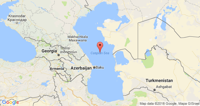
Caspian Sea on the map
Where is the Caspian Sea located? It is located on the continent of Eurasia. It is interesting that its eastern coast is located in Asia, and the western coast is in Europe. Conventionally, the sea is divided into several parts:
- Northern Caspian;
- South Caspian;
- Middle Caspian.
Of these, only the North Caspian is a sea shelf. It contains only 1 percent of the total volume of water and ends at Chechen Island, located near the Kizlyar Bay.
Which countries are washed by the Caspian Sea? There are 5 states on the shore of the lake:
- Azerbaijan;
- Iran;
- Turkmenistan;
- Kazakhstan;
- Russia.
The largest coastline runs through the territory of Kazakhstan, in second place, according to this indicator, is Russia. The coast of Azerbaijan has the smallest length, but it owns the largest port - Baku.
There are also other large settlements on the coast of the salt reservoir:
- Anzali (Iran) - 111 thousand people;
- Aktau (Kazakhstan) - 178 thousand people;
- Atyrau (Russia) - 183 thousand people
Astrakhan also belongs to the coastal cities of the Caspian Sea, although the city is located 69 kilometers from the coast. Among the rest Russian cities on the seashore one can note Makhachkala, Derbent and Kaspiysk.
Caspian Sea or lake?
The Caspian Sea is a geographical feature, the essence of which does not quite correlate with its name.
Why is the Caspian Sea considered a lake? Caspian Sea It is an endorheic and closed reservoir. It receives water from rivers and has no connection with oceans and other seas. Although the water here is salty, this figure is much lower than that of other seas. International maritime laws do not apply to the Caspian Sea.
On the other hand, the Caspian is quite large in size, which differs from traditional ideas about lakes. Even Baikal, and even more so, is inferior to it in terms of area. There are no other lakes in the world whose coast belongs to five states at the same time. The bottom structure is also very similar to the ocean type. With a high degree of probability, the waters of the Caspian Sea flowed into the Mediterranean Sea many centuries ago, but due to drying and tectonic processes, they were separated.
The water area of the Caspian Sea is rich in islands, the size of which, even by international standards, is quite large.
Nature of the Caspian Sea
One of the most interesting mysteries of the Caspian Sea is the population of seals living on the territory of the lake, which are a small variety of those that live in the cold northern waters. However, their appearance on the coast, at least suggests that these places are beginning to recover ecologically after the negative consequences of oil production.
vegetable and animal world The Caspian Sea is very diverse. The underwater ecosystem boasts a large number of crustaceans, mollusks, gobies, herring and sprat. Many species are endemic, meaning they only live in this region and nowhere else.
Freshwater species also live in the waters of the lake. They were able to adapt to salt water. These are primarily carp and perch fish. At the end of the ice age, arctic fish and invertebrates penetrated here. In the 40s of the last century, the waters of the Caspian Sea were deliberately populated with mullet, nereis and abra, which are the food base for sturgeons.


Fish processing plants operate in the vicinity of the Caspian Sea, as well as purification stations designed to ensure water cycles. Systematic work is also underway to breed many varieties of underwater abodes that have industrial value. The region is of great interest for fishing tourism. This holiday is especially popular in the Astrakhan region on the Caspian Sea.
The flora of the lake is represented by more than 700 plant species. Some of them grow on land, others in water. Phytoplankton of the Caspian Sea consists of both marine and freshwater algae. According to rough estimates, about 440 species of algae live in the reservoir.
Historical facts
The Caspian coast was once home to ancient civilization, which subsequently disappeared. There is an opinion that in the vicinity of Dagestan, the waters hide Itil from human eyes - the capital city of the Khazar Khaganate, which completely disappeared in the 12th century. In Derbent, there is still a wall from an ancient settlement, going to a depth of 300 meters. For what purpose it was built and who built it is a mystery.
Another interesting feature of the Caspian Sea is the Sabail citadel, located under water in the Baku Bay. The building was flooded during an earthquake that happened in 1306. In 1723, the upper part of the highest tower became visible above the water surface - this was the result of a decrease in the water level. Today, the fortress is again hidden in the depths of the Caspian Sea, although in sunny weather it can be seen in the water column.
The territory of the Caspian Sea was an "apple of discord" between the adjacent countries. Disputes over the distribution of the possessions and resources of the lake have been going on for 22 years. In 2018, the countries finally came to a common denominator. On August 12, the Convention on the Legal Status of the Caspian Sea was signed. Prior to this, in the legal field, regulation was carried out on the basis of the Soviet-Iranian agreements defining the Caspian as a closed body of water, and each border state had an independent right to a 10-mile zone. The rest of the lake was divided equally.
How the Caspian Sea was divided? The new agreement assigns 15 miles of territorial waters to each state. Also, the bottom of the Caspian Sea is divided into sectors, as happens with the seas, and the sovereignty of the water column is established on the principle of a lake.
For the current day Caspian Sea is an economically important region. Without it, it is impossible to imagine Eurasia, including Russia. Everyone should visit the Caspian Sea, and the protection of the reservoir should be carried out at the state level. Only by joint efforts can this natural pearl be preserved.
The Caspian Sea is located between Asia and Europe. This is the largest salt sea-lake located on the territory of Kazakhstan, Russia, Azerbaijan, Iran and Turkmenistan. At present, its level is 28 meters below the level of the World Ocean. The depth of the Caspian Sea is quite large. The area of the reservoir is 371 thousand square kilometers.
Story
Approximately five million years ago, the sea divided into small bodies of water, including the Black and Caspian Sea. After these events, they united and separated. About two million years ago, the Caspian Lake was cut off from the oceans. This period is considered the beginning of its formation. Throughout history, the reservoir has changed its contours several times, and the depth of the Caspian Sea has also changed.
Now the Caspian is the largest inland body of water containing about 44% of the lake waters of the planet. Despite the ongoing changes, the depth of the Caspian Sea did not change very much.
Once it was called Khvali and Khazar, and the tribes of horse breeders gave it another name - the Caspian. That was the name of the tribe living on the southwestern shore of the reservoir. In total, during its existence, the lake had more than seventy names, here are some of them:
- Abeskun.
- Derbent.
- Saray.
- Sihai.
- Dzhurdzhanskoye.
- Hyrcanian.
Depth and relief
The relief and features of the hydrological regime divide the sea-lake into the northern, middle and southern parts. Throughout the entire area of the Caspian Sea, the average depth is 180-200 m, but the relief in different parts is different.
The northern part of the reservoir is shallow. Here the depth of the Caspian Sea-lake is approximately 25 meters. In the middle part of the Caspian there are very deep depressions, continental slopes, and shelves. Here the average depth is 192 meters, and in the Derbent depression - about 788 meters.
The greatest depth of the Caspian Sea is in the South Caspian depression (1025 meters). Its bottom is flat, and there are several ridges in the northern part of the depression. It is here marked maximum depth Caspian Sea.

Coastline Features
Its length is seven thousand kilometers. The northern part of the coastline is lowland, mountains are on the south and west, and highlands are on the east. The spurs of Elbrus and the Caucasus Mountains approach the shores of the sea.
The Caspian has large bays: Kazakh, Kizlyar, Mangyshlak, Kara-Bogaz-Gol, Krasnovodsk.
If you go on a cruise from north to south, then the length of the route will be 1200 kilometers. In this direction, the reservoir has an elongated shape, and from west to east, the width of the sea is different. It is 195 kilometers at its narrowest point and 435 kilometers at its widest. On average, the width of the reservoir is 315 km.
The sea has several peninsulas: Mangyshlak, Buzachi, Miankale and others. There are also several islands here. The largest are Chygyl, Kyur-Dashi, Gum, Dash, Seal Islands.

Reservoir nutrition
About one hundred and thirty rivers flow into the Caspian. Most of them flow in the north and west. The main river flowing into the sea is the Volga. Approximately ninety percent of the volume of runoff falls on three large rivers: the Volga (80%), the Kura (6%) and the Urals (5%). Five percent - to the Terek, Sulak and Samur, and the remaining four bring small rivers and streams of Iran.
Caspian resources
The pond has amazing beauty, the diversity of ecosystems and the richest stock of natural resources. When there are frosts in its northern part, magnolias and apricots bloom in the south.
Relic flora and fauna have been preserved in the Caspian Sea, including the largest flock of sturgeons. As the marine flora evolved, it changed more than once, adjusting to salinization and desalination. As a result, there are many freshwater species in these waters, but few marine ones.
After the Volga-Don Canal was built, new types of algae appeared in the reservoir, which used to be found in the Black and Seas of Azov. Now there are 854 animal species in the Caspian Sea, of which 79 are vertebrates, and over 500 plant species. This unique sea-lake provides up to 80% of the world's sturgeon catch and about 95% of black caviar.
Five species of sturgeon are found in the Caspian Sea: stellate sturgeon, spike, sterlet, beluga and sturgeon. Beluga is the largest representative of the species. Its weight can reach a ton, and its length can reach five meters. In addition to sturgeon, herring, salmon, kutuma, vobla, asp and other types of fish are caught in the sea.
Of the mammals in the Caspian Sea, only the local seal is found, which is not found in other water bodies of the world. It is considered the smallest on the planet. Its weight is about a hundred kilograms, and its length is 160 centimeters. The Caspian region is the main migration route for birds between Asia, the Middle East and Europe. Every year approximately 12 million birds fly over the sea during their migration (south in spring and north in autumn). In addition, another 5 million remain in these places for wintering.

The greatest wealth of the Caspian Sea is the huge reserves of oil and gas. Geological exploration in the region has discovered large deposits of these minerals. Their potential puts local reserves in second place in the world after