Port on the Black Sea, major ports of the Black Sea, what you need to visit. The meaning of the black sea
Black Sea- inland sea of the Atlantic Ocean. The Bosphorus connects with the Sea of Marmara, then, through the Dardanelles, with the Aegean and Mediterranean Seas. Kerch Strait connects with the Sea of Azov. From the north, the Crimean peninsula cuts deep into the sea. The water boundary between Europe and Asia Minor runs along the surface of the Black Sea.
Area 422,000 sq. km. The outlines of the Black Sea resemble an oval with the largest axis about 1150 km. The greatest length of the sea from north to south is 580 km. The greatest depth is 2210 m, the average is 1240 m.
The only large peninsula is the Crimean. The largest bays: Yagorlytsky, Tendrovsky, Dzharylgachsky, Karkinitsky, Kalamitsky and Feodosia in Ukraine, Varna and Burgassky in Bulgaria, Sinopsky and Samsunsky - at the southern coast of the sea. In the north and northwest, estuaries overflow at the confluence of the rivers. The total length of the coastline is 3400 km.
A number of sections of the sea coast have their own names: the southern coast of Crimea, the Black Sea coast of the Caucasus in Russia, the Rumeli coast and the Anatolian coast in Turkey. In the west and northwest, the coasts are low-lying, steep in places; in the Crimea - mostly low-lying, with the exception of the southern mountainous coasts. On the eastern and southern shores, the spurs of the Caucasus and Pontic mountains come close to the sea.
There are practically no islands in the Black Sea. The largest ones are Berezan' and Zmeiny (both with an area of less than 1 sq. km).
The following largest rivers flow into the Black Sea: Danube, Dnieper, as well as smaller Rioni, Kodori, Inguri (in the east of the sea), Chorokh, Kyzyl-Irmak, Ashli-Irmak, Sakarya (in the south), Southern Bug and Dniester (in the north ).
The fauna of the Black Sea is noticeably poorer than that of the Mediterranean. 2.5 thousand species of animals live in the Black Sea (of which 500 species are unicellular, 160 species of vertebrates - fish and mammals, 500 species of crustaceans, 200 species of mollusks, the rest are invertebrates different types), for comparison, in the Mediterranean - about 9 thousand species.
Among the fish found in the Black Sea: various types of gobies (goby-goby, goby-whip, goby-round goby, goby-martovik, goby-rotan), Azov anchovy, Black Sea anchovy (anchovy), shark-katran, flounder-glossa, five species of mullet, bluefish, hake (hake), sea ruff, red mullet (common Black Sea sultanka), haddock, mackerel, horse mackerel, Black Sea-Azov herring, Black Sea-Azov sprat, etc. There are sturgeons (beluga, Black Sea-Azov sturgeon).
Among the dangerous fish of the Black Sea are the sea dragon (the most dangerous is the poisonous spines of the dorsal fin and gill covers), the Black Sea and conspicuous scorpion fish, the stingray (sea cat) with poisonous spikes on the tail.
The largest port cities on the Black Sea:
Burgas, Varna (Bulgaria);
Batumi, Poti (Georgia);
Novorossiysk, Sochi, Tuapse (Russia);
Constanta (Romania);
Samsun, Istanbul, Trabzon (Turkey);
Odessa, Kherson, Ilyichevsk (Ukraine)
Kerch, Sevastopol, Yalta (Crimea)
On the Don River, which flows into the Sea of Azov, there is a river waterway connecting the Black Sea with the Caspian Sea (through the Volga-Don Shipping Canal and the Volga), with the Baltic Sea and the White Sea (through the Volga-Baltic Waterway and the White Sea-Baltic Canal) . The Danube River is connected to the North Sea through a system of canals.
There are 4 ports in the Krasnodar Territory near the Black Sea coast: Novorossiysk, Sochi, Tuapse and Gelendzhik. Each of them is interesting in its own way. Basically, I wanted to write today about the port of Gelendzhik, a lot of interesting news has been associated with it lately. But, perhaps, I will tell briefly about the other three. In general, everything you wanted to know about southern shipping, but were afraid to ask.
Each port Black Sea coast Krasnodar Territory special in its own way.
1. Sochi
Sochi is a magnificent Russian resort. Therefore, the main direction of the company's work is regular sea passenger transportation and cruise tourism on the Black Sea coast of Russia. The border, customs and immigration services of the port are also located here. A little hack. For example, a flight from Krasnodar to Turkey costs about 5,000 rubles one way. It is clear that there are charters and other joys of life, but this is the average price. So, if you are not in a hurry, then you can get from Sochi to Istanbul by sea, and the trip will cost you at least 2 times cheaper. In addition, having a passport, you can go on vacation to Sochi, and from there, for ridiculous money, drive to Turkey for a day or two, take a walk and come back. But if you don’t want to go to Turkey, you can visit Sukhumi or Batumi in the same way. Whatever one may say, Abkhazia is beautiful.
In addition, the port of Sochi, in my humble opinion, is the most beautiful. Why are only the building of the seaport (there is even a duty free) and the view of the beautiful cruise liners On the Sunset.
2. Tuapse
I would characterize it as follows: the most commercial port in the South near the Black Sea coast. Each time I specify which sea, so that there is no debate on the topic of the same port of the Caucasus. So, Tuapse has an excellent logistics base. There is also a railway and a port. Due to this, the city becomes an excellent transshipment base. Let's say the EuroChem enterprise, whose terminal is located here, railway supplies fertilizer, which is later sent to the port for further transportation. This scheme also works in reverse side, say, in terms of grain supplies. Personally, it seems interesting to me that TMTP is not a monopolist in Tuapse, the Rosneft company also has its own berth and several bunkerers.
Vessels are not only engaged in the supply of fuel from the local refinery. The company's subsidiary, RN-bunker, in Tuapse also has oil tankers, which, for example, liquidated oil-contaminated waters around floating hotels in Sochi during the Olympics. In general, life is in full swing in Tuapse and the economy is one of the most promising in the region. And the role of the trading port in all this is very high.
3. Novorossiysk
Perhaps the most famous of the local ports, in addition, the largest in Russia and the fifth port in Europe in terms of cargo turnover. Trade and tourism are also developed here, but this port is completely different. Perhaps this city is the dream of a sailor who was born in the Kuban. Here you can become the captain of the ship and walk the waves with your crew. Novorossiysk is a city of military glory, a city with a great history. Here, of course, there are a lot of problems, but I will talk about them some other time. Now I want to write only about the good.
So, the best thing in Novoros is ships and a lot of events associated with them. For example, in 2014, on May 9, a carnival took place, during which it was possible to visit a real sailing frigate. Walk around the deck like a real sailor, touch the mast, breathe in the salty sea breeze.
And these events happen regularly. So the port of Novorossiysk is informative and interesting.
4. Gelendzhik
Until recently, I confess, I considered this port to be much inferior to the rest in all respects. Somehow he did not stand out in any of the industries. But just a month ago, the media announced its large-scale reconstruction. In particular, with the support of LLC Tuapsenefteprodukt and FSUE Rosmorport, it is planned to build a new yacht marina and parking for yachts. Moreover, as part of the development transport system In Russia, it is planned to reconstruct the cargo pier, organize a yacht club and build the corresponding coastal infrastructure, build a refueling complex for the purpose of bunkering small ships and yachts entering the sea port Gelendzhik and the construction of a hotel, a shopping and entertainment complex with a concert hall.
So, the Gelendzhik port, quite possibly, in the near future will also acquire its own “zest” by becoming the Russian analogue of Miami with yachts, expensive hotels and wonderful beaches. Let's see, while the idea looks just fine.
Z.Y. I have several stories from my grandfather about the Northern ports. About Murmansk, Petrozavodsk and Belomorkanal. But I usually write about the South somehow, so if you would be interested in reading this, then unsubscribe in the comments, it will inspire me. Your opinion is important to me.
And if no one is interested, then I will abandon this idea.
What is the significance of the Black Sea for people and in nature, you will learn by reading this article.
Importance of the Black Sea
The Black Sea belongs to the basin Atlantic Ocean. It is connected with Sea of Azov the Kerch Strait and the Sea of Marmara, the Bosporus Strait. Even the ancient Greeks knew about it, and it was called Pont Aksinsky, that is, "inhospitable sea." Modern name this sea was received in the 13th century and scientists are still at a loss as to why it was named that.
Economic use of the Black Sea
The Black Sea is rich in resources that are used by man. About coastlines and on the shelf there are large deposits of natural gas and oil, chemical and mineral raw materials.
The Black Sea is also famous for its biological resources: algae, fish, shellfish. They are widely used in the food industry. From algae, kelp and phyllophora are mined here, from which medicines are made. The stocks of cystoseira (brown algae) and zostera (sea grass) are used less.
Every year a person catches tons of shrimps and mussels, fish and even dolphins. All this goes to the food industry.
The types of economic activities of people associated with the Black Sea are not limited to fishing and oil production. Today, its pool is actively exploited by people. Its importance as a transport route is especially important: cargo transportation, transport corridors and ferry crossings. It is also used as a recreational recreation area, which brings a good profit to the country washed by the sea during the season.
The most important ports of the Black Sea
Among the largest ports of the Black Sea are:
- Evpatoria, Sevastopol, Kerch, Yalta (Crimea)
- Sochi and Novorossiysk (Russia)
- Odessa, Ukraine)
- Varna (Bulgaria)
- Sukhum (Georgia)
- Trabzon and Samsun (Turkey)
- Constanta (Romania)
Environmental problems of the Black Sea
Human activity in the Black Sea has led to an unfavorable ecological situation. It is heavily polluted with oil products and waste products. Mutated due to anthropogenic influence animal world seas.
Waste mostly comes with the waters of the Danube, Prut and Dnieper. The most pollution of the Black Sea with oil slick is observed near the Caucasian coast and the Crimean peninsula. Along the coast there are zones with an excess of toxic substances: cadmium, copper ions, lead and chromium.
Also in the Black Sea there is a process of blooming water due to lack of oxygen. With river waters, metals and pesticides, nitrogen and phosphorus get into it. Phytoplankton, absorbing these elements, multiplies too quickly and the water "blooms". In this case, bottom microorganisms die. When they rot, they cause hypoxia in mussels, sturgeon fry, squid, crabs, oysters.
The coast and the bottom of the coastal zones are polluted with household waste, which can decompose in salt water for decades, or even centuries. This releases toxic substances into the water.
We hope that from this article you have learned the importance in the nature of the Black Sea.
The territory of the Black Sea coast is divided between seven different countries: Abkhazia, Bulgaria, Georgia, Russia, Romania, Turkey and Ukraine. Almost every port in the Black Sea is a resort center, has a mild climate, picturesque landscapes and rich recreational resources.
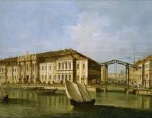
Sevastopol is the most beautiful port city in the Black Sea, a large tourist centre And seaside resort. One of its main attractions is the Chersonese Tauride Reserve, where the ruins of ancient city founded by the Greeks over 2500 years ago. The whole life and history of the city is connected with the sea. The sea is saturated with its very atmosphere. There are many monuments to great sailors and outstanding battles. One of the symbols of the city is the monument to the scuttled ships, set in the sea next to Primorsky Boulevard.
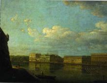
Another big port on the Black Sea- Sochi city. This is one of the most popular Russian resorts, which has all the conditions for recreation and recreation. Subtropical climate, lush southern vegetation, proximity to the Main Caucasian ridge And great amount Beaches attract a wide variety of vacationers to the city: hikers, speleologists, couples with children, and the elderly. Among the city's natural attractions, the Agur Gorge with picturesque lakes and the waterfall of the same name, Vorontsovskaya Cave, White Rocks and unique relic groves on Mount Akhun are in demand. In the city itself there are many parks, among which the most famous is the Sochi arboretum. All types winter holiday presented at the Krasnaya Polyana resort.
Georgian city of Batumi famous resort, surrounded by citrus orchards, bamboo and eucalyptus groves and plantations of bananas, laurels and magnolias. This is a port on the Black Sea, rich in natural and architectural sights. The decorations of the city are Primorsky Boulevard, Singing Fountains, Summer Theater and Batumi Botanical Garden with a magnificent collection of subtropical plants.
Located on the Turkish coast - Trabzon, Samsun, Zonguldak and the handsome Istanbul, which also has access to the Sea of Marmara. Istanbul is both Asian and European city, which has a unique charm and, like a magnet, attracts tourists. Wonderful historical, museum and architectural complex is the famous city wall of Istanbul with its fortresses and towers. Another significant building of the city is the Hagia Sophia, not far from which the Tolkapi Sultan's Palace is located. Ancient mosques and temples, lively squares, wide boulevards, noisy markets - all this gives the atmosphere of the city a special flavor. And one of the main tourist routes is the Bosphorus with a suspension bridge, medieval fortresses, fish taverns and numerous cafes.
The ancient city of Varna in Bulgaria, charming and quiet Constanta in Romania, frivolous and cheerful, and at the same time, heroic Odessa in Ukraine, sunny Yalta in the heart of the southern coast of Crimea - all these are major ports of the Black Sea, each of which has a complicated history and has a special Black Sea charm.
Along with this material they usually read:
If you want to try your luck in treasure hunting or in search of treasures on sunken ships, go to the Islands in the Black Sea. Small and cozy, they will reveal many secrets to you and give you a lot of thrill. The islands of the Black Sea are waiting for you.
Even a short trip across the Black Sea by ferry will not leave you indifferent. Even a small Kerch crossing from Crimea to Krasnodar region or back will give you a bouquet of strong emotions: admiration, pride, surprise.
Often travelers choosing a cruise route prefer distant cities and countries. But the Crimean shores are literally nearby, which can give no less impressions than Turkish or Egyptian ones. Do not miss near miracles in pursuit of distant ones.
Traveling along the Black Sea is not only beautiful landscapes and endless sea expanses, but also a lot of various entertainments. For example, walks on a transparent kayak are popular, through the bottom of which you can observe the life of underwater inhabitants.
list of seaports Russian films 2018, list of seaports Russian flag
Jump to: navigation, search
To the registry Russian seaports 63 ports are included, which are included in five sea basins and are located on the banks of 12 three seas oceans and the Caspian Sea. The total cargo turnover of Russian seaports in 2012 amounted to 565.5 million tons, the main share of cargo is oil (34.8%), oil products (20.2%) and coal (15.8%). In 2006, the cargo turnover of maritime transport amounted to 48 billion t-km, passenger turnover - 30 million passenger-km, 173 thousand freight and 6 thousand passenger and cargo-passenger sea vessels.
The main role of Russian maritime transport is to carry out export-import transportation of goods, small and large cabotage is being developed. The main problem of maritime transport in Russia is the lack of ports in general and large ports with a large cargo turnover in particular, as well as the shallow water of 60% of Russian ports.
Ports account for the largest cargo turnover Black Sea basin where the structure of exports is dominated by oil and oil products, coal, metals, timber, building materials, and the structure of imports - grain, sugar, machinery and equipment, pipes for pipelines, food products. The presence of resorts determines significant development passenger traffic in the basin (up to 30 million people per year). Across Baltic basin oil, timber, metals are exported from Russia, and cars, industrial and food products are imported. Geographical position and good availability of transport routes determined the leading role of foreign trade (90% of cargo turnover). Caspian Basin Coastal transportation prevails, where oil and oil products, salt, grain, cotton, wool, and fish predominate. Far Eastern Basin carries out cabotage and export-import transportation. Through ports Far East they export fish, timber, coal, oil, food, they import cars, equipment, metals. The sea railway crossing Vanino - Kholmsk operates in the basin. north basin- an area of rapid growth in maritime traffic, where the Northern Sea Route plays an important role. the structure of exports is dominated by coal, timber, oil products, non-ferrous metal ores, equipment, in the structure of imports - foodstuffs.
- 1 List of ports by basin
- 1.1 Black Sea basin
- 1.2 Baltic Basin
- 1.3 Caspian Basin
- 1.4 Pacific Basin
- 1.5 North Basin
- 2 Map
- 3 Port turnover
- 4 See also
- 5 Notes
- 6 Literature
- 7 Links
List of ports by basin
Below is a list of ports Russian Federation with their main features. Ice-free ports are highlighted in blue in the table, ports of the Northern Sea Route are marked in green.
Black Sea basin
| Port | Location | Coordinates | Area (aqua + terr), km² |
cargo turnover, thousand tons (2011) |
Vessel dimensions (dl / shir / siege), m |
Number of berths (length) |
Qty stevedores |
Image | |
|---|---|---|---|---|---|---|---|---|---|
| Atlantic Ocean | |||||||||
| Sea of Azov | |||||||||
| Azov | mountains Azov Rostov region |
47°07′05″ s. sh. 39°25"21"E d. (G) | 11 + 1,34 | 4 756,8 | 150 / 18 / 3,7 | 27 units (3,909.5 m) | 10 | ||
| Yeysk | mountains Yeysk Krasnodar region |
46°43′31″ s. sh. 38°16"33" E d. (G) | 0,87 + 0,69 | 3 998,2 | 142 / 18 / 4,5 | 15 units (2,649 m) | 9 | ||
| Rostov-on-Don | mountains Rostov-on-Don Rostov region |
47°12′10″ s. sh. 39°41"26"E d. (G) | 12,84 + 2,84 | 10 366,6 | 140 / 16,7 / 3,5 | 54 units (8,978.9 m) | 24 | ||
| Taganrog | mountains Taganrog Rostov region |
47°12′21″ s. sh. 38°57"07"E d. (G) | 9,76 + 0,54 | 3 467,5 | 149 / 18 / 4,7 | 9 units (1,765.7 m) | 3 | ||
| Temryuk | mountains Temryuk Krasnodar region |
45°19′33″ N sh. 37°22"40" E d. (G) | 22,68 + 2,29 | 2 347,9 | 140 / 17,5 / 4,8 | 10 units (1,394.8 m) | 5 | ||
| Black Sea | |||||||||
| Anapa | mountains Anapa Krasnodar region |
44°53′52″ N. sh. 37°18"25" E d. (G) | 2,09 + 0,02 | 0 | 114 / 16 / 3,7 | 5 units (589 m) | 1 | ||
| Gelendzhik | mountains Gelendzhik Krasnodar region |
44°34′26″ N sh. 38°01"34"E d. (G) | 10,7 + 0,07 | 382,6 | 114 / 14 / 3,8 | 9 units (795.8 m) | 3 | ||
| Caucasus | Temryuk district Krasnodar region |
45°20′28″ s. sh. 36°40"22"E d. (G) | 23,24 + 0,46 | 8 304,2 | 150 / 21 / 5 | 8 units (988 m) | 4 | ||
| Novorossiysk | mountains Novorossiysk Krasnodar region |
44°43′49″ s. sh. 37°46"51" E d. (G) | 344 + 2,38 | 116 139,5 | 295 / 45 / 13,1 | 88 units (15,287.7 m) | 9 | ||
| Sochi | mountains Sochi Krasnodar region |
43°24′36″ N sh. 39°55"58" E d. (G) | 17,72 + 0,38 | 2 446,1 | 190 / 27 / 8 | 20 units (2,390.0 m) | 2 | ||
| Taman | from. Wave Temryuk district Krasnodar region |
45°07′39″ s. sh. 36°41"13" E d. (G) | 89,51 + 0,36 | 1 235,0 | 225 / 32,3 / 11,4 | 4 units (937.0 m) | 2 | ||
| Tuapse | mountains Tuapse Krasnodar region |
44°05′34″ s. sh. 39°04"37"E d. (G) | 25,18 + 0,38 | 19 404,7 | 250 / 44 / 12 | 31 units (5,025.4 m) | 7 | ||
Baltic basin
| Port | Location | Coordinates | Area (aqua + terr), km² |
cargo turnover, thousand tons (2011) |
Vessel dimensions (dl / shir / siege), m |
Number of berths (length) |
Qty stevedores |
Image | |
|---|---|---|---|---|---|---|---|---|---|
| Atlantic Ocean | |||||||||
| Baltic Sea | |||||||||
| Vyborg | mountains Vyborg Leningrad region |
60°42′43″ s. sh. 28°43"46" E d. (G) | 2,87 + 0,17 | 1 103,6 | 135 / 24 / 6,5 | 9 units (1,327.0 m) | 2 | ||
| Vysotsk | mountains Vysotsk Vyborgsky district Leningrad region |
60°37′06″ s. sh. 28°33"39" E d. (G) | 1,26 + 1,44 | 13 422,0 | 250 / 44 / 13,2 | 8 units (1,595.7 m) | 2 | ||
| Kaliningrad | mountains Kaliningrad Kaliningrad region |
54°40′08″ s. sh. 20°24"14"E d. (G) | 17,73 + 8,32 | 13 352,2 | 200 / 30 / 9,5 | 101 units (14,100.0 m) | 30 | ||
| Primorsk | mountains Primorsk Vyborgsky district Leningrad region |
60°21′28″ s. sh. 28°37"08"E d. (G) | 31,36 + 2,47 | 75 124,9 | 307 / 55 / 15,85 | 10 units (2,788.4 m) | 3 | ||
| St. Petersburg (Big Port) | mountains St. Petersburg | 59°52′50″ s. sh. 30°11"57" E d. (G) | 628,9 + 5,29 | 59 989,6 | 320 / 42 / 11 | 145 units (22,364.2 m) | 29 | ||
| St. Petersburg (Passenger Port) | mountains St. Petersburg | 59°55′34″ N sh. 30°14"07" E d. (G) | 3,04 + 0,33 | 0 | 311 / 42 / 8,8 | 7 units (2,171.0 m) | 1 | ||
| Ust-Luga | Kingiseppsky district Leningrad region |
59°40′29″ s. sh. 28°24"37"E d. (G) | 67,56 + 10,56 | 22 692,9 | 285,4 / 50 / 14,8 | 19 units (4,061.7 m) | 9 | ||
Caspian basin
| Port | Location | Coordinates | Area (aqua + terr), km² |
cargo turnover, thousand tons (2011) |
Vessel dimensions (dl / shir / siege), m |
Number of berths (length) |
Qty stevedores |
Image | |
|---|---|---|---|---|---|---|---|---|---|
| Caspian Sea | |||||||||
| Astrakhan | mountains Astrakhan Astrakhan region |
46°19′00″ s. sh. 47°59"40" E d. (G) | 54,96 + 2,0 | 4 655,5 | 150 / 20 / 4,2 | 33 units (4,510.0 m) | 20 | ||
| Makhachkala | mountains Makhachkala The Republic of Dagestan |
42°59′23″ N sh. 47°30"16" E d. (G) | 5,58 + 0,59 | 5 371,1 | 150 / 20 / 6,5 | 20 units (2,113.0 m) | 2 | ||
| Olya | from. Olya Limansky district Astrakhan region |
45°46′51″ N. sh. 47°33"09" E d. (G) | 53,12 + 3,25 | 557,7 | 135 /16,2 / 4,5 | 4 units (688.2 m) | 1 | ||
pacific basin
| Port | Location | Coordinates | Area (aqua + terr), km² |
cargo turnover, thousand tons (2011) |
Vessel dimensions (dl / shir / siege), m |
Number of berths (length) |
Qty stevedores |
Image | |
|---|---|---|---|---|---|---|---|---|---|
| Pacific Ocean | |||||||||
| Petropavlovsk-Kamchatsky | mountains Petropavlovsk-Kamchatsky Kamchatka Krai |
53°00′06″ s. sh. 158°39"25"E d. (G) | 1792,16 + 1,37 | 2 411,0 | 200 / 25 / 9 | 56 units (6,089.1 m) | 8 | ||
| Sea of Okhotsk | |||||||||
| Korsakov | mountains Korsakov Sakhalin region |
46°37′26″ N sh. 142°46"02"E d. (G) | 65,50 + 0,33 | 1 431,6 | 300 / b / o / 17.5 | 30 units (2,737.3 m) | 8 | ||
| Magadan | mountains Magadan Magadan Region |
59°32′03″ s. sh. 150°46"01" E d. (G) | 17,38 + 0,33 | 1 222,2 | 162,1 / 22,9 / 9,9 | 10 units (1,707.6 m) | 6 | ||
| Moskalvo | from. Moskalvo Okhinsky district Sakhalin region |
53°32′50″ s. sh. 142°31"09"E d. (G) | 52,3 + 0,18 | 32,8 | 150 / 40 / 6 | 6 units (657 m) | 2 | ||
| Cape Lazarev | town Lazarev Nikolaevsky district Khabarovsk region |
52°14′14″ s. sh. 141°30"42" E d. (G) | 0,07 + 0,02 | 0 | 120 / 14 / 0,9 | 4 units (582 m) | 0 | ||
| Nikolaevsk-on-Amur | mountains Nikolaevsk-on-Amur Khabarovsk region |
53°08′08″ s. sh. 140°42"45" E d. (G) | 6,93 + 0,17 | 129,9 | 140 / 18 / 4,5 | 8 units (791.6 m) | 2 | ||
| Okhotsk | Okhotsk Khabarovsk region |
59°21′38″ s. sh. 143°14"29"E d. (G) | no data | 105,9 | 105 / 15 / 3,8 | 9 units (615 m) | 2 | ||
| Poronaysk | mountains Poronaysk Sakhalin region |
49°13′49″ s. sh. 143°07"03" E d. (G) | 12,50 + 0,04 | 0 | 37 / 7 / 1,9 | 6 units (386.7 m) | 0 | ||
| Suburban | Korsakovskiy district Sakhalin region |
46°37′29″ N sh. 142°54"25"E d. (G) | 57,80 + 0,20 | 16 328,4 | 300 / b / o / 17.5 | 4 units (951.3 m) | 1 | ||
| Japanese Sea | |||||||||
| Aleksandrovsk-Sakhalinsky | mountains Aleksandrovsk-Sakhalinsky Sakhalin region |
50°53′47″ s. sh. 142°07"50" E d. (G) | 3,69 + 0,04 | 0 | 34 / 7,2 / 2,4 | 4 units (442.1 m) | 1 | ||
| Vanino | Vanino Khabarovsk region |
49°05′16″ s. sh. 140°16"18" in. d. (G) | 16 + 4,58 | 19 066,0 | 292 / 45 / 18 | 21 units (3,382 m) | 3 | ||
| Vladivostok | mountains Vladivostok Primorsky Krai |
43°06′48″ s. sh. 131°53"08" E d. (G) | 131,06 + 2,26 | 11 836,2 | 290 / 35 / 13 | 57 units (12,315.7 m) | 24 | ||
| Oriental | mountains Nakhodka Primorsky Krai |
42°44′03″ s. sh. 133°04"44"E d. (G) | 62,66 + 3,86 | 38 356,8 | 290 / 45 / 16 | 25 units (5,497.2 m) | 8 | ||
| De-Kastri | from. De-Kastri Ulchi district Khabarovsk region |
51°27′59″ s. sh. 140°46"58"E d. (G) | 68,48 + 0,03 | 8 056,4 | 250 / 50 / 15 | 4 units (361 m) | 2 | ||
| Zarubino | Zarubino Khasansky district Primorsky Krai |
42°38′40″ s. sh. 131°04"58" E d. (G) | 27,0 + 0,39 | 117,1 | 130 / 18 / 7,5 | 7 units (841 m) | 2 | ||
| Nakhodka | mountains Nakhodka Primorsky Krai |
42°48′23″ N. sh. 132°52"48"E d. (G) | 127,45 + 2,84 | 14 986,6 | 245 / 44 / 11,5 | 108 units (16,810.4 m) | 27 | ||
| Nevelsk | mountains Nevelsk Sakhalin region |
46°40′06″ s. sh. 141°51"11" E d. (G) | 2,25 + 0,85 | 107,6 | 120 / 16 / 5,5 | 26 units (2,701 m) | 13 | ||
| Olga | village Olga Primorsky Krai |
43°44′25″ N. sh. 135°16"52"E d. (G) | 57,36 + 0,43 | 1 631,5 | 200 / 18 / 8 | 11 units (1,566.2 m) | 5 | ||
| Posyet | village Posyet Khasansky district Primorsky Krai |
42°39′05″ s. sh. 130°48"27"E d. (G) | 22,5 + 0,88 | 5 317,4 | 183 / 32 / 9 | 16 units (2,467.2 m) | 5 | ||
| Sovetskaya Gavan | mountains Sovetskaya Gavan Khabarovsk region |
48°57′27″ N sh. 140°15"55" E d. (G) | 24 + 1,36 | 524,7 | 180 / 25 / 10 | 18 units (2,974 m) | 11 | ||
| Kholmsk | mountains Kholmsk Sakhalin region |
47°02′48″ s. sh. 142°02"29" E d. (G) | 15,62 + 0,49 | 2 192,4 | 130 / 22 / 8 | 27 units (2,469.4 m) | 6 | ||
| Shakhtyorsk | mountains Shakhtyorsk Uglegorsky district Sakhalin region |
49°09′44″ s. sh. 142°03"17" E d. (G) | 12,42 + 0,14 | 1 566,5 | 150 / 20 / 4,6 | 28 units (2,113 m) | 4 | ||
north basin
| Port | Location | Coordinates | Area (aqua + terr), km² |
cargo turnover, thousand tons (2011) |
Vessel dimensions (dl / shir / siege), m |
Number of berths (length) |
Qty stevedores |
Image | |
|---|---|---|---|---|---|---|---|---|---|
| Arctic Ocean | |||||||||
| Barents Sea | |||||||||
| Varandey | from. Varandey Zapolyarny region Nenets Autonomous District |
68°49′28″ N sh. 58°04"08" E d. (G) | 24,98 + 0,02 | 4 010,6 | 120 / 15 / 3,5 | 2 units (199.9 m) | 2 | ||
| Murmansk | mountains Murmansk Murmansk region |
68°58′25″ N sh. 33°03"33"E d. (G) | 53,70 + 6,46 | 25 687,2 | no limits | 97 units (11,525.8 m) | 20 | ||
| Naryan-Mar | mountains Naryan-Mar Nenets Autonomous District |
67°38′48″ N sh. 52°59"39" E d. (G) | 5,62 + 0,22 | 103,8 | 114 / 14 / 3,6 | 4 units (384.6 m) | 1 | ||
| White Sea | |||||||||
| Arkhangelsk | mountains Arkhangelsk Arhangelsk region |
64°32′04″ s. sh. 40°30"48" E d. (G) | 112 + 2,12 | 4 264,3 | 190 / 30 / 9,2 | 61 units (7,454.3 m) | 19 | ||
| Vitino | from. White Sea Kandalaksha district Murmansk region |
67°04′46″ s. sh. 32°19"28"E d. (G) | 11,59 + 0,19 | 4 153,1 | 230 / 32,2 / 11,1 | 4 units (512 m) | 1 | ||
| Kandalaksha | mountains Kandalaksha Murmansk region |
67°09′14″ s. sh. 32°23"24"E d. (G) | 5,09 + 0,26 | 916,7 | 200 / 30 / 9,8 | 5 units (584.5 m) | 2 | ||
| Mezen | mountains Mezen Arhangelsk region |
65°52′01″ s. sh. 44°12"21"E d. (G) | no data | 14,6 | no data | 2 units (220 m) | 3 | ||
| Onega | mountains Onega Arhangelsk region |
63°55′50″ s. sh. 38°01"57" E d. (G) | 845,59 + 0,03 | 71,0 | 242 / 32,4 / 13,6 | 7 units (880 m) | 4 | ||
| East-Siberian Sea | |||||||||
| Pevek | mountains Pevek Chukotka |
69°41′41″ s. sh. 170°15"32"E d. (G) | 8,9 + 0,19 | 189,0 | 172,2 / 24,6 / 9 | 3 units (500 m) | 1 | ||
| Kara Sea | |||||||||
| Amderma | from. Amderma Nenets Autonomous District |
69°45′21″ s. sh. 61°39"08" E d. (G) | no data | 0 | no data | 5 units (445 m) | 0 | ||
| Dixon | Dixon Taymyrsky district Krasnoyarsk region |
73°30′14″ N sh. 80°29"59" E d. (G) | no data | 0 | no data | 2 units (200 m) | 0 | ||
| Dudinka | mountains Dudinka Krasnoyarsk region |
69°24′32″ s. sh. 86°09"19" E d. (G) | 30,22 + 0,25 | 1 102,1 | 260,3 / 32,2 / 11,8 | 9 units (1,795.6 m) | 2 | ||
| Igarka | mountains Igarka Turukhansky district Krasnoyarsk region |
67°27′42″ s. sh. 86°33"19" E d. (G) | no data | 2,5 | no data | 16 units (2 380 m) | 1 | ||
| Laptevih sea | |||||||||
| Tiksi | town Tiksi Republic of Yakutia |
71°37′59″ N sh. 128°53"22"E d. (G) | 96,78 + 0,07 | 55,5 | 129,5 / 15,8 / 3,9 | 2 units (315.0 m) | 1 | ||
| Khatanga | from. Khatanga Taymyrsky district Krasnoyarsk region |
71°58′49″ s. sh. 102°27"24"E d. (G) | no data | 0 | no data | 2 units (700 m) | 1 | ||
| Pacific Ocean | |||||||||
| Bering Sea | |||||||||
| Anadyr | mountains Anadyr Chukotka |
64°44′11″ s. sh. 177°30"51" E d. (G) | 45,33 + 0,12 | 215,6 | 177 / 25 / 7 | 6 units (686 m) | 1 | ||
| Beringovsky | town Beringovsky Anadyrsky district Chukotka |
63°03′47″ s. sh. 179°21"20"E d. (G) | 4318 + 0,22 | 48,8 | 34 / 7 / 2 | 5 units (269 m) | 1 | ||
| Providence | Provideniya village Chukotka |
64°26′08″ s. sh. 173°13"03"W d. (G) | no data | 22,5 | ? / ? / 9 | 6 units (524 m) | 1 | ||
| Egvekinot | Egvekinot Chukotka |
66°14′44″ s. sh. 179°05"03"W d. (G) | 5,75 + 0,07 | 128,4 | 177 / 25 / 12 | 3 units (565.3 m) | 1 | ||
Map
The value of the cargo turnover of the largest ports in 2011:
- - from 1 million to 10 million tons
- - from 10 million to 20 million tons
- - from 20 million to 50 million tons
- - from 50 million to 100 million tons
- - over 100 million tons
Port cargo turnover
Below is alphabetical list seaports of Russia and the value of their cargo turnover (in thousand tons) for 2003-2011.
| Port | inhabited paragraph |
Swimming pool | 2003 | 2004 | 2005 | 2006 | 2007 | 2008 | 2009 | 2010 | 2011 |
|---|---|---|---|---|---|---|---|---|---|---|---|
| Azov | Azov | Black Sea | 0 | 0 | 0 | 0 | 0 | 0 | 4684 | 4273 | 4757 |
| Aleksandrovsk-Sakhalinsky | Aleksandrovsk-Sakhalinsky | Pacific | 144 | 92 | 120 | 95 | 162 | 100 | 113 | 98 | 0 |
| Amderma | Amderma | Northern | 0 | 0 | 0 | 0 | 0 | 0 | 0 | 0 | 0 |
| Anadyr | Anadyr | Northern | 280 | 132 | 271 | 283 | 307 | 223 | 269 | 224 | 216 |
| Anapa | Anapa | Black Sea | 0 | 0 | 0 | 5 | 0 | 0 | 4 | 0 | 0 |
| Arkhangelsk | Arkhangelsk | Northern | 3124 | 5500 | 6470 | 5293 | 5307 | 4680 | 3256 | 3667 | 4264 |
| Astrakhan | Astrakhan | Caspian | 3760 | 5495 | 5128 | 4518 | 5756 | 2568 | 3928 | 5014 | 4656 |
| Beringovsky | Beringovsky | Northern | 114 | 96 | 216 | 209 | 203 | 133 | 44 | 47 | 49 |
| Big port of St. Petersburg | St. Petersburg | Baltic | 42039 | 51266 | 57573 | 54247 | 59519 | 60008 | 50405 | 58048 | 59990 |
| Vanino | Vanino | Pacific | 7397 | 7040 | 8727 | 9497 | 9967 | 10261 | 14516 | 17304 | 19066 |
| Varandey | Varandey | Northern | 0 | 0 | 593 | 501 | 576 | 1901 | 7380 | 7510 | 4011 |
| Vitino | White Sea | Northern | 5715 | 3704 | 1626 | 4758 | 3942 | 4394 | 4359 | 4376 | 4153 |
| Vladivostok | Vladivostok | Pacific | 11263 | 11559 | 10156 | 7811 | 8528 | 9561 | 9976 | 11185 | 11836 |
| Oriental | Nakhodka | Pacific | 15754 | 20815 | 20231 | 20499 | 21685 | 20573 | 18902 | 35638 | 38357 |
| Vyborg | Vyborg | Baltic | 1078 | 1357 | 901 | 1253 | 1111 | 1300 | 1184 | 1100 | 1104 |
| Vysotsk | Vysotsk | Baltic | 2405 | 5200 | 10416 | 13811 | 16527 | 16015 | 17318 | 14843 | 13422 |
| Gelendzhik | Gelendzhik | Black Sea | 63 | 36 | 77 | 127 | 256 | 239 | 267 | 331 | 383 |
| De-Kastri | De-Kastri | Pacific | 1685 | 1767 | 1944 | 3487 | 11618 | 9771 | 8441 | 7373 | 8056 |
| Dixon | Dixon | Northern | 0 | 0 | 0 | 0 | 0 | 0 | 0 | 0 | 0 |
| Dudinka | Dudinka | Northern | 0 | 0 | 0 | 0 | 0 | 2876 | 1065 | 1093 | 1102 |
| Yeysk | Yeysk | Black Sea | 0 | 0 | 2792 | 3331 | 4345 | 3849 | 4262 | 3554 | 3998 |
| Zarubino | Zarubino | Pacific | 0 | 235 | 220 | 210 | 224 | 252 | 93 | 128 | 117 |
| Igarka | Igarka | Northern | 56 | 0 | 49 | 37 | 59 | 59 | 0 | 0 | 3 |
| Caucasus | Port Kavkaz | Black Sea | 6869 | 9198 | 7115 | 7182 | 6382 | 7760 | 8609 | 10055 | 8304 |
| Kaliningrad | Kaliningrad | Baltic | 12722 | 13808 | 14571 | 15150 | 15625 | 15369 | 12363 | 13809 | 13352 |
| Kandalaksha | Kandalaksha | Northern | 1020 | 342 | 339 | 248 | 655 | 963 | 1060 | 863 | 917 |
| Korsakov | Korsakov | Pacific | 2351 | 2683 | 2832 | 3716 | 2818 | 2169 | 1033 | 1106 | 1432 |
| Magadan | Magadan | Pacific | 1006 | 997 | 1066 | 1108 | 1075 | 1093 | 989 | 1128 | 1222 |
| Makhachkala | Makhachkala | Caspian | 3548 | 5838 | 5056 | 5488 | 6260 | 6392 | 5274 | 4863 | 5371 |
| Mezen | Mezen | Northern | 12 | 14 | 33 | 45 | 24 | 24 | 22 | 23 | 15 |
| Moskalvo | Moskalvo | Pacific | 4 | 70 | 80 | 55 | 0 | 37 | 29 | 29 | 33 |
| Murmansk | Murmansk | Northern | 14838 | 24759 | 28070 | 26294 | 24609 | 24832 | 35276 | 32809 | 25687 |
| Cape Lazarev | Lazarev | Pacific | 183 | 63 | 72 | 88 | 76 | 26 | 0 | 0 | 0 |
| Naryan-Mar | Naryan-Mar | Northern | 112 | 67 | 194 | 291 | 84 | 125 | 61 | 103 | 104 |
| Nakhodka | Nakhodka | Pacific | 14025 | 16671 | 14097 | 13430 | 13462 | 15178 | 15761 | 15365 | 14987 |
| Nevelsk | Nevelsk | Pacific | 0 | 0 | 0 | 0 | 0 | 0 | 0 | 90 | 108 |
| Nikolaevsk-on-Amur | Nikolaevsk-on-Amur | Pacific | 735 | 129 | 290 | 359 | 208 | 251 | 172 | 164 | 130 |
| Novorossiysk | Novorossiysk | Black Sea | 85483 | 97767 | 113061 | 113148 | 113489 | 112607 | 122865 | 117079 | 116140 |
| Olga | Olga | Pacific | 1324 | 1268 | 1471 | 1500 | 1503 | 1221 | 1107 | 1438 | 1632 |
| Olya | Olya | Caspian | 70 | 135 | 167 | 290 | 636 | 866 | 775 | 1050 | 558 |
| Onega | Onega | Northern | 784 | 232 | 100 | 104 | 101 | 109 | 74 | 65 | 71 |
| Okhotsk | Okhotsk | Pacific | 0 | 0 | 0 | 0 | 0 | 0 | 59 | 41 | 106 |
| Passenger port of St. Petersburg | St. Petersburg | Baltic | 0 | 0 | 0 | 0 | 0 | 0 | 0 | 0 | 0 |
| Pevek | Pevek | Northern | 137 | 88 | 98 | 108 | 140 | 61 | 55 | 142 | 189 |
| Petropavlovsk-Kamchatsky | Petropavlovsk-Kamchatsky | Pacific | 1536 | 1499 | 1805 | 1909 | 1849 | 1984 | 2485 | 2266 | 2411 |
| Poronaysk | Poronaysk | Pacific | 26 | 3 | 12 | 1 | 0 | 0 | 0 | 0 | 0 |
| Posyet | Posyet | Pacific | 1332 | 1815 | 2260 | 2002 | 2528 | 3907 | 4535 | 4650 | 5317 |
| Suburban | Suburban | Pacific | 0 | 0 | 0 | 0 | 0 | 199 | 10697 | 16102 | 16328 |
| Primorsk | Primorsk | Baltic | 17685 | 44565 | 57337 | 65956 | 74230 | 75582 | 79157 | 77640 | 75125 |
| Providence | Providence | Northern | 88 | 32 | 35 | 70 | 30 | 33 | 21 | 27 | 23 |
| Rostov-on-Don | Rostov-on-Don | Black Sea | 0 | 0 | 0 | 0 | 0 | 0 | 6166 | 7713 | 10367 |
| Sovetskaya Gavan | Sovetskaya Gavan | Pacific | 483 | 451 | 530 | 566 | 475 | 358 | 359 | 408 | 525 |
| Sochi | Sochi | Black Sea | 220 | 166 | 200 | 406 | 517 | 529 | 408 | 2690 | 2446 |
| Taganrog | Taganrog | Black Sea | 2057 | 2850 | 3043 | 2451 | 3264 | 2630 | 3026 | 2895 | 3468 |
| Taman | Wave | Black Sea | 0 | 0 | 0 | 0 | 0 | 10 | 86 | 200 | 1235 |
| Temryuk | Temryuk | Black Sea | 1004 | 646 | 1003 | 1155 | 1349 | 2305 | 2119 | 1940 | 2348 |
| Tiksi | Tiksi | Northern | 12 | 0 | 0 | 0 | 20 | 0 | 39 | 40 | 56 |
| Tuapse | Tuapse | Black Sea | 17712 | 20226 | 21381 | 21292 | 19634 | 19435 | 18445 | 18611 | 19405 |
| Ust-Luga | Ust-Luga | Baltic | 442 | 801 | 708 | 3766 | 7143 | 6763 | 10358 | 11776 | 22693 |
| Khatanga | Khatanga | Northern | 16 | 0 | 62 | 5 | 0 | 0 | 0 | 0 | 0 |
| Kholmsk | Kholmsk | Pacific | 2342 | 1996 | 2181 | 2169 | 2097 | 2017 | 1635 | 1870 | 2192 |
| Shakhtyorsk | Shakhtyorsk | Pacific | 714 | 537 | 706 | 527 | 702 | 892 | 785 | 1069 | 1567 |
| Egvekinot | Egvekinot | Northern | 118 | 248 | 134 | 153 | 112 | 105 | 119 | 135 | 128 |
see also
- List of ports by container handling
- List of river ports in Russia
Notes
- 1 2 Seaports of Russia. ESIMO. Retrieved February 5, 2013. Archived from the original on February 14, 2013.
- Register of seaports of the Russian Federation. Ministry of Transport of the Russian Federation. Retrieved February 5, 2013. Archived from the original on February 14, 2013.
- Cargo turnover of Russian seaports in 2012. Association of Sea Trade Ports. Retrieved February 8, 2013. Archived from the original on February 14, 2013.
- 1 2 Vinokurov, 2008, p. 242-243
- Vidyapin, 2010, p. 258-263
- Lobzhanidze, 2008, p. 502-503
- Northern Sea Route. Ministry of Transport of the Russian Federation. Retrieved February 8, 2013. Archived from the original on February 14, 2013.
- dimensions of ships for inland waters; the outer raid allows you to receive ships with dimensions 260 / 46 / 16
- dimensions of ships for inland waters; the outer road allows you to receive vessels with a draft of up to 19 m, outrigger berths - vessels with a length of 324 m and a width of 58 m
- 1 2 no limits
- dimensions of ships for inland waters; the outer raid allows you to receive ships with dimensions 140 / 14 / 4.5
- dimensions of ships of mixed type; dimensions for marine vessels - 90 / 16 / 3.6
- dimensions of ships for inland waters; the outer road allows you to receive ships with dimensions of 162.1 / 22.8 / 9.9
Literature
- Vidyapin V.I., Stepanov M.V. Economic geography of Russia. - Moscow: INFRA-M, 2010. - 567 p. - 3,000 copies.
- Vinokurov A. A., Glushkova V. G., Plisetsky E. L., Simagin Yu. A. Introduction to economic geography and regional economy of Russia. - Moscow: Humanitarian publishing center "VLADOS", 2008. - 550 p. - 7,000 copies.
- Neklyukova N. P., Dushina I. V., Rakovskaya E. M., Kuznetsov A. P., Lobzhanidze A. A., Berlyant A. M. Reference book on geography. - Moscow, 2008. - 656 p. - 8,000 copies.
Links
- Seaports of Russia
- Register of seaports of the Russian Federation
- Rosmorport
- Cargo turnover of Russian seaports in 2012
| Seaports of Russia | ||
|---|---|---|
| Sea of Azov | Azov Yeysk Caucasus Rostov-on-Don Taganrog Temryuk | |
| Baltic Sea | Vyborg Vysotsk Kaliningrad St. Petersburg (Big Port and Passenger Port) Primorsk Ust-Luga | |
| Barents Sea | Varandey Murmansk Naryan-Mar | |
| White Sea | Arkhangelsk Belomorsk Vitino Kandalaksha Kem Mezen Onega Severodvinsk | |
| Bering Sea | Anadyr Beringovsky Providence Egvekinot | |
| East Siberian Sea | Pevek Chersky | |
| Kara Sea | Amderma Dixon Dudinka Igarka | |
| Caspian Sea¹ | Astrakhan Makhachkala Olya | |
| Laptev Seas | Tiksi Khatanga | |
| Sea of Okhotsk | Korsakov Magadan Moskalvo Cape Lazarev Nikolaevsk-on-Amur Okhotsk Poronaysk Prigorodnoye | |
| pacific coast Kamchatka and the Kuril Islands |
Petropavlovsk-Kamchatsky | |
| Black Sea | Anapa Gelendzhik Yevpatoria4 Kerch (trade fishing)4 Novorossiysk Sevastopol (fish trading)4 Sochi (commercial and passenger cargo) Taman ² Tuapse Feodosiya4 Chernomorsk4 Yalta4 | |
| Chukchi Sea | Cape Schmidt³ | |
| Sea of Japan | Alexandrovsk-Sakhalinsky Boshnyakovo Vanino Vladivostok East De-Kastri Danube Zarubino Nakhodka Nevelsk Olga Plastun Posyet Transfiguration Rudnaya Pier Svetlaya Slavyanka Sovetskaya Gavan Uglegorsk Kholmsk Shakhtyorsk | |
| ¹ Caspian Sea is actually a lake. ² Port of Taman under construction, but already open for communication. ³ Port Cape Schmidt since 2006 it has been part of the Pevek port. 4 Located on the territory that is the subject of a territorial dispute between Russia and Ukraine. | ||
list of seaports russian detectives, list of seaports russian movies 2018, list of seaports russian flag, list of seaports russian cinema