Where is the Pacific Ocean on a contour map.
The Pacific Ocean is the largest and deepest in terms of area and depth. deep ocean our Planet. Its area is 178.684 million km? (which exceeds the area of \u200b\u200bthe entire land by almost 30 million km?), And the greatest depth in the Mariana Trench is 10994 +/- 40 m. The average depth is 3984 m. From north to south, the length of the ocean is approximately 15.8 thousand km, and the width from east to west is 19.5 thousand km. Ferdinand Maggelan (the Portuguese and Spanish navigator who was the first to cross this vast ocean) called it “quiet” because during his journey, which lasted three months and twenty days, the weather was calm all the time.
Location of the Pacific Ocean
The share of the Pacific Ocean in the surface of the World Ocean is 49.5%, and the volume of water is 53%. It is divided into two regions - northern and southern, the boundary of which is the equator. Since the Pacific Ocean is very large, its borders run along the coasts of several continents. In the north, the border with the Arctic Ocean is a line that connects two capes: Cape Dezhnev and Cape Prince of Wales.
In the west, the waters of the ocean wash Eurasia and Australia, then its border runs along the eastern side of Bass Strait, which connects Australia and the island of Tasmania, and drops south along the meridian 146 ° 55 'E. to Antarctica.
In the east, the Pacific Ocean washes the coasts of North and South America, and to the south, the border between it and the Atlantic Ocean runs from Cape Horn along the meridian 68 ° 04 'W. to the Antarctic Peninsula.
But the part of the southern waters of the Pacific Ocean, which is located south of the 60th parallel of south latitude, belongs to the Southern Ocean.
Seas and bays of the Pacific Ocean
The sea is a part of the ocean that differs from it in currents, the properties of water and the organisms living in it. The seas are inland and marginal. They are separated from the ocean by islands, peninsulas or underwater uplifts.
Seas located along the coasts of Eurasia
The Bering Sea - washes the shores of Russia and the United States. Previously, on the maps of the 18th century, it was called the Beaver or Kamchatka Sea. Later it was named after the navigator Vitus Bering. Area 2.315 million sq. km. Max Depth- 4151 m. The peculiarity of this sea is that for 10 months its surface is covered with ice. It is inhabited by common seals, walruses, bearded seals, 402 species of fish, several species of whales. The sea has 28 bays.
Sea of Okhotsk - washes the shores of Russia and Japan. Named after the river - Hunt. It used to be called Lamsky and Kamchatsky. Area - 1603 thousand km?. Maximum depth 3916m. In winter, the northern part of the sea is covered with ice. The sea has 26 bays.
The Sea of Japan is a marginal sea separated from the ocean by Sakhalin Island and the Japanese Islands. Washes the shores of Japan, Russia, North Korea and the Republic of Korea. Area - 1062 thousand km?. The greatest depth is 3742m. In winter, its northern part freezes over. Under water world in the northern and southern regions of the sea is very different. In the northern part, flora and fauna characteristic of temperate latitudes have formed, while in the southern part, warm-water fauna predominates. There are squids and octopuses here. It has 57 bays.
Inland Sea of Japan - connects with Sea of Japan Shimonoseki Strait. It includes the seas of Bingo, Hiuchi, Suo, Iyo and Harima. The area is 18,000 km². Maximum depth 241m.
The Yellow Sea is a shallow marginal sea located on the east coast of Asia. The name is due to its color. The Huanghai River brings a lot of silt into the sea and thus makes it brown-yellow. Sometimes the coasts of the Yellow Sea are simply covered with algae.
Washes the sea of the DPRK, China and the Republic of Korea. Area - 416 thousand km?. The maximum depth is 106 m. Bays: Dalyanvan, West Korean, Bohaivan, Liaodong, Laizhouvan, Jiaozhouvan.
It is here that you can see a very interesting phenomenon - the "Miracle of Moses" - the phenomenon of water parting between the two islands of Chindo and Modo.
At low tide between these islands, the water parted several times a year and only for one hour. A road up to 2.8 km long and up to 40 meters wide appears. Great amount tourists come to these parts to see this phenomenon and follow this path. If someone does not have time to complete their journey, the boats and the police will help them.
The East China Sea is a semi-enclosed sea located between the Japanese Islands and the Chinese coast. Area - 836 thousand km?. The maximum depth is 2719 m.
The Philippine Sea is an inter-island sea located near the Philippine archipelago. It ranks second in size, after the Sargasso Sea. The area is 5726 thousand km². Maximum depth - 10 994 ± 40 m ( Mariana Trench or it is also called the Mariana Trench).
The Mariana Trench is one of mysterious places our planet, which is inhabited by the most unusual creatures.
Seas located between the islands of Southeast Asia
The South China Sea is a semi-enclosed sea off the coast of the South China Sea. East Asia. The area is 3,537,289 km², and the maximum depth is 5560 m. Monsoons and typhoons are a great danger in this sea. The sea has 7 bays. Part of this sea is the Gulf of Thailand.
The Java Sea is an inter-island sea located to the north of the island of Java. The area is 552 thousand km?, and the average depth is 111 m. The main straits are the Sunda and Makassar. The fauna of this sea is very diverse.
Sulu is a sea clearly defined by islands. This sea is unique in the presence of coral reefs. Here is the Tubbataha Atoll, which is world heritage UNESCO and protected by a marine reserve.
Sulawesi is an inter-island sea. The area of the sea is about 453 thousand km?, the depth is up to 6220 m. Mangrove forests grow on the shores of the island of Kalimantan, and there are a lot of coral reefs in the Sulu archipelago.
This list also includes the following seas: Flores, Savu, Seram, Halmahera, Bali, Banda, Moluccas.
Seas along the east coast of Australia
The New Guinea or Bismarck Sea is an inter-island sea with an area of 310 thousand km2 and a maximum depth of 2665 m. Underground earthquakes often occur in this sea.
Solomon - interisland sea of the Pacific Ocean. The area of the sea is about 755 thousand km², the average depth is 2652 m. It has three bays: Velha, Kula, Huon.
Coral - the sea of the Pacific Ocean, the area of which is 4791 thousand km2, and the maximum depth is 9140 m. This sea is famous for the fact that it contains the largest coral reef of our planet.
Fiji is an inter-island sea with an area of 3177 thousand km?. Maximum depth 7633m. It has a complex bottom relief: ridges and volcanoes. Undersea world of this sea is very rich and varied.
Tasmanovo is the sea that separates Australia and New Zealand. The maximum depth is 5200 m. It has 9 bays.
The eastern part of the ocean, located along the coasts of the North and South America, has no seas, but there are such large bays, such as: Alaska, California and Panama.
Islands of the Pacific.
The ocean is located from 20-30 thousand islands and the world's largest Malay archipelago. In the Pacific Ocean, there are the second (New Guinea, with an area of 785.753 thousand km?) And the third (Kalimantan, whose area is 743,330 km?) The largest islands. by the most big island Greenland is considered, with an area of 2,130,800 km2, which is washed by the Arctic and Atlantic oceans.
New Guinea is the second largest island separated from Australia by the Torres Strait. The climate here is dominated by equatorial and subequatorial. Tropical rain forests grow on the island. The western part of the island belongs to Indonesia, and the eastern part belongs to the state of Papua New Guinea. On the island are located mountain ranges. Since the island is tropical, the flora and fauna are very diverse here. In 2005, American researchers discovered a place on this island, which they called the "Garden of Eden". This place, located on the slopes of the mountains of Fiji and occupying 300 thousand hectares, has long been isolated from the influence of the outside and the world. Scientists have discovered here unknown species of frogs, butterflies, palm trees and other plants.
Kalimantan is the third largest island, which is divided between three states: Malaysia, Brunei and Indonesia. It was discovered by Magellan's expedition in 1521. It is located in the center of the Malay Archipelago and is considered the largest backbone of Asia. The climate here is equatorial. There are many low mountains on the island, highest point is Mount Kinabalu (4095 m). The entire territory of the island is occupied by dense forests. There is a huge variety of animals and plants. There are also many unexplored places. One of the interesting plants grows here - Rafflesia Arnold. There are a lot of orchids on the island. Oil and diamonds are mined on the island of Kalimantan.
If you liked this material, share it with your friends in social networks. Thank you!
Pacific Ocean- the largest on the planet. It covers more than half of the entire water surface of the Earth, has an area of 178 ml. sq. km. and stretched from Japan to America. The average depth of the ocean is 4 km.
The opening of the Pacific
It is believed that the first person to visit the Pacific Ocean on a ship was Magellan . In 1520, he circled South America and saw new expanses of water. Since Magellan's team did not meet a single storm during the entire journey, the new ocean was called " Quiet«.
Victoria is the only ship of Magellan's expedition to return.
But even earlier in 1513 the Spaniard Vasco Nunez de Balboa headed south from Colombia to what he was told was a wealthy country with a large sea. Having reached the ocean, the conquistador saw an endless expanse of water stretching to the west, and called it " South Sea«.
Bottom relief
The bottom relief is extremely diverse. Located in the eastEast Pacific Risewhere the terrain is relatively flat. In the center are basins and deep-sea trenches. The average depth is 4,000 m, and in some places exceeds 7 km. The bottom of the center of the ocean covers the products of volcanic activity with a high content of copper, nickel and cobalt. The thickness of such deposits in some areas can be 3 km. The age of these rocks begins with the Jurassic and Cretaceous period.
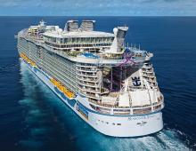
At the bottom there are several long chains of seamounts formed as a result of the action of volcanoes: g Emperor's horns, Louisville and the Hawaiian Islands. There are about 25,000 islands in the Pacific Ocean. That's more than all the other oceans combined. Most of them are located south of the equator.
Islands are classified into 4 types:
- continental islands. Very closely related to the continents. Includes New Guinea, the islands of New Zealand and the Philippines;
- high islands. Appeared as a result of eruptions of underwater volcanoes. Many of the modern high islands have active volcanoes. For example, Bougainville, Hawaii and the Solomon Islands;
- Coral reefs;
- Coral raised platforms;
The last two types of islands are huge colonies of coral polyps that form coral reefs and islands.
Climate
The large extent of the ocean from north to south quite logically explains the diversity of climatic zones - from equatorial to Antarctic. The largest zone is the equatorial zone. Throughout the year, the temperature here does not fall below 20 degrees. Temperature fluctuations during the year are so small that we can safely say that it is always +25 there. There is a lot of precipitation, more than 3,000 mm. in year. Very frequent cyclones are characteristic.
Seasonal phenomenon in the Pacific Ocean - cyclones
The amount of precipitation is greater than the amount of evaporating water. Rivers that bring more than 30 thousand m³ to the ocean annually fresh water, make surface water less saline than other oceans.
Inhabitants of the Pacific
The ocean is famous for its rich flora and fauna. About 100 thousand species of animals live in it. There is no such diversity in any other ocean. For example, the second largest ocean, the Atlantic Ocean, is inhabited by “only” 30,000 species of animals.
There are several places in the Pacific Ocean where the depth exceeds 10 km. These are the famous Mariana Trench, the Philippine Trench and the Kermadec and Tonga depressions. Scientists were able to describe 20 species of animals that live at such a great depth.
Half of all seafood consumed by humans is caught in the Pacific Ocean. Among 3,000 species of fish, industrial-scale fishing is open for herring, anchovies, mackerels, sardines, and others.
- This ocean is so huge that its maximum width is equal to half the earth's equator, i.e. more than 17 thousand km.
- Animal world great and varied. Even now, new animals unknown to science are regularly discovered there. So, in 2005, a group of scientists discovered about 1000 species of decapod cancer, two and a half thousand mollusks and more than a hundred crustaceans.
- The most deep point on the planet is located in the Pacific Ocean in Mariana Trench. Its depth exceeds 11 km.
- The highest mountain in the world is located on Hawaiian Islands. It is called Muana Kea and represents dormant volcano. The height from the base to the top is about 10,000 m.
- At the bottom of the ocean is Pacific volcanic ring of fire, which is a chain of volcanoes located along the perimeter of the entire ocean.
The largest ocean in the world. Located between Asia and Australia in the West, America in the East, Antarctica in the south. The area is 178.7 million km 2 (more than half of the area of the World Ocean), the volume of water mass is 724 million km3. The deepest of the oceans, its average depth. 3984 m, maximum - 11 022 m (Marian Trench). Coastline on the Zap. very dissected, all the marginal and interisland seas are located here (see table). SH. the shores are relatively flat, the largest bays are Alaska, the Gulf of California. On the Zap. abrasion and accumulative prevail, in some places the coast, in the East - abrasion-denudation. In Quiet. ocean. there are over 10 thousand islands.
The most common oceanic islands of coral and volcanic origin, especially in South. and South-West. parts of the ocean (see Oceania). There are also mainland islands (Sakhalin, Japanese islands, Philippine Islands, New Guinea, etc.) and the islands of the transitional zone, mostly volcanic - most Kuril Islands, the Aleutian Islands, the Ryukyu Islands (Nansei), etc. Through the Pacific. ocean. passes the date line.
Bottom relief. In Quiet. ocean. various forms of bottom topography are presented - from planetary order morphostructures to microrelief. The underwater margin of the continents (10% of the bottom area) has the greatest width in the west. parts of the ocean, where lat. the continental shelf (shelf) reaches 800 km (in the Bering Sea). In the transition zone (more than 13% of the bottom area), deep sea trenches(troughs) with the maximum for the World Approx. depths (see table). Bed Quiet. ocean. occupies more than 65% of the bottom area. Within its limits, deep-sea basins with a depth of 5000-6000 m are distinguished, separated by underwater uplifts. Among the largest are the North-Eastern Basin (area 32.5 million km2), dissected by numerous latitudinal faults, the Pol-Foreign-Western Basin with the Shatsky Rise, as well as the Central Basin and the Southern Basin. The relief of the basins is predominantly hilly. Most of the underwater ridges within the Tykh bed. ocean. they are a brill-shaped uplift, complicated by mountains of predominantly volcanic origin, which in some places form islands (Hawaii, Samoa, Easter Island, etc.).
In addition to these elevations, the famous seamounts of Magellan, Musicians, Cartographers. The system of mid-ocean ridges (11% of the bottom area) is represented by the South Pacific Rise, the East Pacific Rise in the east. and Yuzh.-sh. parts of the ocean. Compared to other oceans, this morphostructure has a greater width, less dissected slopes, and is not always clearly defined. rift valley(see Rift). In Quiet. ocean. all types of bottom sediments have been identified. A characteristic feature is the wide distribution of deep-water red clay covering the bottom of oceanic basins. All in. parts of the ocean, siliceous sediments are common, head. rank. diatomaceous silt, in the equatorial zone - silt. To the South From the equator, separate sections of the bottom are covered with silt; near the coast, terrigenous deposits predominate. The greatest thickness of bottom sediments is in the basins of the marginal seas (2-3 km and more), at the bottom of the basins of the bed - up to 1 km. See also Relief of the ocean floor. A detailed resource dedicated to fishing with regular and spinning reels. Opportunity to choose and purchase.
Climate Quiet. ocean. very diverse, which is associated with its position in various climatic zones - from the equatorial to the subarctic in the North. and Antarctic to the South. In subtropical latitudes, the North Pacific and South Pacific highs develop, separated by the Equatorial depression, in the North. hemisphere - Aleutian minimum, in the South. (between 40° and 60° S. latitude) — low atm prevails throughout the year. pressure. Under the influence of these centers, trade winds arise in subtropical and tropical latitudes, and strong westward in temperate latitudes. winds. For app. parts of Quiet. ocean. monsoon winds are characteristic; typhoons form in the tropical latitudes of this part of the ocean. In February average temperature air over the ocean decreases from +26, +27° s near the equator to -20° s in the Bering Sea and to -10° (summer in the southern hemisphere) off the coast of Antarctica, in August respectively +26, +28°, + 6, +8° and -25°. Max. the amount of precipitation at the equator is up to 3000 mm per year, in temperate latitudes - 1000-1500 mm, in high latitudes - 300-500 mm, in subtropics - 100-200 mm per year.
Hydrological regime Quiet. ocean. determined by his climatic conditions and water exchange with other oceans. Normal t-ra surface water +19.1°, total water mass +3.7°. T-ra varies from negative values in high latitudes to +29° and more in the regions of the thermal equator. The latitudinal course of the isotherms is disturbed by warm and cold currents. With depth, the t-ra decreases (down to 1000 m), below it the changes are insignificant, in the bottom layer it ranges from + 2 ° to -D. The highest salinity of surface waters in the pasture zones is 35.9% "(North) and 36.9% s (on Pd). Under the influence of prevailing winds, surface currents have a head. W. direction in low latitudes and east. in high latitudes In temperate latitudes, subtropical anticyclonal circulations predominate, which include the Kuroshio Current, the California Current and the North Equatorial Current in the northern part of the ocean, the East Australian Current, the Peruvian Current and the South Equatorial Current in the southern part.
In high latitudes South. hemisphere, the Antarctic circumpolar current arises, in the North - a cyclonic circulation, including the Kuril current, the North Pacific and Alaska currents. Under South. The pastat current has a powerful deep countercurrent - the Cromwell Current. Most big waves are observed in the area of action. winds - in the North. hemisphere to the north. from 40° N. sh., in Yuzh. - between 40 ° and 60 ° Yuzh. sh. High they are over 20 m (for example, in Alaska). All in. tsunamis occur in parts of the ocean. Tides are most often diurnal and mixed. Max. high tides - 13 m (in the Penzhinsky Bay of Okhotsk m.), in the open ocean - 0.5-2.5 m. Ice in the form floating ice and icebergs are formed in the extreme North. parts of the ocean and off the coast of Antarctica.
Flora and fauna. The greatest development of life is observed along the coast at shallow depths. Among the bottom algae (more than 4,000 species), in temperate latitudes there are many Fucus and Laminaria, in tropical latitudes they are replaced by some green and red algae. Coral reefs are characteristic of shallow water in tropical latitudes, and mangrove forests are characteristic of the coast. The biomass and number of aquatic organisms in the direction from temperate latitudes to the equator decreases, in particular, the biomass of zooplankton (see Plankton) - 5-10 times, benthos - 40-80 times, fish - 2-3 times, and species diversity increases . With depth in the Quiet. ocean. both the number and the number of hydrobiont species are decreasing; at great depths Quiet. ocean. deep sea animals live. As part of the phytoplankton Tikh. ocean. bl. 1300 species; unicellular algae predominate. rank. diatoms, peridynes, and cocolithophorides; zooplankton includes copepods, euphausids, radiolarians, siphonophores, jellyfish, and finfish. Animal world Quiet. ocean. in terms of species composition, it is 3-4 times richer than in other oceans; many of its representatives are endemic (for example, sea urchins, fur seal, sea lion, most salmon), there are sperm whales, smug whales and the like. Of great industrial importance are: fish (anchovy, salmon, herring, sardine, saury, tuna, flounder, pollock, etc.), mammals (fur seal, sea otter, walrus, sea lion), invertebrates (crabs, shrimps, oysters, scallops, cephalopods, etc.), plants (sea kale, agaronos-anfelcia, zoster sea grass, etc.). History of the study Tih. ocean. has several stages. Even in ancient times (1 thousand k. e. and the first st. n. e.) according to Tih. ocean. Chinese, Malays, Polynesians swam. The first European to reach the shores of the ocean was the Spanish. conquistador V. N. de Balboa (1513). In 1521 F. Magellan during the first world travel swam across the ocean and gave it the name "Pacific". Supplemented information about the ocean swimming in Spanish. navigator
A. Saavedra (1528-29), English. F. Drake (1577-80), gal. A. Tasman (1642-43) and others. From the 17th century. Russian sailors began to explore the North. and Sev.-sh. parts of Quiet. ocean. In 1648 SEC. I. Dezhnov first came out from the North. Arctic ca. in Pacific ok. V. Bering and V. I. Chirikov (1728, 1741),
I. Fedorov and M. S. Gvozdev (1732) mapped Sat.-Skh. Pacific coast. ocean. New information about the center. and Yuzh. part of the ocean was given the voyage of J. Cook (1768-79). During the first Russian world travel
I. F. Kruzenshtern and Yu. F. Lisyansky (1803-06) studied, in particular, physical. water properties. In 1823-26 during an expedition on the ship "Enterprise" Rus. physicist E. X. Lenz carried out the first determination of the specific gravity of water. Deep-sea observations were carried out by Zhe. S. S. Dumont-Durville (1828), American C. Wilks (1839-40) and others.
The next period of study is Pacific. ocean. characterized by the development of complex oceanographic research- English. expedition on the ship "Challenger" (1872-76), Amer. on the ship "Tuskarori" (1873-76), Russian. on the ship "Vityaz" (1886-1889) under the leadership of S. A. Makarov and others. After the Great Fatherland. wars in the Pacific. ocean. research advice. scientists on specially equipped ships ("Vityaz", "Mikhail Lomonosov",
The Pacific Ocean is best known for its numerous islands, of which there are about 20-30 thousand. Without considering, since this is a continent located on its own continental plate, this list includes the ten largest islands of the Pacific Ocean.
New Guinea (Indonesia)
New Guinea covers an area of 785.75 thousand km² and is considered the second largest island in the world (after Greenland). Geographically, this island is part of Melanesia. Now the territory of this island is divided between two countries: Indonesia and Papua New Guinea.
The western part of the island contains provinces belonging to Indonesia. Previously, it was considered the territory of the Netherlands. Indonesia took control of it in 1963. Papua and West Papua are two provinces in the western part of New Guinea. The region covers an area of 421.98 thousand km² and has a population of about 3.5 million people, including local residents and immigrants. The population fought for several years against Indonesian rule in the territory, saying they had no choice in the 1963 Free Choice Act. This assertion has led to several conflicts between local residents and the government, and led to uprisings. Since 2014, international organizations have supported the independence of West Papua from Indonesia.
The eastern half of New Guinea belongs to the state Papua New Guinea and forms the mainland region of the country. It was previously occupied by the Germans and then by the Australians after World War II. In 1975, this part of the island became independent from the Australian state. It is home to over 8 million people who speak approximately 800 languages. The country is one of the least developed and most rural countries in the world, with only 18% of its population living in urban areas. The economy of Papua New Guinea is developing, and is largely dependent on. Mineral resources include gold, silver, nickel and cobalt. Forest resources are also extremely important in forestry, although their exploitation has led to a rapid reduction in forest cover. Papua New Guinea is mostly mountainous, making accessibility and infrastructural development difficult.
Borneo (Indonesia)
Borneo, the 3rd largest island in the world with an area of 743.33 thousand km². It is located in the central part of the Malay Archipelago, the world's largest group of islands. It is also the only island on the planet divided between three countries.
The southern two thirds of the island belong to Indonesia and are called Kalimantan; about 60% of the total population of the island lives here. The two states of Malaysia, Sabah and Sarawak, span the northern coast of Borneo.
While Borneo has remarkable natural resources, inspiring vistas and an increasingly rare wildlife, it has not become as popular a travel destination as neighboring Java and Bali.
Borneo retains an image of exoticism and even fear in the popular mind. It is believed that the island was home to bounty hunters. Nevertheless, the practice of head-hunting was real, and some tribal peoples still retain the habit of beheading people. Once upon a time, they carried out constant clan wars. Over time, these peoples are increasingly displaced by new immigrant groups who brought Islam or Christianity with them. Now these indigenous peoples are endangered.
Sumatra (Indonesia)
Sumatra is the 6th largest island on Earth, covering an area of 473.48 thousand km². Sumatra forms the western edge quite well South-East Asia, the last piece of land before the endless expanse of the Indian Ocean. The equator divides Sumatra between and hemispheres.
Over 50 million people call Sumatra home (2014 census), making it the fifth most populated island on our planet.
In the northern part of the island is Lake Toba - the largest volcanic lake in the world. It was formed during a catastrophic explosion. The event actually changed the climate on the entire planet. Thanks to geothermal activity, the water maintains a comfortable temperature. Volcanic pressure even led to the formation of a new island Samosir inside the lake.
There are many palm plantations on the island of Sumatra, which grow for many kilometers in every direction. They may look beautiful, but they pose a serious environmental problem. Large-scale deforestation, burning of agricultural land and annual release are consequences of oil palm cultivation.
One of the largest industries is grazing and Agriculture. From 1850 to 1950 most north island was cleared for this purpose, and since then the rich pastures present in the area have made it possible to graze sheep successfully. Today New Zealand is one of the world's exporters of wool, cheese, butter and meat.
Luzon (Philippines)
Luzon Island, with an area of 109.97 thousand km², is the largest and most populated island of the Philippines, as well as the 15th largest island in the world. Luzon is located in the Western Pacific Ocean.
Parts of the Highlands were created as a result of volcanic activity, as well as the friction of the Australian and Asian tectonic plates over 15 million years ago. The highlands began to take on their current form over the next 10 million years. Thus, Luzon is oceanic in nature, and has never been associated with mainland Asia.
The geological history of the Philippines is very complex and has had a huge impact on the biota currently found there. Luzon is home to many unique plant and animal species.
Mindanao (Philippines)
Mindanao is the second largest island of the Philippines (after Luzon), covers an area of 97.53 thousand km². Rugged, ruined mountains and volcanoes are found in many parts of the island. Mount Apo, 2954 meters high, is an active volcano; it is the highest mountain in the Philippines. The island has narrow coastal plains, while wide, fertile basins and vast swamps are formed by the Mindanao and Agusan river systems. The rare Philippine eagle lives in Mindanao.
Mindanao is a Muslim island. Although Muslims are no longer the majority, Islamic culture is evident. Mindanao also has the largest concentration of ethnic minorities in the Philippines.
Because of the large expanses of undeveloped fertile land, Mindanao was considered the "pioneer frontier" of the country. It did not experience significant population growth until migration progressed, especially in the middle of the 20th century. The main crops grown are corn, rice, bananas, pineapples, mangoes and coconuts. Cotton, coffee and cocoa are also grown. The timber industry plays an important role, and there are deposits of gold, nickel, iron and coal.
If you find an error, please highlight a piece of text and click Ctrl+Enter.
The PACIFIC OCEAN, the largest body of water in the world, is estimated at 178.62 million km2, which is several million square kilometers larger than the earth's land area and more than twice the area of the Atlantic Ocean. The width of the Pacific Ocean from Panama to the eastern coast of Mindanao Island is 17,200 km, and the length from north to south, from the Bering Strait to Antarctica, is 15,450 km. It extends from western coasts North and South America to east coasts Asia and Australia. From the north, the Pacific Ocean is almost completely closed by land, connecting with the North Arctic Ocean narrow Bering Strait(minimum width 86 km). In the south it reaches the coast of Antarctica, and in the east its border with Atlantic Ocean held at 67°W. - meridian of Cape Horn; in the west, the border of the South Pacific Ocean with the Indian Ocean is drawn along 147 ° E, corresponding to the position of Cape Southeast in southern Tasmania.
Pacific ocean map
Usually the Pacific Ocean is divided into two regions - North and South, bordering on the equator. Some specialists prefer to draw the boundary along the axis of the equatorial countercurrent, i.e. approximately 5°N Previously, the waters of the Pacific Ocean were more often divided into three parts: northern, central and southern, the boundaries between which were the Northern and Southern tropics.
Separate parts of the ocean, located between islands or land ledges, have their own names. The largest water areas of the Pacific Basin include the Bering Sea in the north; the Gulf of Alaska in the northeast; Gulfs of California and Tehuantepec in the east, off the coast of Mexico; Gulf of Fonseca off the coast of El Salvador, Honduras and Nicaragua, and somewhat to the south - the Gulf of Panama. At west coast South America has only a few small bays, such as Guayaquil off the coast of Ecuador.
In the western and southwestern Pacific, numerous major islands separate from the main water area many inter-island seas, such as the Tasman Sea southeast of Australia and the Coral Sea off its northeast coast; the Arafura Sea and the Gulf of Carpentaria north of Australia; the Banda Sea north of Timor Island; the Flores Sea north of the island of the same name; the Java Sea to the north of Java Island; the Gulf of Thailand between the peninsulas of Malacca and Indochina; Bakbo Bay (Tonkinsky) off the coast of Vietnam and China; Macassar Strait between the islands of Kalimantan and Sulawesi; the Moluccas and Sulawesi seas, respectively, to the east and north of the island of Sulawesi; finally, the Philippine Sea to the east of the Philippine Islands.
A special area in the southwest of the northern half of the Pacific Ocean is the Sulu Sea within the southwestern part of the Philippine archipelago, where there are also many small bays, inlets and semi-enclosed seas (for example, the Sibuyan Sea, Mindanao Sea, Visayan Sea, Manila Bay, Lamon Bay and Leite). At east coast China has the East China and Yellow Seas; the latter forms two bays in the north: Bohaiwan and West Korean. The Japanese Islands are separated from the Korea Peninsula by the Korea Strait. In the same northwestern part of the Pacific Ocean, several more seas stand out: the Inland Sea of Japan among the southern Japanese islands; the Sea of Japan to their west; to the north - the Sea of Okhotsk, connected with the Sea of Japan by the Tatar Strait. Further north, immediately south of the Chukotka Peninsula, is the Gulf of Anadyr.
The greatest difficulty is the drawing of the border between the Pacific and Indian Oceans in the Malay Archipelago. None of the proposed boundaries could satisfy botanists, zoologists, geologists and oceanologists at the same time. Some scientists consider the so-called dividing line. the Wallace line through the Makassar Strait. Others propose drawing the border across the Gulf of Thailand, the southern part of the South China Sea and the Java Sea.
The shores of the Pacific Ocean vary so much from place to place that it is difficult to single out any common features. With the exception of the extreme south, the Pacific coast is framed by a ring of sleeping or occasionally active volcanoes, known as the "Ring of Fire". Most of the coasts are formed high mountains, so that the absolute marks of the surface change sharply at a close distance from the coast. All this testifies to the presence of a tectonically unstable zone along the periphery of the Pacific Ocean, the slightest movement within which causes strong earthquakes.