Norwegian mountains. Conquest of mountain peaks
Malinovsky Yuri, St. Petersburg Norwegian mountains, fiords and waterfalls, Vikings and autobahns - who has not heard these fairy tales from TV! But, judging by the globe, it's not all that far away.
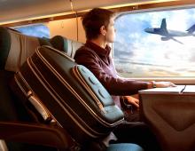
Is it possible to get there without having relatives there and a million dollars in a Swiss bank? What awaits a tourist there? These questions began to occupy me since autumn, when I saw on the Aeroflot website the words "sale of air tickets" and the figures 99 USD for the Moscow-Oslo-Moscow flight.
|
Map |
Since in 20 days we saw only one (one!) car with Russian numbers, it is obvious that very few of our tourists know about the possibilities to walk here. Many have heard that “everything is expensive there”, “they are not allowed to go there”, “heavy fines”, “visa denials are frequent”, etc.
I would like to shed some light on the above issues. I think it will be of interest to many.
Nothing in this report should be construed as a guide or encouragement to violate traffic rules, customs, immigration or other rules, laws or regulations. All prices are for reference only, their availability at the time of your trip is NOT guaranteed, data on the availability of certain goods in stores is also given for reference only. All advice is given from the point of view of the author, reflects his personal private point of view, all advice is relevant only at the time of writing the report - September 07, 2005. All mountain routes pose a potential danger to life and health, no part of this report can be considered as a guide to doing any sport.
 Geiranger |
The difference between Sweden and Norway from other European countries is that tourism is encouraged here. There are many national parks where it is allowed to walk, put up tents, pick mushrooms and berries, go boating, etc. (information boards say this)
norwegian mountains
There are many mountains in Norway, large and popular ones are Jutunheimen, Jostedalsbreen and the Hardangervidda plateau...
 National Tourist Road #258 |
Here is an overview with a bunch of links - http://www.summitpost.org/mountains/mountain_link.pl?mountain_id=827, Here you can download pieces of the mountain map http://www.etojm.com/Norsk/Topper/Toppkart/Galdhopiggen. htm
There is a very good book by James Baxter "Scandinavian mountains"
Cards, unfortunately, we found only there, 1 km were on sale - 500 meters at 99-129 nok per sheet (~ 500 rubles). The entire Jutunheimen fits on 3 sheets, but there is a set of 2 cards for sale - the most popular piece. You can buy a 10-kilometer pass for the country in the Russian Federation (this map is included in the set of a guide book in Russian), but you can also buy a 4-kilometer pass for all of southern Norway for 250 nok.
The general route to the western part of the park is from Oslo via Lilehammer and Otta, then to Lom, and along the 55th road to the desired location. If you want to climb Galdhopiggen, then the easiest option is to go to Juvasshytta (toll road, 70 Nok, and a very significant slope of the road - take care of the clutch). In addition to the mountain, there is a ski slope with a lift, which is long enough and operates throughout the summer, you can ride. .
 Briksdal |
From the east there is an interesting Jostedalen valley - www.jostedalen.no (up from the town of Gaupne, on the banks of the Sogne Fjord). Judging by the advertisement, it is here that it is possible to kayak on glacial lakes - www.icetroll.com. You can get here on the Bergen-Oslo road with a ferry across the Sogne Fjord.
 Laerdal tunnel (which is 24 km) |
hardangervidda national park. Most big park Norway. The plateau is above the forest zone, lakes, mountains and snowfields. Peaks 1500-1600 m.. Something similar to the Khibiny. Drive on the 7th road from Oslo, there is bus service. There are many parking lots along the highway.
Useful site www.hardangerfjord.com
How to get a visa?
A Schengen visa is required.
There are two main ways to obtain a visa to enter Norway:
- as unidentified persons explained to us at the consulate, you can get a Finnish Schengen multivisa for six months. Then go to Helsinki for 1 day by bus to drink a cup of coffee. Further, having a multi-visa, you can already go by plane to any Schengen country, and to the question of what you forgot, for example, in France, answer - so I asked for a visa to Finland, received it, and went, but so far I have one valid Schengen visa - another (for example, French) is not issued. That is, you can go to Norway.
Although this is a more costly way, it is also a win-win - the number of visa refusals is almost 0.5% (this is written on the embassy website).
This is a less expensive way, but the time for consideration of your case may be delayed! They can easily think for two months, so apply early. Of course, in the summer there are queues at the consulate.
See also http://wwwboards.auto.ru/travel/316897.html http://wwwboards.auto.ru/travel/0604/199825.shtml http://wwwboards.auto.ru/travel/319522.html http: //wwwboards.auto.ru/travel/317573.html http://wwwboards.auto.ru/travel/314374.html http://wwwboards.auto.ru/travel/319469.html .Requirements for the vehicle (your car) crossing the border are listed here http://www.mintc.fi/www/sivut/dokumentit/liikenne/suomenl/li170400534rus.htm, in short - the car must be able to pass the inspection itself. She should have everything in order, the brakes (including the “handbrake”) and the light should work. No smoke should come out of the exhaust pipe.. That's enough. The queue for 60% consists of "sixes", "fours" and "nines". So - do not worry if you do not have an "old two-year-old pajero", this does not affect the possibility of traveling around Europe.
But it’s very bad if oil flows out of the car - car parking in campsites takes place on the lawn, where then others put up tents, walk barefoot, etc. Oil stains here are bad. Also, on a ferry, a puddle of oil in the morning can attract the attention of the ferry staff.Regarding possible problems with your car: you can fix imported cars in local services. Here http://www.travel.auto.ru/daniya.html a man changed a Subaru radiator. We saw services and transportation of faulty cars on a tow truck. They did not see domestic-made cars there, therefore, it is unlikely that there are spare parts available. Here http://wwwboards.auto.ru/spb-club/0860/265662.shtml VAZ repair in Scandinavia is mentioned. If you are driving a Russian car, take all critical spare parts with you. We didn’t see overpasses there at all, if you plan to turn the nuts with your own hands, take coasters. http://wwwboards.auto.ru/travel/310713.html
About insuranceFor the trip, you will need driver's liability insurance ("green card") and medical insurance for everyone.
We bought insurance from *** because of the minimum cost. BUT, at the same time, they understood that in the case of an accident, it would be necessary to call the UK in St. Petersburg from Norway and coordinate expenses over 200 euros (this is written in the Insurance Contract).
The only BUT - Norway is not Gabon, if in the hospital of the city of Sogndal, on the banks of the Sogne Fjord, your passport is taken away - until you pay, then maybe it's not so bad?
CampingTo obtain a visa, you will need answers from campsites. It's completely free. Campsites and their e-mail can be found at www.camping.no, www.camping.se, http://wwwboards.auto.ru/travel/0125/37859.shtml, http://www.travel.auto.ru / , http://www.norvegia.ru/travel/accommodation/accommodation/bed.htm , http://wwwboards.auto.ru/travel/314374.html
Ferries
Ferries from Turku to Stockholm run by three companies - these are Silja Line, Viking Line, Sea Wind. http://www.seawind.fi/index.php?l=eng , http://www.silja.ru , www.vikingline.fi . Tickets for Silja and Viking can be bought in the Russian Federation, for example, from www.paromy.ru or www.norvicafinland.org. These are the tickets, with all the nuances of their surrender in which case.
Read about "Sea Wind" here http://wwwboards.auto.ru/travel/104589.html. On the Viking there is a sleeping room - a room with a velor floor, where people spread out sleeping bags and ride (it's cheaper). Valuables in the luggage room (2€). The contingent on the ferries is 80% pensioners.And now visas have been received, ferry tickets and insurance have been bought, you can go.
 Bergen |
And that's all - as the brother from the famous film says - "there are no further checkpoints until Lisbon itself."
Great Russian language
It is quite enough if you know at least a few words in English. At the border, a Finnish customs officer speaks Russian to you, there is a Russian administrator on the Viking Line ferry, there are booklets in Russian in the metro and museums in Stockholm (not everywhere, of course), Russian is often spoken. At Angby camping (www.angbycamping.se), the administrator learned the word "shower", etc. There are a lot of signs, everything is clear and so.
There are almost no booklets in Russian in Oslo. But tourism is very developed there, there are so many signs and pictograms that everything is clear and so.
From the border of the Russian Federation to Oslo exactly 1000 km along the highway (if, in order to save money, go through Turku). Further, to national parks with mountains about 200 more km. It is reasonable to divide this stage into 3 parts. This is the distance from the border of the Russian Federation to any port in Finland (Turku or Helsinki), then overnight on the ferry. The second stage - Stockholm - Oslo and the third - Oslo - the mountains. It is quite possible to complete stages 2 and 3 in 1 day, which is about 700 km. In principle, from Stockholm to Oslo 5 hours, to the mountains another 2-3 hours.
From time to time there were signs - a Christmas tree and a bench - this is a place of rest. Some recreation areas had free toilets with hot water, soap, hair dryers, etc., dining tables and awnings, and a map of the area showing where you were on that map. On the map, such parking lots are marked P and WC if there is a toilet from the mountains. water. A good place- before reaching the town of Karlskoga.
There is no border between Sweden and Norway as such, no one needed to stamp anything. Driving on E18. If you decide to spend the night in Oslo (like us), then you will find toll through the town of Askim (20 nok) and paid entry to Oslo (20 nok). I advise you to go FOR the locals - if the sign “50” is hanging, and you eat 45, then this seriously slows down local traffic - the locals go here 60-70, and slow down only before traffic control. As a result, a tail of 20 or more cars gathers behind you. In Norway, places with speed meters are reported by billboards over 200 meters, and yet - not everyone has speed meters on the tracks. For example, on the 7th road there are none at all.
There are no traffic police posts at all, none. There were no police officers with radars, like ours, at all. People drive sensibly, no one drives 200 km / h, they don’t drive on sidewalks, they don’t scare pedestrians with horns. Here http://www.bugeurope.com/transport/driveno.html is the traffic rules of Norway. http://www.russisk.org/modules.php?name=Forums&file=viewtopic&t=1126
About parking lots. In all major cities, they are paid in the center. In small towns and villages - parking was free. The cost of parking in the center of Stockholm or Oslo was 30-35 crowns per hour. Payment by coins to the machine. Parking in the port of Turku 2. Ferry to Stockholm and back - 8,700 rubles.
3. Travel in cities - 3,000 rubles ( Oslo pass, metro Stockholm, etc.)
4. Toll roads, ferries and tunnels - 2,400 rubles.
5. Camping - 4,000 rubles.
6. Food - 5,800 rubles.
7. Gasoline - 13,000 rubles. The average consumption of gasoline in the plains is 7.4 l/100 km, in the mountains 8.4 l/100 km
8. Repair of the car after the trip - 2,000 rubles.
9. Spare parts for the car - 3,700 rubles.
Total: 47 thousand rubles. for two excluding purchases. This is approximately $1680.
An important note - they didn’t go to the cafe, they spent the night everywhere in a tent, they went in the off season, they cooked themselves, they practically didn’t buy food there, they went to the Bergen Aquarium without a ticket (it happened :), and this is 200 nok - 900 rubles), and etc.
1. Probably, it is advisable to go in June-July - it should be warm in the mountains. Please note that the descriptions in the books are given precisely for this period, apparently, this is no accident.
2. It is worth considering the option of flying to Oslo and back if you are only interested in mountains. http://www.russisk.org/modules.php?name=Forums&file=viewtopic&t=3311 It might be cheaper than driving there. Or the car should be a minivan and 4 people should go there. Also a good option is a passenger diesel minibus. This is how often youth companies of Europeans travel - in m / a 4-5 people, a bunch of bicycles are hung behind.
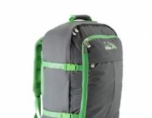
Gear Tips
1. Considering the nature of the weather, you must have capes for yourself and a backpack, windproof tents. Our "Lafuma Acadia 2/3" with plastic arches, for example - does not fit!
2. You must have a supply of gas - fires are allowed to burn only from September 15 to April 15. Primus gas cylinders (threaded) are sold everywhere in sports shops, 75-85 nok.
3. We have not seen sales of equipment that is interesting for us. Even a Primus gas lamp is slightly more expensive than in St. Petersburg. So take everything from home.
4. Food prices - were "like in St. Petersburg, only in crowns." That is, 4.5 times more expensive. There are few exceptions - chilled meat, for example, was only 50% more expensive.
5. It is advisable to have an air-conditioned car - cities are already difficult to navigate, and the heat should not be an additional stress. Surprisingly, the least expensive gasoline is in Sweden.
Cycling routesThere are bicycle roads - for example Laerdal - Luster - Turtagro. The places are really amazing. Also check out http://www.rallarvegen.no/default.asp?sprak=3 - during the season there is mass skating.
http://www.turist.ru/onews/stories/index2.shtml?2003/05/14/24410 - "Help for those traveling to the ends of the world"
http://tournavigator.ru/pclub.php?id=356 - what to see in Norway.
http://www.sun-light.ru/index/catalogue/149 - what to see in Norway.
http://norway.narod.ru/ - site of general information.
http://www.norvegia.narod.ru/ - site of general information.
Country:
18-06-2014, 14:12
mountain ranges
- Galldhøpiggen
Mountain, the highest point of the Scandinavian mountains. It is located in the Yutunheimen massif, northeast of Sognefjord in the southwest of the Scandinavian Peninsula (Norway). Composed of crystalline rocks (gabbro). The mountain is covered with small glaciers and eternal snows. It is an object of tourism. - Dovrefjell
Mountain range, part of the Scandinavian Mountains system The highest point is the summit of Snöhetta, 2286 m. It is located on the territory of the provinces of Oppland, Sør-Trøndelag, Hedmark and Møre og Romsdal. About 110 km to the northwest is the city of Kristiansund. - seven sisters
Mountain range on Alsten island, Nordland county, Norway. The ridge consists of seven peaks (from northeast to southwest). This ridge is popular with hikers and offers scenic views of the surrounding area. On clear days, visitors can understand why the locals refer to the area as the "Kingdom of the Thousand Islands".
Mountains of Svalbard
- Peak Galileo
Mountain peak on the island of Western Svalbard in the Svalbard archipelago. Peak Galileo is the fifth highest peak in Svalbard (1637 m). Galileo Peak is located west of Viydefjord, northwest of Newton Peak. The name was given in honor of the Italian astronomer Galileo Galilei. - miserifellet
Mountain peak on Bear Island (Spitsbergen archipelago), the highest point of the island. The mountain is located in the southern part of the island. Its height reaches 536 m. - newton
Mountain peak on the island of Western Svalbard, the highest point of the Svalbard archipelago. Mount Newton is located in the southern part of the New Friesland peninsula. The height of the peak is 1713 m. - Opera
Mountain on the island of West Spitsbergen with a height of 951 meters west coast Adventfjord. The mountain is named after its unusual shape - an amphitheater with Mount Tenor in the middle. - Peak Perrier
The second highest mountain peak in the Svalbard archipelago. Peak Perrier is located in the northeastern part of the island of Western Svalbard, 22 km northwest of Newton Peak. The height of the peak reaches 1712 m. - Templet
A mountain peak on the island of Western Svalbard (Spitsbergen archipelago. Mount Templet is located in the northern part of the Sassenfjord, in the south of Bunsow Land. Its height is 766 m. The name comes from the word temple - “temple” (due to the outward resemblance of the mountain to the ruined cathedral). - Ceres
Mountain peak on the island of Western Svalbard, the third highest point in the archipelago. Mount Ceres is located in the west of Viydefjord. The height of the peak reaches 1675 m. It is named after the dwarf planet Ceres. - Chadwick
Mountain peak on the island of Western Svalbard, the fourth highest point of the Svalbard archipelago. Mount Chadwick is located on the Ny Friesland peninsula, west of Viydefjord. Its height reaches 1640 m.
Glaciers
- Svartisen
The common name for two glaciers located in the northern. The name comes from the word sartis, which means the deep color of the ice in contrast to the white snow. Svartisen is the lowest glacier on European mainland. It is located at an altitude of only 20 m above sea level. The highest point of the glacier is 1594 meters, the maximum thickness of the glacier is 450 meters. - Jostedalsbreen
The largest glacier in continental Europe. It is located in the Norwegian county of Sogn og Fjordane. The highest peak of the glacier is Högste Bräakulen (1957 meters), although Lodalskop's nunatak rises to 2083 meters. - Brosvelbrin
An outflow glacier in the south of the island of North-Eastern Land (Spitsbergen archipelago). Brosvelbrin is located in the southern part of Serfonna, an ice sheet in the south of the island. Its length is 45 km, width - 20 km, area - 1,160 km². The glacier protrudes into the Barents Sea for 20–30 km. - Westfonna
The northwestern part of the ice sheet of the island of North-East Land. Vestfonna is located between the Valenbergfjord and the north coast of the island; covers an area of about 2,500 km², the maximum height is 637 m. The ice thickness in the center of the cover reaches 120 m, snow accumulation exceeds 1000 mm per year. In the south, southwest and northwest (in some places) glaciers descend to the sea. - Land of Olaf V
Glacier on the island of Western Svalbard in the Svalbard archipelago (Norway). The area of the glacier is over 4,150 km², making it the largest on the island. Also, the glacier is the second largest in the entire archipelago (after Ostfonna, located on the island of North-East Land, whose area is 8,492 km²). - Kongswegen
Glacier in the western part of the island of Western Svalbard (Spitsbergen archipelago, Norway). The glacier is located southeast of Kongsfjord, between Haakon VII Land and Oscar II Land. Its length is 20 km, its area is 105 km². - Cronebrine
Glacier located in the western part of the island of Western Svalbard (Spitsbergen archipelago). The area of the glacier is about 690 km². The glacier moves at an average speed of 2 m per day. It merges with two other glaciers - Conswegen and Conway. - Librin
Glacier on the island of North-East Land (Spitsbergen archipelago). The glacier is located near the northeast coast of the island. Its area is 925 km². Named after British explorer Benjamin Lee Smith (1828–1913), who visited Svalbard several times in 1870–1880. - Lomonosovfonna
Glacier on the island of Western Svalbard (Spitsbergen archipelago). The glacier is located in the central part of the island, northeast of Billefjord and west of Olaf V Land. Its area is about 800 km². - monacobrine
Glacier on the island of Western Svalbard (Spitsbergen archipelago, Norway). The glacier is located in the western part of the island, on the territory of Haakon VII Land. Its area is 408 km². - Negribrin
Glacier on the island of Western Svalbard (Spitsbergen archipelago). The glacier is located in the eastern part of the island and covers the territory of Olaf V Land and Sabin Land. The area of the glacier is about 1,180 km². - Nordenskiöldbreen
Glacier on the island of Western Svalbard (Spitsbergen archipelago, Norway). The glacier is located in the central part of the island, between Dixon Land and Byunsov Land. The glacier is 25 km long and 11 km wide. The glacier was named after the Finnish scientist and polar explorer Adolf Eric Nordenskjöld. - Osgardfonna
Glacier on the island of Western Svalbard (Spitsbergen archipelago). The glacier is located in the northern part of the island, on the Ny Friesland peninsula, between Viydefjord and Lomfjord. Its area is 1230 km². - Ostfonna
Ice cap on the island of North-East Land (Spitsbergen archipelago, Norway). The second largest glacier in Europe (after the ice cap north island) and seventh in the world. The glacier is located in the eastern part of the island and covers an area of about 8,492 km². In the south it merges with Serfonnaya, in the north and east it descends into the sea, forming icebergs. The central part reaches a height of 600–720 m above sea level, the thickness of the ice is about 560 m. - Serfonna
The southern part of the ice sheet of the island of North-East Land (Spitsbergen archipelago, Norway). Serfonna is the southern part of Ostfonna, the largest glacier in Svalbard. Its area is about 2,350 km². The height reaches 721 m. The thickness of the ice is up to 400 m. The outlet glacier Brosvelbrin protrudes into the Barents Sea for 20–30 km. In the north and northeast, Serfonna merges with Ostfonna. - Hinlopenbreen
Glacier on the island of Western Svalbard (Spitsbergen archipelago). The glacier is located in the eastern part of the island and covers an area of about 1,250 km². Its length is 70 km. - Edgejoyukulen
An ice cap located on Edge Island in the Svalbard archipelago. The area of the glacier is about 1365 km², which is almost a third of the area of the island. The ice thickness in the central part of the glacier reaches 250 km, along the periphery - 100 m. - Ethonbrine
Glacier on the island of North-East Land (Spitsbergen archipelago). The glacier is located on the west coast of the island and juts out into the Valenbergfjord. The area of the glacier is 1,070 km². The name of the glacier was given in honor of Eton College.
The mountains
- blocktinn
A mountain in the commune of Rødøy on the south side of Hjongsfjord. From the top you can see the Svartisen glacier and the offshore islands. - Maanselka
A mountain range in the northeast, it extends along the Russian-Finnish border ( Murmansk region in the north, Karelia in the south) from Norway to Karelia. The average height is 300–400 m. - Preikestolen
This is a giant cliff 604 m high above the Lysefjord opposite the Kjerag plateau in the commune of Forsand, Norway. The top of the cliff is about 25 by 25 meters square and almost flat. From the cliff hanging over, a magnificent view opens up, and thanks to him the rock is known as one of the main natural attractions of Norway. In 2006, about 95,000 people undertook the 6 km Preikestolen walk over 4 summer months. - Reinheimen
A triangle of mountains between the Otta Valley in the south, Gudbrandsdal in the northeast and Valldal in the northwest. The name of the territory was given when the traveler and writer Olaf Heitkötter wrote the book Reinheimen, in 1974. - Saltfjellet
The mountain range in the county of Nordland in Norway, separating the two regions of Helgeland and Salten. It is also a cultural border between the southern and central parts of Lapland. It is one of the largest mountain ranges in Norway, located on the border of the Arctic Circle. The ridge is part of 7 communes, such as: Saltdal, Bodø, Beyarn and Yildeskol - the northern part of the ridge; the western part is located on the territory of the communes of Meløy and Rødøy, the southern part is in the commune of Rana. - scandinavian mountains
Mountain system on the Scandinavian Peninsula. The length is about 1700 km, the width is up to 1320 km. The western slopes approach directly to the North Sea, forming steep shores, the famous ones. The eastern slopes gradually decrease and turn into flat spaces in Sweden. The northeastern part of the Scandinavian Mountains, stretching from the Trondheimsfjord to the Finnmarksvidda Plateau, is called Hjölen, or Kjölen. - Snönut
Mountain peak in Norway. It has a height of 1606 meters. Mount Snönut is located in the southern part of the country, in the municipality of Suldal and is the sixth most important peak in the province of Rogaland. The peak is located east of the Hürhjesteinskaret pass and north of the mountain lakes Svartavatnet and Kringlevatnet. - Troll Wall
Part of the Trolltinden mountain range. Located on the west coast of Norway, in the Ramsdal region. It has a height of 1100 meters above sea level. The highest stone wall in Europe. The Troll Wall is part of the Big Wall group. It also includes the walls of Trango Tower, El Capitan and others - these are the most famous and difficult climbing walls in the world. There are frequent landslides in this area. One of the largest occurred in the fall of 1998. The fallen off piece of rock radically changed some of the climbing routes. - Turghatten
A mountain located on the island of Torget in the municipality of Brönnøy, Nordland county in Norway. It is famous for its characteristic hole: a natural tunnel located in its center. - Ulriken
The highest of the Seven Mountains surrounding the city of Bergen, Norway's second largest city. Its height is 643 meters (according to other sources, 642 meters or 640 meters) above sea level. At the top of the mountain there is a tower for television and radio broadcasting, as well as cafes and viewing telescopes. - Floyen
The mountain, which is the most visited of the seven mountains surrounding the center of Bergen. This mountain has a funicular system that transports passengers from the center of Bergen to the observation deck, located at an altitude of 320 meters, in 6 minutes. The top of the mountain - 425 meters - is located 1 km northeast of the end station of the funicular. The funicular is used by tourists and citizens all year round. - Hjölen
Highlands in Sweden and Norway, northeastern part of the Scandinavian mountains; stretches for about 600 km from Trondheimsfjord and Lake Femunn approximately along the Swedish-Norwegian border to the Finnmarksvidda plateau (to the Finnish-Norwegian and Finnish-Swedish borders). The highest point of the upland is Mount Kebnekaise (2123 m). - Troll tongue
A stone ledge on Mount Skjeggedal, located near the city of Odda in Norway, towering over Lake Ringedalsvatn at an altitude of 350 meters. The shape of the protrusion resembles a tongue, for which it received its name. It is a broken piece of rock, frozen on its edge in a horizontal position.
They say you can't get away from yourself. But you can break out of the usual circle of life. At least not for long. To do this, it is enough to go off-road or along specially marked mountain routes. For example, in the mountains of Norway.
Such a journey through Norway involves not only an irresistible craving for adventure, but also a desire to plunge into the world of history, harsh landscapes and active rest. Thanks to the natural and spiritual beauty of this country, hiking is very popular here. In particular, mountain hiking along narrow fjords, seething waterfalls, high mountains and non-melting glaciers. Summer tourism in Norway is hiking along the marked paths of the Norwegian mountains in the Jotunheimen National Park, visiting the famous stone ledge on Mount Skjeggedal - the Troll language, Lake Ende - a cozy refuge for swans and gulls, the Hardangervidda plateau and many others. other.
The Kingdom of Norway is the embodiment of progress and prosperity. It is no coincidence that for several years in a row this country has topped the list of countries according to the HDI (the so-called "Human Development Index"). Here is the highest standard of living in the world. But in addition to material well-being, there are many stunning landscapes in Norway, where sheer cliffs imperceptibly pass into the bottomless depths of the fjords, where crystal clear mountain rivers constantly flow, giant rocks and impregnable glaciers rise.
The Jostedalsbreen glacier is the largest in Europe.
High in the mountains of Norway, where most of the space is occupied by impregnable cliffs and snow, frost and ice reign all year round. Here is the largest glacier in Europe - Jostedalsbreen, with an area of more than 480 km2. The thickness of its ice in some places reaches 600 m. Unfortunately, due to global warming, Jostedalsbreen gradually begins to give way to a warm climate, and, perhaps, in the near future, only documentary data will remain about this largest glacier in continental Europe.
Norway's highest mountain - Galdhøpiggen
The large rounded mountain or Galdhøpiggen is the highest point in Scandinavia (almost 2500m). They say that every Norwegian is simply obliged to conquer this peak at least once in his life. Located in the heart of the Jotunheimen National Park, Galdhøpiggen is surrounded by many other mountains and glaciers (about 250 in total), not so high (more than 2000 m), but no less majestic and impregnable. You can stand on the highest point in Norway along with our hike or an easier and shorter one.
Troll language in Norway (trolltunga, trolltunga)
Above Lake Ringedalsvatn on Mount Skjeggedal rises a natural ledge of an unusual shape and with no less strange name- Troll language (Trolltunga). Its height is almost 700 m. To climb it, you have to overcome many hours of climbing among waterfalls, mountain streams and lakes, of which there are many. But the views from Trolltung are worth it. Such a feeling of freedom and majesty of nature you will not feel, perhaps, anywhere else. Experience an incomparable sensation
standing on the edge of the Trolltongue you can in our nine-day hiking, as well as in the most saturated with attractions.
Pulpit Rock Preikestolen
The steep, severe peaks of the Norwegian mountains, more than two thousand meters high, serenely look at the picturesque valleys, evergreen forests, numerous mountain lakes and waterfalls of Scandinavia. One of the main natural attractions of the country is the giant Preikestolen - a rock, a block of which seemed to be torn apart by the god Thor himself. The famous Pulpit rises 604 meters above the Lysefjord, and has an almost flat top. From its height, almost at the level of the clouds, wonderful views of the harsh, but at the same time pacifying, Norwegian nature open up. There is a belief that Preikestolen will collapse on the very day when seven sisters from one village marry seven brothers from the same area. In accordance with the laws of random phenomena, this is, of course, possible, but unlikely. Our hikes include a visit to Preikestolen.
Each new trip to Norway is an opportunity to plunge into the atmosphere of hospitality, beautiful nature And modern life large metropolis, which is the capital of Norway - Oslo. Everything here is filled with positivity and kindness. And although this northern country has the lowest population density, campsites in Norway are found throughout the tourist routes. Among tourists, the most popular is the rest in tent city. Here you can put up a tent, stay in a hotel standard cottage or in a motor home. In general, Norway is the most favorable country not only for its inhabitants, but also for tourists.
in photosNorway is a fabulous country. There is clean air, a high standard of living, picturesque nature, clear turquoise water, lilac mountains, winding fjords and waterfalls. There are only two seasons in the country: white winter and green winter. The photo shows a landscape in the side Ulvik Fjord.
The Hardangerfjord (Norwegian: Hardangerfjorden) is one of the many fjords that Norway is famous for. The fjord is located in southwestern Norway and is surrounded by rocky mountains. The fjord is a popular tourist attraction with many hotels along its banks.
The Vøringsfossen waterfall (Norwegian: Vøringsfossen) is part of the Bjoreyu River.
Mountains of the North Cape (Norwegian: Nordkapplatået). The upper part of Nordkamp is flat, covered with rocky tundra with small lakes.
The Svartisen Glacier is the lowest glacier on the European mainland. The glacier is located on the Saltfjellet mountain range and is part of the national park.
Storglomvatnet lake with meltwater from the Svartisen glacier (Nor. Saltfjellet).
Huringan Mountains (Norwegian Hurrungane).
View of Preikestolen (Norwegian Preikestolen) and Lysefjord (Norwegian Lysefjord). Lysefjord was formed in the form of a tectonic fault caused by the movement of plates of the earth's crust about 400 million years ago.
The giant Preikestolen cliff rises above the Lysefjord. Its height is 604 meters, and the top is square and almost flat. There is a magnificent view from the cliff. Therefore, Preikestolen is one of the main attractions of Norway and is very popular among tourists. On the English language Preikestolen cliff sounds like Preacher's Pulpit or Pulpit Rock, which is translated into Russian as “Preacher's Chair” or “Rock-Chair”.
Kjeragbolt (Norwegian Kjeragbolten) or "Stone Pea" is a huge cobblestone stuck between two vertical rocky walls. This is another popular place among tourists. An abyss opens under the canal and reaches a depth of about a kilometer. In the photo on the right, a view of the Lysefjord from Kjoragbolt.
The northern slope of Kjøraga arouses and attracts the interest of base jumpers. 18-19 seconds of free flight attract thrill-seekers from all over the world. Kjøraga is one of the places in Norway where jumping is legal. Unfortunately, there were some tragic incidents (several deaths were recorded).
The Norwegian National Park Forlannet is located on the island of Prince Karl Land, belonging to the Svalbard archipelago.
Walrus colony in Prince Karl Land.
Osses (ridge, ridges) on the territory of Oscar II Land, located in the western part of the Svalbard archipelago. The land was named after Oscar II, King of Norway and Sweden.
The Vorlandsundet Strait separates Prince Carl Land and Oscar II Land.
The Norwegian Polar Institute (Norsk Polarinstitutt) is engaged in polar research. It was founded in 1928 by Adolf Gul. The Institute organizes expeditions to the Arctic and Antarctic and carries out research work.
Bear Island was discovered in 1596 by the Dutch navigators Willem Barents and Jacob van Heemskerk and got its name due to the fact that the discoverers saw a polar bear swimming off its coast, which tried to board the ship. The photo shows a rock on Bear Island.
Sea bird puffin or Atlantic puffin.
The village of Barentsburg (Norwegian: Barentsburg) is located on the Svalbard archipelago and got its name in honor of the Dutch navigator Willem Barents.
The active volcano Beerenberg on the island of Jan Mayen (Norwegian Jan Mayen) is the highest point. The island is partly covered by glaciers.
Glacier on the west coast of Bouvet Island (Norwegian: Bouvetøya). The island is uninhabited, volcanic, 93% of which is covered with glaciers.
Oslo (Norwegian Oslo) is the capital of Norway and the seat of government. Is the most major city Norway. The city is located at the northernmost tip of the Oslo Fjord. Pictured is the Norwegian Parliament building.
National Opera theatre Oslo (Norwegian Operahuset). The theater is located on the banks of the Oslo Fjord, and the theater building itself comes close to the very shore and even steps a little into the water. Anyone can climb the ramps from the shore to the very high point building, which offers a magnificent panorama of the city and the bay. The roof of the theater was also chosen by skateboarders.
The settlement of Undredal on the banks of the Sognefjord (Norwegian Sognefjorden). In Norway, he is called the "King of the Fjords". In the photo on the right below Sognefjord in winter.
The Vøringsfossen waterfall (Norwegian Vøringsfossen) is part of the Bjoreio River (Norwegian Bjoreio).
The Troll Wall (Nor. Trollveggen, Trollwall) is located on the western coast of Norway and is part of the Trolltinden mountain range (Nor. Trolltindene). The Troll Wall is the tallest stone wall in Europe.
Troll Staircase (Norwegian Trollstigen) or Troll Road is a popular and visited tourist place in Norway. The road was opened on July 31, 1936 by King Haakon VII and is an example of engineering and design art. In winter, the road is closed. There is parking at the very top. observation deck, which offers a magnificent view of the winding Troll Staircase.
On Mount Skjeggedal there is a stone ledge called the Troll's Tongue (Norwegian: Trolltunga). Located near the Norwegian city of Odda. The ledge got its name because of the shape, resembling a tongue.
The Vettisfossen waterfall (Norwegian Vettisfossen) is located in Western Norway, near the town of Ordal, on a tributary of the Utla River.
Traditional Norwegian house.
The village of Geiranger (Norwegian Geiranger) is located at the end of the Geirangerfjord (Norwegian Geirangerfjorden). The inhabitants of the village live exclusively on tourism.
The Geirangerfjord is considered the most beautiful fjord in the world. The main attraction of these places is the Seven Sisters waterfall. The spectacle is truly breathtaking.
View of the city of Bergen (nor. Bergen). The city is located in the west of the country, on the coast North Sea and is the second largest city in Norway. Until 1299, Bergen was the capital of Norway, now - major port, center of the oil industry.
Bergen is the most Old city Norway and is located on seven hills, which offer stunning views of the bay. The city center looks like a fairyland: colorful houses with tiled roofs, souvenir shops and restaurants, a view of the harbor dotted with snow-white yachts.
Nygårdsparken is the largest city park in Bergen and is located in the heart of the city.
The medieval embankment of Bergen - Bryggen (Norwegian Bryggen i Bergen), which is a complex of commercial buildings. The embankment is a favorite place for walks of tourists and locals.
The Urnes stave church is the oldest surviving stave church. The temple was built around 1130.
In the center of the city of Røros (Nor. Røros), many wooden buildings from the heyday of mining have been preserved. The city has an airport with regular flights to Oslo.
The main attraction of the city of Alta (Norwegian Alta) - cave drawings which have been turned into a museum open sky. The earliest drawing dates from around 4200 BC.
Alta Fjord (Norwegian Altafjorden) is located in the vicinity of the city of Alta.
The municipality of Vega (Norwegian Vega) has 6,500 islands.
Mount Turghatten or Torghatten (Norwegian Torghatten) is located on the island of Turget and is famous for its characteristic hole: a natural tunnel located in its center. You can walk along the mountain tunnel; a well-prepared path has been laid to it.
The Saltstraumen tidal current (Norwegian Saltstraumen) is considered one of the strongest tidal currents in the world. The water then forms whirlpools. This phenomenon occurs four times a day.
Norway, country of mountains. According to ongoing research, its territory was very often covered with glaciers that formed fjords. Fjords - today are considered the main attractions of Norway.
The most high peak in Norway - Mount Gallhöppigen, its height rises to the sky at 2469 m. Mount Glittertinn is slightly inferior to this hill, its height is 2452 m.
There are several mountainous regions in Norway, some of which are rich in vegetation, while others are presented in the form of naked majestic rocks. In each of these places there are quite a few opportunities for the whole family to go hiking in the mountains and have a great rest.
Mountain regions include Hardangervidda, Finnmarksvidda, Sunnmør Alps, Jotunheimen, Dovrefjell, Lyngsalpene, Rondane.
Hardangervidda is a mountain plateau, the local glacier is one of the largest. In the center is Mount Horteigen at an altitude of 1690 m. There are excellent routes for trekking, as well as for skiing and cycling with children.
Finnmarksvidda is a plateau immersed in greenery, known as the place of residence of the Sami, the indigenous population of the country. This place is very suitable for an active family holiday, in winter they go skiing and snowmobiling. In autumn and winter, you can admire the northern lights here.
The Sunnmør Alps rise 2,000 meters above the fjords. This place is known to all freeride lovers. Off-piste skiing is possible here even in summer. The gently sloping slopes allow for horseback riding and skiing. Children will feel very comfortable here on a hike.
Jotunheimen - here is the largest number of mountains, their height reaches two thousand meters. Here is Mount Galldhöppigen. The nature is picturesque, there are many rivers, lakes, glaciers, waterfalls and flowering valleys. There are excellent opportunities for cycling, mountaineering, downhill and cross-country skiing, as well as caving. Exactly this beautiful place in Europe.
Dovrefjell - borders southern and central Norway, here are National parks Dovre and Dovrefjell-Sundalsfjella. There are trails for hiking, cycling and skiing. The Pilgrim's Road is very popular.
Lyngsalpene is a mountain range located 300 km north of the Arctic Circle. Here the temperature is the lowest compared to other places, but there are excellent conditions for horseback riding, hiking, skiing dog sledding and skiing. There are many fish in local rivers and lakes.
Rondane is Norway's oldest national park. There are peaks over 2 thousand meters. A very remarkable place for casual walks. Most popular local tourist route It's called the Troll Trail. 170 km.