Islands of British Columbia. Local attractions
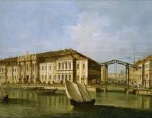
Have you ever dreamed of getting off the ground and soaring above the world like a bird? If so, Vancouver Island Flight Center is sure to please.
Having risen into the sky on a two-seat glider, controlled by an experienced pilot, visitors to the center can see the real Canada - majestic mountains and crystal clear lakes, sparkling waterfalls and endless ocean expanses for which this country is famous all over the world.
For a fee, the flight can be filmed on a video camera.
There is also a system of gift certificates.
The center is open 7 days a week from April to the end of September (in good weather also in October).
Graham Island
Graham Island belongs to British Columbia. The Spanish expedition of J. Perez discovered it in 1774. Later, in 1853, the island was named after Lord James Graham. Currently, the Indian Haida people live on the island. The area of the island is 6361 square kilometers - 22nd among the islands of Canada, as well as 101st among the world's islands.
The island is washed by the Pacific Ocean, the Dixon Entrance Strait and the Hekate Strait, which separates the island from the mainland. In the northeast, the extreme point of the island is called Rose Point, and in the northwest, Cape Knox. Langara Island is located not far from Cape Knox.
The climate on the island is very humid, which has a positive effect on the growth of coniferous forests, which the island is rich in. Mountainous terrain prevails in the west, lowlands in the northeast. There is an inner bay on the island called Masset. In the northeast of the island you can see the Nykun Park.
Newcastle Island
Newcastle Island is located in the eastern part of Vancouver Island, near the city of Nanaimo, British Columbia, Canada. You can get to it using ferry crossing from Nanaimo.
Once the island was owned by a mining company and coal mining was carried out on it, but after the mineral reserves dried up, the island was turned into an entertainment complex with floating hotels, dance floors and golf and football fields. On the larger territory of the island, there is a nature reserve, which is a delightful place for a picnic, fishing, tourist excursions and a paradise for photographers.
On the island you can rent a boat and go on an unforgettable fishing trip, you can visit the sea caves on its western shore, where once upon a time ritual burials were held, you can stay at an equipped campsite for a picnic, or go kayaking and canoeing.
Every year thousands of shorebirds flock to the island, which can be viewed from its eastern coast. There are also guides who will tell you about the flora and fauna of this paradise with great accuracy and reliability. There are over 20 kilometers of hiking trails on the island, which you can walk or ride a bike to see the local attractions.
Lyell Island
Lyell Island is one of the many islands in the Haida Guai archipelago, better known as the Queen Charlotte Islands. The island belongs to the Canadian province of British Columbia.
The size of the island is impressive: its area is 176 square kilometers, while the length of the coastline is 130 kilometers. The island is located not far from the mainland, and is also separated from another large island of the Moresby archipelago by a narrow strait.
The territory of the island is completely part of the Guai Haanas National Park Reservation, where many rare species of animals are collected, including the fastest bird in the world, peregrine falcon, black bear, marten, bald eagle and others.
Axel Heiberg Island
Axel-Heiberg Island is located west of the island Ellesmere and belong to the Arctic archipelago of Canada. The island is uninhabited. It is separated from the island of Mien by the Svredrup Strait. Axel-Heiberg is part of the Sverdrup and Queen Elizabeth Islands. The area of the island is 43,178 square kilometers, it ranks 7th among the islands of Canada and 32nd among the world's islands. The island has mountains over 2000 meters high, and there are also many glaciers.
In former times, the island was inhabited by the Inuit, now it is uninhabited. The island was named after Axel Heiberg, who sponsored the expedition. Until 1930, Norway claimed the island, now it is part of Canada. Later, in 1960, a research station was placed on the island. In 1968, unusual fossil forests were discovered and until 1999 its conservation was threatened. Canadian military helicopters appeared on the island to prevent forest theft.
North Island Wildlife Association
In the natural area North Island Associations Wildlife many animals live - turkeys, vultures, eagles, turtles, black bears, ducks and owls.
The territory of the park is very picturesque, the tours are informative and exciting. Everyone will like it here, from young to old. The perfect place for family holidays.
Many interesting and new things about the animal world will be discovered here by children, they will learn to respect nature and our smaller brothers. The park was created by volunteers, caring and dedicated people who help animals in need of help survive and return to their wild world.
North Island of the Wildlife Association is a unique animal sanctuary.
Lulu Island
The largest island at the mouth of the Fraser River, in the southwest of British Columbia, Canada, is Lulu Island. It is 19 kilometers long and 10 kilometers wide. Almost the entire territory of the island is occupied by the suburb of Vancouver, the city of Richmond, and only the eastern part belongs to the city of New Westminster.
There are different versions of where the name of the island came from: according to one version, the island was named after the actress of the first New Westmincer theater company Lulu Sweet, and another says that the name comes from the word "lolo", which means "carry" or "drag".
Most of the island of Lulu, on which the city of Richmond arose and is located, was once covered with swamps. Richmond City Nature Park carefully preserves the history of the island. There are more than 200 hectares of peatlands in the park. Bogs have long scared people. They were feared, especially at night, when “running” lights become visible, which move from one place to another, disappear, and then reappear. All this was associated with evil spirits. Although this phenomenon has a completely natural explanation, the whole point is that when plants die, when they rot in damp soil, gas is released in portions in water. The gas comes out in bubbles - it flashes and goes out, giving the impression that it runs across.
The city of Richmond, located on the island of Lulu, came out on top in the world in terms of life expectancy of its inhabitants. She is approximately 83 years old. themselves locals associate this with the pure nature of the island.
Prince Charles Island
Prince Charles Island belongs to the Arctic archipelago of Canada, geographically it belongs to Nunavut. The island is located in Fox Bay. Its area is 9521 square kilometers, it is the 19th place among the islands of Canada and the 78th place among the islands of the world's oceans.
The length of the coast is 402 kilometers. The island was discovered in 1948, in 1949, after Manning's research, it was mapped. The island was named after Prince Charles.
The surface of Prince Charles Island is mostly flat, however, hilly areas are also present. The island is surrounded by many small islands. As of 2012, the island is classified as uninhabited.
Southampton Island
Southampton Island is a fairly large island belonging to the Arctic archipelago of Canada, located at the entrance to Hudson Bay. The area of the island is 41,214 square kilometers, it ranks 9th among the islands of Canada and 34th among the world's islands.
The length of the coast is 1944 kilometers. It is separated from the Melville Peninsula by the Frozen Strait, and from West Bank Hudson Bay - Ros-Welcome Strait.
Mount Matiasen is the highest point of the island. This is one of the islands where there is no daylight saving time. The island has the settlement of Coral Harbor, whose population, according to 2001, is 721 people.
Salt Spring Island
All in search of inspiration creative people planets come to Salt Spring Island sooner or later. This is a unique place in Canada, because only here are healing mineral springs. The entire population of the island is represented by artists, sculptors and musicians who came here to relax and stayed to live forever. Gorgeous lavender fields and picturesque hills are able to charm anyone.
The entire territory of the island is covered with hilly pastures, where small herds peacefully graze. Local farmers make great cheese. In the southern part of the island there are several vineyards and local craftsmen are engaged in home winemaking.
Special art routes are organized for tourists, where you can get acquainted with the daily life of the islanders, as well as with the works of their creativity. Almost every resident is engaged in some kind of craft and gladly receives guests, showing their workshops. In the summer season, concerts and festivals are constantly organized here. From April to December, the Saturday Market Fair is open on the island, to which the islanders bring their products. But even in winter, life does not stop - skiers rush to Salt Spring with the first snow.
Kangit Island
Kangit Island is one of largest islands in the Haida Guai archipelago, formerly known as the Queen Charlotte Islands. The island occupies the southern part of the archipelago, its area is 132 square kilometers, the length from north to south is 24 kilometers, and the average width varies around 2-3 kilometers.
Geographically, the island belongs to the province of British Columbia, the Pacific Ocean is located around the island, as well as numerous straits, the largest of which is Hekate, which surrounds Kangit Island from the east.
The length of the coastline on the island is 121 kilometers, it belongs entirely to the water area Pacific Ocean, and the wide Hekate Strait separates the island from the mainland, which makes transport connection with Canada is very convenient.
Banks Island
Banks Island belongs to Canada's Arctic Archipelago and is located in the Northwest Territories. The island was named after Joseph Banks. It is separated from Victoria Island by the Prince of Wales Strait, and from the continent on the south side by Amundsen Bay. The Beaufort Sea is located to the west, and the McClure Strait separates it from Prince Patrick and Melville Islands.
The area of the island is 70028 square kilometers, it is the 5th place among the islands of Canada and the 24th place among the world's islands. The island is 380 kilometers long and 290 kilometers wide. The highest point on the island is Durham Heights, a mountain that reaches 370 meters in height.
Cape Prince Alfred is located in the northwest of the island, Cape Kellett is in the southwest. To the south is Cape Lamton, to the east is Cape Russell, and to the north is Cape Wrotsley. Eskimos live permanently on the island.
It is impossible to see tall trees on the island. In 1961, two reserves were created here and national park Olavik. There are large rivers on the island. Inhabitants of the island: white goose, musk oxen, polar bears, thrush, swallow, etc.
Air Force Island
Air Force Island is located in the Fox area (Northern Arctic Ocean) and is part of the Canadian Arctic Archipelago. You can go there by ship.
In the northeastern part of Air Fox Bay, everything is different: there are no ports, maritime stations where bustle reigns, but you can calmly admire the untouched bends of the coast, the surface of the bay, single boulders, and also stretch your legs, breathe freely. And the ocean here is not so seething and roaring, the excitement is noticeably less than in other parts of the island. The rays of the sun warm Air Force and make sea water spark. This is truly a magical place.
The area of Air Force Island is 1,720 square kilometers. The length of the coastline is 201 kilometers. The island is 62 kilometers long and has an average width of about 30 kilometers.
Moresby Island
Moresby is a large, inhabited scenic island in the Haida Guai (Queen Charlotte Islands) archipelago. The area of the island is 2608 square kilometers, about fifty people live on its territory.
The island has a very impressive landscape and landscapes, because it is covered with picturesque coniferous forests, and its shores are intricately cut by magnificent fjords. Not surprisingly, the island is home to the Guayi Haanas National Park.
The population is represented by indigenous people North America- the Haida people, and is concentrated in the northeastern part of the island. The island is named after the English naval officer Fairfax Moresby.
Sillem Island
Sillem Island is located on the north coast of Baffin Island. The path to it is not blocked by small rocks, and this suggests that it sank into the water slowly under the influence of inexplicable reasons, until it acquired stability and finally established itself in a position of 1590 meters above sea level.
Sillem Island, deep in Scott Bay, looks like a hill, it seems to have died out, there is not a single soul. Abandoned by mankind on the body of water, it is washed by the waters of the Gibbs and Clark fjord, and the upland heart of the island is under a permanent snow and ice dome.
Salisbury Island
In the waters of Hudson Bay, you can see a long 43-kilometer strip of sandy coast of Salisbury Island. On this deserted island, not a single cloud overshadows the clear azure of the sky, and the sea is wiped with a calm surface.
Seagulls sway on the frozen, calm surface of the ocean. The picture around is dull, but something still attracts the gaze of the traveler - this is an amazing calmness, the tranquility of nature.
In the central-eastern part of Salisbury Island, which is a plateau with a height of 250 to 500 meters, coastline drops steeply to the sea.
The western part of the island is a coastal plain, smoothly turning into low hills from 25 to 165 meters high. The maximum length of Salisbury Island from northwest to southeast is 47 kilometers, and its maximum width is 23 kilometers.
Ellef Ringnes Island
Ellef-Ringnes Island is one of the Sverdrup Islands belonging to the Canadian Arctic Archipelago. The area of the island is quite large - 11,295 square kilometers, which allows it to take 16th place among the islands of Canada and 69th place among the islands of the world's oceans.
The length of the coast is 1026 kilometers. The island was discovered in 1901 by expedition members Gunnar Isaksen and Sverre Hassel. The island was named after one of the Oslo brewing brothers who sponsored the expedition. Since 1902, the island belonged to Norway, however, in 1929, she abandoned it in favor of Canada.
There is no permanent population on the island, however, there is a weather station and Isaksen Airport, which began its activity in 1948.
Cornwallis Island
Cornwallis Island belongs to the Arctic archipelago of Canada. It was opened in 1819 and named after William Conwallis, a British admiral. The island covers an area of 6995 square kilometers, it is 21st among the islands of Canada and 96th among the world's oceans. The length of the coast is 636 kilometers. Near Cornwallis Island is Somerset Island, separated by Barrow Strait.
The island is 115 kilometers long and 90 kilometers wide. For the most part, the landscape is represented by plains, only in the southeast there are hills, the maximum height of which is 350 meters. The only place where people live is Resolute.
Pender Island Golf Club
Pender Island Golf Club has one of the most beautiful public golf courses in all of Canada.
In 1937, several Pender residents purchased 60 acres of land from George Grimmer. People have worked hard on the layout and construction of these amazing green golf courses.
From 1945 to the present, the golf club has been operating continuously. Open all year round, the golf center awaits its visitors, for whom wonderful golf courses, specialized shops with sports equipment, restaurants and bistros are prepared.
On the official website of the golf club you can see the schedule of events and tournaments, as well as prices for classes. Experienced instructors are ready to deal with novice players.
Bylot Island
Bylot Island is located off the northeast coast of Baffin Island and is part of Canada's Arctic Archipelago. The area of the island is 11,067 square kilometers, among the islands of Canada it takes 17th place, among the islands of the world's oceans - 72nd place. The length of the coast is 579 kilometers. Bylot Island, among other things, is part of national park Sirmilik.
The island was discovered by Robert Bylot during an expedition that was looking for a "northwest passage" in 1616, and the island was named after him. It was not until 1906 that Captain Joseph-Elzer Bernier recognized and proclaimed the island a part of Canadian territory.
Melville Island
Melville Island belongs to the Arctic Archipelago of Canada, territorially the island is divided between Nunavut and the Northwest Territories. The area of the island is 42149 square kilometers, it is the 8th among the islands of Canada and the 33rd among the world's islands. Melville Island is one of the largest islands in the Parry Archipelago. The length of the coast is 3107 kilometers.
The island is uninhabited. It was discovered in 1819 by William Parry. The island was named in honor of Robert Dundas, he was a Melville Viking. The researchers made an assumption that there are natural gas deposits on the island. The island is considered one of the coldest places in North America, since the air temperature here, even in summer, does not exceed plus five degrees.
Devon Island
Devon Island belongs to the Arctic archipelago of Canada and is part of the Queen Elizabeth Islands. This is the largest of uninhabited island in the world. The area of the island is 55247 square kilometers, the length of the coast is 3589 kilometers. Devon Island is ranked 6th among the islands of Canada and 27th among the world's islands.
From west to east, the island stretches for 503 kilometers, from south to north - for 289 kilometers. Lancaster Strait separates it from Baffin Island, Wellington Strait from Cornwallis Island, and Penny Strait from Bathurst Island. It is separated from North Kent Island, located to the northwest of Devon Island, by the Cardigan Strait, from Ellesmere Island by the Jones Strait, and from Coberg Island by the Lady Ann Strait.
The island was discovered by William Baffin and Richard Bylot in 1616. In 1819, the island was named after the county of Devon in Great Britain.
Bathurst Island
Bathurst Island is located in the Arctic archipelago of Canada, belongs to the group of Queen Elizabeth Islands. The area of the island is 16,042 square kilometers, it ranks 13th among the islands of Canada and 54th among the world's islands. The length of the coast is 2069 kilometers.
The landscape of the island is a plain, only sometimes the height is 300-350 meters above sea level. The island has a lot of greenery, ideal conditions for polar species of fauna. The island was discovered in 1819 by William Edward Parry during an expedition and named after the 3rd Earl of Bathurst.
Also on the island is a valley rich in vegetation, with a humid climate, with many herbs and flowering plants. Also, about 30 species of birds live here, mostly waterfowl. In former times, the Eskimos lived on the island, but now the island is uninhabited.
Crown Island Golf Resort
Crown Isle Golf Resort is located in the heart of the Comox Valley in Courtenay. The 18-hole course is the centerpiece of Crown Island, offering a variety of levels of golf throughout the year.
The golf resort has a Resort Center with conference facilities, a dining room and a hotel. Life is constantly in full swing here, as the pristine beaches of the island, ski resorts, numerous hiking trails, specialty shops, unique restaurants, galleries, festivals and other events make this island delightfully attractive.
The Comox Valley's central location makes it easily accessible to tourists with daily flights from Vancouver, Calgary, Edmonton and other areas. The resort is only five minutes drive from the international airport.
Kliluk Lake, British Columbia, Canada

 73°00′ s. sh. 121°30′ W d. /
73.000° N sh. 121.500°W d. / 73.000; -121.500
Coordinates :
73°00′ s. sh. 121°30′ W d. /
73.000° N sh. 121.500°W d. / 73.000; -121.500
Coordinates :
Banks(Banks, Banks Island) Banks Island listen)) is one of the largest islands in the Canadian Arctic Archipelago, ( ) is located in administrative district Inuvik Northwest Territories, Canada.
Name history
Population
The only permanent Eskimo settlement on the island is Sachs Harbor or Ikhuaq, located on southwest coast.
see also
Write a review on the article "Banks (island)"
Literature
- Canada. Banks Island, a Natural Area of Canadian Significance. Natural area of Canadian significance. Ottawa: Parks Canada, 1978.
- Cotter, R. C., and J. E. Hines. 2001. Breeding Biology of Brant on Banks Island, Northwest Territories, Canada. Arctic. 54: 357-366.
- Gajewski, K, R Mott, J Ritchie, and K Hadden. 2000. Holocene Vegetation History of Banks Island, Northwest Territories, Canada. Canadian Journal of Botany. 78: 430-436.
- Holyoak, D.T. Notes on the Birds of Southwestern Banks Island, Northwest Territories, Canada. Bulletin of the British Ornithologists" Club, Vol. 103, No. 2, June. 1983.
- Manning, T. H., E. O. Höhn, and A. H. Macpherson. The Birds of Banks Island. 1956.
- Stephens, L. E., L. W. Sobczak, and E. S. Wainwright. Gravity Measurements on Banks Island, N.W.T.. Gravity map series, no. 150. Ottawa: Dept. of Energy, Mines and Resources, Earth Physics Branch, 1972.
- Struzik, Ed. 2000. AND THEN THERE WERE 84,000 - The Return of Musk-Oxen to Canada's Banks Island in Recent Decades Is Just One Chapter of a Beguiling Arctic Mystery. International Wildlife. 30, no. 1:28.
- Will, Richard T. Utilization of Banks Island Muskoxen by Nineteenth Century Copper Inuit. : Boreal Institute for Northern Studies, 1983.
Links
An excerpt characterizing Banks (island)
I looked at him with my eyes wide open, and could not believe that I really heard all this ... Again, Caraffa was extremely dangerous in his madness, and it was unlikely that there was a medicine somewhere that could help him .- Enough empty talk! - suddenly, quite rubbing his hands, exclaimed "the holy father." - Come with me, my dear, I think this time I will still be able to stun you! ..
If only he knew how well he was constantly able to do it! .. My heart ached, anticipating evil. But there was no choice - I had to go ...
Smiling contentedly, Caraffa literally “dragged” me by the hand along a long corridor until we finally stopped at a heavy door decorated with patterned gilding. He turned the handle and... Oh, gods!!!.. I found myself in my favorite Venetian room, in our own family palazzo...
Looking around in shock, not being able to recover from the “surprise” that had so unexpectedly collapsed, I calmed my jumping heart, being unable to breathe! wonderful years, then not yet ruined by the anger of a cruel person ... who recreated for some reason here (!) today my dear, but long-lost, happy world ... In this miraculously “resurrected” room, each of my personal thing, every little thing I love!.. Unable to take my eyes off all this sweet and so familiar to me environment, I was afraid to move, so as not to accidentally frighten off the wondrous vision ...
– Do you like my surprise, Madonna? - Satisfied with the effect, asked Karaffa.
The most incredible thing was that this strange man sincerely did not understand what deep mental pain he caused me with his “surprise”!.. Seeing HERE (!!!) what was once a real “center” of my family happiness peace, I wanted only one thing - to rush at this terrible "holy" Pope and strangle him in a deadly embrace until his terrifying black soul flies out of him forever ... But instead of realizing what I wanted so much, I just tried to get myself together so that Caraffa does not hear how my voice trembles, and as calmly as possible said:
“Excuse me, Your Holiness, can I stay here alone for a while?”
– Well, of course, Isidora! This is now your quarters! I hope you like them.
Did he really not understand what he was doing?! .. Or vice versa - he knew perfectly well? .. And it was just his restless atrocity that “had fun” that still did not find peace, inventing some new tortures for me? !.. Suddenly, a burning thought slashed me - what, in this case, became of everything else?.. What happened to our wonderful home, which we all loved so much? What happened to the servants and servants, to all the people who lived there?!
“May I ask Your Holiness, what has become of our ancestral palace in Venice?” I whispered in a shaky voice. - What happened to those who lived there? .. You didn’t throw people out into the street, I hope? They have no other home, Holiness! ..
Caraffa grimaced in displeasure.
– Have mercy, Isidora! Should you take care of them now? .. Your house, as you, of course, understand, has now become the property of our holy church. And everything that was connected with him is no longer your concern!
- My house, like everything that is inside it, Your Holiness, after the death of my beloved husband, Girolamo, belongs to my daughter Anna, while she is alive! I exclaimed indignantly. – Or does the “holy” church no longer consider her a tenant in this world?!
Everything was boiling inside me, although I perfectly understood that, being angry, I only complicated my already hopeless situation. But the arrogance and arrogance of Caraffa, I'm sure, could not leave a single normal person calm! Even when it was only about desecrated memories dear to his heart...
- As long as Anna is alive, she will be here, Madonna, and serve our beloved holy church! Well, if she, unfortunately, changes her mind, she, one way or another, will no longer need your wonderful home! - Caraffa hissed furiously. – Do not overdo it in your zeal to find justice, Isidora! It can only harm you. My long-suffering also has limits... And I sincerely advise you not to cross them!..
Abstract on the topic:
Banks (island)
Plan:
- Introduction
- 1 Geography
- 2 Name history
- 3 Flora and fauna Literature
Introduction
Coordinates: 73°00′00″ s. sh. 121°30′00″ W d. / 73° N sh. 121.5°W d.(G) (O) (I)
73 , -121.5Banks(Banks, Banks Island) Banks Island) is one of the largest islands in the Canadian Arctic Archipelago, ( 73 , -121.5 73°00′ s. sh. 121°30′ W d. / 73° N sh. 121.5°W d.(G)(O)
listen)) is located in the administrative district of Inuvik, Northwest Territories, Canada. It is separated from Victoria Island in the east by the Prince of Wales Strait, and from the mainland in the south by Amundsen Bay. The Beaufort Sea lies to the west. To the northeast, the McClure Strait separates it from Prince Patrick and Melville Islands.1. Geography
The only permanent Eskimo settlement on the island is Sachs Harbor or Ikhuaq, located on the southwest coast. Banks Island covers an area of 70,028 km², in terms of area it ranks 24th in the world and 5th in Canada. It is almost 380 km long and up to 290 km wide. Highest point on the island is located in the south, it is the mountain Durham Heights (Durham Heights), which reaches a height of 730 m.
Major rivers: Thomsen, Big River and Bernard. The Big River and Bernard Rivers flow west into the Arctic Ocean, the Thomsen River north into McClure Strait. Large bays - De Saly (in the southeast), Teeseger (in the southwest), Burnet and Storkerson (in the west). Extreme points: Cape Prince Alfred in the northwest, Cape Kellett in the southwest, Cape Lamton in the south, Cape Russell in the east and Cape Rothsley in the north.
2. History of the name
Named in 1820 by Sir William Parry after Sir Joseph Banks. However, during the survey of the territory conducted by Robert McClure (1850-1854), the island was marked on his maps as "Baring Island".
Banks from space
3. Flora and fauna
Trees do not grow on Banks, the tallest plant on the island is the arctic willow, which occasionally reaches the height of a human knee, usually no higher than 10 cm.
In 1961, two migratory bird sanctuaries were founded on the island. Olavik National Park is located in the north of the island. Banks Island is home to two-thirds of the world's population of the little white goose, and the geese migrate to the island from the mainland via the Amundsen Strait. The island also has the highest concentration of musk oxen in the world - about 70 thousand individuals. In the vicinity of Saks Harbor, they are hunted annually. Here you can also meet the tundra caribou, polar bear and birds such as the wandering thrush and swallow.
It was here that a hybrid of a polar and brown bear was found for the first time in the world.
downloadThis abstract is based on an article from the Russian Wikipedia. Synchronization completed 07/12/11 08:33:23
Similar abstracts: Banks ,