What and where washes the Indian Ocean. Indian Ocean: on the map, seas, currents, photo, islands, depressions, fish, geography, ecology, depth, size, area
Ocean area - 76.2 million square kilometers;
Maximum depth - Sunda Trench, 7729 m;
Number of seas - 11;
The largest seas are the Arabian Sea, the Red Sea;
The largest bay is the Bay of Bengal;
Most big islands- the island of Madagascar, Sri Lanka;
The strongest currents:
- warm - South Tradewind, Monsoon;
- cold - Western Winds, Somali.
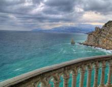
By size Indian Ocean takes third place. Most of it is in the Southern Hemisphere. In the north it washes the shores of Eurasia, in the west - Africa, in the south - Antarctica, and in the east - Australia. The coastline of the Indian Ocean is slightly indented. On the north side, the Indian Ocean seems to be shrouded in land, as a result of which it is the only one of the oceans that is not connected to the Arctic Ocean.
The Indian Ocean was formed as a result of the split of the ancient mainland Gondwana into parts. It is located on the border of three lithospheric plates - Indo-Australian, African and Antarctic. The Arabian-Indian, West Indian, and Australo-Antarctic mid-ocean ridges are the boundaries between these plates. Underwater ridges and elevations divide the ocean floor into separate basins. The shelf zone of the ocean is very narrow. Most of the ocean is within the boundaries of the bed and has a significant depth.
From the north, the Indian Ocean is reliably protected by mountains from the penetration of cold air masses. Therefore, the temperature of surface waters in the northern part of the ocean reaches +29 ˚С, and in the summer in the Persian Gulf it rises to +30…+35 ˚С.
An important feature of the Indian Ocean is the monsoon winds and the monsoon current created by them, which changes its direction seasonally. Hurricanes are frequent, especially around the island of Madagascar.
The coldest regions of the ocean are in the south, where the influence of Antarctica is felt. Icebergs are found in this part of the Pacific Ocean.
The salinity of surface waters is higher than in the oceans. The salinity record was recorded in the Red Sea - 41%.
The organic world of the Indian Ocean is diverse. Tropical water masses are rich in plankton. The most common fish include: sardinella, mackerel, tuna, mackerel, flounder, flying fish and numerous sharks.
Shelf areas and coral reefs are especially saturated with life. In the warm waters of the Pacific Ocean there are giant sea turtles, sea snakes, many squids, cuttlefish, starfish. Closer to Antarctica there are whales and seals. In the Persian Gulf near the island of Sri Lanka, pearls are mined.
Important shipping routes pass through the Indian Ocean, mostly in its northern part. The Suez Canal, dug at the end of the 19th century, connects the Indian Ocean with the Mediterranean Sea.
The first information about the Indian Ocean was collected as far back as 3 thousand years BC by Indian, Egyptian and Phoenician navigators. The first sailing routes in the Indian Ocean were compiled by the Arabs.
Vasco da Gama, after the discovery of India in 1499, Europeans began to explore the Indian Ocean. English navigator James Cook during the expedition made the first measurements of the depth of the ocean.
A comprehensive study of the nature of the Indian Ocean begins at the end of the 19th century.
Nowadays, warm waters and picturesque coral islands of the Indian Ocean, which attract the attention of tourists from different countries world, are carefully studied by numerous scientific expeditions from all over the world.
The Indian Ocean is the third largest ocean on Earth, covering about 20% of its water surface. Its area is 76.17 million km², volume - 282.65 million km³. The most deep point ocean is located in the Sunda Trench (7729 m).
- Area: 76,170 thousand km²
- Volume: 282,650 thousand km³
- Maximum depth: 7729 m
- Average depth: 3711 m
In the north it washes Asia, in the west - Africa, in the east - Australia; in the south it borders on Antarctica. The border with the Atlantic Ocean runs along the 20 ° meridian of east longitude; from the Pacific - along the 146 ° 55 'meridian of eastern longitude. The northernmost point of the Indian Ocean is located at approximately 30° north latitude in the Persian Gulf. The width of the Indian Ocean is approximately 10,000 km between the southern points of Australia and Africa.
Etymology
The ancient Greeks called the western part of the ocean known to them with adjacent seas and bays the Erythrean Sea (ancient Greek Ἐρυθρά θάλασσα - Red Sea, and in old Russian sources the Red Sea). Gradually, this name began to be attributed only to the nearest sea, and the ocean gets its name from India, the country most famous at that time for its wealth on the shores of the ocean. So Alexander the Great in the IV century BC. e. calls it Indicon Pelagos (ancient Greek Ἰνδικόν πέλαγος) - "Indian Sea". Among the Arabs, it is known as Bar-el-Hind (modern Arabic المحيط الهندي - al-mụkhіt al-hindi) - "Indian Ocean". Since the 16th century, the name Oceanus Indicus (lat. Oceanus Indicus) introduced by the Roman scientist Pliny the Elder back in the 1st century was established - the Indian Ocean.
Physical and geographical characteristics
General information
The Indian Ocean is mainly located south of the Tropic of Cancer between Eurasia to the north, Africa to the west, Australia to the east and Antarctica to the south. The border with the Atlantic Ocean runs along the meridian of Cape Agulhas (20 ° E to the coast of Antarctica (Queen Maud Land)). The border with the Pacific Ocean runs: south of Australia - along the eastern border of the Bass Strait to the island of Tasmania, then along the meridian 146 ° 55 'E. to Antarctica; north of Australia - between the Andaman Sea and the Strait of Malacca, further along the southwestern coast of Sumatra, the Sunda Strait, the southern coast of Java, the southern borders of the Bali and Savu seas, the northern border of the Arafura Sea, the southwestern coast of New Guinea and the western border of the Torres Strait . Sometimes the southern part of the ocean, with a northern boundary of 35 ° S. sh. (on the basis of the circulation of water and the atmosphere) up to 60 ° S. sh. (according to the nature of the bottom topography), they are attributed to the Southern Ocean, which is not officially distinguished.
Seas, bays, islands
The area of the seas, bays and straits of the Indian Ocean is 11.68 million km² (15% of the total ocean area), the volume is 26.84 million km³ (9.5%). The seas and main bays located along the coast of the ocean (clockwise): Red Sea, Arabian Sea (Gulf of Aden, Gulf of Oman, Persian Gulf), Laccadive Sea, Bay of Bengal, Andaman Sea, Timor Sea, Arafura Sea (Gulf of Carpentaria), Large Australian Gulf, Mawson Sea, Davis Sea, Commonwealth Sea, Astronaut Sea (the last four are sometimes referred to as the Southern Ocean). 
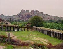
Some islands - for example, Madagascar, Socotra, Maldives - are fragments of ancient continents, others - Andaman, Nicobar or Christmas Island - are of volcanic origin. The largest island in the Indian Ocean is Madagascar (590 thousand km²). The largest islands and archipelagos: Tasmania, Sri Lanka, the Kerguelen archipelago, Andaman Islands, Melville, Mascarene Islands (Reunion, Mauritius), Kangaroo, Nias, Mentawai Islands (Siberut), Socotra, Groot Island, Comoros, Tiwi Islands (Bathurst), Zanzibar, Simeulue, Furno Islands (Flinders), Nicobar Islands, Qeshm , King, Bahrain Islands, Seychelles, Maldives, Chagos Archipelago. 
The history of the formation of the Indian Ocean
During the early Jurassic, the ancient supercontinent Gondwana began to break apart. As a result, Africa with Arabia, Hindustan and Antarctica with Australia were formed. The process ended at the turn of the Jurassic and Cretaceous periods (140-130 million years ago), and a young basin of the modern Indian Ocean began to form. In the Cretaceous period, the ocean floor grew due to the movement of Hindustan to the north and the reduction in the area of the Pacific and Tethys oceans. In the Late Cretaceous, the split of the single Australo-Antarctic continent began. At the same time, as a result of the formation of a new rift zone, the Arabian plate broke away from the African plate, and the Red Sea and the Gulf of Aden were formed. At the beginning of the Cenozoic era, the growth of the Indian Ocean stopped towards the Pacific, but continued towards the Tethys Sea. At the end of the Eocene - the beginning of the Oligocene, Hindustan collided with the Asian continent. 
Today, the movement of tectonic plates continues. The axis of this movement is the mid-ocean rift zones of the African-Antarctic Ridge, the Central Indian Ridge, and the Australo-Antarctic Rise. The Australian plate continues to move north at a rate of 5-7 cm per year. The Indian plate continues to move in the same direction at a speed of 3-6 cm per year. The Arabian Plate is moving northeast at a rate of 1-3 cm per year. The Somali Plate continues to break away from the African Plate along the East African Rift Zone, which moves at a speed of 1-2 cm per year in a northeasterly direction. December 26, 2004 in the Indian Ocean near the island of Simeulue, located near the north West Bank islands of Sumatra (Indonesia), there was the largest earthquake in the history of observations with a magnitude of up to 9.3. The reason was the shift of about 1200 km (according to some estimates - 1600 km) of the earth's crust at a distance of 15 m along the subduction zone, as a result of which the Hindustan plate moved under the Burma plate. The earthquake triggered a tsunami that caused massive damage and great amount dead (up to 300 thousand people). 
Geological structure and topography of the bottom of the Indian Ocean
mid-ocean ridges
Mid-ocean ridges divide the bottom of the Indian Ocean into three sectors: African, Indo-Australian and Antarctic. There are four mid-ocean ridges: the West Indian, Arabian-Indian, Central Indian ridges and the Australo-Antarctic Rise. The West Indian Ridge is located in the southwestern part of the ocean. It is characterized by underwater volcanism, seismicity, rift-type crust and rift structure of the axial zone; it is crossed by several oceanic faults of submeridional strike. In the region of the island of Rodrigues (Mascarene archipelago) there is a so-called triple connection, where the system of ridges is divided to the north into the Arabian-Indian ridge and to the south-west into the Central Indian ridge. The Arabian-Indian ridge is composed of ultramafic rocks; deep depressions(ocean troughs) with depths up to 6.4 km. The northern part of the ridge is crossed by the most powerful Owen Fault, along which the northern segment of the ridge experienced a displacement of 250 km to the north. Further west, the rift zone continues into the Gulf of Aden and north-northwest into the Red Sea. Here the rift zone is composed of carbonate deposits with volcanic ash. In the rift zone of the Red Sea, strata of evaporites and metal-bearing silts associated with powerful hot (up to 70 °C) and very saline (up to 350 ‰) juvenile waters have been found. 
In the southwest direction from the triple junction extends the Central Indian Ridge, which has a well-defined rift and flank zones, ending in the south with the Amsterdam volcanic plateau with the volcanic islands of Saint-Paul and Amsterdam. From this plateau, the Australo-Antarctic Rise extends to the east-southeast, having the form of a wide, slightly dissected arch. In the eastern part, the uplift is dissected by a series of meridional faults into a number of segments displaced relative to each other in the meridional direction.
African segment of the ocean
The underwater margin of Africa has a narrow shelf and a distinct continental slope with marginal plateaus and continental foot. In the south, the African continent forms protrusions protruding to the south: the Agulhas bank, the Mozambique and Madagascar ridges, composed of continental-type earth's crust. The continental foot forms a sloping plain extending south along the coast of Somalia and Kenya, which continues in the Mozambique Channel and borders Madagascar from the east. The Mascarene Range runs along the east of the sector, in the northern part of which the Seychelles are located.
The surface of the ocean floor in the sector, especially along the mid-ocean ridges, is dissected by numerous ridges and troughs associated with submeridional fault zones. There are many underwater volcanic mountains, most of which are built on coral superstructures in the form of atolls and underwater coral reefs. Between the mountain rises there are basins of the ocean floor with a hilly and mountainous relief: Agulhas, Mozambique, Madagascar, Mascarene and Somali. In the Somali and Mascarene basins, vast flat abyssal plains are formed, where a significant amount of terrigenous and biogenic sedimentary material enters. In the Mozambique Basin, there is an underwater valley of the Zambezi River with a system of alluvial fans.
Indo-Australian segment of the ocean
The Indo-Australian segment occupies half the area of the Indian Ocean. In the west, in the meridional direction, the Maldives Range passes, on the top surface of which the islands of Laccadive, Maldives and Chagos are located. The ridge is composed of continental-type crust. A very narrow shelf, a narrow and steep continental slope, and a very wide continental foot stretched along the coast of Arabia and Hindustan, mainly formed by two giant fans of turbid streams of the Indus and Ganges rivers. These two rivers carry 400 million tons of debris into the ocean. The Indus cone extends far into the Arabian Basin. And only the southern part of this basin is occupied by a flat asbyssal plain with separate seamounts.
Almost exactly 90° E. The blocky oceanic East Indian Ridge stretches for 4,000 km from north to south. Between the Maldives and the East Indian Ranges is the Central Basin - the largest basin of the Indian Ocean. Its northern part is occupied by the Bengal alluvial fan (from the Ganges River), to the southern border of which the abyssal plain adjoins. In the central part of the basin there is a small Lanka ridge and the Afanasy Nikitin seamount. To the east of the East Indian Ridge are the Cocos and Western Australian Basins, separated by a blocky sublatitudinally oriented Cocos Rise with the Cocos and Christmas Islands. In the northern part of the Coconut Basin there is a flat abyssal plain. From the south, it is bounded by the West Australian Rise, which drops steeply to the south and gently plunges under the bottom of the basin to the north. From the south, the West Australian Rise is bounded by a steep ledge associated with the Diamantina Fault Zone. The ralome zone combines deep and narrow grabens (the most significant are the Ob and Diamatina) and numerous narrow horsts. 
The transitional region of the Indian Ocean is represented by the Andaman Trench and the deep-sea Sunda Trench, to which maximum depth Indian Ocean (7209 m). The outer ridge of the Sunda island arc is the underwater Mentawai Range and its continuation in the form of the Andaman and Nicobar Islands.
Underwater margin of the Australian mainland
The northern part of the Australian continent is bordered by a wide Sahul shelf with many coral structures. To the south, this shelf narrows and widens again off the coast of southern Australia. The continental slope is composed of marginal plateaus (the largest of them are the Exmouth and Naturalists plateaus). In the western part of the Western Australian Basin, the Zenith, Cuvier and other rises are located, which are pieces of the continental structure. Between the southern underwater margin of Australia and the Australo-Antarctic Rise, there is a small South Australian Basin, which is a flat abyssal plain.
Antarctic segment of the ocean
The Antarctic segment is bounded by the West Indian and Central Indian ridges, and from the south by the coast of Antarctica. Under the influence of tectonic and glaciological factors, the shelf of Antarctica is overdeepened. The wide continental slope is cut through by large and wide canyons, through which supercooled water flows from the shelf into the abyssal depressions. The continental foot of Antarctica is distinguished by a wide and significant (up to 1.5 km) thickness of loose deposits.
The largest protrusion of the Antarctic continent is the Kerguelen Plateau, as well as the volcanic uplift of the Prince Edward and Crozet Islands, which divide the Antarctic sector into three basins. To the west is the African-Antarctic Basin, which is half located in the Atlantic Ocean. Most of its bottom is a flat abyssal plain. The Crozet Basin, located to the north, is characterized by a large-hilly bottom topography. The Australo-Antarctic Basin, lying to the east of Kerguelen, is occupied in the southern part by a flat plain, and in the northern part by Abyssotian hills.
Bottom sediments
The Indian Ocean is dominated by calcareous foraminiferal-coccolithic deposits, which occupy more than half of the bottom area. The wide development of biogenic (including coral) calcareous deposits is explained by the position of a large part of the Indian Ocean within the tropical and equatorial belts, as well as by the relatively shallow depth of oceanic basins. Numerous mountain uplifts are also favorable for the formation of lime deposits. In the deep parts of some basins (for example, the Central, Western Australian), deep-water red clays occur. The equatorial belt is characterized by radiolarian muds. In the southern cold part of the ocean, where the conditions for the development of diatom flora are especially favorable, siliceous diatom deposits are represented. Iceberg sediments are deposited off the Antarctic coast. At the bottom of the Indian Ocean, ferromanganese nodules are widely distributed, confined mainly to areas of deposition of red clays and radiolarian silts.
Climate
In this region, four climatic zones are distinguished, stretched along the parallels. Under the influence of the Asian continent, a monsoonal climate is established in the northern part of the Indian Ocean with frequent cyclones moving towards the coasts. High atmospheric pressure over Asia in winter causes the northeast monsoon to form. In summer, it is replaced by a humid southwest monsoon, carrying air from the southern regions of the ocean. During the summer monsoon, there is often a wind force of more than 7 points (with a frequency of 40%). In summer, the temperature over the ocean is 28-32 °C, in winter it drops to 18-22 °C.
In the southern tropics, the southeast trade wind dominates, which in winter does not extend north of 10°N. The average annual temperature reaches 25 °C. In the zone 40-45°S. Throughout the year, the western transfer of air masses is characteristic, it is especially strong in temperate latitudes, where the frequency of storm weather is 30-40%. In the mid-ocean, stormy weather is associated with tropical hurricanes. In winter, they can also occur in the southern tropical zone. Most often, hurricanes occur in the western part of the ocean (up to 8 times a year), in the areas of Madagascar and the Mascarene Islands. In subtropical and temperate latitudes, the temperature reaches 10-22 °C in summer and 6-17 °C in winter. Strong winds are characteristic from 45 degrees and south. In winter, the temperature here ranges from -16 °C to 6 °C, and in summer - from -4 °C to 10 °C.
The maximum amount of precipitation (2.5 thousand mm) is confined to the eastern region of the equatorial zone. There is also increased cloudiness (more than 5 points). The least amount of precipitation is observed in the tropical regions of the southern hemisphere, especially in the eastern part. In the northern hemisphere, clear weather is characteristic of the Arabian Sea for most of the year. The maximum cloudiness is observed in Antarctic waters.
Hydrological regime of the Indian Ocean
Surface water circulation
 In the northern part of the ocean, there is a seasonal change in currents caused by monsoon circulation. In winter, the Southwest Monsoon Current sets in, starting in the Bay of Bengal. South of 10° N. sh. this current passes into the Western Current, crossing the ocean from the Nicobar Islands to the coast of East Africa. Further, it branches: one branch goes north to the Red Sea, the other - south to 10 ° S. sh. and, turning to the east, gives rise to the Equatorial Countercurrent. The latter crosses the ocean and, off the coast of Sumatra, again divides into a part that goes into the Andaman Sea and the main branch, which between the Lesser Sunda Islands and Australia goes to the Pacific Ocean. In summer, the southeast monsoon ensures the movement of the entire mass of surface water to the east, and the Equatorial countercurrent disappears. The summer monsoon current begins off the coast of Africa with the powerful Somali current, which is joined by the current from the Red Sea in the Gulf of Aden. In the Bay of Bengal, the summer monsoon current divides into north and south, which flows into the South Equatorial Current.
In the southern hemisphere, currents are constant, without seasonal fluctuations. Driven by the trade winds, the South Trade Wind Current crosses the ocean from east to west towards Madagascar. It intensifies in winter (for the southern hemisphere) time, due to additional food Pacific Ocean waters flowing along the northern coast of Australia. At Madagascar, the South Equatorial Current forks, giving rise to the Equatorial Countercurrent, Mozambique and Madagascar currents. Merging southwest of Madagascar, they form the warm Agulhas Current. The southern part of this current goes into the Atlantic Ocean, and part of it flows into the westerly winds. On the approach to Australia, the cold West Australian Current departs from the latter to the north. Local gyres operate in the Arabian Sea, the Bengal and Great Australian Bays, and in Antarctic waters.
The northern part of the Indian Ocean is characterized by the predominance of a semidiurnal tide. The amplitudes of the tide in the open ocean are small and average 1 m. In the Antarctic and subantarctic zones, the amplitude of the tides decreases from east to west from 1.6 m to 0.5 m, and near the coast they increase to 2-4 m. The maximum amplitudes are noted between islands, in shallow bays. In the Bay of Bengal, the tide is 4.2-5.2 m, near Mumbai - 5.7 m, near Yangon - 7 m, near northwestern Australia - 6 m, and in the port of Darwin - 8 m. In other areas, the amplitude of the tides about 1-3 m.
temperature, salinity
In the equatorial zone of the Indian Ocean all year round surface water temperature is about 28 °C in both the western and eastern parts of the ocean. In the Red and Arabian Seas, winter temperatures drop to 20-25 °C, but in summer the maximum temperatures for the entire Indian Ocean are set in the Red Sea - up to 30-31 °C. High winter water temperatures (up to 29 ° C) are typical for the coasts of northwestern Australia. In the southern hemisphere, at the same latitudes in the eastern part of the ocean, the water temperature in winter and summer is 1-2° lower than in the western part. Water temperatures below 0°C in summer are found south of 60°S. sh. Ice formation in these areas begins in April and the thickness of the fast ice reaches 1-1.5 m by the end of winter. Melting begins in December-January, and by March the waters are completely cleared of fast ice. In the southern part of the Indian Ocean, icebergs are common, sometimes setting north of 40 ° S. sh.
The maximum salinity of surface waters is observed in the Persian Gulf and the Red Sea, where it reaches 40-41 ‰. High salinity (more than 36 ‰) is also observed in the southern tropical zone, especially in the eastern regions, and in the northern hemisphere also in the Arabian Sea. In the neighboring Bay of Bengal, due to the desalination effect of the Ganges runoff from the Brahmaputra and the Irrawaddy, the salinity is reduced to 30-34 ‰. Increased salinity correlates with areas of maximum evaporation and the least amount of precipitation. Reduced salinity (less than 34 ‰) is characteristic of subarctic waters, where the strong freshening effect of melted glacial waters is felt. The seasonal difference in salinity is significant only in the Antarctic and equatorial zones. In winter, desalinated waters from the northeastern part of the ocean are carried by the monsoon current, forming a tongue of low salinity along 5°N. sh. In summer, this language disappears. In the Arctic waters in winter, salinity slightly increases due to the salinization of waters in the process of ice formation. Salinity decreases from the surface to the bottom of the ocean. Bottom waters from the equator to the arctic latitudes have a salinity of 34.7-34.8 ‰.
water masses
The waters of the Indian Ocean are divided into several water masses. In the part of the ocean north of 40 ° S. sh. they distinguish central and equatorial surface and subsurface water masses and underlying them (deeper than 1000 m) deep. To the north to 15-20 ° S. sh. the central water mass spreads. Temperature varies with depth from 20-25 °C to 7-8 °C, salinity is 34.6-35.5 ‰. Surface layers north of 10-15°S sh. make up the equatorial water mass with a temperature of 4-18 ° C and a salinity of 34.9-35.3 ‰. This water mass is characterized by significant speeds of horizontal and vertical movement. In the southern part of the ocean, there are subantarctic (temperature 5-15 ° C, salinity up to 34 ‰) and Antarctic (temperature from 0 to -1 ° C, salinity drops to 32 ‰ due to melting ice). Deep water masses are divided into: very cold circulation, formed by lowering the Arctic water masses and the inflow of circulation water from the Atlantic Ocean; South Indian, formed as a result of lowering subarctic surface waters; North Indian, formed by dense waters flowing from the Red Sea and the Gulf of Oman. Deeper than 3.5-4 thousand m, bottom water masses are common, formed from Antarctic supercooled and dense salt water Red Sea and Persian Gulf.
Flora and fauna
The flora and fauna of the Indian Ocean is extremely diverse. The tropical region stands out for its abundance of plankton. The single-celled alga Trichodesmium (cyanobacteria) is especially abundant, due to which the surface layer of water becomes very cloudy and changes its color. The plankton of the Indian Ocean big number organisms that glow at night: peridine, some types of jellyfish, ctenophores, tunicates. Brightly colored siphonophores, including poisonous physalia, are abundant. In temperate and arctic waters, the main representatives of plankton are copepods, euphausids and diatoms. The most numerous fish of the Indian Ocean are dolphins, tuna, notothenia and various sharks. From reptiles there are several species of giant sea turtles, sea snakes, from mammals - cetaceans (toothless and blue whales, sperm whales, dolphins), seals, sea elephants. Most cetaceans live in temperate and polar regions, where, due to the intensive mixing of waters, favorable conditions arise for the development of planktonic organisms. Birds are represented by albatrosses and frigatebirds, as well as several species of penguins that inhabit the coasts. South Africa, Antarctica and islands lying in the temperate zone of the ocean. 
The flora of the Indian Ocean is represented by brown algae (Sargasso, Turbinarium) and green algae (Caulerpa). The calcareous algae lithotamnia and chalimeda also flourish and participate together with corals in the construction of reef structures. In the process of activity of reef-forming organisms, coral platforms are created, sometimes reaching a width of several kilometers. Typical for the coastal zone of the Indian Ocean is a phytocenosis formed by mangroves. Such thickets are especially characteristic of river mouths and occupy significant areas in Southeast Africa, in western Madagascar, in South-East Asia and other areas. For temperate and Antarctic waters, the most characteristic are red and brown algae, mainly from the groups of fucus and kelp, porphyry, and helidium. In the subpolar regions of the southern hemisphere, giant macrocystis are found. 
Zoobenthos is represented by a variety of mollusks, calcareous and flint sponges, echinoderms ( sea urchins, starfish, brittle stars, holothurians), numerous crustaceans, hydroids, bryozoans. Coral polyps are widespread in the tropical zone.
Environmental problems
Human economic activity in the Indian Ocean has led to the pollution of its waters and to the reduction of biodiversity. At the beginning of the 20th century, some species of whales were almost completely exterminated, others - sperm whales and sei whales - still survived, but their number was greatly reduced. Since the 1985-1986 season, the International Whaling Commission has introduced a complete moratorium on commercial whaling of any kind. In June 2010, at the 62nd meeting of the International Whaling Commission, under pressure from Japan, Iceland and Denmark, the moratorium was suspended. The Mauritius dodo, destroyed by 1651 on the island of Mauritius, became a symbol of extinction and extinction of species. After it became extinct, people first formed the opinion that they could cause the extinction of other animals. 
A great danger in the ocean is the pollution of waters with oil and oil products (the main pollutants), some heavy metals, and waste from the nuclear industry. The routes of oil tankers transporting oil from the countries of the Persian Gulf run across the ocean. Any major accident can lead to an ecological disaster and the death of many animals, birds and plants.
States of the Indian Ocean
States along the borders of the Indian Ocean (clockwise):
- Republic Of South Africa,
- Mozambique,
- Tanzania,
- Kenya,
- Somalia,
- Djibouti,
- Eritrea,
- Sudan,
- Egypt,
- Israel,
- Jordan,
- Saudi Arabia,
- Yemen,
- Oman,
- United United Arab Emirates,
- Qatar,
- Kuwait,
- Iraq,
- Iran,
- Pakistan,
- India,
- Bangladesh,
- Myanmar,
- Thailand,
- Malaysia,
- Indonesia,
- East Timor,
- Australia.
Located in the Indian Ocean island states and possessions of states outside the region:
- Bahrain,
- British Indian Ocean Territory (UK),
- Comoros,
- Mauritius,
- Madagascar,
- Mayotte (France),
- Maldives,
- Reunion (France),
- Seychelles,
- French Southern and Antarctic Territories (France),
- Sri Lanka.
Research history
The shores of the Indian Ocean are one of the areas of settlement of the most ancient peoples and the emergence of the first river civilizations. In ancient times, ships such as junks and catamarans were used by people for sailing, with favorable monsoons from India to East Africa and back. The Egyptians in 3500 BC conducted a brisk maritime trade with the countries of the Arabian Peninsula, India and East Africa. The countries of Mesopotamia for 3000 years BC made sea trips to Arabia and India. From the 6th century BC, the Phoenicians, according to the Greek historian Herodotus, made sea voyages from the Red Sea across the Indian Ocean to India and around Africa. In the 6th-5th centuries BC, Persian merchants conducted maritime trade from the mouth of the Indus River along the east coast of Africa. At the end of the Indian campaign of Alexander the Great in 325 BC, the Greeks with a huge fleet with a crew of five thousand in severe storm conditions made a many-month voyage between the mouths of the Indus and Euphrates rivers. Byzantine merchants in the 4th-6th centuries penetrated in the east to India, and in the south - to Ethiopia and Arabia. Starting from the 7th century, Arab sailors began intensive exploration of the Indian Ocean. They perfectly studied the coast of East Africa, West and East India, the islands of Socotra, Java and Ceylon, visited the Laccadives and Maldives, the islands of Sulawesi, Timor and others. 
At the end of the 13th century, the Venetian traveler Marco Polo, on his way back from China, passed through the Indian Ocean from Malacca to the Strait of Hormuz, visiting Sumatra, India, and Ceylon. The journey was described in the Book of the Diversity of the World, which had a significant impact on navigators, cartographers, and writers of the Middle Ages in Europe. Chinese junks made trips along the Asian shores of the Indian Ocean and reached the Eastern coast of Africa (for example, Zheng He's seven voyages in 1405-1433). An expedition led by the Portuguese navigator Vasco da Gama, rounding Africa from the south, passing along east coast continent in 1498, reached India. In 1642, the Dutch trading East India Company organized an expedition of two ships under the command of Captain Tasman. As a result of this expedition, the central part of the Indian Ocean was explored and it was proved that Australia is the mainland. In 1772, a British expedition under the command of James Cook penetrated the southern Indian Ocean to 71°S. sh., while extensive scientific material on hydrometeorology and oceanography was obtained.
From 1872 to 1876, the first scientific oceanic expedition took place on the English sailing-steam corvette Challenger, new data were obtained on the composition of the ocean waters, on the flora and fauna, on the bottom topography and soils, the first map of the depths of the ocean was compiled and the first collection was collected. deep sea animals. World expedition on the Russian sailing-screw corvette "Vityaz" of 1886-1889 under the guidance of the scientist-oceanographer S. O. Makarov, she carried out large-scale research work in the Indian Ocean. A great contribution to the study of the Indian Ocean was made by oceanographic expeditions on the German ships Valkyrie (1898-1899) and Gauss (1901-1903), on the English ship Discovery II (1930-1951), the Soviet expeditionary ship Ob ( 1956-1958) and others. In 1960-1965, under the auspices of the Intergovernmental Oceanographic Expedition under UNESCO, an international Indian Ocean Expedition was carried out. She was the largest of all the expeditions ever to work in the Indian Ocean. The program of oceanographic work covered almost the entire ocean with observations, which was facilitated by the participation of scientists from about 20 countries in the research. Among them: Soviet and foreign scientists on the research ships Vityaz, A. I. Voeikov”, “Yu. M. Shokalsky, non-magnetic schooner Zarya (USSR), Natal (South Africa), Diamantina (Australia), Kistna and Varuna (India), Zulfikvar (Pakistan). As a result, valuable new data were collected on hydrology, hydrochemistry, meteorology, geology, geophysics and biology of the Indian Ocean. Since 1972, the American ship Glomar Challenger has carried out regular deep-water drilling, work on the study of the movement of water masses at great depths, and biological research.
In recent decades, numerous measurements of the ocean have been carried out using space satellites. The result was a bathymetric atlas of the oceans released in 1994 by the US National Geophysical Data Center with a map resolution of 3-4 km and a depth accuracy of ±100 m.
Economic importance
Fishing and marine industries
The importance of the Indian Ocean for the world fishing industry is small: the catches here are only 5% of the total. The main commercial fish of the local waters are tuna, sardine, anchovy, several species of sharks, barracudas and rays; Shrimps, lobsters and lobsters are also caught here. Until recently, whaling, which was intensive in the southern regions of the ocean, is rapidly curtailing due to the almost complete extermination of some species of whales. On the northwestern coast of Australia, in Sri Lanka and the Bahrain Islands, pearls and mother-of-pearl are mined. 
Transport routes
The most important transport routes of the Indian Ocean are the routes from the Persian Gulf to Europe, North America, Japan and China, as well as from the Gulf of Aden to India, Indonesia, Australia, Japan and China. The main navigable straits of the Indian Strait: Mozambique, Bab-el-Mandeb, Hormuz, Sunda. The Indian Ocean is connected by the artificial Suez Canal to the Mediterranean Sea of the Atlantic Ocean. In the Suez Canal and the Red Sea, all the main cargo flows of the Indian Ocean converge and diverge. Major ports: Durban, Maputo (export: ore, coal, cotton, minerals, oil, asbestos, tea, raw sugar, cashew nuts, import: machinery and equipment, manufactured goods, food), Dar es Salaam (export: cotton , coffee, sisal, diamonds, gold, petroleum products, cashew nuts, cloves, tea, meat, leather, import: manufactured goods, food, chemicals), Jeddah, Salalah, Dubai, Bandar Abbas, Basra (export: oil, grain, salt, dates, cotton, leather, import: cars, timber, textiles, sugar, tea), Karachi (export: cotton, textiles, wool, leather, shoes, carpets, rice, fish, import: coal, coke, oil products, mineral fertilizers, equipment, metals, grain, food, paper, jute, tea, sugar), Mumbai (export: manganese and iron ore, oil products, sugar, wool, leather, cotton, fabrics, import: oil, coal, cast iron, equipment, grain, chemicals, manufactured goods), Colombo, Chennai (iron ore, coal, granite, fertilizers, oil products, containers, cars), Calcutta (export: coal, iron and copper ores , tea, import: manufactured goods, grain, food, equipment), Chittagong (clothing, jute, leather, tea, chemicals), Yangon (export: rice, hardwood, non-ferrous metals, bagasse, legumes, rubber, precious stones, import: coal, cars, foodstuffs, fabrics), Perth Fremantle (export: ores, alumina, coal, coke, caustic soda, phosphate raw materials, import: oil, equipment). 
Minerals
The most important minerals of the Indian Ocean are oil and natural gas. Their deposits are found on the shelves of the Persian and Suez Gulfs, in the Bass Strait, on the shelf of the Hindustan Peninsula. On the coasts of India, Mozambique, Tanzania, South Africa, the islands of Madagascar and Sri Lanka, ilmenite, monazite, rutile, titanite and zirconium are exploited. There are deposits of barite and phosphorite off the coast of India and Australia, and deposits of cassiterite and ilmenite are exploited on an industrial scale in the shelf zones of Indonesia, Thailand and Malaysia. 
Recreational resources
The main recreational areas of the Indian Ocean: the Red Sea, the western coast of Thailand, the islands of Malaysia and Indonesia, the island of Sri Lanka, the area of coastal urban agglomerations of India, East Coast Madagascar, Seychelles and Maldives. Among the countries of the Indian Ocean with the largest flow of tourists (according to 2010 data from the World Tourism Organization) stand out: Malaysia (25 million visits per year), Thailand (16 million), Egypt (14 million), Saudi Arabia (11 million), South Africa (8 million), United Arab Emirates (7 million), Indonesia (7 million), Australia (6 million), India (6 million), Qatar (1.6 million), Oman (1.5 million). 
(Visited 322 times, 1 visits today)
Position of the Indian Ocean
Or where is the Indian Ocean
First of all, the Indian Ocean is the youngest on Earth. It is located mainly in the Southern Hemisphere. Four continents surround it. In the north - the Asian part of Eurasia, in the west Africa, in the east Australia and Antarctica in the south. Along the line from Cape Agulhas, the southernmost point of Africa, and along the twentieth meridian to Antarctica, its waves merge with the Atlantic. The Indian Ocean borders the Pacific Ocean in the north from the western coast of the Malay Peninsula to northern point the islands of Sumatra and further along the islands of Sumatra, Java, Bali, Sumba, Timor and New Guinea. There was a lot of controversy among geographers about the eastern border. But now everyone seems to have agreed to count it from Cape York in Australia, through the Torres Strait, New Guinea and further northeast through the Lesser Sunda Islands to the islands of Java, Sumatra and the city of Singapore. Between the islands of New Guinea and Australia, its border runs along the Torres Strait. In the south, the ocean border runs from Australia to west coast the islands of Tasmania and further along the meridian to Antarctica. Thus, when viewed from space, The Indian Ocean is shaped like a triangle…
What is the area of the Indian Ocean?
The Indian Ocean is the third largest after the Pacific and Atlantic (), its area is 74,917 thousand square kilometers.
Seas of the Indian Ocean
The shores of the bordering continents are slightly indented, therefore there are very few seas in it - in the north it is the Red Sea, the Persian Gulf, the Arabian Sea, the Bay of Bengal and the Andaman Sea, and in the east - the Timor and Arafura Seas.
Depth of the Indian Ocean
At the bottom of the Indian Ocean, in its central part, there are several deep-water basins separated by underwater ridges and underwater plateaus, and along the Sunda island arc there is deep water Sunda Trench. In it, oceanologists found the deepest hole on the ocean floor - 7130 meters from the surface of the water. The average depth of the ocean is 3897 meters. Most major islands in the Indian Ocean - Madagascar, Socotra and Sri Lanka. All of them are fragments of ancient continents. In the central part of the ocean there are groups of small volcanic islands, and in tropical latitudes there are quite a lot of coral islands.
Temperature of the Indian Ocean
The water in the Indian Ocean is warm. In June - August, closer to the equator, its temperature, as in a bath, is 27-28 ° C (and there are places where the thermometer shows 29 ° C). And only off the coast of Africa, where the cold Somali current passes, the water is colder - 22-23 ° С. But from the equator south to the Antarctic, the temperature of the water in the ocean changes to 26 and even 28 ° C. From the north, it is limited by the shores of the Eurasian continent. From the south - a conditional line connecting the tips of South Africa and Australia. West is Africa.
?But why is the Indian Ocean considered the youngest? On the geographical map it is clearly visible how its basin is surrounded by continental land areas. In the not so distant geological past of our planet, these areas were most likely connected into a single mainland Gondwana, which split, and its parts spread out in different directions, making room for water.
At the bottom of the Indian Ocean, scientists have discovered several underwater mountain ranges. And The Central Indian Range divides the ocean basin into two regions. with completely different types of earth's crust. Deep cracks adjoin the seamounts. Such proximity inevitably causes frequent earthquakes in these areas, or rather, seaquakes. As a result, tsunamis are born, which bring incalculable troubles to island and coastal mainland residents.
Submarine volcanoes in these restless regions eject so much material from the bowels that new islands appear from time to time. Many coral reefs and atolls are found in the local warm waters. Driving ships in the Indian Ocean is not easy. During stormy periods, in some of its areas, huge waves as high as a five-story building were recorded! .. Giant catastrophic tsunami waves are not such a rare exotic for the inhabitants of the Indian Ocean basin.
It has the fewest seas. It has a peculiar bottom topography, and in the northern part - a special system of winds and sea currents.
Mostly located in the Southern Hemisphere between, and. His coastline slightly indented, with the exception of the northern and northeastern parts, where almost all the seas and large bays are located.
Unlike other oceans, the mid-ocean ridges of the Indian Ocean consist of three branches radiating from its central part. The ridges are dissected by deep and narrow longitudinal depressions - grabens. One of these huge grabens is the Red Sea depression, which is a continuation of the faults in the axial part of the Arabian-Indian mid-ocean ridge.
Mid-ocean ridges divide the bed into 3 large sections that are part of three different ones. The transition from the ocean floor to the continents is gradual everywhere, only in the northeastern part of the ocean is the arc of the Sunda Islands, under which the Indo-Australian lithospheric plate plunges. Therefore, along these islands stretches deep sea trench about 4000 km long. There are over a hundred active volcanoes, among which the famous - Krakatau, earthquakes often occur.
At the surface of the Indian Ocean depends on the geographical latitude. The northern part of the Indian Ocean is much warmer than the southern part.
Monsoons form in the northern part of the Indian Ocean (to the north of 10 S). In summer, the southwest summer monsoon blows here, carrying moist equatorial air from the sea to land, in winter - the northeast winter monsoon, carrying dry tropical air from the continent.
The system of surface currents in the southern half of the Indian Ocean is similar to the system of currents in the corresponding latitudes of the Pacific and Atlantic Oceans. However, north of 10°N. arises special treatment water movements: monsoonal seasonal currents appear, changing direction to the opposite twice a year.
The organic world of the Indian Ocean has much in common with the organic world of the Pacific and Atlantic Oceans in the corresponding latitudes. In the shallow waters of the hot zones, coral polyps are common, creating numerous reef structures, including islands. Among the fish, the most numerous are anchovies, tuna, flying fish, sailfish, and sharks. The tropical coasts of the mainland are often occupied by mangroves. They are characterized by peculiar plants with terrestrial respiratory roots and special animal communities (oysters, crabs, shrimps, mudskipper fish). The bulk of the ocean animals are invertebrate planktonic organisms. In tropical coastal areas, sea turtles, poisonous sea snakes, endangered mammals - dugongs are common. Whales, sperm whales, dolphins, and seals live in the cold waters of the southern part of the ocean. Among the birds, the most interesting are the penguins that inhabit the coasts of South Africa, Antarctica and the islands of the temperate zone of the ocean.
Natural resources and economic development
The Indian Ocean has great biological wealth, but fishing is mainly limited to coastal areas, where, in addition to fish, lobsters, shrimps, and mollusks are caught. In the open waters of hot zones, tuna is fished, and in cold waters - whales and krill.
The most important are oil and natural gas deposits. The Persian Gulf with the land adjacent to it stands out especially, where 1/3 of the oil of the foreign world is extracted.
In the last decades of the coast warm seas and the islands of the northern part of the ocean are becoming more and more attractive for people to relax, and the tourism business is booming here. Through the Indian Ocean, the volume of traffic is much less than through the Atlantic and Pacific Oceans. However, it plays an important role in the development of the countries of South and Southeast Asia.
The Indian Ocean ranks third in terms of area. At the same time, compared with others, the greatest depth of the Indian Ocean is very modest - only 7.45 kilometers.
Location
It is not difficult to find it on the map - the Asian part of Eurasia is located in the north of the ocean, Antarctica is located on the southern shores, and Australia lies in the east along the path of the currents. Africa is in the western part of it.
Most of the ocean area is located in the southern hemisphere. A very conditional line separates the Indian and - from Africa, down the twentieth meridian to Antarctica itself. It is separated from the Pacific by the Indochinese peninsulas of Malacca, the border goes to the north then along a line that on the map connects the islands of Sumatra, Java, Sumba and New Guinea. With the fourth - the Arctic - the Indian Ocean has no common borders.
Square
The average depth of the Indian Ocean is 3897 meters. At the same time, it occupies an area of 74,917 thousand kilometers, which allows it to be in third place in size among its "brothers". The shores of this huge reservoir are very weakly indented - this is the reason why there are few seas in its composition.

Relatively few islands lie in this ocean. The most significant of them once broke away from the mainland, so they are located close to the coastline - Socotra, Madagascar, Sri Lanka. Far from the coast, in the open part, you can find islands that originated from volcanoes. These are Crozet, Mascarensky and others. In the tropics, on the cones of volcanoes, there are islands of coral origin, such as the Maldives, Cocos, Adaman and others.
The shores in the east and northwest are indigenous, while in the west and northeast they are mostly alluvial. The edge of the coast is indented very weakly, except for its northern part. It is here that most of the large bays are concentrated.
Depth
Of course, on such a large area, the depth of the Indian Ocean cannot be the same - the maximum is 7130 meters. This point is located in the Sunda Trench. The average depth of the Indian Ocean is 3897 meters.
Sailors and water explorers cannot rely on the average figure. Therefore, scientists have long drawn up a map of the depths of the Indian Ocean. It accurately indicates the height of the bottom at various points, all the shoals, gutters, depressions, volcanoes and other features of the relief are visible.
Relief
Along the coast lies a narrow strip of continental shallows, about 100 kilometers wide. The edge of the shelf, located in the ocean, has a shallow depth - from 50 to 200 meters. Only in the northwest of Australia and along the Antarctic coast does it increase to 300-500 meters. The slope of the mainland is quite steep, in some places separated by underwater valleys of large rivers, such as the Ganges, Indus and others. In the northeast, the rather monotonous relief of the bottom of the Indian Ocean is enlivened by the Sunda Island Arc. It is here that the most significant depth of the Indian Ocean is found. The maximum point of this trough is located at 7130 meters below sea level.

Ridges, ramparts and mountains broke the bed into several basins. The most famous are the Arabian Basin, African-Antarctic and Western Australian. These depressions have formed hilly, located in the center of the ocean, and accumulative plains, located not far from the continents, in those areas where sedimentary material is supplied in sufficient quantities.
Among the large number of ridges, the East Indian is especially noticeable - its length is about 5 thousand kilometers. However, the relief of the bottom of the Indian Ocean has other significant ridges - the Western Australian, meridional and others. The bed is also rich in various volcanoes, in places forming chains and even rather large massifs.
Mid-ocean ridges - three branches mountain system dividing the ocean from the center to the north, southeast and southwest. The width of the ranges ranges from 400 to 800 kilometers, the height is 2-3 kilometers. The relief of the bottom of the Indian Ocean in this part is characterized by faults across the ridges. Along them, the bottom is most often horizontally displaced by 400 kilometers.
Unlike the ridges, the Australo-Antarctic Rise is a rampart with gentle slopes, the height of which reaches a kilometer, while the width extends up to one and a half thousand kilometers.
The predominantly tectonic structures of the bottom of this particular ocean are quite stable. Active developing structures occupy a much smaller area and flow into similar structures in Indochina and East Africa. These main macrostructures are divided into smaller ones: plates, blocky and volcanic ridges, banks and coral islands, trenches, tectonic ledges, depressions of the Indian Ocean and others.
Among the various irregularities, a special place is occupied by the north of the Mascarene Range. Presumably, this part previously belonged to the long-lost ancient mainland Gondwana.
Climate
The area and depth of the Indian Ocean make it possible to assume that the climate in its different parts will be completely different. And indeed it is. The northern part of this huge body of water has a monsoonal climate. In the summer, during a period of low pressure over mainland Asia, southwestern flows of equatorial air predominate over the water. In winter, tropical air masses from the northwest dominate here.

A little south of 10 degrees south latitude, the climate over the ocean becomes much more constant. In tropical (and subtropical in summer) latitudes, southeast trade winds rule here. In temperate - extratropical cyclones that move from west to east. Hurricanes are often found in the west of tropical latitudes. Most often they sweep in the summer and autumn.
The air in the north of the ocean warms up to 27 degrees in summer. African coasts are blown with air with a temperature of about 23 degrees. In winter, the temperature drops depending on latitude: in the south it can be below zero, while in northern Africa the thermometer does not fall below 20 degrees.
The water temperature depends on the currents. The coast of Africa is washed by the Somali current, which has rather low temperatures. This leads to the fact that the water temperature in this region is kept at about 22-23 degrees. In the north of the ocean, the upper layers of water can reach a temperature of 29 degrees, while in the southern regions, off the coast of Antarctica, it drops to -1. Of course, we are talking only about the upper layers, since the greater the depth of the Indian Ocean, the more difficult it is to draw conclusions about the water temperature.

Water
The depth of the Indian Ocean does not affect the number of seas at all. And there are fewer of them than in any other ocean. mediterranean seas there are only two: Red and Persian Gulf. In addition, there is also the marginal Arabian Sea, the Andaman Sea, which is only partially enclosed. To the east of the vast waters are Timor and
The largest rivers in Asia belong to the basin of this ocean: the Ganges, Salween, Brahmaputra, Irwaddy, Indus, Euphrates and Tigris. Among the African rivers, it is worth highlighting the Limpopo and Zambezi.
The average depth of the Indian Ocean is 3897 meters. And in this column of water a unique phenomenon occurs - a change in the direction of currents. The currents of all other oceans are unchanged from year to year, while in the Indian one the currents are subject to winds: in winter they are monsoon, in summer they prevail.
Since the deep waters originate in the Red Sea and the Persian Gulf, almost all the water mass has a high salinity with a low percentage of oxygen.
coast
In the west and northeast, there are mainly alluvial shores, while in the northwest and east they are bedrock. As already mentioned, the coastline is almost flat, very weakly indented almost along the entire length of this water body. The exception is the northern part - it is here that most of the seas belonging to the Indian Ocean basin are concentrated.

inhabitants
The rather small average depth of the Indian Ocean boasts a wide variety of representatives of the animal and plant worlds. The Indian Ocean is located in the tropical and temperate zones. The shallow waters are full of corals and hydrocorals, among which a huge number of invertebrate species live. These are worms, and crabs, and sea urchins, stars and other animals. An equal number of brightly colored tropical fish find shelter in these areas. The coasts are rich in mangroves, in which the mudskipper has settled - this fish can live for a very long time without water.
The flora and fauna of the beaches subject to low tide is very poor, as the hot sun rays destroy all living things here. in this sense, it is much more diverse: there is a rich selection of algae and invertebrates.

The open ocean is even richer in living beings - representatives of both the animal and plant worlds.
The main animals are copepods. More than a hundred species of them live in the waters of the Indian Ocean. Pteropods, siphonophores, jellyfish and other invertebrates are almost as numerous as species. Several species of flying fish, sharks, glowing anchovies, tuna, and sea snakes frolic in the waters of the ocean. Whales, pinnipeds, sea turtles, dugongs are no less common in these waters.
Feathered inhabitants are represented by albatrosses, frigates and several species of penguins.

Minerals
Oil deposits are being developed in the waters of the Indian Ocean. In addition, the ocean is also rich in phosphates, potash raw materials necessary for fertilizing agricultural land.